Firefly Rd, Krambach NSW, Australien Sonnenaufgang Sonnenuntergang Zeiten
Location: Australien > New South Wales > MidCoast Council > Krambach NSW >
Zeitzone:
Australia/Sydney
Ortszeit:
2024-04-27 21:55:30
Länge:
152.2635634
Breite:
-32.0700714
Sonnenaufgang Heute:
06:20:20 AM
Sonnenuntergang Heute:
05:16:46 PM
Tageslänge heute:
10h 56m 26s
Sonnenaufgang morgen:
06:21:02 AM
Sonnenuntergang Morgen:
05:15:46 PM
Tageslänge von morgen:
10h 54m 44s
Alle Termine anzeigen
| Datum | Sonnenaufgang | Sonnenuntergang | Tageslänge |
|---|---|---|---|
| 2024-01-01 | 05:47:41 AM | 08:00:29 PM | 14h 12m 48s |
| 2024-01-02 | 05:48:25 AM | 08:00:42 PM | 14h 12m 17s |
| 2024-01-03 | 05:49:10 AM | 08:00:54 PM | 14h 11m 44s |
| 2024-01-04 | 05:49:55 AM | 08:01:03 PM | 14h 11m 8s |
| 2024-01-05 | 05:50:42 AM | 08:01:11 PM | 14h 10m 29s |
| 2024-01-06 | 05:51:30 AM | 08:01:17 PM | 14h 9m 47s |
| 2024-01-07 | 05:52:18 AM | 08:01:21 PM | 14h 9m 3s |
| 2024-01-08 | 05:53:08 AM | 08:01:24 PM | 14h 8m 16s |
| 2024-01-09 | 05:53:58 AM | 08:01:25 PM | 14h 7m 27s |
| 2024-01-10 | 05:54:49 AM | 08:01:24 PM | 14h 6m 35s |
| 2024-01-11 | 05:55:40 AM | 08:01:21 PM | 14h 5m 41s |
| 2024-01-12 | 05:56:32 AM | 08:01:16 PM | 14h 4m 44s |
| 2024-01-13 | 05:57:25 AM | 08:01:09 PM | 14h 3m 44s |
| 2024-01-14 | 05:58:19 AM | 08:01:01 PM | 14h 2m 42s |
| 2024-01-15 | 05:59:13 AM | 08:00:51 PM | 14h 1m 38s |
| 2024-01-16 | 06:00:07 AM | 08:00:39 PM | 14h 0m 32s |
| 2024-01-17 | 06:01:02 AM | 08:00:26 PM | 13h 59m 24s |
| 2024-01-18 | 06:01:57 AM | 08:00:10 PM | 13h 58m 13s |
| 2024-01-19 | 06:02:53 AM | 07:59:53 PM | 13h 57m 0s |
| 2024-01-20 | 06:03:49 AM | 07:59:34 PM | 13h 55m 45s |
| 2024-01-21 | 06:04:45 AM | 07:59:13 PM | 13h 54m 28s |
| 2024-01-22 | 06:05:41 AM | 07:58:51 PM | 13h 53m 10s |
| 2024-01-23 | 06:06:37 AM | 07:58:27 PM | 13h 51m 50s |
| 2024-01-24 | 06:07:34 AM | 07:58:01 PM | 13h 50m 27s |
| 2024-01-25 | 06:08:31 AM | 07:57:34 PM | 13h 49m 3s |
| 2024-01-26 | 06:09:28 AM | 07:57:05 PM | 13h 47m 37s |
| 2024-01-27 | 06:10:25 AM | 07:56:34 PM | 13h 46m 9s |
| 2024-01-28 | 06:11:21 AM | 07:56:01 PM | 13h 44m 40s |
| 2024-01-29 | 06:12:18 AM | 07:55:28 PM | 13h 43m 10s |
| 2024-01-30 | 06:13:15 AM | 07:54:52 PM | 13h 41m 37s |
| 2024-01-31 | 06:14:12 AM | 07:54:15 PM | 13h 40m 3s |
| 2024-02-01 | 06:15:08 AM | 07:53:36 PM | 13h 38m 28s |
| 2024-02-02 | 06:16:05 AM | 07:52:56 PM | 13h 36m 51s |
| 2024-02-03 | 06:17:01 AM | 07:52:15 PM | 13h 35m 14s |
| 2024-02-04 | 06:17:57 AM | 07:51:32 PM | 13h 33m 35s |
| 2024-02-05 | 06:18:53 AM | 07:50:48 PM | 13h 31m 55s |
| 2024-02-06 | 06:19:49 AM | 07:50:02 PM | 13h 30m 13s |
| 2024-02-07 | 06:20:44 AM | 07:49:15 PM | 13h 28m 31s |
| 2024-02-08 | 06:21:39 AM | 07:48:26 PM | 13h 26m 47s |
| 2024-02-09 | 06:22:34 AM | 07:47:36 PM | 13h 25m 2s |
| 2024-02-10 | 06:23:29 AM | 07:46:45 PM | 13h 23m 16s |
| 2024-02-11 | 06:24:23 AM | 07:45:53 PM | 13h 21m 30s |
| 2024-02-12 | 06:25:17 AM | 07:45:00 PM | 13h 19m 43s |
| 2024-02-13 | 06:26:10 AM | 07:44:05 PM | 13h 17m 55s |
| 2024-02-14 | 06:27:04 AM | 07:43:09 PM | 13h 16m 5s |
| 2024-02-15 | 06:27:56 AM | 07:42:12 PM | 13h 14m 16s |
| 2024-02-16 | 06:28:49 AM | 07:41:14 PM | 13h 12m 25s |
| 2024-02-17 | 06:29:41 AM | 07:40:15 PM | 13h 10m 34s |
| 2024-02-18 | 06:30:33 AM | 07:39:15 PM | 13h 8m 42s |
| 2024-02-19 | 06:31:24 AM | 07:38:14 PM | 13h 6m 50s |
| 2024-02-20 | 06:32:15 AM | 07:37:11 PM | 13h 4m 56s |
| 2024-02-21 | 06:33:06 AM | 07:36:08 PM | 13h 3m 2s |
| 2024-02-22 | 06:33:56 AM | 07:35:04 PM | 13h 1m 8s |
| 2024-02-23 | 06:34:46 AM | 07:34:00 PM | 12h 59m 14s |
| 2024-02-24 | 06:35:35 AM | 07:32:54 PM | 12h 57m 19s |
| 2024-02-25 | 06:36:24 AM | 07:31:47 PM | 12h 55m 23s |
| 2024-02-26 | 06:37:13 AM | 07:30:40 PM | 12h 53m 27s |
| 2024-02-27 | 06:38:01 AM | 07:29:32 PM | 12h 51m 31s |
| 2024-02-28 | 06:38:49 AM | 07:28:23 PM | 12h 49m 34s |
| 2024-02-29 | 06:39:37 AM | 07:27:13 PM | 12h 47m 36s |
| 2024-03-01 | 06:40:24 AM | 07:26:03 PM | 12h 45m 39s |
| 2024-03-02 | 06:41:11 AM | 07:24:52 PM | 12h 43m 41s |
| 2024-03-03 | 06:41:57 AM | 07:23:41 PM | 12h 41m 44s |
| 2024-03-04 | 06:42:43 AM | 07:22:29 PM | 12h 39m 46s |
| 2024-03-05 | 06:43:29 AM | 07:21:16 PM | 12h 37m 47s |
| 2024-03-06 | 06:44:14 AM | 07:20:03 PM | 12h 35m 49s |
| 2024-03-07 | 06:44:59 AM | 07:18:50 PM | 12h 33m 51s |
| 2024-03-08 | 06:45:44 AM | 07:17:36 PM | 12h 31m 52s |
| 2024-03-09 | 06:46:29 AM | 07:16:21 PM | 12h 29m 52s |
| 2024-03-10 | 06:47:13 AM | 07:15:07 PM | 12h 27m 54s |
| 2024-03-11 | 06:47:57 AM | 07:13:51 PM | 12h 25m 54s |
| 2024-03-12 | 06:48:40 AM | 07:12:36 PM | 12h 23m 56s |
| 2024-03-13 | 06:49:24 AM | 07:11:20 PM | 12h 21m 56s |
| 2024-03-14 | 06:50:07 AM | 07:10:04 PM | 12h 19m 57s |
| 2024-03-15 | 06:50:50 AM | 07:08:48 PM | 12h 17m 58s |
| 2024-03-16 | 06:51:32 AM | 07:07:31 PM | 12h 15m 59s |
| 2024-03-17 | 06:52:15 AM | 07:06:14 PM | 12h 13m 59s |
| 2024-03-18 | 06:52:57 AM | 07:04:57 PM | 12h 12m 0s |
| 2024-03-19 | 06:53:39 AM | 07:03:40 PM | 12h 10m 1s |
| 2024-03-20 | 06:54:21 AM | 07:02:23 PM | 12h 8m 2s |
| 2024-03-21 | 06:55:02 AM | 07:01:06 PM | 12h 6m 4s |
| 2024-03-22 | 06:55:44 AM | 06:59:49 PM | 12h 4m 5s |
| 2024-03-23 | 06:56:25 AM | 06:58:31 PM | 12h 2m 6s |
| 2024-03-24 | 06:57:06 AM | 06:57:14 PM | 12h 0m 8s |
| 2024-03-25 | 06:57:47 AM | 06:55:57 PM | 11h 58m 10s |
| 2024-03-26 | 06:58:28 AM | 06:54:39 PM | 11h 56m 11s |
| 2024-03-27 | 06:59:09 AM | 06:53:22 PM | 11h 54m 13s |
| 2024-03-28 | 06:59:50 AM | 06:52:05 PM | 11h 52m 15s |
| 2024-03-29 | 07:00:31 AM | 06:50:49 PM | 11h 50m 18s |
| 2024-03-30 | 07:01:11 AM | 06:49:32 PM | 11h 48m 21s |
| 2024-03-31 | 07:01:52 AM | 06:48:16 PM | 11h 46m 24s |
| 2024-04-01 | 07:02:32 AM | 06:46:59 PM | 11h 44m 27s |
| 2024-04-02 | 07:03:13 AM | 06:45:44 PM | 11h 42m 31s |
| 2024-04-03 | 07:03:53 AM | 06:44:28 PM | 11h 40m 35s |
| 2024-04-04 | 07:04:34 AM | 06:43:13 PM | 11h 38m 39s |
| 2024-04-05 | 07:05:14 AM | 06:41:58 PM | 11h 36m 44s |
| 2024-04-06 | 07:05:55 AM | 06:40:43 PM | 11h 34m 48s |
| 2024-04-07 | 06:06:37 AM | 05:39:26 PM | 11h 32m 49s |
| 2024-04-07 | 06:06:37 AM | 05:39:26 PM | 11h 32m 49s |
| 2024-04-08 | 06:07:17 AM | 05:38:12 PM | 11h 30m 55s |
| 2024-04-09 | 06:07:58 AM | 05:36:59 PM | 11h 29m 1s |
| 2024-04-10 | 06:08:38 AM | 05:35:46 PM | 11h 27m 8s |
| 2024-04-11 | 06:09:19 AM | 05:34:34 PM | 11h 25m 15s |
| 2024-04-12 | 06:09:59 AM | 05:33:22 PM | 11h 23m 23s |
| 2024-04-13 | 06:10:40 AM | 05:32:11 PM | 11h 21m 31s |
| 2024-04-14 | 06:11:21 AM | 05:31:01 PM | 11h 19m 40s |
| 2024-04-15 | 06:12:02 AM | 05:29:51 PM | 11h 17m 49s |
| 2024-04-16 | 06:12:43 AM | 05:28:42 PM | 11h 15m 59s |
| 2024-04-17 | 06:13:23 AM | 05:27:33 PM | 11h 14m 10s |
| 2024-04-18 | 06:14:04 AM | 05:26:25 PM | 11h 12m 21s |
| 2024-04-19 | 06:14:46 AM | 05:25:18 PM | 11h 10m 32s |
| 2024-04-20 | 06:15:27 AM | 05:24:12 PM | 11h 8m 45s |
| 2024-04-21 | 06:16:08 AM | 05:23:06 PM | 11h 6m 58s |
| 2024-04-22 | 06:16:49 AM | 05:22:01 PM | 11h 5m 12s |
| 2024-04-23 | 06:17:31 AM | 05:20:57 PM | 11h 3m 26s |
| 2024-04-24 | 06:18:12 AM | 05:19:54 PM | 11h 1m 42s |
| 2024-04-25 | 06:18:54 AM | 05:18:52 PM | 10h 59m 58s |
| 2024-04-26 | 06:19:35 AM | 05:17:51 PM | 10h 58m 16s |
| 2024-04-27 | 06:20:17 AM | 05:16:51 PM | 10h 56m 34s |
| 2024-04-28 | 06:20:58 AM | 05:15:51 PM | 10h 54m 53s |
| 2024-04-29 | 06:21:40 AM | 05:14:53 PM | 10h 53m 13s |
| 2024-04-30 | 06:22:22 AM | 05:13:56 PM | 10h 51m 34s |
| 2024-05-01 | 06:23:04 AM | 05:12:59 PM | 10h 49m 55s |
| 2024-05-02 | 06:23:45 AM | 05:12:04 PM | 10h 48m 19s |
| 2024-05-03 | 06:24:27 AM | 05:11:10 PM | 10h 46m 43s |
| 2024-05-04 | 06:25:09 AM | 05:10:17 PM | 10h 45m 8s |
| 2024-05-05 | 06:25:51 AM | 05:09:25 PM | 10h 43m 34s |
| 2024-05-06 | 06:26:33 AM | 05:08:34 PM | 10h 42m 1s |
| 2024-05-07 | 06:27:14 AM | 05:07:44 PM | 10h 40m 30s |
| 2024-05-08 | 06:27:56 AM | 05:06:56 PM | 10h 39m 0s |
| 2024-05-09 | 06:28:37 AM | 05:06:09 PM | 10h 37m 32s |
| 2024-05-10 | 06:29:19 AM | 05:05:23 PM | 10h 36m 4s |
| 2024-05-11 | 06:30:00 AM | 05:04:38 PM | 10h 34m 38s |
| 2024-05-12 | 06:30:42 AM | 05:03:55 PM | 10h 33m 13s |
| 2024-05-13 | 06:31:23 AM | 05:03:13 PM | 10h 31m 50s |
| 2024-05-14 | 06:32:04 AM | 05:02:32 PM | 10h 30m 28s |
| 2024-05-15 | 06:32:44 AM | 05:01:52 PM | 10h 29m 8s |
| 2024-05-16 | 06:33:25 AM | 05:01:14 PM | 10h 27m 49s |
| 2024-05-17 | 06:34:05 AM | 05:00:37 PM | 10h 26m 32s |
| 2024-05-18 | 06:34:45 AM | 05:00:02 PM | 10h 25m 17s |
| 2024-05-19 | 06:35:25 AM | 04:59:28 PM | 10h 24m 3s |
| 2024-05-20 | 06:36:04 AM | 04:58:55 PM | 10h 22m 51s |
| 2024-05-21 | 06:36:43 AM | 04:58:24 PM | 10h 21m 41s |
| 2024-05-22 | 06:37:22 AM | 04:57:54 PM | 10h 20m 32s |
| 2024-05-23 | 06:38:00 AM | 04:57:26 PM | 10h 19m 26s |
| 2024-05-24 | 06:38:38 AM | 04:56:59 PM | 10h 18m 21s |
| 2024-05-25 | 06:39:16 AM | 04:56:33 PM | 10h 17m 17s |
| 2024-05-26 | 06:39:53 AM | 04:56:09 PM | 10h 16m 16s |
| 2024-05-27 | 06:40:29 AM | 04:55:47 PM | 10h 15m 18s |
| 2024-05-28 | 06:41:05 AM | 04:55:26 PM | 10h 14m 21s |
| 2024-05-29 | 06:41:40 AM | 04:55:06 PM | 10h 13m 26s |
| 2024-05-30 | 06:42:15 AM | 04:54:48 PM | 10h 12m 33s |
| 2024-05-31 | 06:42:49 AM | 04:54:32 PM | 10h 11m 43s |
| 2024-06-01 | 06:43:22 AM | 04:54:16 PM | 10h 10m 54s |
| 2024-06-02 | 06:43:55 AM | 04:54:03 PM | 10h 10m 8s |
| 2024-06-03 | 06:44:27 AM | 04:53:51 PM | 10h 9m 24s |
| 2024-06-04 | 06:44:58 AM | 04:53:40 PM | 10h 8m 42s |
| 2024-06-05 | 06:45:28 AM | 04:53:31 PM | 10h 8m 3s |
| 2024-06-06 | 06:45:58 AM | 04:53:23 PM | 10h 7m 25s |
| 2024-06-07 | 06:46:27 AM | 04:53:17 PM | 10h 6m 50s |
| 2024-06-08 | 06:46:54 AM | 04:53:12 PM | 10h 6m 18s |
| 2024-06-09 | 06:47:21 AM | 04:53:08 PM | 10h 5m 47s |
| 2024-06-10 | 06:47:47 AM | 04:53:07 PM | 10h 5m 20s |
| 2024-06-11 | 06:48:12 AM | 04:53:06 PM | 10h 4m 54s |
| 2024-06-12 | 06:48:36 AM | 04:53:07 PM | 10h 4m 31s |
| 2024-06-13 | 06:48:59 AM | 04:53:09 PM | 10h 4m 10s |
| 2024-06-14 | 06:49:20 AM | 04:53:13 PM | 10h 3m 53s |
| 2024-06-15 | 06:49:41 AM | 04:53:18 PM | 10h 3m 37s |
| 2024-06-16 | 06:50:00 AM | 04:53:24 PM | 10h 3m 24s |
| 2024-06-17 | 06:50:19 AM | 04:53:32 PM | 10h 3m 13s |
| 2024-06-18 | 06:50:36 AM | 04:53:41 PM | 10h 3m 5s |
| 2024-06-19 | 06:50:52 AM | 04:53:51 PM | 10h 2m 59s |
| 2024-06-20 | 06:51:06 AM | 04:54:03 PM | 10h 2m 57s |
| 2024-06-21 | 06:51:19 AM | 04:54:16 PM | 10h 2m 57s |
| 2024-06-22 | 06:51:31 AM | 04:54:30 PM | 10h 2m 59s |
| 2024-06-23 | 06:51:42 AM | 04:54:45 PM | 10h 3m 3s |
| 2024-06-24 | 06:51:52 AM | 04:55:01 PM | 10h 3m 9s |
| 2024-06-25 | 06:52:00 AM | 04:55:19 PM | 10h 3m 19s |
| 2024-06-26 | 06:52:06 AM | 04:55:38 PM | 10h 3m 32s |
| 2024-06-27 | 06:52:11 AM | 04:55:57 PM | 10h 3m 46s |
| 2024-06-28 | 06:52:15 AM | 04:56:18 PM | 10h 4m 3s |
| 2024-06-29 | 06:52:18 AM | 04:56:40 PM | 10h 4m 22s |
| 2024-06-30 | 06:52:19 AM | 04:57:03 PM | 10h 4m 44s |
| 2024-07-01 | 06:52:18 AM | 04:57:26 PM | 10h 5m 8s |
| 2024-07-02 | 06:52:16 AM | 04:57:51 PM | 10h 5m 35s |
| 2024-07-03 | 06:52:13 AM | 04:58:17 PM | 10h 6m 4s |
| 2024-07-04 | 06:52:08 AM | 04:58:43 PM | 10h 6m 35s |
| 2024-07-05 | 06:52:01 AM | 04:59:11 PM | 10h 7m 10s |
| 2024-07-06 | 06:51:53 AM | 04:59:39 PM | 10h 7m 46s |
| 2024-07-07 | 06:51:44 AM | 05:00:08 PM | 10h 8m 24s |
| 2024-07-08 | 06:51:33 AM | 05:00:37 PM | 10h 9m 4s |
| 2024-07-09 | 06:51:20 AM | 05:01:08 PM | 10h 9m 48s |
| 2024-07-10 | 06:51:06 AM | 05:01:39 PM | 10h 10m 33s |
| 2024-07-11 | 06:50:50 AM | 05:02:10 PM | 10h 11m 20s |
| 2024-07-12 | 06:50:33 AM | 05:02:43 PM | 10h 12m 10s |
| 2024-07-13 | 06:50:15 AM | 05:03:16 PM | 10h 13m 1s |
| 2024-07-14 | 06:49:55 AM | 05:03:49 PM | 10h 13m 54s |
| 2024-07-15 | 06:49:33 AM | 05:04:23 PM | 10h 14m 50s |
| 2024-07-16 | 06:49:10 AM | 05:04:57 PM | 10h 15m 47s |
| 2024-07-17 | 06:48:45 AM | 05:05:32 PM | 10h 16m 47s |
| 2024-07-18 | 06:48:19 AM | 05:06:08 PM | 10h 17m 49s |
| 2024-07-19 | 06:47:51 AM | 05:06:43 PM | 10h 18m 52s |
| 2024-07-20 | 06:47:22 AM | 05:07:20 PM | 10h 19m 58s |
| 2024-07-21 | 06:46:52 AM | 05:07:56 PM | 10h 21m 4s |
| 2024-07-22 | 06:46:20 AM | 05:08:33 PM | 10h 22m 13s |
| 2024-07-23 | 06:45:46 AM | 05:09:10 PM | 10h 23m 24s |
| 2024-07-24 | 06:45:11 AM | 05:09:47 PM | 10h 24m 36s |
| 2024-07-25 | 06:44:35 AM | 05:10:25 PM | 10h 25m 50s |
| 2024-07-26 | 06:43:57 AM | 05:11:02 PM | 10h 27m 5s |
| 2024-07-27 | 06:43:18 AM | 05:11:40 PM | 10h 28m 22s |
| 2024-07-28 | 06:42:38 AM | 05:12:19 PM | 10h 29m 41s |
| 2024-07-29 | 06:41:56 AM | 05:12:57 PM | 10h 31m 1s |
| 2024-07-30 | 06:41:13 AM | 05:13:35 PM | 10h 32m 22s |
| 2024-07-31 | 06:40:28 AM | 05:14:14 PM | 10h 33m 46s |
| 2024-08-01 | 06:39:42 AM | 05:14:52 PM | 10h 35m 10s |
| 2024-08-02 | 06:38:55 AM | 05:15:31 PM | 10h 36m 36s |
| 2024-08-03 | 06:38:07 AM | 05:16:10 PM | 10h 38m 3s |
| 2024-08-04 | 06:37:17 AM | 05:16:48 PM | 10h 39m 31s |
| 2024-08-05 | 06:36:26 AM | 05:17:27 PM | 10h 41m 1s |
| 2024-08-06 | 06:35:34 AM | 05:18:06 PM | 10h 42m 32s |
| 2024-08-07 | 06:34:41 AM | 05:18:44 PM | 10h 44m 3s |
| 2024-08-08 | 06:33:47 AM | 05:19:23 PM | 10h 45m 36s |
| 2024-08-09 | 06:32:51 AM | 05:20:02 PM | 10h 47m 11s |
| 2024-08-10 | 06:31:55 AM | 05:20:40 PM | 10h 48m 45s |
| 2024-08-11 | 06:30:57 AM | 05:21:19 PM | 10h 50m 22s |
| 2024-08-12 | 06:29:58 AM | 05:21:57 PM | 10h 51m 59s |
| 2024-08-13 | 06:28:59 AM | 05:22:36 PM | 10h 53m 37s |
| 2024-08-14 | 06:27:58 AM | 05:23:14 PM | 10h 55m 16s |
| 2024-08-15 | 06:26:56 AM | 05:23:52 PM | 10h 56m 56s |
| 2024-08-16 | 06:25:53 AM | 05:24:31 PM | 10h 58m 38s |
| 2024-08-17 | 06:24:50 AM | 05:25:09 PM | 11h 0m 19s |
| 2024-08-18 | 06:23:45 AM | 05:25:47 PM | 11h 2m 2s |
| 2024-08-19 | 06:22:40 AM | 05:26:24 PM | 11h 3m 44s |
| 2024-08-20 | 06:21:34 AM | 05:27:02 PM | 11h 5m 28s |
| 2024-08-21 | 06:20:26 AM | 05:27:40 PM | 11h 7m 14s |
| 2024-08-22 | 06:19:18 AM | 05:28:17 PM | 11h 8m 59s |
| 2024-08-23 | 06:18:10 AM | 05:28:55 PM | 11h 10m 45s |
| 2024-08-24 | 06:17:00 AM | 05:29:32 PM | 11h 12m 32s |
| 2024-08-25 | 06:15:50 AM | 05:30:09 PM | 11h 14m 19s |
| 2024-08-26 | 06:14:39 AM | 05:30:46 PM | 11h 16m 7s |
| 2024-08-27 | 06:13:27 AM | 05:31:23 PM | 11h 17m 56s |
| 2024-08-28 | 06:12:15 AM | 05:32:00 PM | 11h 19m 45s |
| 2024-08-29 | 06:11:02 AM | 05:32:37 PM | 11h 21m 35s |
| 2024-08-30 | 06:09:49 AM | 05:33:14 PM | 11h 23m 25s |
| 2024-08-31 | 06:08:35 AM | 05:33:51 PM | 11h 25m 16s |
| 2024-09-01 | 06:07:20 AM | 05:34:27 PM | 11h 27m 7s |
| 2024-09-02 | 06:06:05 AM | 05:35:04 PM | 11h 28m 59s |
| 2024-09-03 | 06:04:49 AM | 05:35:40 PM | 11h 30m 51s |
| 2024-09-04 | 06:03:33 AM | 05:36:17 PM | 11h 32m 44s |
| 2024-09-05 | 06:02:17 AM | 05:36:53 PM | 11h 34m 36s |
| 2024-09-06 | 06:01:00 AM | 05:37:29 PM | 11h 36m 29s |
| 2024-09-07 | 05:59:43 AM | 05:38:06 PM | 11h 38m 23s |
| 2024-09-08 | 05:58:25 AM | 05:38:42 PM | 11h 40m 17s |
| 2024-09-09 | 05:57:07 AM | 05:39:18 PM | 11h 42m 11s |
| 2024-09-10 | 05:55:49 AM | 05:39:55 PM | 11h 44m 6s |
| 2024-09-11 | 05:54:30 AM | 05:40:31 PM | 11h 46m 1s |
| 2024-09-12 | 05:53:12 AM | 05:41:07 PM | 11h 47m 55s |
| 2024-09-13 | 05:51:53 AM | 05:41:44 PM | 11h 49m 51s |
| 2024-09-14 | 05:50:33 AM | 05:42:20 PM | 11h 51m 47s |
| 2024-09-15 | 05:49:14 AM | 05:42:57 PM | 11h 53m 43s |
| 2024-09-16 | 05:47:54 AM | 05:43:33 PM | 11h 55m 39s |
| 2024-09-17 | 05:46:35 AM | 05:44:10 PM | 11h 57m 35s |
| 2024-09-18 | 05:45:15 AM | 05:44:47 PM | 11h 59m 32s |
| 2024-09-19 | 05:43:56 AM | 05:45:24 PM | 12h 1m 28s |
| 2024-09-20 | 05:42:36 AM | 05:46:01 PM | 12h 3m 25s |
| 2024-09-21 | 05:41:16 AM | 05:46:38 PM | 12h 5m 22s |
| 2024-09-22 | 05:39:56 AM | 05:47:15 PM | 12h 7m 19s |
| 2024-09-23 | 05:38:37 AM | 05:47:53 PM | 12h 9m 16s |
| 2024-09-24 | 05:37:17 AM | 05:48:30 PM | 12h 11m 13s |
| 2024-09-25 | 05:35:58 AM | 05:49:08 PM | 12h 13m 10s |
| 2024-09-26 | 05:34:38 AM | 05:49:46 PM | 12h 15m 8s |
| 2024-09-27 | 05:33:19 AM | 05:50:24 PM | 12h 17m 5s |
| 2024-09-28 | 05:32:00 AM | 05:51:03 PM | 12h 19m 3s |
| 2024-09-29 | 05:30:42 AM | 05:51:42 PM | 12h 21m 0s |
| 2024-09-30 | 05:29:23 AM | 05:52:21 PM | 12h 22m 58s |
| 2024-10-01 | 05:28:05 AM | 05:53:00 PM | 12h 24m 55s |
| 2024-10-02 | 05:26:47 AM | 05:53:39 PM | 12h 26m 52s |
| 2024-10-03 | 05:25:30 AM | 05:54:19 PM | 12h 28m 49s |
| 2024-10-04 | 05:24:13 AM | 05:54:59 PM | 12h 30m 46s |
| 2024-10-05 | 05:22:56 AM | 05:55:40 PM | 12h 32m 44s |
| 2024-10-07 | 06:20:27 AM | 06:57:00 PM | 12h 36m 33s |
| 2024-10-08 | 06:19:12 AM | 06:57:41 PM | 12h 38m 29s |
| 2024-10-09 | 06:17:57 AM | 06:58:23 PM | 12h 40m 26s |
| 2024-10-10 | 06:16:43 AM | 06:59:05 PM | 12h 42m 22s |
| 2024-10-11 | 06:15:29 AM | 06:59:47 PM | 12h 44m 18s |
| 2024-10-12 | 06:14:16 AM | 07:00:30 PM | 12h 46m 14s |
| 2024-10-13 | 06:13:04 AM | 07:01:13 PM | 12h 48m 9s |
| 2024-10-14 | 06:11:52 AM | 07:01:57 PM | 12h 50m 5s |
| 2024-10-15 | 06:10:41 AM | 07:02:41 PM | 12h 52m 0s |
| 2024-10-16 | 06:09:31 AM | 07:03:25 PM | 12h 53m 54s |
| 2024-10-17 | 06:08:22 AM | 07:04:10 PM | 12h 55m 48s |
| 2024-10-18 | 06:07:13 AM | 07:04:55 PM | 12h 57m 42s |
| 2024-10-19 | 06:06:05 AM | 07:05:41 PM | 12h 59m 36s |
| 2024-10-20 | 06:04:58 AM | 07:06:27 PM | 13h 1m 29s |
| 2024-10-21 | 06:03:52 AM | 07:07:13 PM | 13h 3m 21s |
| 2024-10-22 | 06:02:46 AM | 07:08:00 PM | 13h 5m 14s |
| 2024-10-23 | 06:01:42 AM | 07:08:47 PM | 13h 7m 5s |
| 2024-10-24 | 06:00:39 AM | 07:09:35 PM | 13h 8m 56s |
| 2024-10-25 | 05:59:37 AM | 07:10:23 PM | 13h 10m 46s |
| 2024-10-26 | 05:58:35 AM | 07:11:12 PM | 13h 12m 37s |
| 2024-10-27 | 05:57:35 AM | 07:12:01 PM | 13h 14m 26s |
| 2024-10-28 | 05:56:36 AM | 07:12:50 PM | 13h 16m 14s |
| 2024-10-29 | 05:55:38 AM | 07:13:40 PM | 13h 18m 2s |
| 2024-10-30 | 05:54:41 AM | 07:14:30 PM | 13h 19m 49s |
| 2024-10-31 | 05:53:45 AM | 07:15:20 PM | 13h 21m 35s |
| 2024-11-01 | 05:52:51 AM | 07:16:11 PM | 13h 23m 20s |
| 2024-11-02 | 05:51:58 AM | 07:17:02 PM | 13h 25m 4s |
| 2024-11-03 | 05:51:06 AM | 07:17:54 PM | 13h 26m 48s |
| 2024-11-04 | 05:50:15 AM | 07:18:45 PM | 13h 28m 30s |
| 2024-11-05 | 05:49:26 AM | 07:19:37 PM | 13h 30m 11s |
| 2024-11-06 | 05:48:38 AM | 07:20:30 PM | 13h 31m 52s |
| 2024-11-07 | 05:47:52 AM | 07:21:23 PM | 13h 33m 31s |
| 2024-11-08 | 05:47:07 AM | 07:22:16 PM | 13h 35m 9s |
| 2024-11-09 | 05:46:23 AM | 07:23:09 PM | 13h 36m 46s |
| 2024-11-10 | 05:45:41 AM | 07:24:02 PM | 13h 38m 21s |
| 2024-11-11 | 05:45:00 AM | 07:24:56 PM | 13h 39m 56s |
| 2024-11-12 | 05:44:21 AM | 07:25:50 PM | 13h 41m 29s |
| 2024-11-13 | 05:43:44 AM | 07:26:44 PM | 13h 43m 0s |
| 2024-11-14 | 05:43:08 AM | 07:27:38 PM | 13h 44m 30s |
| 2024-11-15 | 05:42:33 AM | 07:28:32 PM | 13h 45m 59s |
| 2024-11-16 | 05:42:00 AM | 07:29:26 PM | 13h 47m 26s |
| 2024-11-17 | 05:41:29 AM | 07:30:21 PM | 13h 48m 52s |
| 2024-11-18 | 05:41:00 AM | 07:31:15 PM | 13h 50m 15s |
| 2024-11-19 | 05:40:32 AM | 07:32:09 PM | 13h 51m 37s |
| 2024-11-20 | 05:40:06 AM | 07:33:03 PM | 13h 52m 57s |
| 2024-11-21 | 05:39:42 AM | 07:33:57 PM | 13h 54m 15s |
| 2024-11-22 | 05:39:19 AM | 07:34:51 PM | 13h 55m 32s |
| 2024-11-23 | 05:38:58 AM | 07:35:45 PM | 13h 56m 47s |
| 2024-11-24 | 05:38:39 AM | 07:36:38 PM | 13h 57m 59s |
| 2024-11-25 | 05:38:22 AM | 07:37:32 PM | 13h 59m 10s |
| 2024-11-26 | 05:38:06 AM | 07:38:25 PM | 14h 0m 19s |
| 2024-11-27 | 05:37:53 AM | 07:39:17 PM | 14h 1m 24s |
| 2024-11-28 | 05:37:41 AM | 07:40:10 PM | 14h 2m 29s |
| 2024-11-29 | 05:37:31 AM | 07:41:01 PM | 14h 3m 30s |
| 2024-11-30 | 05:37:23 AM | 07:41:53 PM | 14h 4m 30s |
| 2024-12-01 | 05:37:16 AM | 07:42:44 PM | 14h 5m 28s |
| 2024-12-02 | 05:37:12 AM | 07:43:34 PM | 14h 6m 22s |
| 2024-12-03 | 05:37:09 AM | 07:44:23 PM | 14h 7m 14s |
| 2024-12-04 | 05:37:08 AM | 07:45:12 PM | 14h 8m 4s |
| 2024-12-05 | 05:37:09 AM | 07:46:01 PM | 14h 8m 52s |
| 2024-12-06 | 05:37:12 AM | 07:46:48 PM | 14h 9m 36s |
| 2024-12-07 | 05:37:17 AM | 07:47:35 PM | 14h 10m 18s |
| 2024-12-08 | 05:37:23 AM | 07:48:21 PM | 14h 10m 58s |
| 2024-12-09 | 05:37:31 AM | 07:49:06 PM | 14h 11m 35s |
| 2024-12-10 | 05:37:41 AM | 07:49:50 PM | 14h 12m 9s |
| 2024-12-11 | 05:37:53 AM | 07:50:33 PM | 14h 12m 40s |
| 2024-12-12 | 05:38:07 AM | 07:51:15 PM | 14h 13m 8s |
| 2024-12-13 | 05:38:22 AM | 07:51:56 PM | 14h 13m 34s |
| 2024-12-14 | 05:38:40 AM | 07:52:36 PM | 14h 13m 56s |
| 2024-12-15 | 05:38:58 AM | 07:53:15 PM | 14h 14m 17s |
| 2024-12-16 | 05:39:19 AM | 07:53:53 PM | 14h 14m 34s |
| 2024-12-17 | 05:39:41 AM | 07:54:29 PM | 14h 14m 48s |
| 2024-12-18 | 05:40:05 AM | 07:55:04 PM | 14h 14m 59s |
| 2024-12-19 | 05:40:31 AM | 07:55:37 PM | 14h 15m 6s |
| 2024-12-20 | 05:40:58 AM | 07:56:10 PM | 14h 15m 12s |
| 2024-12-21 | 05:41:26 AM | 07:56:41 PM | 14h 15m 15s |
| 2024-12-22 | 05:41:57 AM | 07:57:10 PM | 14h 15m 13s |
| 2024-12-23 | 05:42:28 AM | 07:57:38 PM | 14h 15m 10s |
| 2024-12-24 | 05:43:01 AM | 07:58:05 PM | 14h 15m 4s |
| 2024-12-25 | 05:43:36 AM | 07:58:30 PM | 14h 14m 54s |
| 2024-12-26 | 05:44:12 AM | 07:58:53 PM | 14h 14m 41s |
| 2024-12-27 | 05:44:49 AM | 07:59:15 PM | 14h 14m 26s |
| 2024-12-28 | 05:45:28 AM | 07:59:35 PM | 14h 14m 7s |
| 2024-12-29 | 05:46:08 AM | 07:59:54 PM | 14h 13m 46s |
| 2024-12-30 | 05:46:49 AM | 08:00:11 PM | 14h 13m 22s |
Fotos

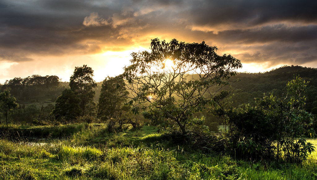
Trees at sunset

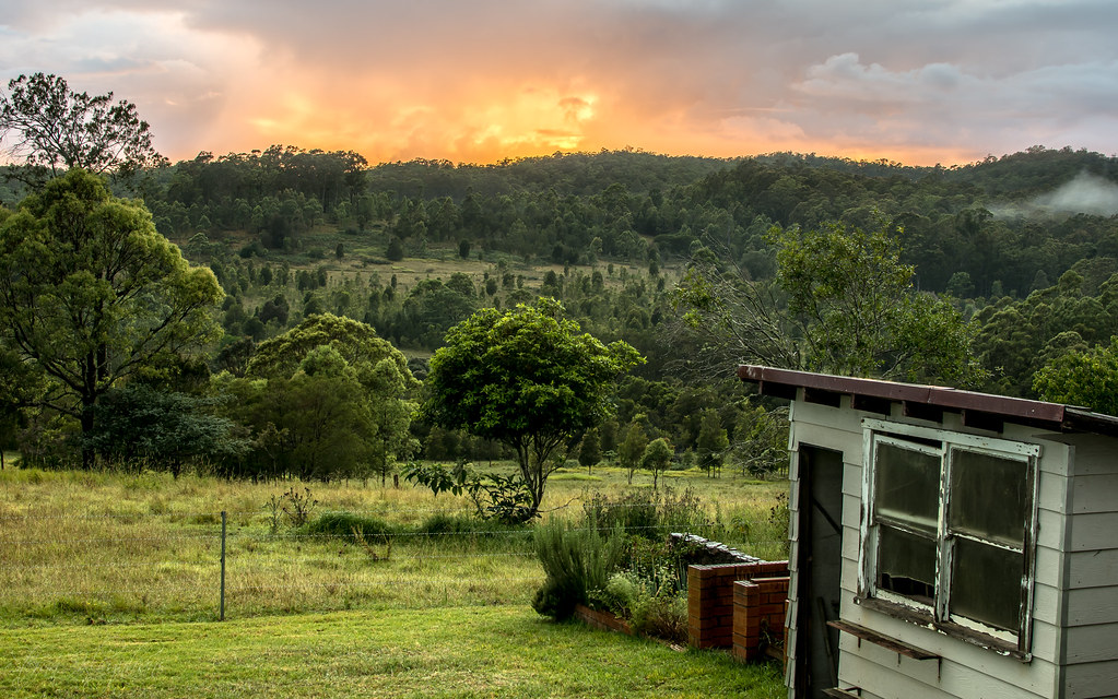
Farm Life
A wet and overcast sunrise
A raging fire in the sky

Refelections on Wang Wauk (4k)

Sunrise over Forster

Log at Sunrise (1 of 1)

Nabiac Under the Pump - View North to the Hillville Fire near Mt Talawahl from Caltex Service Centre, Nabiac, NSW

A Sunday Drive to Breakneck Lookout and through Talawahl State Conservation Area and Talawahl Nature Reserve, Mid North Coast, NSW

View East from Spurwing Hill, Krambach, Mid North Coast, NSW

Southern Rural View Just Outside Village Limits - Dyers Crossing on Wallanbah Rd, Near Nabiac, NSW
Firefly Rd, Krambach NSW, Australien Karte
Suchen Sie einen anderen Ort
Nahe Plätze
Krambach NSW, Australien
The Bucketts Way, Krambach NSW, Australien
Watsons Rd, Wang Wauk NSW, Australien
Buccabeappleby Creek Rd, Bucca Wauka NSW, Australien
Bucca Wauka NSW, Australien
Hillville NSW, Australien
Nabiac NSW, Australien
Sunshine Rd, Hillville NSW, Australien
99 Kundle Creek Ln, Bucca Wauka NSW, Australien
Kiwarrak NSW, Australien
Kardinia Rd, Dollys Flat NSW, Australien
Nowendoc Rd, Mount George NSW, Australien
Nowendoc Rd, Mount George NSW, Australien
Mount George NSW, Australien
Wingham Museum, 12 Farquhar St, Wingham NSW, Australien
Wingham NSW, Australien
12 Bundarra Cl, Taree NSW, Australien
Tallwood Dr, Tallwoods Village NSW, Australien
Wootton Way, Wootton NSW, Australien
Khatabundah Rd, Wingham NSW, Australien
Letzte Suche
- Papingo 04, Griechenland Sonnenaufgang Sonnenuntergang Zeiten
- Pagonija rock, Kranto 7-oji g. 8"N, Kaunas, Lithuania Sonnenaufgang Sonnenuntergang Zeiten
- Co Rd 87, Jamestown, CO, USA Sonnenaufgang Sonnenuntergang Zeiten
- Tenjo, Cundinamarca, Colombia Sonnenaufgang Sonnenuntergang Zeiten
- -1 Gosho, Ichihara, Chiba -, Japan Sonnenaufgang Sonnenuntergang Zeiten
- -, Japan Sonnenaufgang Sonnenuntergang Zeiten
- Spaceport America, Co Rd A, Truth or Consequences, NM, USA Sonnenaufgang Sonnenuntergang Zeiten
- Warwick, Rhode Island, USA Sonnenaufgang Sonnenuntergang Zeiten
- Moriyama House, 3-chōme-21-21 Nishikamata, Ota City, Tokyo -, Japan Sonnenaufgang Sonnenuntergang Zeiten
- Manjojiki, Sawasaki, Sado, Niigata -, Japan Sonnenaufgang Sonnenuntergang Zeiten