E Mize Rd, Demorest, GA, USA Sonnenaufgang Sonnenuntergang Zeiten
Location: USA > Georgia > Habersham County > Demorest >
Zeitzone:
America/New_York
Ortszeit:
2024-04-28 13:43:08
Länge:
-83.5100087
Breite:
34.5599404
Sonnenaufgang Heute:
06:44:54 AM
Sonnenuntergang Heute:
08:17:39 PM
Tageslänge heute:
13h 32m 45s
Sonnenaufgang morgen:
06:43:51 AM
Sonnenuntergang Morgen:
08:18:27 PM
Tageslänge von morgen:
13h 34m 36s
Alle Termine anzeigen
| Datum | Sonnenaufgang | Sonnenuntergang | Tageslänge |
|---|---|---|---|
| 2024-01-01 | 07:40:54 AM | 05:34:43 PM | 9h 53m 49s |
| 2024-01-02 | 07:41:03 AM | 05:35:29 PM | 9h 54m 26s |
| 2024-01-03 | 07:41:11 AM | 05:36:16 PM | 9h 55m 5s |
| 2024-01-04 | 07:41:17 AM | 05:37:05 PM | 9h 55m 48s |
| 2024-01-05 | 07:41:21 AM | 05:37:54 PM | 9h 56m 33s |
| 2024-01-06 | 07:41:23 AM | 05:38:45 PM | 9h 57m 22s |
| 2024-01-07 | 07:41:23 AM | 05:39:36 PM | 9h 58m 13s |
| 2024-01-08 | 07:41:22 AM | 05:40:28 PM | 9h 59m 6s |
| 2024-01-09 | 07:41:18 AM | 05:41:21 PM | 10h 0m 3s |
| 2024-01-10 | 07:41:12 AM | 05:42:15 PM | 10h 1m 3s |
| 2024-01-11 | 07:41:05 AM | 05:43:10 PM | 10h 2m 5s |
| 2024-01-12 | 07:40:56 AM | 05:44:05 PM | 10h 3m 9s |
| 2024-01-13 | 07:40:45 AM | 05:45:01 PM | 10h 4m 16s |
| 2024-01-14 | 07:40:32 AM | 05:45:57 PM | 10h 5m 25s |
| 2024-01-15 | 07:40:17 AM | 05:46:54 PM | 10h 6m 37s |
| 2024-01-16 | 07:40:00 AM | 05:47:52 PM | 10h 7m 52s |
| 2024-01-17 | 07:39:41 AM | 05:48:50 PM | 10h 9m 9s |
| 2024-01-18 | 07:39:21 AM | 05:49:48 PM | 10h 10m 27s |
| 2024-01-19 | 07:38:58 AM | 05:50:47 PM | 10h 11m 49s |
| 2024-01-20 | 07:38:34 AM | 05:51:46 PM | 10h 13m 12s |
| 2024-01-21 | 07:38:08 AM | 05:52:45 PM | 10h 14m 37s |
| 2024-01-22 | 07:37:41 AM | 05:53:45 PM | 10h 16m 4s |
| 2024-01-23 | 07:37:11 AM | 05:54:45 PM | 10h 17m 34s |
| 2024-01-24 | 07:36:40 AM | 05:55:45 PM | 10h 19m 5s |
| 2024-01-25 | 07:36:07 AM | 05:56:45 PM | 10h 20m 38s |
| 2024-01-26 | 07:35:33 AM | 05:57:45 PM | 10h 22m 12s |
| 2024-01-27 | 07:34:56 AM | 05:58:45 PM | 10h 23m 49s |
| 2024-01-28 | 07:34:18 AM | 05:59:46 PM | 10h 25m 28s |
| 2024-01-29 | 07:33:39 AM | 06:00:46 PM | 10h 27m 7s |
| 2024-01-30 | 07:32:58 AM | 06:01:46 PM | 10h 28m 48s |
| 2024-01-31 | 07:32:15 AM | 06:02:46 PM | 10h 30m 31s |
| 2024-02-01 | 07:31:31 AM | 06:03:47 PM | 10h 32m 16s |
| 2024-02-02 | 07:30:45 AM | 06:04:47 PM | 10h 34m 2s |
| 2024-02-03 | 07:29:58 AM | 06:05:47 PM | 10h 35m 49s |
| 2024-02-04 | 07:29:09 AM | 06:06:46 PM | 10h 37m 37s |
| 2024-02-05 | 07:28:19 AM | 06:07:46 PM | 10h 39m 27s |
| 2024-02-06 | 07:27:27 AM | 06:08:45 PM | 10h 41m 18s |
| 2024-02-07 | 07:26:34 AM | 06:09:44 PM | 10h 43m 10s |
| 2024-02-08 | 07:25:40 AM | 06:10:43 PM | 10h 45m 3s |
| 2024-02-09 | 07:24:44 AM | 06:11:42 PM | 10h 46m 58s |
| 2024-02-10 | 07:23:47 AM | 06:12:40 PM | 10h 48m 53s |
| 2024-02-11 | 07:22:49 AM | 06:13:39 PM | 10h 50m 50s |
| 2024-02-12 | 07:21:49 AM | 06:14:36 PM | 10h 52m 47s |
| 2024-02-13 | 07:20:49 AM | 06:15:34 PM | 10h 54m 45s |
| 2024-02-14 | 07:19:47 AM | 06:16:31 PM | 10h 56m 44s |
| 2024-02-15 | 07:18:44 AM | 06:17:28 PM | 10h 58m 44s |
| 2024-02-16 | 07:17:40 AM | 06:18:25 PM | 11h 0m 45s |
| 2024-02-17 | 07:16:35 AM | 06:19:21 PM | 11h 2m 46s |
| 2024-02-18 | 07:15:29 AM | 06:20:17 PM | 11h 4m 48s |
| 2024-02-19 | 07:14:21 AM | 06:21:13 PM | 11h 6m 52s |
| 2024-02-20 | 07:13:13 AM | 06:22:08 PM | 11h 8m 55s |
| 2024-02-21 | 07:12:04 AM | 06:23:03 PM | 11h 10m 59s |
| 2024-02-22 | 07:10:54 AM | 06:23:57 PM | 11h 13m 3s |
| 2024-02-23 | 07:09:43 AM | 06:24:52 PM | 11h 15m 9s |
| 2024-02-24 | 07:08:31 AM | 06:25:46 PM | 11h 17m 15s |
| 2024-02-25 | 07:07:19 AM | 06:26:39 PM | 11h 19m 20s |
| 2024-02-26 | 07:06:05 AM | 06:27:32 PM | 11h 21m 27s |
| 2024-02-27 | 07:04:51 AM | 06:28:25 PM | 11h 23m 34s |
| 2024-02-28 | 07:03:36 AM | 06:29:18 PM | 11h 25m 42s |
| 2024-02-29 | 07:02:21 AM | 06:30:10 PM | 11h 27m 49s |
| 2024-03-01 | 07:01:05 AM | 06:31:02 PM | 11h 29m 57s |
| 2024-03-02 | 06:59:48 AM | 06:31:53 PM | 11h 32m 5s |
| 2024-03-03 | 06:58:30 AM | 06:32:45 PM | 11h 34m 15s |
| 2024-03-04 | 06:57:12 AM | 06:33:36 PM | 11h 36m 24s |
| 2024-03-05 | 06:55:54 AM | 06:34:26 PM | 11h 38m 32s |
| 2024-03-06 | 06:54:34 AM | 06:35:17 PM | 11h 40m 43s |
| 2024-03-07 | 06:53:15 AM | 06:36:07 PM | 11h 42m 52s |
| 2024-03-08 | 06:51:55 AM | 06:36:57 PM | 11h 45m 2s |
| 2024-03-09 | 06:50:34 AM | 06:37:46 PM | 11h 47m 12s |
| 2024-03-10 | 07:49:17 AM | 07:38:34 PM | 11h 49m 17s |
| 2024-03-11 | 07:47:56 AM | 07:39:23 PM | 11h 51m 27s |
| 2024-03-12 | 07:46:34 AM | 07:40:12 PM | 11h 53m 38s |
| 2024-03-13 | 07:45:12 AM | 07:41:00 PM | 11h 55m 48s |
| 2024-03-14 | 07:43:50 AM | 07:41:49 PM | 11h 57m 59s |
| 2024-03-15 | 07:42:28 AM | 07:42:37 PM | 12h 0m 9s |
| 2024-03-16 | 07:41:05 AM | 07:43:25 PM | 12h 2m 20s |
| 2024-03-17 | 07:39:42 AM | 07:44:13 PM | 12h 4m 31s |
| 2024-03-18 | 07:38:19 AM | 07:45:01 PM | 12h 6m 42s |
| 2024-03-19 | 07:36:56 AM | 07:45:49 PM | 12h 8m 53s |
| 2024-03-20 | 07:35:33 AM | 07:46:36 PM | 12h 11m 3s |
| 2024-03-21 | 07:34:10 AM | 07:47:23 PM | 12h 13m 13s |
| 2024-03-22 | 07:32:47 AM | 07:48:11 PM | 12h 15m 24s |
| 2024-03-23 | 07:31:24 AM | 07:48:58 PM | 12h 17m 34s |
| 2024-03-24 | 07:30:00 AM | 07:49:45 PM | 12h 19m 45s |
| 2024-03-25 | 07:28:37 AM | 07:50:32 PM | 12h 21m 55s |
| 2024-03-26 | 07:27:14 AM | 07:51:19 PM | 12h 24m 5s |
| 2024-03-27 | 07:25:51 AM | 07:52:05 PM | 12h 26m 14s |
| 2024-03-28 | 07:24:28 AM | 07:52:52 PM | 12h 28m 24s |
| 2024-03-29 | 07:23:06 AM | 07:53:39 PM | 12h 30m 33s |
| 2024-03-30 | 07:21:43 AM | 07:54:26 PM | 12h 32m 43s |
| 2024-03-31 | 07:20:21 AM | 07:55:12 PM | 12h 34m 51s |
| 2024-04-01 | 07:18:59 AM | 07:55:59 PM | 12h 37m 0s |
| 2024-04-02 | 07:17:37 AM | 07:56:46 PM | 12h 39m 9s |
| 2024-04-03 | 07:16:16 AM | 07:57:32 PM | 12h 41m 16s |
| 2024-04-04 | 07:14:55 AM | 07:58:19 PM | 12h 43m 24s |
| 2024-04-05 | 07:13:34 AM | 07:59:06 PM | 12h 45m 32s |
| 2024-04-06 | 07:12:14 AM | 07:59:52 PM | 12h 47m 38s |
| 2024-04-07 | 07:10:54 AM | 08:00:39 PM | 12h 49m 45s |
| 2024-04-08 | 07:09:34 AM | 08:01:26 PM | 12h 51m 52s |
| 2024-04-09 | 07:08:15 AM | 08:02:13 PM | 12h 53m 58s |
| 2024-04-10 | 07:06:57 AM | 08:03:00 PM | 12h 56m 3s |
| 2024-04-11 | 07:05:39 AM | 08:03:47 PM | 12h 58m 8s |
| 2024-04-12 | 07:04:22 AM | 08:04:34 PM | 13h 0m 12s |
| 2024-04-13 | 07:03:05 AM | 08:05:21 PM | 13h 2m 16s |
| 2024-04-14 | 07:01:49 AM | 08:06:08 PM | 13h 4m 19s |
| 2024-04-15 | 07:00:34 AM | 08:06:55 PM | 13h 6m 21s |
| 2024-04-16 | 06:59:19 AM | 08:07:43 PM | 13h 8m 24s |
| 2024-04-17 | 06:58:05 AM | 08:08:30 PM | 13h 10m 25s |
| 2024-04-18 | 06:56:51 AM | 08:09:17 PM | 13h 12m 26s |
| 2024-04-19 | 06:55:39 AM | 08:10:05 PM | 13h 14m 26s |
| 2024-04-20 | 06:54:27 AM | 08:10:52 PM | 13h 16m 25s |
| 2024-04-21 | 06:53:16 AM | 08:11:40 PM | 13h 18m 24s |
| 2024-04-22 | 06:52:06 AM | 08:12:28 PM | 13h 20m 22s |
| 2024-04-23 | 06:50:57 AM | 08:13:16 PM | 13h 22m 19s |
| 2024-04-24 | 06:49:49 AM | 08:14:03 PM | 13h 24m 14s |
| 2024-04-25 | 06:48:42 AM | 08:14:51 PM | 13h 26m 9s |
| 2024-04-26 | 06:47:35 AM | 08:15:39 PM | 13h 28m 4s |
| 2024-04-27 | 06:46:30 AM | 08:16:27 PM | 13h 29m 57s |
| 2024-04-28 | 06:45:26 AM | 08:17:15 PM | 13h 31m 49s |
| 2024-04-29 | 06:44:22 AM | 08:18:03 PM | 13h 33m 41s |
| 2024-04-30 | 06:43:20 AM | 08:18:51 PM | 13h 35m 31s |
| 2024-05-01 | 06:42:19 AM | 08:19:38 PM | 13h 37m 19s |
| 2024-05-02 | 06:41:19 AM | 08:20:26 PM | 13h 39m 7s |
| 2024-05-03 | 06:40:20 AM | 08:21:14 PM | 13h 40m 54s |
| 2024-05-04 | 06:39:23 AM | 08:22:02 PM | 13h 42m 39s |
| 2024-05-05 | 06:38:26 AM | 08:22:50 PM | 13h 44m 24s |
| 2024-05-06 | 06:37:31 AM | 08:23:37 PM | 13h 46m 6s |
| 2024-05-07 | 06:36:37 AM | 08:24:25 PM | 13h 47m 48s |
| 2024-05-08 | 06:35:45 AM | 08:25:12 PM | 13h 49m 27s |
| 2024-05-09 | 06:34:53 AM | 08:25:59 PM | 13h 51m 6s |
| 2024-05-10 | 06:34:03 AM | 08:26:46 PM | 13h 52m 43s |
| 2024-05-11 | 06:33:14 AM | 08:27:33 PM | 13h 54m 19s |
| 2024-05-12 | 06:32:27 AM | 08:28:19 PM | 13h 55m 52s |
| 2024-05-13 | 06:31:41 AM | 08:29:06 PM | 13h 57m 25s |
| 2024-05-14 | 06:30:57 AM | 08:29:52 PM | 13h 58m 55s |
| 2024-05-15 | 06:30:14 AM | 08:30:37 PM | 14h 0m 23s |
| 2024-05-16 | 06:29:32 AM | 08:31:23 PM | 14h 1m 51s |
| 2024-05-17 | 06:28:52 AM | 08:32:08 PM | 14h 3m 16s |
| 2024-05-18 | 06:28:13 AM | 08:32:52 PM | 14h 4m 39s |
| 2024-05-19 | 06:27:36 AM | 08:33:36 PM | 14h 6m 0s |
| 2024-05-20 | 06:27:00 AM | 08:34:20 PM | 14h 7m 20s |
| 2024-05-21 | 06:26:26 AM | 08:35:04 PM | 14h 8m 38s |
| 2024-05-22 | 06:25:54 AM | 08:35:46 PM | 14h 9m 52s |
| 2024-05-23 | 06:25:23 AM | 08:36:28 PM | 14h 11m 5s |
| 2024-05-24 | 06:24:53 AM | 08:37:10 PM | 14h 12m 17s |
| 2024-05-25 | 06:24:25 AM | 08:37:51 PM | 14h 13m 26s |
| 2024-05-26 | 06:23:59 AM | 08:38:32 PM | 14h 14m 33s |
| 2024-05-27 | 06:23:34 AM | 08:39:11 PM | 14h 15m 37s |
| 2024-05-28 | 06:23:11 AM | 08:39:50 PM | 14h 16m 39s |
| 2024-05-29 | 06:22:50 AM | 08:40:28 PM | 14h 17m 38s |
| 2024-05-30 | 06:22:30 AM | 08:41:06 PM | 14h 18m 36s |
| 2024-05-31 | 06:22:12 AM | 08:41:42 PM | 14h 19m 30s |
| 2024-06-01 | 06:21:55 AM | 08:42:18 PM | 14h 20m 23s |
| 2024-06-02 | 06:21:41 AM | 08:42:53 PM | 14h 21m 12s |
| 2024-06-03 | 06:21:27 AM | 08:43:27 PM | 14h 22m 0s |
| 2024-06-04 | 06:21:16 AM | 08:44:00 PM | 14h 22m 44s |
| 2024-06-05 | 06:21:06 AM | 08:44:32 PM | 14h 23m 26s |
| 2024-06-06 | 06:20:57 AM | 08:45:03 PM | 14h 24m 6s |
| 2024-06-07 | 06:20:50 AM | 08:45:33 PM | 14h 24m 43s |
| 2024-06-08 | 06:20:45 AM | 08:46:01 PM | 14h 25m 16s |
| 2024-06-09 | 06:20:42 AM | 08:46:29 PM | 14h 25m 47s |
| 2024-06-10 | 06:20:40 AM | 08:46:55 PM | 14h 26m 15s |
| 2024-06-11 | 06:20:39 AM | 08:47:21 PM | 14h 26m 42s |
| 2024-06-12 | 06:20:41 AM | 08:47:45 PM | 14h 27m 4s |
| 2024-06-13 | 06:20:43 AM | 08:48:07 PM | 14h 27m 24s |
| 2024-06-14 | 06:20:48 AM | 08:48:29 PM | 14h 27m 41s |
| 2024-06-15 | 06:20:53 AM | 08:48:49 PM | 14h 27m 56s |
| 2024-06-16 | 06:21:01 AM | 08:49:07 PM | 14h 28m 6s |
| 2024-06-17 | 06:21:10 AM | 08:49:25 PM | 14h 28m 15s |
| 2024-06-18 | 06:21:20 AM | 08:49:41 PM | 14h 28m 21s |
| 2024-06-19 | 06:21:31 AM | 08:49:55 PM | 14h 28m 24s |
| 2024-06-20 | 06:21:45 AM | 08:50:08 PM | 14h 28m 23s |
| 2024-06-21 | 06:21:59 AM | 08:50:20 PM | 14h 28m 21s |
| 2024-06-22 | 06:22:15 AM | 08:50:30 PM | 14h 28m 15s |
| 2024-06-23 | 06:22:32 AM | 08:50:38 PM | 14h 28m 6s |
| 2024-06-24 | 06:22:51 AM | 08:50:45 PM | 14h 27m 54s |
| 2024-06-25 | 06:23:11 AM | 08:50:50 PM | 14h 27m 39s |
| 2024-06-26 | 06:23:32 AM | 08:50:54 PM | 14h 27m 22s |
| 2024-06-27 | 06:23:54 AM | 08:50:56 PM | 14h 27m 2s |
| 2024-06-28 | 06:24:18 AM | 08:50:57 PM | 14h 26m 39s |
| 2024-06-29 | 06:24:42 AM | 08:50:56 PM | 14h 26m 14s |
| 2024-06-30 | 06:25:08 AM | 08:50:53 PM | 14h 25m 45s |
| 2024-07-01 | 06:25:35 AM | 08:50:49 PM | 14h 25m 14s |
| 2024-07-02 | 06:26:03 AM | 08:50:43 PM | 14h 24m 40s |
| 2024-07-03 | 06:26:32 AM | 08:50:35 PM | 14h 24m 3s |
| 2024-07-04 | 06:27:02 AM | 08:50:26 PM | 14h 23m 24s |
| 2024-07-05 | 06:27:33 AM | 08:50:15 PM | 14h 22m 42s |
| 2024-07-06 | 06:28:05 AM | 08:50:02 PM | 14h 21m 57s |
| 2024-07-07 | 06:28:38 AM | 08:49:48 PM | 14h 21m 10s |
| 2024-07-08 | 06:29:11 AM | 08:49:32 PM | 14h 20m 21s |
| 2024-07-09 | 06:29:46 AM | 08:49:14 PM | 14h 19m 28s |
| 2024-07-10 | 06:30:21 AM | 08:48:55 PM | 14h 18m 34s |
| 2024-07-11 | 06:30:57 AM | 08:48:34 PM | 14h 17m 37s |
| 2024-07-12 | 06:31:34 AM | 08:48:11 PM | 14h 16m 37s |
| 2024-07-13 | 06:32:11 AM | 08:47:47 PM | 14h 15m 36s |
| 2024-07-14 | 06:32:49 AM | 08:47:21 PM | 14h 14m 32s |
| 2024-07-15 | 06:33:28 AM | 08:46:54 PM | 14h 13m 26s |
| 2024-07-16 | 06:34:07 AM | 08:46:24 PM | 14h 12m 17s |
| 2024-07-17 | 06:34:47 AM | 08:45:54 PM | 14h 11m 7s |
| 2024-07-18 | 06:35:27 AM | 08:45:21 PM | 14h 9m 54s |
| 2024-07-19 | 06:36:08 AM | 08:44:47 PM | 14h 8m 39s |
| 2024-07-20 | 06:36:49 AM | 08:44:12 PM | 14h 7m 23s |
| 2024-07-21 | 06:37:30 AM | 08:43:34 PM | 14h 6m 4s |
| 2024-07-22 | 06:38:12 AM | 08:42:56 PM | 14h 4m 44s |
| 2024-07-23 | 06:38:55 AM | 08:42:15 PM | 14h 3m 20s |
| 2024-07-24 | 06:39:37 AM | 08:41:34 PM | 14h 1m 57s |
| 2024-07-25 | 06:40:20 AM | 08:40:51 PM | 14h 0m 31s |
| 2024-07-26 | 06:41:03 AM | 08:40:06 PM | 13h 59m 3s |
| 2024-07-27 | 06:41:47 AM | 08:39:20 PM | 13h 57m 33s |
| 2024-07-28 | 06:42:31 AM | 08:38:32 PM | 13h 56m 1s |
| 2024-07-29 | 06:43:14 AM | 08:37:43 PM | 13h 54m 29s |
| 2024-07-30 | 06:43:58 AM | 08:36:53 PM | 13h 52m 55s |
| 2024-07-31 | 06:44:43 AM | 08:36:01 PM | 13h 51m 18s |
| 2024-08-01 | 06:45:27 AM | 08:35:08 PM | 13h 49m 41s |
| 2024-08-02 | 06:46:11 AM | 08:34:14 PM | 13h 48m 3s |
| 2024-08-03 | 06:46:56 AM | 08:33:18 PM | 13h 46m 22s |
| 2024-08-04 | 06:47:40 AM | 08:32:21 PM | 13h 44m 41s |
| 2024-08-05 | 06:48:25 AM | 08:31:23 PM | 13h 42m 58s |
| 2024-08-06 | 06:49:09 AM | 08:30:24 PM | 13h 41m 15s |
| 2024-08-07 | 06:49:54 AM | 08:29:23 PM | 13h 39m 29s |
| 2024-08-08 | 06:50:39 AM | 08:28:22 PM | 13h 37m 43s |
| 2024-08-09 | 06:51:23 AM | 08:27:19 PM | 13h 35m 56s |
| 2024-08-10 | 06:52:08 AM | 08:26:15 PM | 13h 34m 7s |
| 2024-08-11 | 06:52:52 AM | 08:25:10 PM | 13h 32m 18s |
| 2024-08-12 | 06:53:37 AM | 08:24:04 PM | 13h 30m 27s |
| 2024-08-13 | 06:54:21 AM | 08:22:56 PM | 13h 28m 35s |
| 2024-08-14 | 06:55:06 AM | 08:21:48 PM | 13h 26m 42s |
| 2024-08-15 | 06:55:50 AM | 08:20:39 PM | 13h 24m 49s |
| 2024-08-16 | 06:56:34 AM | 08:19:29 PM | 13h 22m 55s |
| 2024-08-17 | 06:57:18 AM | 08:18:18 PM | 13h 21m 0s |
| 2024-08-18 | 06:58:03 AM | 08:17:06 PM | 13h 19m 3s |
| 2024-08-19 | 06:58:46 AM | 08:15:54 PM | 13h 17m 8s |
| 2024-08-20 | 06:59:30 AM | 08:14:40 PM | 13h 15m 10s |
| 2024-08-21 | 07:00:14 AM | 08:13:26 PM | 13h 13m 12s |
| 2024-08-22 | 07:00:58 AM | 08:12:10 PM | 13h 11m 12s |
| 2024-08-23 | 07:01:41 AM | 08:10:54 PM | 13h 9m 13s |
| 2024-08-24 | 07:02:25 AM | 08:09:38 PM | 13h 7m 13s |
| 2024-08-25 | 07:03:08 AM | 08:08:20 PM | 13h 5m 12s |
| 2024-08-26 | 07:03:51 AM | 08:07:02 PM | 13h 3m 11s |
| 2024-08-27 | 07:04:35 AM | 08:05:44 PM | 13h 1m 9s |
| 2024-08-28 | 07:05:18 AM | 08:04:24 PM | 12h 59m 6s |
| 2024-08-29 | 07:06:01 AM | 08:03:05 PM | 12h 57m 4s |
| 2024-08-30 | 07:06:43 AM | 08:01:44 PM | 12h 55m 1s |
| 2024-08-31 | 07:07:26 AM | 08:00:23 PM | 12h 52m 57s |
| 2024-09-01 | 07:08:09 AM | 07:59:02 PM | 12h 50m 53s |
| 2024-09-02 | 07:08:52 AM | 07:57:40 PM | 12h 48m 48s |
| 2024-09-03 | 07:09:34 AM | 07:56:17 PM | 12h 46m 43s |
| 2024-09-04 | 07:10:17 AM | 07:54:55 PM | 12h 44m 38s |
| 2024-09-05 | 07:10:59 AM | 07:53:32 PM | 12h 42m 33s |
| 2024-09-06 | 07:11:42 AM | 07:52:08 PM | 12h 40m 26s |
| 2024-09-07 | 07:12:24 AM | 07:50:44 PM | 12h 38m 20s |
| 2024-09-08 | 07:13:07 AM | 07:49:20 PM | 12h 36m 13s |
| 2024-09-09 | 07:13:49 AM | 07:47:56 PM | 12h 34m 7s |
| 2024-09-10 | 07:14:31 AM | 07:46:31 PM | 12h 32m 0s |
| 2024-09-11 | 07:15:14 AM | 07:45:06 PM | 12h 29m 52s |
| 2024-09-12 | 07:15:56 AM | 07:43:41 PM | 12h 27m 45s |
| 2024-09-13 | 07:16:39 AM | 07:42:16 PM | 12h 25m 37s |
| 2024-09-14 | 07:17:21 AM | 07:40:50 PM | 12h 23m 29s |
| 2024-09-15 | 07:18:04 AM | 07:39:25 PM | 12h 21m 21s |
| 2024-09-16 | 07:18:47 AM | 07:37:59 PM | 12h 19m 12s |
| 2024-09-17 | 07:19:29 AM | 07:36:34 PM | 12h 17m 5s |
| 2024-09-18 | 07:20:12 AM | 07:35:08 PM | 12h 14m 56s |
| 2024-09-19 | 07:20:55 AM | 07:33:43 PM | 12h 12m 48s |
| 2024-09-20 | 07:21:38 AM | 07:32:17 PM | 12h 10m 39s |
| 2024-09-21 | 07:22:21 AM | 07:30:52 PM | 12h 8m 31s |
| 2024-09-22 | 07:23:04 AM | 07:29:26 PM | 12h 6m 22s |
| 2024-09-23 | 07:23:48 AM | 07:28:01 PM | 12h 4m 13s |
| 2024-09-24 | 07:24:31 AM | 07:26:36 PM | 12h 2m 5s |
| 2024-09-25 | 07:25:15 AM | 07:25:11 PM | 11h 59m 56s |
| 2024-09-26 | 07:25:59 AM | 07:23:46 PM | 11h 57m 47s |
| 2024-09-27 | 07:26:43 AM | 07:22:22 PM | 11h 55m 39s |
| 2024-09-28 | 07:27:28 AM | 07:20:58 PM | 11h 53m 30s |
| 2024-09-29 | 07:28:12 AM | 07:19:34 PM | 11h 51m 22s |
| 2024-09-30 | 07:28:57 AM | 07:18:10 PM | 11h 49m 13s |
| 2024-10-01 | 07:29:42 AM | 07:16:47 PM | 11h 47m 5s |
| 2024-10-02 | 07:30:27 AM | 07:15:24 PM | 11h 44m 57s |
| 2024-10-03 | 07:31:13 AM | 07:14:02 PM | 11h 42m 49s |
| 2024-10-04 | 07:31:59 AM | 07:12:40 PM | 11h 40m 41s |
| 2024-10-05 | 07:32:45 AM | 07:11:18 PM | 11h 38m 33s |
| 2024-10-06 | 07:33:31 AM | 07:09:57 PM | 11h 36m 26s |
| 2024-10-07 | 07:34:18 AM | 07:08:37 PM | 11h 34m 19s |
| 2024-10-08 | 07:35:05 AM | 07:07:17 PM | 11h 32m 12s |
| 2024-10-09 | 07:35:53 AM | 07:05:58 PM | 11h 30m 5s |
| 2024-10-10 | 07:36:40 AM | 07:04:39 PM | 11h 27m 59s |
| 2024-10-11 | 07:37:28 AM | 07:03:21 PM | 11h 25m 53s |
| 2024-10-12 | 07:38:17 AM | 07:02:04 PM | 11h 23m 47s |
| 2024-10-13 | 07:39:05 AM | 07:00:48 PM | 11h 21m 43s |
| 2024-10-14 | 07:39:54 AM | 06:59:32 PM | 11h 19m 38s |
| 2024-10-15 | 07:40:44 AM | 06:58:17 PM | 11h 17m 33s |
| 2024-10-16 | 07:41:34 AM | 06:57:03 PM | 11h 15m 29s |
| 2024-10-17 | 07:42:24 AM | 06:55:49 PM | 11h 13m 25s |
| 2024-10-18 | 07:43:14 AM | 06:54:37 PM | 11h 11m 23s |
| 2024-10-19 | 07:44:05 AM | 06:53:25 PM | 11h 9m 20s |
| 2024-10-20 | 07:44:57 AM | 06:52:14 PM | 11h 7m 17s |
| 2024-10-21 | 07:45:48 AM | 06:51:05 PM | 11h 5m 17s |
| 2024-10-22 | 07:46:40 AM | 06:49:56 PM | 11h 3m 16s |
| 2024-10-23 | 07:47:33 AM | 06:48:48 PM | 11h 1m 15s |
| 2024-10-24 | 07:48:25 AM | 06:47:42 PM | 10h 59m 17s |
| 2024-10-25 | 07:49:18 AM | 06:46:36 PM | 10h 57m 18s |
| 2024-10-26 | 07:50:12 AM | 06:45:32 PM | 10h 55m 20s |
| 2024-10-27 | 07:51:06 AM | 06:44:29 PM | 10h 53m 23s |
| 2024-10-28 | 07:52:00 AM | 06:43:27 PM | 10h 51m 27s |
| 2024-10-29 | 07:52:54 AM | 06:42:26 PM | 10h 49m 32s |
| 2024-10-30 | 07:53:49 AM | 06:41:27 PM | 10h 47m 38s |
| 2024-10-31 | 07:54:44 AM | 06:40:28 PM | 10h 45m 44s |
| 2024-11-01 | 07:55:40 AM | 06:39:31 PM | 10h 43m 51s |
| 2024-11-02 | 07:56:35 AM | 06:38:36 PM | 10h 42m 1s |
| 2024-11-03 | 06:57:34 AM | 05:37:39 PM | 10h 40m 5s |
| 2024-11-04 | 06:58:30 AM | 05:36:47 PM | 10h 38m 17s |
| 2024-11-05 | 06:59:26 AM | 05:35:55 PM | 10h 36m 29s |
| 2024-11-06 | 07:00:23 AM | 05:35:05 PM | 10h 34m 42s |
| 2024-11-07 | 07:01:20 AM | 05:34:17 PM | 10h 32m 57s |
| 2024-11-08 | 07:02:17 AM | 05:33:30 PM | 10h 31m 13s |
| 2024-11-09 | 07:03:14 AM | 05:32:45 PM | 10h 29m 31s |
| 2024-11-10 | 07:04:11 AM | 05:32:01 PM | 10h 27m 50s |
| 2024-11-11 | 07:05:09 AM | 05:31:19 PM | 10h 26m 10s |
| 2024-11-12 | 07:06:06 AM | 05:30:38 PM | 10h 24m 32s |
| 2024-11-13 | 07:07:04 AM | 05:29:59 PM | 10h 22m 55s |
| 2024-11-14 | 07:08:01 AM | 05:29:22 PM | 10h 21m 21s |
| 2024-11-15 | 07:08:59 AM | 05:28:47 PM | 10h 19m 48s |
| 2024-11-16 | 07:09:56 AM | 05:28:13 PM | 10h 18m 17s |
| 2024-11-17 | 07:10:53 AM | 05:27:41 PM | 10h 16m 48s |
| 2024-11-18 | 07:11:51 AM | 05:27:11 PM | 10h 15m 20s |
| 2024-11-19 | 07:12:48 AM | 05:26:42 PM | 10h 13m 54s |
| 2024-11-20 | 07:13:45 AM | 05:26:15 PM | 10h 12m 30s |
| 2024-11-21 | 07:14:41 AM | 05:25:51 PM | 10h 11m 10s |
| 2024-11-22 | 07:15:38 AM | 05:25:28 PM | 10h 9m 50s |
| 2024-11-23 | 07:16:34 AM | 05:25:07 PM | 10h 8m 33s |
| 2024-11-24 | 07:17:30 AM | 05:24:47 PM | 10h 7m 17s |
| 2024-11-25 | 07:18:25 AM | 05:24:30 PM | 10h 6m 5s |
| 2024-11-26 | 07:19:20 AM | 05:24:14 PM | 10h 4m 54s |
| 2024-11-27 | 07:20:14 AM | 05:24:01 PM | 10h 3m 47s |
| 2024-11-28 | 07:21:08 AM | 05:23:49 PM | 10h 2m 41s |
| 2024-11-29 | 07:22:01 AM | 05:23:39 PM | 10h 1m 38s |
| 2024-11-30 | 07:22:54 AM | 05:23:32 PM | 10h 0m 38s |
| 2024-12-01 | 07:23:46 AM | 05:23:26 PM | 9h 59m 40s |
| 2024-12-02 | 07:24:37 AM | 05:23:22 PM | 9h 58m 45s |
| 2024-12-03 | 07:25:28 AM | 05:23:20 PM | 9h 57m 52s |
| 2024-12-04 | 07:26:18 AM | 05:23:20 PM | 9h 57m 2s |
| 2024-12-05 | 07:27:07 AM | 05:23:21 PM | 9h 56m 14s |
| 2024-12-06 | 07:27:55 AM | 05:23:25 PM | 9h 55m 30s |
| 2024-12-07 | 07:28:42 AM | 05:23:31 PM | 9h 54m 49s |
| 2024-12-08 | 07:29:28 AM | 05:23:38 PM | 9h 54m 10s |
| 2024-12-09 | 07:30:13 AM | 05:23:48 PM | 9h 53m 35s |
| 2024-12-10 | 07:30:56 AM | 05:23:59 PM | 9h 53m 3s |
| 2024-12-11 | 07:31:39 AM | 05:24:13 PM | 9h 52m 34s |
| 2024-12-12 | 07:32:21 AM | 05:24:28 PM | 9h 52m 7s |
| 2024-12-13 | 07:33:01 AM | 05:24:45 PM | 9h 51m 44s |
| 2024-12-14 | 07:33:40 AM | 05:25:03 PM | 9h 51m 23s |
| 2024-12-15 | 07:34:18 AM | 05:25:24 PM | 9h 51m 6s |
| 2024-12-16 | 07:34:54 AM | 05:25:46 PM | 9h 50m 52s |
| 2024-12-17 | 07:35:29 AM | 05:26:10 PM | 9h 50m 41s |
| 2024-12-18 | 07:36:02 AM | 05:26:36 PM | 9h 50m 34s |
| 2024-12-19 | 07:36:34 AM | 05:27:04 PM | 9h 50m 30s |
| 2024-12-20 | 07:37:05 AM | 05:27:33 PM | 9h 50m 28s |
| 2024-12-21 | 07:37:34 AM | 05:28:03 PM | 9h 50m 29s |
| 2024-12-22 | 07:38:01 AM | 05:28:36 PM | 9h 50m 35s |
| 2024-12-23 | 07:38:27 AM | 05:29:10 PM | 9h 50m 43s |
| 2024-12-24 | 07:38:51 AM | 05:29:45 PM | 9h 50m 54s |
| 2024-12-25 | 07:39:13 AM | 05:30:22 PM | 9h 51m 9s |
| 2024-12-26 | 07:39:34 AM | 05:31:00 PM | 9h 51m 26s |
| 2024-12-27 | 07:39:53 AM | 05:31:40 PM | 9h 51m 47s |
| 2024-12-28 | 07:40:10 AM | 05:32:21 PM | 9h 52m 11s |
| 2024-12-29 | 07:40:26 AM | 05:33:03 PM | 9h 52m 37s |
| 2024-12-30 | 07:40:39 AM | 05:33:47 PM | 9h 53m 8s |
Fotos

Wells Viaduct

The crest of the Blue Ridge seen from Currahee Mountain.

Bailey at Jekyll island
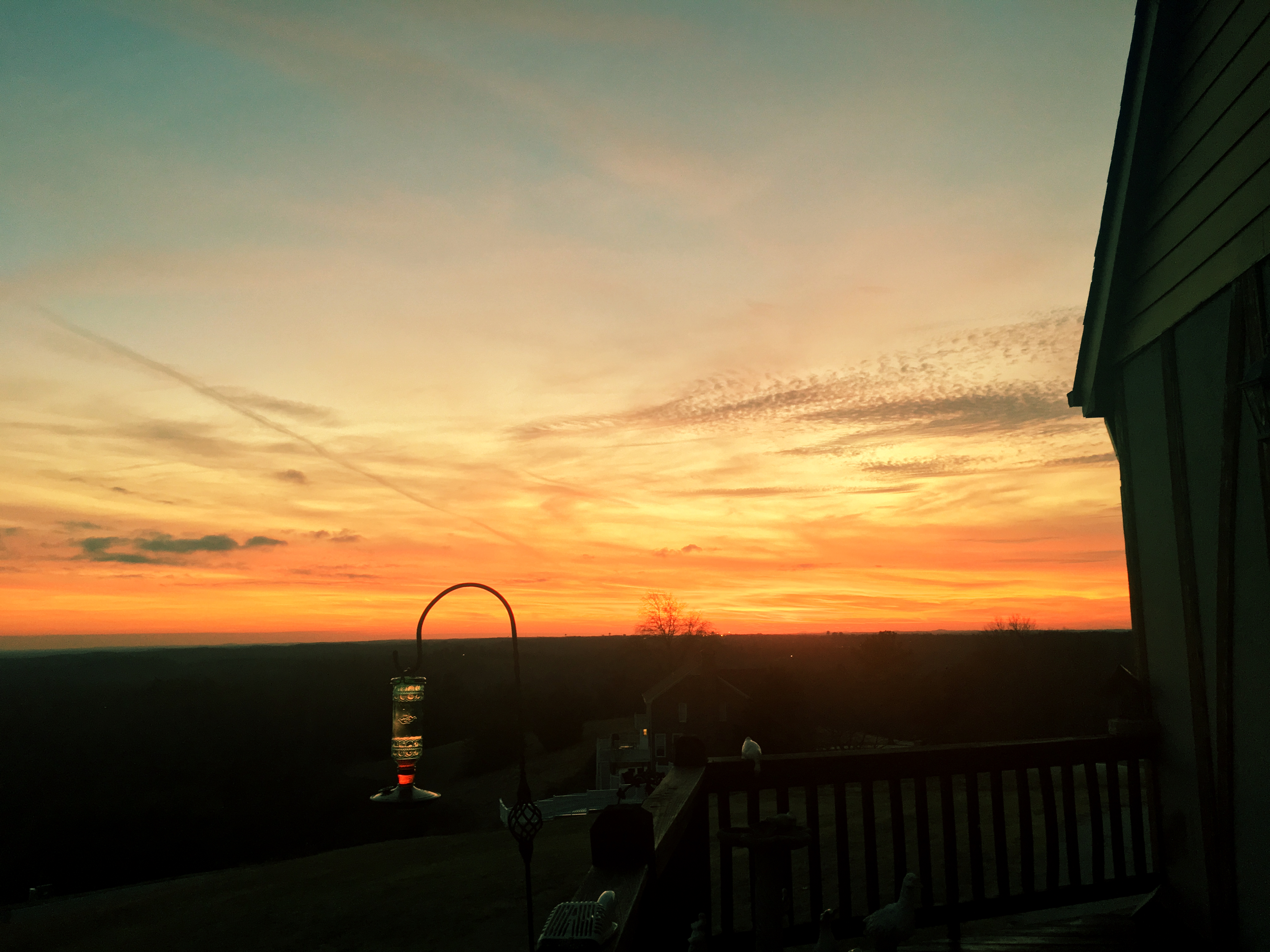
Sunset on a Georgia ridge.

The Sunset

2011-10-30_18-47-26

2011-10-30_18-55-38

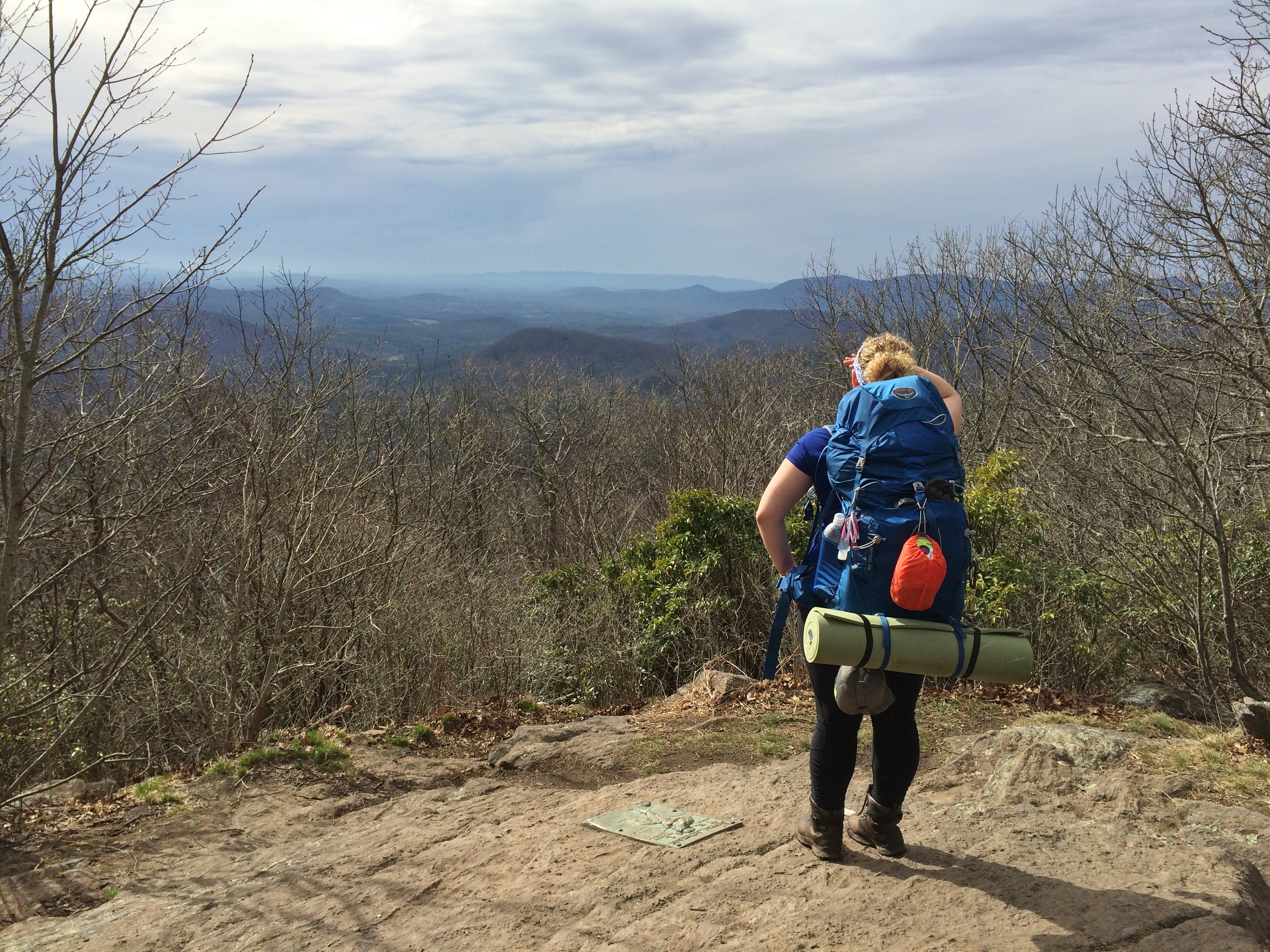
View from W4G/NG-086 - Currahee Mtn
View from Springer Mtn. summit

Currahee - 3 Miles Up
E Mize Rd, Demorest, GA, USA Karte
Suchen Sie einen anderen Ort
Nahe Plätze
Hazel Creek Rd, Mt Airy, GA, USA
Windfield Ridge Dr, Mt Airy, GA, USA
Demorest, GA, USA
Old Hwy S, Mt Airy, GA, USA
J Kennedy Rd, Clarkesville, GA, USA
Railroad Ave, Clarkesville, GA, USA
Mount Airy, Mt Airy, GA, USA
J Warren Rd, Cornelia, GA, USA
Dewberry Ln, Mt Airy, GA, USA
Richard St, Clarkesville, GA, USA
Cornelia, GA, USA
Blacksnake Rd, Mt Airy, GA, USA
N Main St, Cornelia, GA, USA
Clarkesville, GA, USA
Chenocetah Mountain, Cornelia, GA, USA
Grandview Cir, Cornelia, GA, USA
Jess Kinney Rd, Mt Airy, GA, USA
Camp Creek Rd, Mt Airy, GA, USA
New Liberty Rd, Clarkesville, GA, USA
Demorest, Georgia, USA
Letzte Suche
- Jialuohu, Datong Township, Yilan County, Taiwan Sonnenaufgang Sonnenuntergang Zeiten
- 大下港, Sekizenoge, Imabari, Präfektur Ehime -, Japan Sonnenaufgang Sonnenuntergang Zeiten
- Oge port Ferry Terminal, -1 Sekizenōge, Imabari, Ehime -, Japan Sonnenaufgang Sonnenuntergang Zeiten
- San Telmo, Autonomen Stadt Buenos Aires, Argentinien Sonnenaufgang Sonnenuntergang Zeiten
- Congressional Dr, Stevensville, MD, USA Sonnenaufgang Sonnenuntergang Zeiten
- Papingo 04, Griechenland Sonnenaufgang Sonnenuntergang Zeiten
- Pagonija rock, Kranto 7-oji g. 8"N, Kaunas, Litauen Sonnenaufgang Sonnenuntergang Zeiten
- Co Rd 87, Jamestown, CO, USA Sonnenaufgang Sonnenuntergang Zeiten
- Tenjo, Cundinamarca, Colombia Sonnenaufgang Sonnenuntergang Zeiten
- -1 Gosho, Ichihara, Chiba -, Japan Sonnenaufgang Sonnenuntergang Zeiten