Chemin McKendrick, Val-d'Amours, NB E3N 5K6, Kanada Sonnenaufgang Sonnenuntergang Zeiten
Location: Kanada > New Brunswick > Restigouche County > Addington > Val-d'Amour >
Zeitzone:
America/Halifax
Ortszeit:
2024-05-05 08:46:48
Länge:
-66.6827856
Breite:
47.9140145
Sonnenaufgang Heute:
06:00:47 AM
Sonnenuntergang Heute:
08:45:57 PM
Tageslänge heute:
14h 45m 10s
Sonnenaufgang morgen:
05:59:16 AM
Sonnenuntergang Morgen:
08:47:19 PM
Tageslänge von morgen:
14h 48m 3s
Alle Termine anzeigen
| Datum | Sonnenaufgang | Sonnenuntergang | Tageslänge |
|---|---|---|---|
| 2024-01-01 | 08:16:03 AM | 04:44:52 PM | 8h 28m 49s |
| 2024-01-02 | 08:15:59 AM | 04:45:52 PM | 8h 29m 53s |
| 2024-01-03 | 08:15:52 AM | 04:46:53 PM | 8h 31m 1s |
| 2024-01-04 | 08:15:43 AM | 04:47:57 PM | 8h 32m 14s |
| 2024-01-05 | 08:15:31 AM | 04:49:03 PM | 8h 33m 32s |
| 2024-01-06 | 08:15:16 AM | 04:50:11 PM | 8h 34m 55s |
| 2024-01-07 | 08:14:57 AM | 04:51:20 PM | 8h 36m 23s |
| 2024-01-08 | 08:14:37 AM | 04:52:32 PM | 8h 37m 55s |
| 2024-01-09 | 08:14:13 AM | 04:53:45 PM | 8h 39m 32s |
| 2024-01-10 | 08:13:46 AM | 04:55:00 PM | 8h 41m 14s |
| 2024-01-11 | 08:13:17 AM | 04:56:17 PM | 8h 43m 0s |
| 2024-01-12 | 08:12:45 AM | 04:57:35 PM | 8h 44m 50s |
| 2024-01-13 | 08:12:10 AM | 04:58:54 PM | 8h 46m 44s |
| 2024-01-14 | 08:11:33 AM | 05:00:15 PM | 8h 48m 42s |
| 2024-01-15 | 08:10:53 AM | 05:01:37 PM | 8h 50m 44s |
| 2024-01-16 | 08:10:10 AM | 05:03:01 PM | 8h 52m 51s |
| 2024-01-17 | 08:09:25 AM | 05:04:26 PM | 8h 55m 1s |
| 2024-01-18 | 08:08:37 AM | 05:05:52 PM | 8h 57m 15s |
| 2024-01-19 | 08:07:47 AM | 05:07:19 PM | 8h 59m 32s |
| 2024-01-20 | 08:06:54 AM | 05:08:46 PM | 9h 1m 52s |
| 2024-01-21 | 08:05:59 AM | 05:10:15 PM | 9h 4m 16s |
| 2024-01-22 | 08:05:01 AM | 05:11:45 PM | 9h 6m 44s |
| 2024-01-23 | 08:04:01 AM | 05:13:15 PM | 9h 9m 14s |
| 2024-01-24 | 08:02:59 AM | 05:14:46 PM | 9h 11m 47s |
| 2024-01-25 | 08:01:55 AM | 05:16:18 PM | 9h 14m 23s |
| 2024-01-26 | 08:00:48 AM | 05:17:51 PM | 9h 17m 3s |
| 2024-01-27 | 07:59:39 AM | 05:19:23 PM | 9h 19m 44s |
| 2024-01-28 | 07:58:28 AM | 05:20:57 PM | 9h 22m 29s |
| 2024-01-29 | 07:57:15 AM | 05:22:31 PM | 9h 25m 16s |
| 2024-01-30 | 07:56:00 AM | 05:24:05 PM | 9h 28m 5s |
| 2024-01-31 | 07:54:43 AM | 05:25:40 PM | 9h 30m 57s |
| 2024-02-01 | 07:53:25 AM | 05:27:14 PM | 9h 33m 49s |
| 2024-02-02 | 07:52:04 AM | 05:28:50 PM | 9h 36m 46s |
| 2024-02-03 | 07:50:41 AM | 05:30:25 PM | 9h 39m 44s |
| 2024-02-04 | 07:49:17 AM | 05:32:00 PM | 9h 42m 43s |
| 2024-02-05 | 07:47:51 AM | 05:33:36 PM | 9h 45m 45s |
| 2024-02-06 | 07:46:23 AM | 05:35:12 PM | 9h 48m 49s |
| 2024-02-07 | 07:44:54 AM | 05:36:47 PM | 9h 51m 53s |
| 2024-02-08 | 07:43:22 AM | 05:38:23 PM | 9h 55m 1s |
| 2024-02-09 | 07:41:50 AM | 05:39:59 PM | 9h 58m 9s |
| 2024-02-10 | 07:40:16 AM | 05:41:35 PM | 10h 1m 19s |
| 2024-02-11 | 07:38:40 AM | 05:43:10 PM | 10h 4m 30s |
| 2024-02-12 | 07:37:03 AM | 05:44:46 PM | 10h 7m 43s |
| 2024-02-13 | 07:35:25 AM | 05:46:21 PM | 10h 10m 56s |
| 2024-02-14 | 07:33:45 AM | 05:47:57 PM | 10h 14m 12s |
| 2024-02-15 | 07:32:04 AM | 05:49:32 PM | 10h 17m 28s |
| 2024-02-16 | 07:30:22 AM | 05:51:07 PM | 10h 20m 45s |
| 2024-02-17 | 07:28:38 AM | 05:52:41 PM | 10h 24m 3s |
| 2024-02-18 | 07:26:54 AM | 05:54:16 PM | 10h 27m 22s |
| 2024-02-19 | 07:25:08 AM | 05:55:50 PM | 10h 30m 42s |
| 2024-02-20 | 07:23:21 AM | 05:57:24 PM | 10h 34m 3s |
| 2024-02-21 | 07:21:33 AM | 05:58:58 PM | 10h 37m 25s |
| 2024-02-22 | 07:19:44 AM | 06:00:32 PM | 10h 40m 48s |
| 2024-02-23 | 07:17:54 AM | 06:02:05 PM | 10h 44m 11s |
| 2024-02-24 | 07:16:03 AM | 06:03:38 PM | 10h 47m 35s |
| 2024-02-25 | 07:14:12 AM | 06:05:11 PM | 10h 50m 59s |
| 2024-02-26 | 07:12:19 AM | 06:06:43 PM | 10h 54m 24s |
| 2024-02-27 | 07:10:26 AM | 06:08:16 PM | 10h 57m 50s |
| 2024-02-28 | 07:08:31 AM | 06:09:48 PM | 11h 1m 17s |
| 2024-02-29 | 07:06:37 AM | 06:11:19 PM | 11h 4m 42s |
| 2024-03-01 | 07:04:41 AM | 06:12:51 PM | 11h 8m 10s |
| 2024-03-02 | 07:02:45 AM | 06:14:22 PM | 11h 11m 37s |
| 2024-03-03 | 07:00:48 AM | 06:15:53 PM | 11h 15m 5s |
| 2024-03-04 | 06:58:50 AM | 06:17:23 PM | 11h 18m 33s |
| 2024-03-05 | 06:56:52 AM | 06:18:54 PM | 11h 22m 2s |
| 2024-03-06 | 06:54:53 AM | 06:20:24 PM | 11h 25m 31s |
| 2024-03-07 | 06:52:54 AM | 06:21:54 PM | 11h 29m 0s |
| 2024-03-08 | 06:50:54 AM | 06:23:23 PM | 11h 32m 29s |
| 2024-03-09 | 06:48:54 AM | 06:24:52 PM | 11h 35m 58s |
| 2024-03-10 | 07:46:59 AM | 07:26:18 PM | 11h 39m 19s |
| 2024-03-11 | 07:44:58 AM | 07:27:47 PM | 11h 42m 49s |
| 2024-03-12 | 07:42:56 AM | 07:29:15 PM | 11h 46m 19s |
| 2024-03-13 | 07:40:55 AM | 07:30:44 PM | 11h 49m 49s |
| 2024-03-14 | 07:38:53 AM | 07:32:12 PM | 11h 53m 19s |
| 2024-03-15 | 07:36:51 AM | 07:33:40 PM | 11h 56m 49s |
| 2024-03-16 | 07:34:49 AM | 07:35:08 PM | 12h 0m 19s |
| 2024-03-17 | 07:32:46 AM | 07:36:35 PM | 12h 3m 49s |
| 2024-03-18 | 07:30:44 AM | 07:38:03 PM | 12h 7m 19s |
| 2024-03-19 | 07:28:41 AM | 07:39:30 PM | 12h 10m 49s |
| 2024-03-20 | 07:26:38 AM | 07:40:57 PM | 12h 14m 19s |
| 2024-03-21 | 07:24:35 AM | 07:42:24 PM | 12h 17m 49s |
| 2024-03-22 | 07:22:32 AM | 07:43:51 PM | 12h 21m 19s |
| 2024-03-23 | 07:20:29 AM | 07:45:18 PM | 12h 24m 49s |
| 2024-03-24 | 07:18:27 AM | 07:46:45 PM | 12h 28m 18s |
| 2024-03-25 | 07:16:24 AM | 07:48:11 PM | 12h 31m 47s |
| 2024-03-26 | 07:14:21 AM | 07:49:38 PM | 12h 35m 17s |
| 2024-03-27 | 07:12:18 AM | 07:51:04 PM | 12h 38m 46s |
| 2024-03-28 | 07:10:16 AM | 07:52:31 PM | 12h 42m 15s |
| 2024-03-29 | 07:08:14 AM | 07:53:57 PM | 12h 45m 43s |
| 2024-03-30 | 07:06:12 AM | 07:55:23 PM | 12h 49m 11s |
| 2024-03-31 | 07:04:10 AM | 07:56:49 PM | 12h 52m 39s |
| 2024-04-01 | 07:02:08 AM | 07:58:15 PM | 12h 56m 7s |
| 2024-04-02 | 07:00:07 AM | 07:59:41 PM | 12h 59m 34s |
| 2024-04-03 | 06:58:06 AM | 08:01:07 PM | 13h 3m 1s |
| 2024-04-04 | 06:56:06 AM | 08:02:34 PM | 13h 6m 28s |
| 2024-04-05 | 06:54:06 AM | 08:04:00 PM | 13h 9m 54s |
| 2024-04-06 | 06:52:06 AM | 08:05:26 PM | 13h 13m 20s |
| 2024-04-07 | 06:50:07 AM | 08:06:51 PM | 13h 16m 44s |
| 2024-04-08 | 06:48:09 AM | 08:08:17 PM | 13h 20m 8s |
| 2024-04-09 | 06:46:11 AM | 08:09:43 PM | 13h 23m 32s |
| 2024-04-10 | 06:44:13 AM | 08:11:09 PM | 13h 26m 56s |
| 2024-04-11 | 06:42:16 AM | 08:12:35 PM | 13h 30m 19s |
| 2024-04-12 | 06:40:20 AM | 08:14:01 PM | 13h 33m 41s |
| 2024-04-13 | 06:38:24 AM | 08:15:27 PM | 13h 37m 3s |
| 2024-04-14 | 06:36:29 AM | 08:16:53 PM | 13h 40m 24s |
| 2024-04-15 | 06:34:35 AM | 08:18:19 PM | 13h 43m 44s |
| 2024-04-16 | 06:32:42 AM | 08:19:45 PM | 13h 47m 3s |
| 2024-04-17 | 06:30:49 AM | 08:21:10 PM | 13h 50m 21s |
| 2024-04-18 | 06:28:58 AM | 08:22:36 PM | 13h 53m 38s |
| 2024-04-19 | 06:27:07 AM | 08:24:02 PM | 13h 56m 55s |
| 2024-04-20 | 06:25:17 AM | 08:25:28 PM | 14h 0m 11s |
| 2024-04-21 | 06:23:28 AM | 08:26:53 PM | 14h 3m 25s |
| 2024-04-22 | 06:21:40 AM | 08:28:19 PM | 14h 6m 39s |
| 2024-04-23 | 06:19:53 AM | 08:29:44 PM | 14h 9m 51s |
| 2024-04-24 | 06:18:07 AM | 08:31:09 PM | 14h 13m 2s |
| 2024-04-25 | 06:16:23 AM | 08:32:35 PM | 14h 16m 12s |
| 2024-04-26 | 06:14:39 AM | 08:34:00 PM | 14h 19m 21s |
| 2024-04-27 | 06:12:57 AM | 08:35:25 PM | 14h 22m 28s |
| 2024-04-28 | 06:11:16 AM | 08:36:49 PM | 14h 25m 33s |
| 2024-04-29 | 06:09:36 AM | 08:38:14 PM | 14h 28m 38s |
| 2024-04-30 | 06:07:57 AM | 08:39:38 PM | 14h 31m 41s |
| 2024-05-01 | 06:06:20 AM | 08:41:02 PM | 14h 34m 42s |
| 2024-05-02 | 06:04:44 AM | 08:42:26 PM | 14h 37m 42s |
| 2024-05-03 | 06:03:09 AM | 08:43:49 PM | 14h 40m 40s |
| 2024-05-04 | 06:01:36 AM | 08:45:12 PM | 14h 43m 36s |
| 2024-05-05 | 06:00:05 AM | 08:46:35 PM | 14h 46m 30s |
| 2024-05-06 | 05:58:35 AM | 08:47:57 PM | 14h 49m 22s |
| 2024-05-07 | 05:57:07 AM | 08:49:19 PM | 14h 52m 12s |
| 2024-05-08 | 05:55:40 AM | 08:50:40 PM | 14h 55m 0s |
| 2024-05-09 | 05:54:15 AM | 08:52:01 PM | 14h 57m 46s |
| 2024-05-10 | 05:52:51 AM | 08:53:21 PM | 15h 0m 30s |
| 2024-05-11 | 05:51:30 AM | 08:54:41 PM | 15h 3m 11s |
| 2024-05-12 | 05:50:10 AM | 08:55:59 PM | 15h 5m 49s |
| 2024-05-13 | 05:48:52 AM | 08:57:18 PM | 15h 8m 26s |
| 2024-05-14 | 05:47:36 AM | 08:58:35 PM | 15h 10m 59s |
| 2024-05-15 | 05:46:21 AM | 08:59:52 PM | 15h 13m 31s |
| 2024-05-16 | 05:45:09 AM | 09:01:08 PM | 15h 15m 59s |
| 2024-05-17 | 05:43:59 AM | 09:02:23 PM | 15h 18m 24s |
| 2024-05-18 | 05:42:51 AM | 09:03:37 PM | 15h 20m 46s |
| 2024-05-19 | 05:41:45 AM | 09:04:50 PM | 15h 23m 5s |
| 2024-05-20 | 05:40:40 AM | 09:06:02 PM | 15h 25m 22s |
| 2024-05-21 | 05:39:39 AM | 09:07:13 PM | 15h 27m 34s |
| 2024-05-22 | 05:38:39 AM | 09:08:23 PM | 15h 29m 44s |
| 2024-05-23 | 05:37:41 AM | 09:09:32 PM | 15h 31m 51s |
| 2024-05-24 | 05:36:46 AM | 09:10:39 PM | 15h 33m 53s |
| 2024-05-25 | 05:35:53 AM | 09:11:45 PM | 15h 35m 52s |
| 2024-05-26 | 05:35:02 AM | 09:12:50 PM | 15h 37m 48s |
| 2024-05-27 | 05:34:14 AM | 09:13:53 PM | 15h 39m 39s |
| 2024-05-28 | 05:33:28 AM | 09:14:55 PM | 15h 41m 27s |
| 2024-05-29 | 05:32:45 AM | 09:15:55 PM | 15h 43m 10s |
| 2024-05-30 | 05:32:04 AM | 09:16:54 PM | 15h 44m 50s |
| 2024-05-31 | 05:31:25 AM | 09:17:51 PM | 15h 46m 26s |
| 2024-06-01 | 05:30:49 AM | 09:18:46 PM | 15h 47m 57s |
| 2024-06-02 | 05:30:16 AM | 09:19:39 PM | 15h 49m 23s |
| 2024-06-03 | 05:29:44 AM | 09:20:31 PM | 15h 50m 47s |
| 2024-06-04 | 05:29:16 AM | 09:21:21 PM | 15h 52m 5s |
| 2024-06-05 | 05:28:50 AM | 09:22:08 PM | 15h 53m 18s |
| 2024-06-06 | 05:28:27 AM | 09:22:54 PM | 15h 54m 27s |
| 2024-06-07 | 05:28:06 AM | 09:23:38 PM | 15h 55m 32s |
| 2024-06-08 | 05:27:48 AM | 09:24:20 PM | 15h 56m 32s |
| 2024-06-09 | 05:27:32 AM | 09:24:59 PM | 15h 57m 27s |
| 2024-06-10 | 05:27:19 AM | 09:25:36 PM | 15h 58m 17s |
| 2024-06-11 | 05:27:09 AM | 09:26:11 PM | 15h 59m 2s |
| 2024-06-12 | 05:27:02 AM | 09:26:44 PM | 15h 59m 42s |
| 2024-06-13 | 05:26:56 AM | 09:27:15 PM | 16h 0m 19s |
| 2024-06-14 | 05:26:54 AM | 09:27:43 PM | 16h 0m 49s |
| 2024-06-15 | 05:26:54 AM | 09:28:09 PM | 16h 1m 15s |
| 2024-06-16 | 05:26:57 AM | 09:28:32 PM | 16h 1m 35s |
| 2024-06-17 | 05:27:02 AM | 09:28:53 PM | 16h 1m 51s |
| 2024-06-18 | 05:27:10 AM | 09:29:11 PM | 16h 2m 1s |
| 2024-06-19 | 05:27:21 AM | 09:29:27 PM | 16h 2m 6s |
| 2024-06-20 | 05:27:34 AM | 09:29:40 PM | 16h 2m 6s |
| 2024-06-21 | 05:27:49 AM | 09:29:50 PM | 16h 2m 1s |
| 2024-06-22 | 05:28:07 AM | 09:29:58 PM | 16h 1m 51s |
| 2024-06-23 | 05:28:27 AM | 09:30:04 PM | 16h 1m 37s |
| 2024-06-24 | 05:28:50 AM | 09:30:07 PM | 16h 1m 17s |
| 2024-06-25 | 05:29:15 AM | 09:30:07 PM | 16h 0m 52s |
| 2024-06-26 | 05:29:43 AM | 09:30:04 PM | 16h 0m 21s |
| 2024-06-27 | 05:30:12 AM | 09:29:59 PM | 15h 59m 47s |
| 2024-06-28 | 05:30:44 AM | 09:29:51 PM | 15h 59m 7s |
| 2024-06-29 | 05:31:18 AM | 09:29:41 PM | 15h 58m 23s |
| 2024-06-30 | 05:31:55 AM | 09:29:27 PM | 15h 57m 32s |
| 2024-07-01 | 05:32:33 AM | 09:29:11 PM | 15h 56m 38s |
| 2024-07-02 | 05:33:14 AM | 09:28:53 PM | 15h 55m 39s |
| 2024-07-03 | 05:33:56 AM | 09:28:32 PM | 15h 54m 36s |
| 2024-07-04 | 05:34:41 AM | 09:28:08 PM | 15h 53m 27s |
| 2024-07-05 | 05:35:27 AM | 09:27:42 PM | 15h 52m 15s |
| 2024-07-06 | 05:36:16 AM | 09:27:13 PM | 15h 50m 57s |
| 2024-07-07 | 05:37:06 AM | 09:26:41 PM | 15h 49m 35s |
| 2024-07-08 | 05:37:58 AM | 09:26:07 PM | 15h 48m 9s |
| 2024-07-09 | 05:38:51 AM | 09:25:30 PM | 15h 46m 39s |
| 2024-07-10 | 05:39:47 AM | 09:24:51 PM | 15h 45m 4s |
| 2024-07-11 | 05:40:43 AM | 09:24:09 PM | 15h 43m 26s |
| 2024-07-12 | 05:41:42 AM | 09:23:25 PM | 15h 41m 43s |
| 2024-07-13 | 05:42:41 AM | 09:22:38 PM | 15h 39m 57s |
| 2024-07-14 | 05:43:43 AM | 09:21:49 PM | 15h 38m 6s |
| 2024-07-15 | 05:44:45 AM | 09:20:58 PM | 15h 36m 13s |
| 2024-07-16 | 05:45:49 AM | 09:20:04 PM | 15h 34m 15s |
| 2024-07-17 | 05:46:54 AM | 09:19:08 PM | 15h 32m 14s |
| 2024-07-18 | 05:48:00 AM | 09:18:10 PM | 15h 30m 10s |
| 2024-07-19 | 05:49:08 AM | 09:17:09 PM | 15h 28m 1s |
| 2024-07-20 | 05:50:16 AM | 09:16:07 PM | 15h 25m 51s |
| 2024-07-21 | 05:51:26 AM | 09:15:02 PM | 15h 23m 36s |
| 2024-07-22 | 05:52:36 AM | 09:13:55 PM | 15h 21m 19s |
| 2024-07-23 | 05:53:47 AM | 09:12:45 PM | 15h 18m 58s |
| 2024-07-24 | 05:55:00 AM | 09:11:34 PM | 15h 16m 34s |
| 2024-07-25 | 05:56:13 AM | 09:10:21 PM | 15h 14m 8s |
| 2024-07-26 | 05:57:26 AM | 09:09:06 PM | 15h 11m 40s |
| 2024-07-27 | 05:58:41 AM | 09:07:49 PM | 15h 9m 8s |
| 2024-07-28 | 05:59:56 AM | 09:06:30 PM | 15h 6m 34s |
| 2024-07-29 | 06:01:12 AM | 09:05:09 PM | 15h 3m 57s |
| 2024-07-30 | 06:02:28 AM | 09:03:47 PM | 15h 1m 19s |
| 2024-07-31 | 06:03:45 AM | 09:02:22 PM | 14h 58m 37s |
| 2024-08-01 | 06:05:03 AM | 09:00:56 PM | 14h 55m 53s |
| 2024-08-02 | 06:06:21 AM | 08:59:28 PM | 14h 53m 7s |
| 2024-08-03 | 06:07:39 AM | 08:57:59 PM | 14h 50m 20s |
| 2024-08-04 | 06:08:58 AM | 08:56:28 PM | 14h 47m 30s |
| 2024-08-05 | 06:10:17 AM | 08:54:56 PM | 14h 44m 39s |
| 2024-08-06 | 06:11:36 AM | 08:53:22 PM | 14h 41m 46s |
| 2024-08-07 | 06:12:56 AM | 08:51:46 PM | 14h 38m 50s |
| 2024-08-08 | 06:14:16 AM | 08:50:09 PM | 14h 35m 53s |
| 2024-08-09 | 06:15:36 AM | 08:48:31 PM | 14h 32m 55s |
| 2024-08-10 | 06:16:56 AM | 08:46:51 PM | 14h 29m 55s |
| 2024-08-11 | 06:18:17 AM | 08:45:10 PM | 14h 26m 53s |
| 2024-08-12 | 06:19:38 AM | 08:43:28 PM | 14h 23m 50s |
| 2024-08-13 | 06:20:59 AM | 08:41:44 PM | 14h 20m 45s |
| 2024-08-14 | 06:22:20 AM | 08:40:00 PM | 14h 17m 40s |
| 2024-08-15 | 06:23:41 AM | 08:38:14 PM | 14h 14m 33s |
| 2024-08-16 | 06:25:02 AM | 08:36:27 PM | 14h 11m 25s |
| 2024-08-17 | 06:26:23 AM | 08:34:39 PM | 14h 8m 16s |
| 2024-08-18 | 06:27:45 AM | 08:32:50 PM | 14h 5m 5s |
| 2024-08-19 | 06:29:06 AM | 08:31:00 PM | 14h 1m 54s |
| 2024-08-20 | 06:30:27 AM | 08:29:09 PM | 13h 58m 42s |
| 2024-08-21 | 06:31:49 AM | 08:27:17 PM | 13h 55m 28s |
| 2024-08-22 | 06:33:10 AM | 08:25:24 PM | 13h 52m 14s |
| 2024-08-23 | 06:34:32 AM | 08:23:30 PM | 13h 48m 58s |
| 2024-08-24 | 06:35:53 AM | 08:21:35 PM | 13h 45m 42s |
| 2024-08-25 | 06:37:14 AM | 08:19:40 PM | 13h 42m 26s |
| 2024-08-26 | 06:38:36 AM | 08:17:44 PM | 13h 39m 8s |
| 2024-08-27 | 06:39:57 AM | 08:15:47 PM | 13h 35m 50s |
| 2024-08-28 | 06:41:19 AM | 08:13:50 PM | 13h 32m 31s |
| 2024-08-29 | 06:42:40 AM | 08:11:51 PM | 13h 29m 11s |
| 2024-08-30 | 06:44:01 AM | 08:09:53 PM | 13h 25m 52s |
| 2024-08-31 | 06:45:23 AM | 08:07:53 PM | 13h 22m 30s |
| 2024-09-01 | 06:46:44 AM | 08:05:53 PM | 13h 19m 9s |
| 2024-09-02 | 06:48:05 AM | 08:03:53 PM | 13h 15m 48s |
| 2024-09-03 | 06:49:26 AM | 08:01:52 PM | 13h 12m 26s |
| 2024-09-04 | 06:50:48 AM | 07:59:50 PM | 13h 9m 2s |
| 2024-09-05 | 06:52:09 AM | 07:57:49 PM | 13h 5m 40s |
| 2024-09-06 | 06:53:30 AM | 07:55:46 PM | 13h 2m 16s |
| 2024-09-07 | 06:54:51 AM | 07:53:44 PM | 12h 58m 53s |
| 2024-09-08 | 06:56:13 AM | 07:51:41 PM | 12h 55m 28s |
| 2024-09-09 | 06:57:34 AM | 07:49:37 PM | 12h 52m 3s |
| 2024-09-10 | 06:58:55 AM | 07:47:34 PM | 12h 48m 39s |
| 2024-09-11 | 07:00:17 AM | 07:45:30 PM | 12h 45m 13s |
| 2024-09-12 | 07:01:38 AM | 07:43:26 PM | 12h 41m 48s |
| 2024-09-13 | 07:02:59 AM | 07:41:22 PM | 12h 38m 23s |
| 2024-09-14 | 07:04:21 AM | 07:39:18 PM | 12h 34m 57s |
| 2024-09-15 | 07:05:42 AM | 07:37:13 PM | 12h 31m 31s |
| 2024-09-16 | 07:07:04 AM | 07:35:09 PM | 12h 28m 5s |
| 2024-09-17 | 07:08:26 AM | 07:33:04 PM | 12h 24m 38s |
| 2024-09-18 | 07:09:48 AM | 07:30:59 PM | 12h 21m 11s |
| 2024-09-19 | 07:11:10 AM | 07:28:55 PM | 12h 17m 45s |
| 2024-09-20 | 07:12:32 AM | 07:26:50 PM | 12h 14m 18s |
| 2024-09-21 | 07:13:54 AM | 07:24:45 PM | 12h 10m 51s |
| 2024-09-22 | 07:15:16 AM | 07:22:41 PM | 12h 7m 25s |
| 2024-09-23 | 07:16:39 AM | 07:20:37 PM | 12h 3m 58s |
| 2024-09-24 | 07:18:02 AM | 07:18:32 PM | 12h 0m 30s |
| 2024-09-25 | 07:19:24 AM | 07:16:28 PM | 11h 57m 4s |
| 2024-09-26 | 07:20:47 AM | 07:14:24 PM | 11h 53m 37s |
| 2024-09-27 | 07:22:11 AM | 07:12:21 PM | 11h 50m 10s |
| 2024-09-28 | 07:23:34 AM | 07:10:18 PM | 11h 46m 44s |
| 2024-09-29 | 07:24:58 AM | 07:08:15 PM | 11h 43m 17s |
| 2024-09-30 | 07:26:22 AM | 07:06:12 PM | 11h 39m 50s |
| 2024-10-01 | 07:27:46 AM | 07:04:10 PM | 11h 36m 24s |
| 2024-10-02 | 07:29:10 AM | 07:02:08 PM | 11h 32m 58s |
| 2024-10-03 | 07:30:35 AM | 07:00:06 PM | 11h 29m 31s |
| 2024-10-04 | 07:32:00 AM | 06:58:05 PM | 11h 26m 5s |
| 2024-10-05 | 07:33:25 AM | 06:56:05 PM | 11h 22m 40s |
| 2024-10-06 | 07:34:50 AM | 06:54:05 PM | 11h 19m 15s |
| 2024-10-07 | 07:36:16 AM | 06:52:05 PM | 11h 15m 49s |
| 2024-10-08 | 07:37:42 AM | 06:50:06 PM | 11h 12m 24s |
| 2024-10-09 | 07:39:08 AM | 06:48:08 PM | 11h 9m 0s |
| 2024-10-10 | 07:40:35 AM | 06:46:10 PM | 11h 5m 35s |
| 2024-10-11 | 07:42:02 AM | 06:44:13 PM | 11h 2m 11s |
| 2024-10-12 | 07:43:29 AM | 06:42:17 PM | 10h 58m 48s |
| 2024-10-13 | 07:44:56 AM | 06:40:22 PM | 10h 55m 26s |
| 2024-10-14 | 07:46:24 AM | 06:38:27 PM | 10h 52m 3s |
| 2024-10-15 | 07:47:52 AM | 06:36:34 PM | 10h 48m 42s |
| 2024-10-16 | 07:49:21 AM | 06:34:41 PM | 10h 45m 20s |
| 2024-10-17 | 07:50:49 AM | 06:32:49 PM | 10h 42m 0s |
| 2024-10-18 | 07:52:18 AM | 06:30:58 PM | 10h 38m 40s |
| 2024-10-19 | 07:53:47 AM | 06:29:08 PM | 10h 35m 21s |
| 2024-10-20 | 07:55:17 AM | 06:27:19 PM | 10h 32m 2s |
| 2024-10-21 | 07:56:47 AM | 06:25:31 PM | 10h 28m 44s |
| 2024-10-22 | 07:58:17 AM | 06:23:44 PM | 10h 25m 27s |
| 2024-10-23 | 07:59:47 AM | 06:21:58 PM | 10h 22m 11s |
| 2024-10-24 | 08:01:18 AM | 06:20:14 PM | 10h 18m 56s |
| 2024-10-25 | 08:02:49 AM | 06:18:30 PM | 10h 15m 41s |
| 2024-10-26 | 08:04:20 AM | 06:16:48 PM | 10h 12m 28s |
| 2024-10-27 | 08:05:51 AM | 06:15:07 PM | 10h 9m 16s |
| 2024-10-28 | 08:07:22 AM | 06:13:28 PM | 10h 6m 6s |
| 2024-10-29 | 08:08:54 AM | 06:11:50 PM | 10h 2m 56s |
| 2024-10-30 | 08:10:25 AM | 06:10:13 PM | 9h 59m 48s |
| 2024-10-31 | 08:11:57 AM | 06:08:38 PM | 9h 56m 41s |
| 2024-11-01 | 08:13:29 AM | 06:07:05 PM | 9h 53m 36s |
| 2024-11-02 | 08:15:01 AM | 06:05:33 PM | 9h 50m 32s |
| 2024-11-03 | 07:16:37 AM | 05:03:59 PM | 9h 47m 22s |
| 2024-11-04 | 07:18:09 AM | 05:02:30 PM | 9h 44m 21s |
| 2024-11-05 | 07:19:41 AM | 05:01:03 PM | 9h 41m 22s |
| 2024-11-06 | 07:21:13 AM | 04:59:38 PM | 9h 38m 25s |
| 2024-11-07 | 07:22:44 AM | 04:58:14 PM | 9h 35m 30s |
| 2024-11-08 | 07:24:16 AM | 04:56:53 PM | 9h 32m 37s |
| 2024-11-09 | 07:25:47 AM | 04:55:33 PM | 9h 29m 46s |
| 2024-11-10 | 07:27:18 AM | 04:54:15 PM | 9h 26m 57s |
| 2024-11-11 | 07:28:49 AM | 04:53:00 PM | 9h 24m 11s |
| 2024-11-12 | 07:30:20 AM | 04:51:46 PM | 9h 21m 26s |
| 2024-11-13 | 07:31:50 AM | 04:50:34 PM | 9h 18m 44s |
| 2024-11-14 | 07:33:20 AM | 04:49:25 PM | 9h 16m 5s |
| 2024-11-15 | 07:34:49 AM | 04:48:17 PM | 9h 13m 28s |
| 2024-11-16 | 07:36:18 AM | 04:47:12 PM | 9h 10m 54s |
| 2024-11-17 | 07:37:46 AM | 04:46:09 PM | 9h 8m 23s |
| 2024-11-18 | 07:39:13 AM | 04:45:09 PM | 9h 5m 56s |
| 2024-11-19 | 07:40:40 AM | 04:44:10 PM | 9h 3m 30s |
| 2024-11-20 | 07:42:06 AM | 04:43:14 PM | 9h 1m 8s |
| 2024-11-21 | 07:43:31 AM | 04:42:21 PM | 8h 58m 50s |
| 2024-11-22 | 07:44:55 AM | 04:41:30 PM | 8h 56m 35s |
| 2024-11-23 | 07:46:19 AM | 04:40:42 PM | 8h 54m 23s |
| 2024-11-24 | 07:47:41 AM | 04:39:56 PM | 8h 52m 15s |
| 2024-11-25 | 07:49:02 AM | 04:39:13 PM | 8h 50m 11s |
| 2024-11-26 | 07:50:22 AM | 04:38:32 PM | 8h 48m 10s |
| 2024-11-27 | 07:51:40 AM | 04:37:54 PM | 8h 46m 14s |
| 2024-11-28 | 07:52:58 AM | 04:37:19 PM | 8h 44m 21s |
| 2024-11-29 | 07:54:14 AM | 04:36:46 PM | 8h 42m 32s |
| 2024-11-30 | 07:55:28 AM | 04:36:16 PM | 8h 40m 48s |
| 2024-12-01 | 07:56:41 AM | 04:35:50 PM | 8h 39m 9s |
| 2024-12-02 | 07:57:52 AM | 04:35:25 PM | 8h 37m 33s |
| 2024-12-03 | 07:59:02 AM | 04:35:04 PM | 8h 36m 2s |
| 2024-12-04 | 08:00:10 AM | 04:34:46 PM | 8h 34m 36s |
| 2024-12-05 | 08:01:16 AM | 04:34:30 PM | 8h 33m 14s |
| 2024-12-06 | 08:02:20 AM | 04:34:18 PM | 8h 31m 58s |
| 2024-12-07 | 08:03:22 AM | 04:34:08 PM | 8h 30m 46s |
| 2024-12-08 | 08:04:23 AM | 04:34:02 PM | 8h 29m 39s |
| 2024-12-09 | 08:05:21 AM | 04:33:58 PM | 8h 28m 37s |
| 2024-12-10 | 08:06:17 AM | 04:33:57 PM | 8h 27m 40s |
| 2024-12-11 | 08:07:10 AM | 04:33:59 PM | 8h 26m 49s |
| 2024-12-12 | 08:08:02 AM | 04:34:04 PM | 8h 26m 2s |
| 2024-12-13 | 08:08:51 AM | 04:34:12 PM | 8h 25m 21s |
| 2024-12-14 | 08:09:38 AM | 04:34:23 PM | 8h 24m 45s |
| 2024-12-15 | 08:10:22 AM | 04:34:37 PM | 8h 24m 15s |
| 2024-12-16 | 08:11:04 AM | 04:34:54 PM | 8h 23m 50s |
| 2024-12-17 | 08:11:43 AM | 04:35:14 PM | 8h 23m 31s |
| 2024-12-18 | 08:12:19 AM | 04:35:37 PM | 8h 23m 18s |
| 2024-12-19 | 08:12:53 AM | 04:36:02 PM | 8h 23m 9s |
| 2024-12-20 | 08:13:25 AM | 04:36:31 PM | 8h 23m 6s |
| 2024-12-21 | 08:13:53 AM | 04:37:02 PM | 8h 23m 9s |
| 2024-12-22 | 08:14:19 AM | 04:37:36 PM | 8h 23m 17s |
| 2024-12-23 | 08:14:42 AM | 04:38:12 PM | 8h 23m 30s |
| 2024-12-24 | 08:15:02 AM | 04:38:52 PM | 8h 23m 50s |
| 2024-12-25 | 08:15:19 AM | 04:39:34 PM | 8h 24m 15s |
| 2024-12-26 | 08:15:34 AM | 04:40:18 PM | 8h 24m 44s |
| 2024-12-27 | 08:15:45 AM | 04:41:05 PM | 8h 25m 20s |
| 2024-12-28 | 08:15:54 AM | 04:41:55 PM | 8h 26m 1s |
| 2024-12-29 | 08:16:00 AM | 04:42:47 PM | 8h 26m 47s |
| 2024-12-30 | 08:16:03 AM | 04:43:41 PM | 8h 27m 38s |
Fotos
First and last sunlight of the day
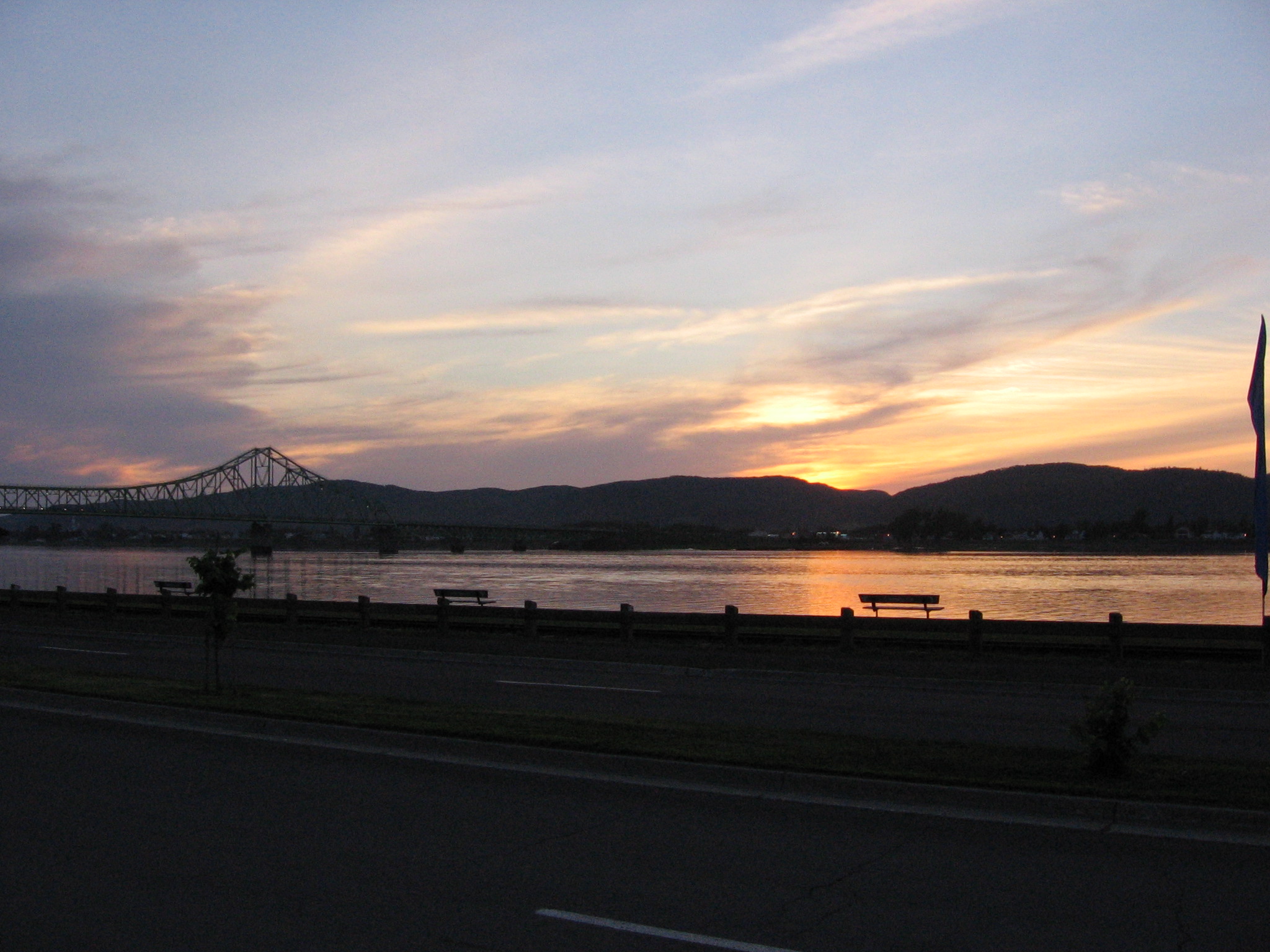
Campbellton sunset

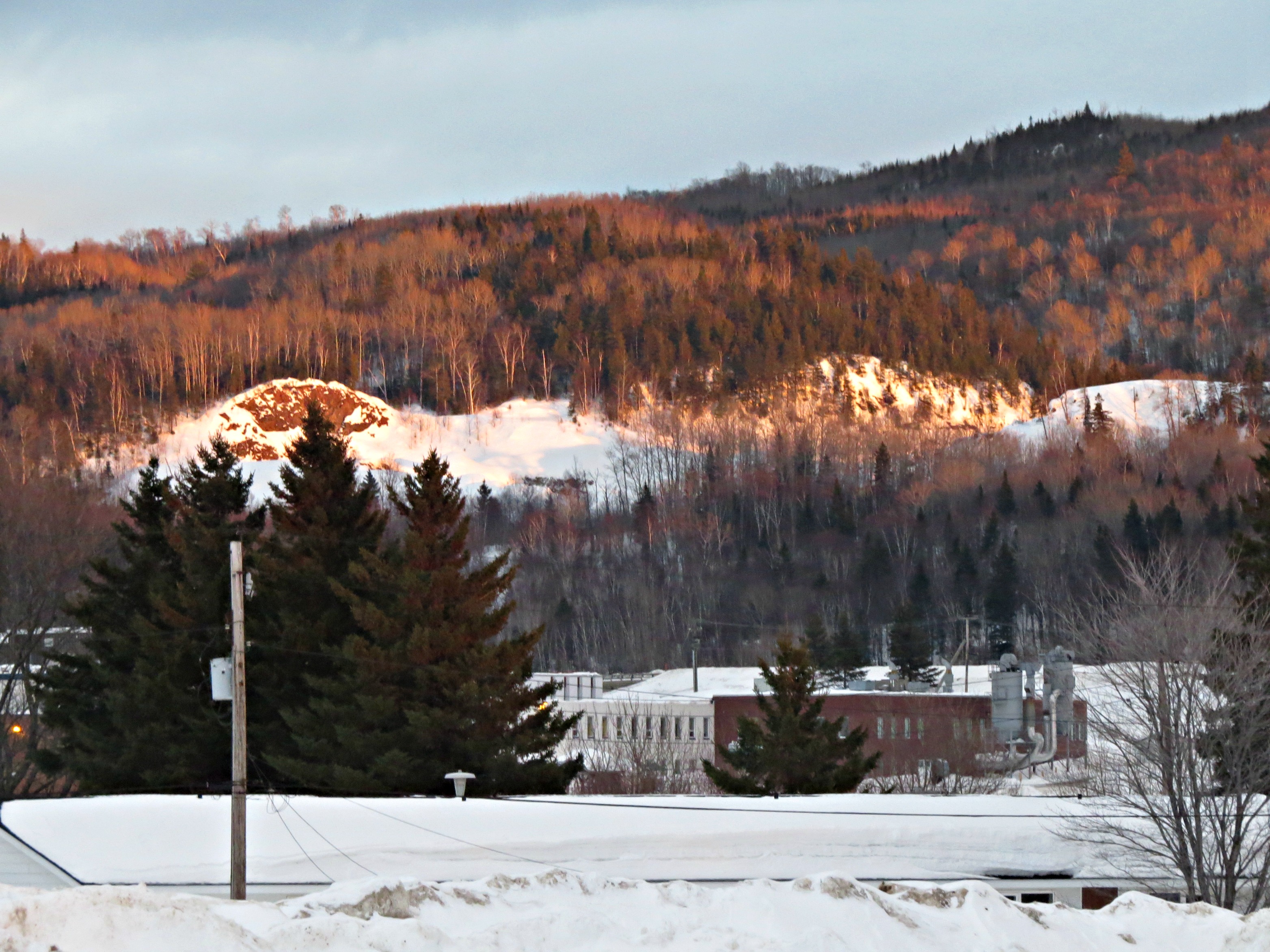
IMG_3831 Mont Sugarloaf Campbellton, N.B.

Pointe-à-la-Croix, Quebec

Restigouche River

TROISIÈME DES CHUTES À NORMAND

LA DEUXIÈME CHUTE À NORMAND

LA PREMIÈRE CHUTE À NORMAND

Road food - the ride home, 2018

Canada, au Québec, le viaduc Van Horne Bridge sur la Rivière Restigouche

World's Largest Atlantic Salmon
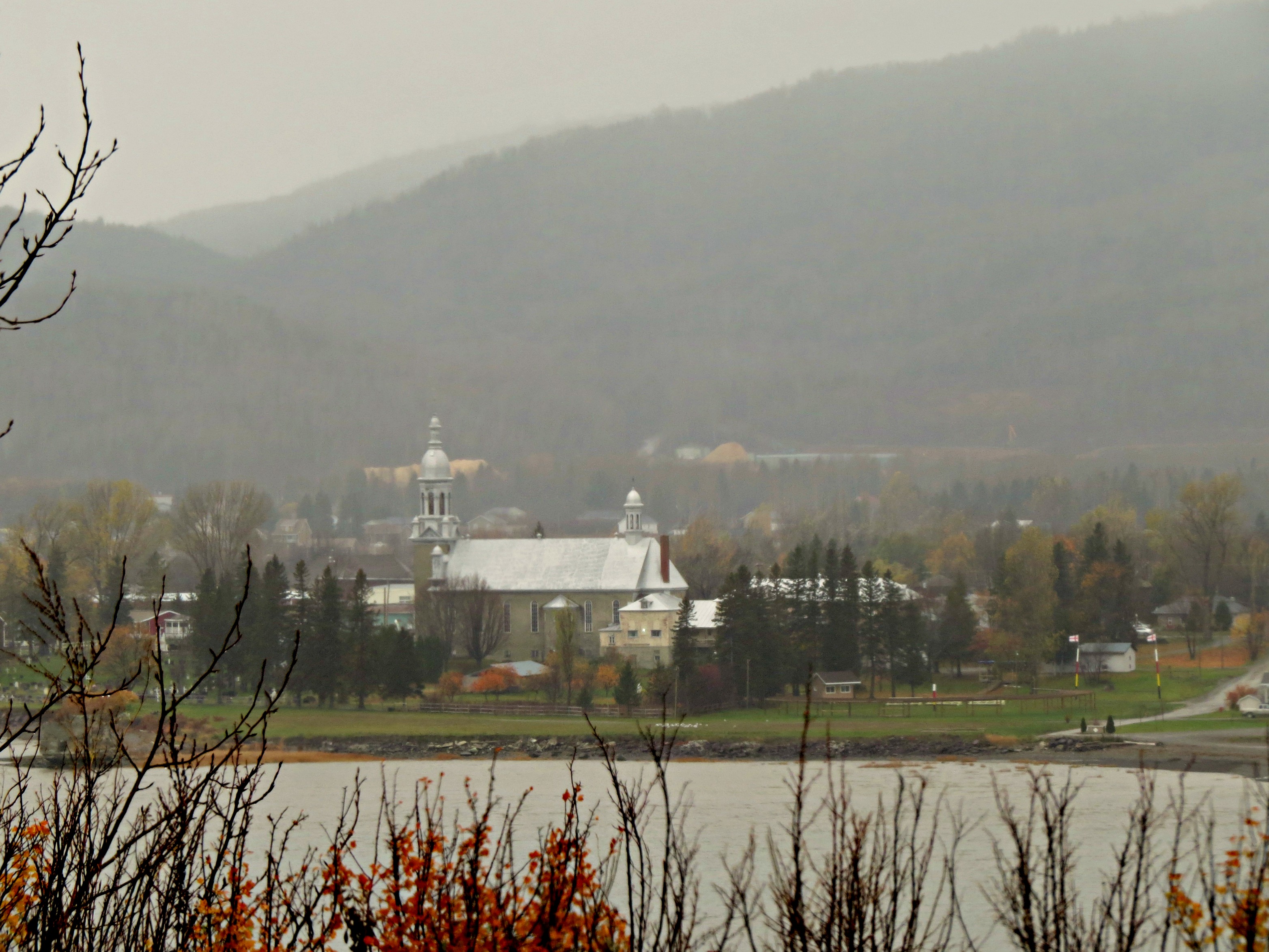
Rain and mist over the mountains and Church across the Restigouche River in Listuguj, Quebec from Atholville, New Brunswick

IMG_6375 Les prés, Pointe-à-la-Croix

IMG_6241 Bord de mer à Baie au Chêne, Pointe-à-la-Croix

IMG_6240 Les prés de Baie au Chêne, Pointe-à-la-Croix

IMG_5886 Vue sur les prés, Pointe-à-la-Croix

Andrew & Salmon; Stop / Arrêt

QUATRIÈME DES CHUTES À NORMAND

Canada, au Québec, reste de la frégate Machault au Musée Historique National

IMG_6369 Cheval libre, Pointe-à-la-Croix

IMG_6368 paysage, Pointe-à-la-Croix

IMG_6361 Paysage, Pointe-à-la-Croix

Arriving at Auberge de la Vallee

Towards a crossing
Chemin McKendrick, Val-d'Amours, NB E3N 5K6, Kanada Karte
Suchen Sie einen anderen Ort
Nahe Plätze
Chemin McKendrick, Val-d'Amours, NB E3N 5K6, Kanada
McKendrick, NB E3N 5E4, Kanada
Val-d'Amour, NB E3N, Kanada
Sugarloaf Provincial Park, Chemin Val d’Amour, Atholville, NB E3N 4C9, Kanada
25 Savoie Ave, Atholville, NB E3N 4A8, Kanada
Saint-Arthur, NB E3N, Kanada
Atholville, NB, Kanada
Sugarloaf Senior High School, Dover St, Campbellton, NB E3N 1R3, Kanada
Campbellton, New Brunswick E3N 2K4, Kanada
12 Comeau Ave, Atholville, NB E3N 4G1, Kanada
Campbellton, New Brunswick, Kanada
NB-, Saint-Arthur, NB E3N 5S4, Kanada
King Street, King St, Campbellton, NB E3N, Kanada
Pointe-à-la-Croix, QC, Kanada
Babcock St E, Tide Head, NB E3N 4K9, Kanada
88 Riverside Rd, Tide Head, NB E3N 4G7, Kanada
82 Riverside Rd, Tide Head, NB E3N 4G7, Kanada
Tide Head, NB, Kanada
Pointe-à-la-Croix, QC, Kanada
Glen Levit, NB E3N 5A1, Kanada
Letzte Suche
- Deep Gap Farm Rd E, Mill Spring, NC, USA Sonnenaufgang Sonnenuntergang Zeiten
- Jiujiangzhen, Nanhai District, Foshan, Guangdong Province, China Sonnenaufgang Sonnenuntergang Zeiten
- Mountain View, CA, USA Sonnenaufgang Sonnenuntergang Zeiten
- Road to the sky observatory, Shuenhigashi, Shari, Shari District, Hokkaido -, Japan Sonnenaufgang Sonnenuntergang Zeiten
- 海岸咖啡, No. 31號, Chaishan Ave, Gushan District, Kaohsiung City, Taiwan Sonnenaufgang Sonnenuntergang Zeiten
- Estates Loop, Priest River, ID, USA Sonnenaufgang Sonnenuntergang Zeiten
- Woodland Oak Pl, Thousand Oaks, CA, USA Sonnenaufgang Sonnenuntergang Zeiten
- Sarangdanda, Nepal Sonnenaufgang Sonnenuntergang Zeiten
- Nakanoshima, Shiogama, Miyagi -, Japan Sonnenaufgang Sonnenuntergang Zeiten
- Centre de recherche en astronomie, astrophysique et géophysique, bp - 63 Rte de l'Observatoire, Bouz Sonnenaufgang Sonnenuntergang Zeiten