Balmoral Rd, Tatamagouche, NS B0K 1V0, Kanada Sonnenaufgang Sonnenuntergang Zeiten
Location: Kanada > Nova Scotia > Colchester County > Colchester > The Falls >
Zeitzone:
America/Halifax
Ortszeit:
2024-05-01 19:43:46
Länge:
-63.222034
Breite:
45.639249
Sonnenaufgang Heute:
05:57:38 AM
Sonnenuntergang Heute:
08:21:56 PM
Tageslänge heute:
14h 24m 18s
Sonnenaufgang morgen:
05:56:10 AM
Sonnenuntergang Morgen:
08:23:12 PM
Tageslänge von morgen:
14h 27m 2s
Alle Termine anzeigen
| Datum | Sonnenaufgang | Sonnenuntergang | Tageslänge |
|---|---|---|---|
| 2024-01-01 | 07:53:22 AM | 04:39:51 PM | 8h 46m 29s |
| 2024-01-02 | 07:53:21 AM | 04:40:48 PM | 8h 47m 27s |
| 2024-01-03 | 07:53:18 AM | 04:41:46 PM | 8h 48m 28s |
| 2024-01-04 | 07:53:12 AM | 04:42:46 PM | 8h 49m 34s |
| 2024-01-05 | 07:53:03 AM | 04:43:49 PM | 8h 50m 46s |
| 2024-01-06 | 07:52:52 AM | 04:44:53 PM | 8h 52m 1s |
| 2024-01-07 | 07:52:38 AM | 04:45:58 PM | 8h 53m 20s |
| 2024-01-08 | 07:52:21 AM | 04:47:05 PM | 8h 54m 44s |
| 2024-01-09 | 07:52:02 AM | 04:48:14 PM | 8h 56m 12s |
| 2024-01-10 | 07:51:40 AM | 04:49:25 PM | 8h 57m 45s |
| 2024-01-11 | 07:51:16 AM | 04:50:36 PM | 8h 59m 20s |
| 2024-01-12 | 07:50:49 AM | 04:51:49 PM | 9h 1m 0s |
| 2024-01-13 | 07:50:19 AM | 04:53:04 PM | 9h 2m 45s |
| 2024-01-14 | 07:49:47 AM | 04:54:19 PM | 9h 4m 32s |
| 2024-01-15 | 07:49:13 AM | 04:55:36 PM | 9h 6m 23s |
| 2024-01-16 | 07:48:36 AM | 04:56:54 PM | 9h 8m 18s |
| 2024-01-17 | 07:47:56 AM | 04:58:13 PM | 9h 10m 17s |
| 2024-01-18 | 07:47:14 AM | 04:59:33 PM | 9h 12m 19s |
| 2024-01-19 | 07:46:30 AM | 05:00:54 PM | 9h 14m 24s |
| 2024-01-20 | 07:45:44 AM | 05:02:15 PM | 9h 16m 31s |
| 2024-01-21 | 07:44:55 AM | 05:03:38 PM | 9h 18m 43s |
| 2024-01-22 | 07:44:04 AM | 05:05:01 PM | 9h 20m 57s |
| 2024-01-23 | 07:43:10 AM | 05:06:25 PM | 9h 23m 15s |
| 2024-01-24 | 07:42:15 AM | 05:07:49 PM | 9h 25m 34s |
| 2024-01-25 | 07:41:17 AM | 05:09:14 PM | 9h 27m 57s |
| 2024-01-26 | 07:40:17 AM | 05:10:40 PM | 9h 30m 23s |
| 2024-01-27 | 07:39:16 AM | 05:12:06 PM | 9h 32m 50s |
| 2024-01-28 | 07:38:12 AM | 05:13:32 PM | 9h 35m 20s |
| 2024-01-29 | 07:37:06 AM | 05:14:59 PM | 9h 37m 53s |
| 2024-01-30 | 07:35:58 AM | 05:16:26 PM | 9h 40m 28s |
| 2024-01-31 | 07:34:49 AM | 05:17:53 PM | 9h 43m 4s |
| 2024-02-01 | 07:33:37 AM | 05:19:21 PM | 9h 45m 44s |
| 2024-02-02 | 07:32:24 AM | 05:20:48 PM | 9h 48m 24s |
| 2024-02-03 | 07:31:09 AM | 05:22:16 PM | 9h 51m 7s |
| 2024-02-04 | 07:29:52 AM | 05:23:44 PM | 9h 53m 52s |
| 2024-02-05 | 07:28:33 AM | 05:25:12 PM | 9h 56m 39s |
| 2024-02-06 | 07:27:13 AM | 05:26:40 PM | 9h 59m 27s |
| 2024-02-07 | 07:25:51 AM | 05:28:08 PM | 10h 2m 17s |
| 2024-02-08 | 07:24:28 AM | 05:29:37 PM | 10h 5m 9s |
| 2024-02-09 | 07:23:03 AM | 05:31:05 PM | 10h 8m 2s |
| 2024-02-10 | 07:21:37 AM | 05:32:33 PM | 10h 10m 56s |
| 2024-02-11 | 07:20:09 AM | 05:34:00 PM | 10h 13m 51s |
| 2024-02-12 | 07:18:40 AM | 05:35:28 PM | 10h 16m 48s |
| 2024-02-13 | 07:17:09 AM | 05:36:56 PM | 10h 19m 47s |
| 2024-02-14 | 07:15:37 AM | 05:38:23 PM | 10h 22m 46s |
| 2024-02-15 | 07:14:04 AM | 05:39:50 PM | 10h 25m 46s |
| 2024-02-16 | 07:12:30 AM | 05:41:17 PM | 10h 28m 47s |
| 2024-02-17 | 07:10:54 AM | 05:42:44 PM | 10h 31m 50s |
| 2024-02-18 | 07:09:18 AM | 05:44:11 PM | 10h 34m 53s |
| 2024-02-19 | 07:07:40 AM | 05:45:37 PM | 10h 37m 57s |
| 2024-02-20 | 07:06:01 AM | 05:47:03 PM | 10h 41m 2s |
| 2024-02-21 | 07:04:21 AM | 05:48:29 PM | 10h 44m 8s |
| 2024-02-22 | 07:02:40 AM | 05:49:55 PM | 10h 47m 15s |
| 2024-02-23 | 07:00:58 AM | 05:51:20 PM | 10h 50m 22s |
| 2024-02-24 | 06:59:15 AM | 05:52:45 PM | 10h 53m 30s |
| 2024-02-25 | 06:57:32 AM | 05:54:10 PM | 10h 56m 38s |
| 2024-02-26 | 06:55:47 AM | 05:55:34 PM | 10h 59m 47s |
| 2024-02-27 | 06:54:02 AM | 05:56:59 PM | 11h 2m 57s |
| 2024-02-28 | 06:52:16 AM | 05:58:23 PM | 11h 6m 7s |
| 2024-02-29 | 06:50:29 AM | 05:59:46 PM | 11h 9m 17s |
| 2024-03-01 | 06:48:41 AM | 06:01:10 PM | 11h 12m 29s |
| 2024-03-02 | 06:46:53 AM | 06:02:33 PM | 11h 15m 40s |
| 2024-03-03 | 06:45:04 AM | 06:03:56 PM | 11h 18m 52s |
| 2024-03-04 | 06:43:14 AM | 06:05:18 PM | 11h 22m 4s |
| 2024-03-05 | 06:41:24 AM | 06:06:40 PM | 11h 25m 16s |
| 2024-03-06 | 06:39:34 AM | 06:08:02 PM | 11h 28m 28s |
| 2024-03-07 | 06:37:42 AM | 06:09:24 PM | 11h 31m 42s |
| 2024-03-08 | 06:35:51 AM | 06:10:46 PM | 11h 34m 55s |
| 2024-03-09 | 06:33:59 AM | 06:12:07 PM | 11h 38m 8s |
| 2024-03-10 | 07:32:11 AM | 07:13:25 PM | 11h 41m 14s |
| 2024-03-11 | 07:30:18 AM | 07:14:45 PM | 11h 44m 27s |
| 2024-03-12 | 07:28:25 AM | 07:16:06 PM | 11h 47m 41s |
| 2024-03-13 | 07:26:31 AM | 07:17:26 PM | 11h 50m 55s |
| 2024-03-14 | 07:24:38 AM | 07:18:47 PM | 11h 54m 9s |
| 2024-03-15 | 07:22:44 AM | 07:20:07 PM | 11h 57m 23s |
| 2024-03-16 | 07:20:49 AM | 07:21:26 PM | 12h 0m 37s |
| 2024-03-17 | 07:18:55 AM | 07:22:46 PM | 12h 3m 51s |
| 2024-03-18 | 07:17:00 AM | 07:24:05 PM | 12h 7m 5s |
| 2024-03-19 | 07:15:06 AM | 07:25:25 PM | 12h 10m 19s |
| 2024-03-20 | 07:13:11 AM | 07:26:44 PM | 12h 13m 33s |
| 2024-03-21 | 07:11:16 AM | 07:28:03 PM | 12h 16m 47s |
| 2024-03-22 | 07:09:21 AM | 07:29:22 PM | 12h 20m 1s |
| 2024-03-23 | 07:07:26 AM | 07:30:40 PM | 12h 23m 14s |
| 2024-03-24 | 07:05:31 AM | 07:31:59 PM | 12h 26m 28s |
| 2024-03-25 | 07:03:37 AM | 07:33:18 PM | 12h 29m 41s |
| 2024-03-26 | 07:01:42 AM | 07:34:36 PM | 12h 32m 54s |
| 2024-03-27 | 06:59:47 AM | 07:35:55 PM | 12h 36m 8s |
| 2024-03-28 | 06:57:53 AM | 07:37:13 PM | 12h 39m 20s |
| 2024-03-29 | 06:55:59 AM | 07:38:31 PM | 12h 42m 32s |
| 2024-03-30 | 06:54:05 AM | 07:39:49 PM | 12h 45m 44s |
| 2024-03-31 | 06:52:11 AM | 07:41:07 PM | 12h 48m 56s |
| 2024-04-01 | 06:50:18 AM | 07:42:25 PM | 12h 52m 7s |
| 2024-04-02 | 06:48:24 AM | 07:43:44 PM | 12h 55m 20s |
| 2024-04-03 | 06:46:32 AM | 07:45:02 PM | 12h 58m 30s |
| 2024-04-04 | 06:44:39 AM | 07:46:20 PM | 13h 1m 41s |
| 2024-04-05 | 06:42:47 AM | 07:47:38 PM | 13h 4m 51s |
| 2024-04-06 | 06:40:56 AM | 07:48:56 PM | 13h 8m 0s |
| 2024-04-07 | 06:39:04 AM | 07:50:13 PM | 13h 11m 9s |
| 2024-04-08 | 06:37:14 AM | 07:51:31 PM | 13h 14m 17s |
| 2024-04-09 | 06:35:24 AM | 07:52:49 PM | 13h 17m 25s |
| 2024-04-10 | 06:33:34 AM | 07:54:07 PM | 13h 20m 33s |
| 2024-04-11 | 06:31:45 AM | 07:55:25 PM | 13h 23m 40s |
| 2024-04-12 | 06:29:57 AM | 07:56:43 PM | 13h 26m 46s |
| 2024-04-13 | 06:28:09 AM | 07:58:01 PM | 13h 29m 52s |
| 2024-04-14 | 06:26:23 AM | 07:59:19 PM | 13h 32m 56s |
| 2024-04-15 | 06:24:36 AM | 08:00:37 PM | 13h 36m 1s |
| 2024-04-16 | 06:22:51 AM | 08:01:55 PM | 13h 39m 4s |
| 2024-04-17 | 06:21:06 AM | 08:03:13 PM | 13h 42m 7s |
| 2024-04-18 | 06:19:23 AM | 08:04:30 PM | 13h 45m 7s |
| 2024-04-19 | 06:17:40 AM | 08:05:48 PM | 13h 48m 8s |
| 2024-04-20 | 06:15:58 AM | 08:07:06 PM | 13h 51m 8s |
| 2024-04-21 | 06:14:17 AM | 08:08:24 PM | 13h 54m 7s |
| 2024-04-22 | 06:12:37 AM | 08:09:41 PM | 13h 57m 4s |
| 2024-04-23 | 06:10:58 AM | 08:10:59 PM | 14h 0m 1s |
| 2024-04-24 | 06:09:20 AM | 08:12:16 PM | 14h 2m 56s |
| 2024-04-25 | 06:07:43 AM | 08:13:34 PM | 14h 5m 51s |
| 2024-04-26 | 06:06:07 AM | 08:14:51 PM | 14h 8m 44s |
| 2024-04-27 | 06:04:32 AM | 08:16:08 PM | 14h 11m 36s |
| 2024-04-28 | 06:02:59 AM | 08:17:25 PM | 14h 14m 26s |
| 2024-04-29 | 06:01:26 AM | 08:18:42 PM | 14h 17m 16s |
| 2024-04-30 | 05:59:56 AM | 08:19:58 PM | 14h 20m 2s |
| 2024-05-01 | 05:58:26 AM | 08:21:15 PM | 14h 22m 49s |
| 2024-05-02 | 05:56:58 AM | 08:22:31 PM | 14h 25m 33s |
| 2024-05-03 | 05:55:31 AM | 08:23:47 PM | 14h 28m 16s |
| 2024-05-04 | 05:54:05 AM | 08:25:02 PM | 14h 30m 57s |
| 2024-05-05 | 05:52:41 AM | 08:26:17 PM | 14h 33m 36s |
| 2024-05-06 | 05:51:18 AM | 08:27:32 PM | 14h 36m 14s |
| 2024-05-07 | 05:49:57 AM | 08:28:47 PM | 14h 38m 50s |
| 2024-05-08 | 05:48:38 AM | 08:30:01 PM | 14h 41m 23s |
| 2024-05-09 | 05:47:20 AM | 08:31:14 PM | 14h 43m 54s |
| 2024-05-10 | 05:46:04 AM | 08:32:27 PM | 14h 46m 23s |
| 2024-05-11 | 05:44:49 AM | 08:33:40 PM | 14h 48m 51s |
| 2024-05-12 | 05:43:36 AM | 08:34:52 PM | 14h 51m 16s |
| 2024-05-13 | 05:42:25 AM | 08:36:03 PM | 14h 53m 38s |
| 2024-05-14 | 05:41:16 AM | 08:37:14 PM | 14h 55m 58s |
| 2024-05-15 | 05:40:08 AM | 08:38:24 PM | 14h 58m 16s |
| 2024-05-16 | 05:39:03 AM | 08:39:33 PM | 15h 0m 30s |
| 2024-05-17 | 05:37:59 AM | 08:40:42 PM | 15h 2m 43s |
| 2024-05-18 | 05:36:57 AM | 08:41:49 PM | 15h 4m 52s |
| 2024-05-19 | 05:35:57 AM | 08:42:56 PM | 15h 6m 59s |
| 2024-05-20 | 05:34:59 AM | 08:44:02 PM | 15h 9m 3s |
| 2024-05-21 | 05:34:03 AM | 08:45:07 PM | 15h 11m 4s |
| 2024-05-22 | 05:33:10 AM | 08:46:11 PM | 15h 13m 1s |
| 2024-05-23 | 05:32:18 AM | 08:47:14 PM | 15h 14m 56s |
| 2024-05-24 | 05:31:28 AM | 08:48:15 PM | 15h 16m 47s |
| 2024-05-25 | 05:30:41 AM | 08:49:16 PM | 15h 18m 35s |
| 2024-05-26 | 05:29:56 AM | 08:50:15 PM | 15h 20m 19s |
| 2024-05-27 | 05:29:12 AM | 08:51:13 PM | 15h 22m 1s |
| 2024-05-28 | 05:28:32 AM | 08:52:10 PM | 15h 23m 38s |
| 2024-05-29 | 05:27:53 AM | 08:53:05 PM | 15h 25m 12s |
| 2024-05-30 | 05:27:17 AM | 08:53:59 PM | 15h 26m 42s |
| 2024-05-31 | 05:26:43 AM | 08:54:52 PM | 15h 28m 9s |
| 2024-06-01 | 05:26:11 AM | 08:55:43 PM | 15h 29m 32s |
| 2024-06-02 | 05:25:41 AM | 08:56:32 PM | 15h 30m 51s |
| 2024-06-03 | 05:25:14 AM | 08:57:20 PM | 15h 32m 6s |
| 2024-06-04 | 05:24:50 AM | 08:58:06 PM | 15h 33m 16s |
| 2024-06-05 | 05:24:27 AM | 08:58:50 PM | 15h 34m 23s |
| 2024-06-06 | 05:24:07 AM | 08:59:32 PM | 15h 35m 25s |
| 2024-06-07 | 05:23:49 AM | 09:00:13 PM | 15h 36m 24s |
| 2024-06-08 | 05:23:34 AM | 09:00:52 PM | 15h 37m 18s |
| 2024-06-09 | 05:23:21 AM | 09:01:29 PM | 15h 38m 8s |
| 2024-06-10 | 05:23:11 AM | 09:02:04 PM | 15h 38m 53s |
| 2024-06-11 | 05:23:03 AM | 09:02:37 PM | 15h 39m 34s |
| 2024-06-12 | 05:22:57 AM | 09:03:07 PM | 15h 40m 10s |
| 2024-06-13 | 05:22:54 AM | 09:03:36 PM | 15h 40m 42s |
| 2024-06-14 | 05:22:53 AM | 09:04:03 PM | 15h 41m 10s |
| 2024-06-15 | 05:22:54 AM | 09:04:27 PM | 15h 41m 33s |
| 2024-06-16 | 05:22:58 AM | 09:04:49 PM | 15h 41m 51s |
| 2024-06-17 | 05:23:04 AM | 09:05:10 PM | 15h 42m 6s |
| 2024-06-18 | 05:23:12 AM | 09:05:27 PM | 15h 42m 15s |
| 2024-06-19 | 05:23:23 AM | 09:05:43 PM | 15h 42m 20s |
| 2024-06-20 | 05:23:36 AM | 09:05:56 PM | 15h 42m 20s |
| 2024-06-21 | 05:23:51 AM | 09:06:07 PM | 15h 42m 16s |
| 2024-06-22 | 05:24:08 AM | 09:06:15 PM | 15h 42m 7s |
| 2024-06-23 | 05:24:28 AM | 09:06:22 PM | 15h 41m 54s |
| 2024-06-24 | 05:24:50 AM | 09:06:25 PM | 15h 41m 35s |
| 2024-06-25 | 05:25:14 AM | 09:06:27 PM | 15h 41m 13s |
| 2024-06-26 | 05:25:40 AM | 09:06:26 PM | 15h 40m 46s |
| 2024-06-27 | 05:26:08 AM | 09:06:22 PM | 15h 40m 14s |
| 2024-06-28 | 05:26:38 AM | 09:06:16 PM | 15h 39m 38s |
| 2024-06-29 | 05:27:10 AM | 09:06:08 PM | 15h 38m 58s |
| 2024-06-30 | 05:27:44 AM | 09:05:57 PM | 15h 38m 13s |
| 2024-07-01 | 05:28:19 AM | 09:05:44 PM | 15h 37m 25s |
| 2024-07-02 | 05:28:57 AM | 09:05:28 PM | 15h 36m 31s |
| 2024-07-03 | 05:29:37 AM | 09:05:10 PM | 15h 35m 33s |
| 2024-07-04 | 05:30:18 AM | 09:04:50 PM | 15h 34m 32s |
| 2024-07-05 | 05:31:01 AM | 09:04:27 PM | 15h 33m 26s |
| 2024-07-06 | 05:31:45 AM | 09:04:02 PM | 15h 32m 17s |
| 2024-07-07 | 05:32:32 AM | 09:03:34 PM | 15h 31m 2s |
| 2024-07-08 | 05:33:19 AM | 09:03:04 PM | 15h 29m 45s |
| 2024-07-09 | 05:34:09 AM | 09:02:32 PM | 15h 28m 23s |
| 2024-07-10 | 05:34:59 AM | 09:01:57 PM | 15h 26m 58s |
| 2024-07-11 | 05:35:51 AM | 09:01:20 PM | 15h 25m 29s |
| 2024-07-12 | 05:36:45 AM | 09:00:41 PM | 15h 23m 56s |
| 2024-07-13 | 05:37:40 AM | 08:59:59 PM | 15h 22m 19s |
| 2024-07-14 | 05:38:36 AM | 08:59:15 PM | 15h 20m 39s |
| 2024-07-15 | 05:39:33 AM | 08:58:29 PM | 15h 18m 56s |
| 2024-07-16 | 05:40:31 AM | 08:57:41 PM | 15h 17m 10s |
| 2024-07-17 | 05:41:31 AM | 08:56:50 PM | 15h 15m 19s |
| 2024-07-18 | 05:42:31 AM | 08:55:58 PM | 15h 13m 27s |
| 2024-07-19 | 05:43:33 AM | 08:55:03 PM | 15h 11m 30s |
| 2024-07-20 | 05:44:35 AM | 08:54:06 PM | 15h 9m 31s |
| 2024-07-21 | 05:45:39 AM | 08:53:08 PM | 15h 7m 29s |
| 2024-07-22 | 05:46:43 AM | 08:52:07 PM | 15h 5m 24s |
| 2024-07-23 | 05:47:48 AM | 08:51:04 PM | 15h 3m 16s |
| 2024-07-24 | 05:48:53 AM | 08:49:59 PM | 15h 1m 6s |
| 2024-07-25 | 05:50:00 AM | 08:48:53 PM | 14h 58m 53s |
| 2024-07-26 | 05:51:07 AM | 08:47:44 PM | 14h 56m 37s |
| 2024-07-27 | 05:52:15 AM | 08:46:34 PM | 14h 54m 19s |
| 2024-07-28 | 05:53:23 AM | 08:45:22 PM | 14h 51m 59s |
| 2024-07-29 | 05:54:32 AM | 08:44:08 PM | 14h 49m 36s |
| 2024-07-30 | 05:55:42 AM | 08:42:52 PM | 14h 47m 10s |
| 2024-07-31 | 05:56:51 AM | 08:41:35 PM | 14h 44m 44s |
| 2024-08-01 | 05:58:02 AM | 08:40:16 PM | 14h 42m 14s |
| 2024-08-02 | 05:59:12 AM | 08:38:56 PM | 14h 39m 44s |
| 2024-08-03 | 06:00:23 AM | 08:37:33 PM | 14h 37m 10s |
| 2024-08-04 | 06:01:35 AM | 08:36:10 PM | 14h 34m 35s |
| 2024-08-05 | 06:02:47 AM | 08:34:45 PM | 14h 31m 58s |
| 2024-08-06 | 06:03:59 AM | 08:33:18 PM | 14h 29m 19s |
| 2024-08-07 | 06:05:11 AM | 08:31:50 PM | 14h 26m 39s |
| 2024-08-08 | 06:06:23 AM | 08:30:20 PM | 14h 23m 57s |
| 2024-08-09 | 06:07:36 AM | 08:28:50 PM | 14h 21m 14s |
| 2024-08-10 | 06:08:49 AM | 08:27:18 PM | 14h 18m 29s |
| 2024-08-11 | 06:10:02 AM | 08:25:44 PM | 14h 15m 42s |
| 2024-08-12 | 06:11:15 AM | 08:24:10 PM | 14h 12m 55s |
| 2024-08-13 | 06:12:28 AM | 08:22:34 PM | 14h 10m 6s |
| 2024-08-14 | 06:13:42 AM | 08:20:57 PM | 14h 7m 15s |
| 2024-08-15 | 06:14:55 AM | 08:19:19 PM | 14h 4m 24s |
| 2024-08-16 | 06:16:08 AM | 08:17:39 PM | 14h 1m 31s |
| 2024-08-17 | 06:17:22 AM | 08:15:59 PM | 13h 58m 37s |
| 2024-08-18 | 06:18:35 AM | 08:14:18 PM | 13h 55m 43s |
| 2024-08-19 | 06:19:49 AM | 08:12:36 PM | 13h 52m 47s |
| 2024-08-20 | 06:21:03 AM | 08:10:52 PM | 13h 49m 49s |
| 2024-08-21 | 06:22:16 AM | 08:09:08 PM | 13h 46m 52s |
| 2024-08-22 | 06:23:30 AM | 08:07:23 PM | 13h 43m 53s |
| 2024-08-23 | 06:24:43 AM | 08:05:37 PM | 13h 40m 54s |
| 2024-08-24 | 06:25:57 AM | 08:03:51 PM | 13h 37m 54s |
| 2024-08-25 | 06:27:11 AM | 08:02:03 PM | 13h 34m 52s |
| 2024-08-26 | 06:28:24 AM | 08:00:15 PM | 13h 31m 51s |
| 2024-08-27 | 06:29:38 AM | 07:58:26 PM | 13h 28m 48s |
| 2024-08-28 | 06:30:51 AM | 07:56:36 PM | 13h 25m 45s |
| 2024-08-29 | 06:32:05 AM | 07:54:46 PM | 13h 22m 41s |
| 2024-08-30 | 06:33:18 AM | 07:52:55 PM | 13h 19m 37s |
| 2024-08-31 | 06:34:32 AM | 07:51:03 PM | 13h 16m 31s |
| 2024-09-01 | 06:35:45 AM | 07:49:11 PM | 13h 13m 26s |
| 2024-09-02 | 06:36:58 AM | 07:47:19 PM | 13h 10m 21s |
| 2024-09-03 | 06:38:12 AM | 07:45:26 PM | 13h 7m 14s |
| 2024-09-04 | 06:39:25 AM | 07:43:32 PM | 13h 4m 7s |
| 2024-09-05 | 06:40:38 AM | 07:41:38 PM | 13h 1m 0s |
| 2024-09-06 | 06:41:52 AM | 07:39:44 PM | 12h 57m 52s |
| 2024-09-07 | 06:43:05 AM | 07:37:49 PM | 12h 54m 44s |
| 2024-09-08 | 06:44:18 AM | 07:35:54 PM | 12h 51m 36s |
| 2024-09-09 | 06:45:32 AM | 07:33:59 PM | 12h 48m 27s |
| 2024-09-10 | 06:46:45 AM | 07:32:03 PM | 12h 45m 18s |
| 2024-09-11 | 06:47:59 AM | 07:30:07 PM | 12h 42m 8s |
| 2024-09-12 | 06:49:12 AM | 07:28:11 PM | 12h 38m 59s |
| 2024-09-13 | 06:50:26 AM | 07:26:15 PM | 12h 35m 49s |
| 2024-09-14 | 06:51:39 AM | 07:24:18 PM | 12h 32m 39s |
| 2024-09-15 | 06:52:53 AM | 07:22:22 PM | 12h 29m 29s |
| 2024-09-16 | 06:54:07 AM | 07:20:25 PM | 12h 26m 18s |
| 2024-09-17 | 06:55:20 AM | 07:18:29 PM | 12h 23m 9s |
| 2024-09-18 | 06:56:34 AM | 07:16:32 PM | 12h 19m 58s |
| 2024-09-19 | 06:57:48 AM | 07:14:35 PM | 12h 16m 47s |
| 2024-09-20 | 06:59:03 AM | 07:12:38 PM | 12h 13m 35s |
| 2024-09-21 | 07:00:17 AM | 07:10:42 PM | 12h 10m 25s |
| 2024-09-22 | 07:01:31 AM | 07:08:45 PM | 12h 7m 14s |
| 2024-09-23 | 07:02:46 AM | 07:06:49 PM | 12h 4m 3s |
| 2024-09-24 | 07:04:01 AM | 07:04:52 PM | 12h 0m 51s |
| 2024-09-25 | 07:05:16 AM | 07:02:56 PM | 11h 57m 40s |
| 2024-09-26 | 07:06:31 AM | 07:01:00 PM | 11h 54m 29s |
| 2024-09-27 | 07:07:46 AM | 06:59:05 PM | 11h 51m 19s |
| 2024-09-28 | 07:09:02 AM | 06:57:09 PM | 11h 48m 7s |
| 2024-09-29 | 07:10:17 AM | 06:55:14 PM | 11h 44m 57s |
| 2024-09-30 | 07:11:33 AM | 06:53:19 PM | 11h 41m 46s |
| 2024-10-01 | 07:12:50 AM | 06:51:25 PM | 11h 38m 35s |
| 2024-10-02 | 07:14:06 AM | 06:49:31 PM | 11h 35m 25s |
| 2024-10-03 | 07:15:23 AM | 06:47:37 PM | 11h 32m 14s |
| 2024-10-04 | 07:16:40 AM | 06:45:44 PM | 11h 29m 4s |
| 2024-10-05 | 07:17:57 AM | 06:43:52 PM | 11h 25m 55s |
| 2024-10-06 | 07:19:14 AM | 06:42:00 PM | 11h 22m 46s |
| 2024-10-07 | 07:20:32 AM | 06:40:08 PM | 11h 19m 36s |
| 2024-10-08 | 07:21:50 AM | 06:38:17 PM | 11h 16m 27s |
| 2024-10-09 | 07:23:09 AM | 06:36:27 PM | 11h 13m 18s |
| 2024-10-10 | 07:24:27 AM | 06:34:37 PM | 11h 10m 10s |
| 2024-10-11 | 07:25:46 AM | 06:32:48 PM | 11h 7m 2s |
| 2024-10-12 | 07:27:05 AM | 06:31:00 PM | 11h 3m 55s |
| 2024-10-13 | 07:28:25 AM | 06:29:12 PM | 11h 0m 47s |
| 2024-10-14 | 07:29:45 AM | 06:27:26 PM | 10h 57m 41s |
| 2024-10-15 | 07:31:05 AM | 06:25:40 PM | 10h 54m 35s |
| 2024-10-16 | 07:32:26 AM | 06:23:55 PM | 10h 51m 29s |
| 2024-10-17 | 07:33:46 AM | 06:22:11 PM | 10h 48m 25s |
| 2024-10-18 | 07:35:07 AM | 06:20:28 PM | 10h 45m 21s |
| 2024-10-19 | 07:36:29 AM | 06:18:45 PM | 10h 42m 16s |
| 2024-10-20 | 07:37:50 AM | 06:17:04 PM | 10h 39m 14s |
| 2024-10-21 | 07:39:12 AM | 06:15:24 PM | 10h 36m 12s |
| 2024-10-22 | 07:40:35 AM | 06:13:45 PM | 10h 33m 10s |
| 2024-10-23 | 07:41:57 AM | 06:12:07 PM | 10h 30m 10s |
| 2024-10-24 | 07:43:20 AM | 06:10:30 PM | 10h 27m 10s |
| 2024-10-25 | 07:44:43 AM | 06:08:55 PM | 10h 24m 12s |
| 2024-10-26 | 07:46:06 AM | 06:07:21 PM | 10h 21m 15s |
| 2024-10-27 | 07:47:30 AM | 06:05:48 PM | 10h 18m 18s |
| 2024-10-28 | 07:48:53 AM | 06:04:16 PM | 10h 15m 23s |
| 2024-10-29 | 07:50:17 AM | 06:02:46 PM | 10h 12m 29s |
| 2024-10-30 | 07:51:41 AM | 06:01:17 PM | 10h 9m 36s |
| 2024-10-31 | 07:53:05 AM | 05:59:49 PM | 10h 6m 44s |
| 2024-11-01 | 07:54:30 AM | 05:58:23 PM | 10h 3m 53s |
| 2024-11-02 | 07:55:54 AM | 05:56:59 PM | 10h 1m 5s |
| 2024-11-03 | 06:57:22 AM | 04:55:33 PM | 9h 58m 11s |
| 2024-11-04 | 06:58:46 AM | 04:54:11 PM | 9h 55m 25s |
| 2024-11-05 | 07:00:11 AM | 04:52:52 PM | 9h 52m 41s |
| 2024-11-06 | 07:01:35 AM | 04:51:34 PM | 9h 49m 59s |
| 2024-11-07 | 07:03:00 AM | 04:50:18 PM | 9h 47m 18s |
| 2024-11-08 | 07:04:24 AM | 04:49:04 PM | 9h 44m 40s |
| 2024-11-09 | 07:05:48 AM | 04:47:51 PM | 9h 42m 3s |
| 2024-11-10 | 07:07:12 AM | 04:46:41 PM | 9h 39m 29s |
| 2024-11-11 | 07:08:36 AM | 04:45:32 PM | 9h 36m 56s |
| 2024-11-12 | 07:09:59 AM | 04:44:25 PM | 9h 34m 26s |
| 2024-11-13 | 07:11:23 AM | 04:43:20 PM | 9h 31m 57s |
| 2024-11-14 | 07:12:45 AM | 04:42:18 PM | 9h 29m 33s |
| 2024-11-15 | 07:14:08 AM | 04:41:17 PM | 9h 27m 9s |
| 2024-11-16 | 07:15:30 AM | 04:40:18 PM | 9h 24m 48s |
| 2024-11-17 | 07:16:51 AM | 04:39:22 PM | 9h 22m 31s |
| 2024-11-18 | 07:18:12 AM | 04:38:28 PM | 9h 20m 16s |
| 2024-11-19 | 07:19:33 AM | 04:37:36 PM | 9h 18m 3s |
| 2024-11-20 | 07:20:52 AM | 04:36:46 PM | 9h 15m 54s |
| 2024-11-21 | 07:22:11 AM | 04:35:59 PM | 9h 13m 48s |
| 2024-11-22 | 07:23:30 AM | 04:35:14 PM | 9h 11m 44s |
| 2024-11-23 | 07:24:47 AM | 04:34:32 PM | 9h 9m 45s |
| 2024-11-24 | 07:26:04 AM | 04:33:51 PM | 9h 7m 47s |
| 2024-11-25 | 07:27:19 AM | 04:33:14 PM | 9h 5m 55s |
| 2024-11-26 | 07:28:34 AM | 04:32:39 PM | 9h 4m 5s |
| 2024-11-27 | 07:29:47 AM | 04:32:06 PM | 9h 2m 19s |
| 2024-11-28 | 07:30:59 AM | 04:31:36 PM | 9h 0m 37s |
| 2024-11-29 | 07:32:10 AM | 04:31:08 PM | 8h 58m 58s |
| 2024-11-30 | 07:33:20 AM | 04:30:43 PM | 8h 57m 23s |
| 2024-12-01 | 07:34:28 AM | 04:30:21 PM | 8h 55m 53s |
| 2024-12-02 | 07:35:35 AM | 04:30:01 PM | 8h 54m 26s |
| 2024-12-03 | 07:36:41 AM | 04:29:44 PM | 8h 53m 3s |
| 2024-12-04 | 07:37:45 AM | 04:29:29 PM | 8h 51m 44s |
| 2024-12-05 | 07:38:47 AM | 04:29:18 PM | 8h 50m 31s |
| 2024-12-06 | 07:39:48 AM | 04:29:09 PM | 8h 49m 21s |
| 2024-12-07 | 07:40:47 AM | 04:29:02 PM | 8h 48m 15s |
| 2024-12-08 | 07:41:44 AM | 04:28:59 PM | 8h 47m 15s |
| 2024-12-09 | 07:42:39 AM | 04:28:58 PM | 8h 46m 19s |
| 2024-12-10 | 07:43:32 AM | 04:29:00 PM | 8h 45m 28s |
| 2024-12-11 | 07:44:24 AM | 04:29:04 PM | 8h 44m 40s |
| 2024-12-12 | 07:45:13 AM | 04:29:12 PM | 8h 43m 59s |
| 2024-12-13 | 07:46:00 AM | 04:29:22 PM | 8h 43m 22s |
| 2024-12-14 | 07:46:45 AM | 04:29:34 PM | 8h 42m 49s |
| 2024-12-15 | 07:47:28 AM | 04:29:50 PM | 8h 42m 22s |
| 2024-12-16 | 07:48:09 AM | 04:30:08 PM | 8h 41m 59s |
| 2024-12-17 | 07:48:47 AM | 04:30:28 PM | 8h 41m 41s |
| 2024-12-18 | 07:49:23 AM | 04:30:52 PM | 8h 41m 29s |
| 2024-12-19 | 07:49:56 AM | 04:31:18 PM | 8h 41m 22s |
| 2024-12-20 | 07:50:27 AM | 04:31:46 PM | 8h 41m 19s |
| 2024-12-21 | 07:50:56 AM | 04:32:17 PM | 8h 41m 21s |
| 2024-12-22 | 07:51:22 AM | 04:32:51 PM | 8h 41m 29s |
| 2024-12-23 | 07:51:46 AM | 04:33:27 PM | 8h 41m 41s |
| 2024-12-24 | 07:52:07 AM | 04:34:05 PM | 8h 41m 58s |
| 2024-12-25 | 07:52:26 AM | 04:34:46 PM | 8h 42m 20s |
| 2024-12-26 | 07:52:41 AM | 04:35:29 PM | 8h 42m 48s |
| 2024-12-27 | 07:52:55 AM | 04:36:14 PM | 8h 43m 19s |
| 2024-12-28 | 07:53:05 AM | 04:37:02 PM | 8h 43m 57s |
| 2024-12-29 | 07:53:13 AM | 04:37:52 PM | 8h 44m 39s |
| 2024-12-30 | 07:53:19 AM | 04:38:44 PM | 8h 45m 25s |
Fotos

Low Tide
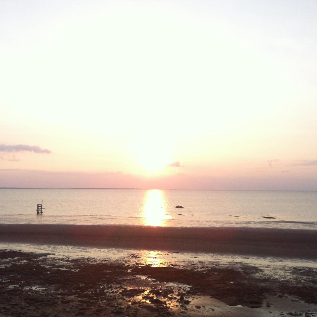
For those of you who haven't been fortunate to experience Brule Beach sunsets...enjoy the following photos #BruleBeach #EpicSunsets
Calmness at Brule Beach #LowTide #SerenityRules #NovaScotiaBeaches #Canada'sOceanPlayground
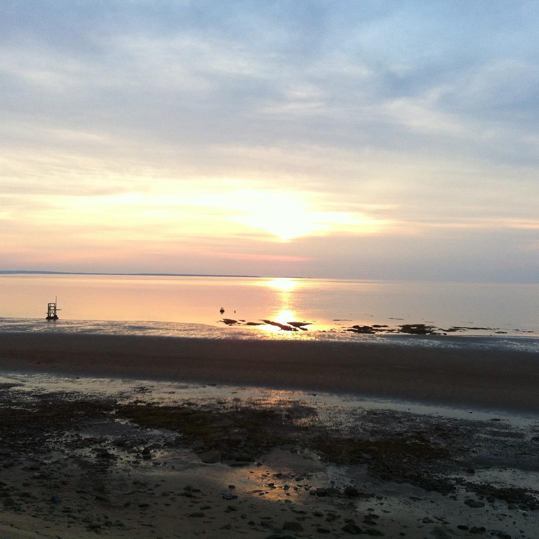
It was a good night
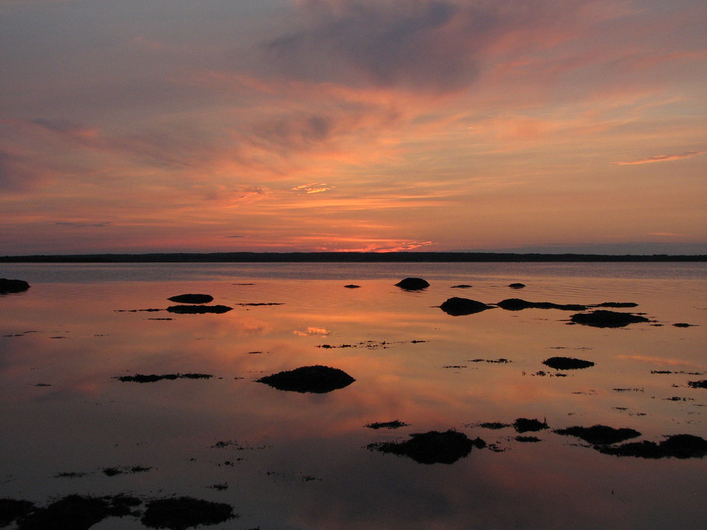
Broken mirror
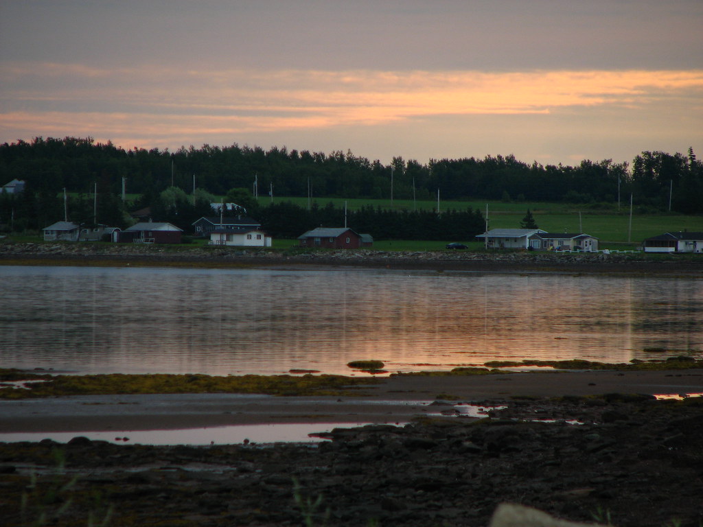
Sunrise
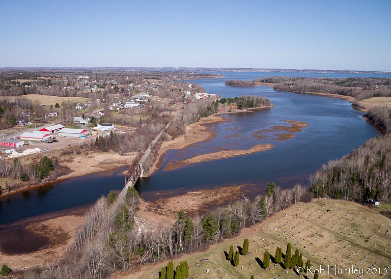
Aerial view of the town of Tatamagouche, Nova Scotia alongside the Waugh River - Kite Aerial Photography (KAP)

Aerial view of the town of Tatamagouche, Nova Scotia alongside the Waugh River - Kite Aerial Photography (KAP)

Aerial view of the Waugh River flowing past Tatamagouche, Nova Scotia - Kite Aerial Photography (KAP)

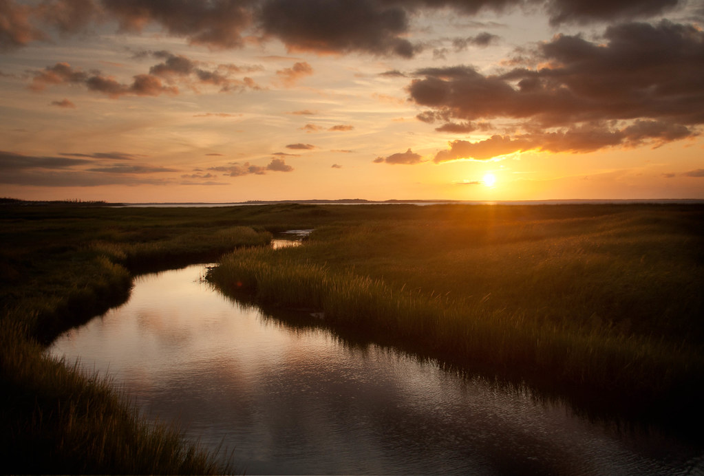
Waterfall at Earltown

Waterfall at Earltown2
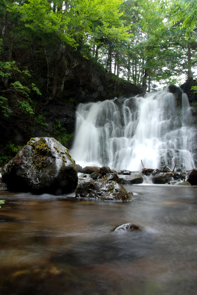
Earltown Falls in Nova Scotia
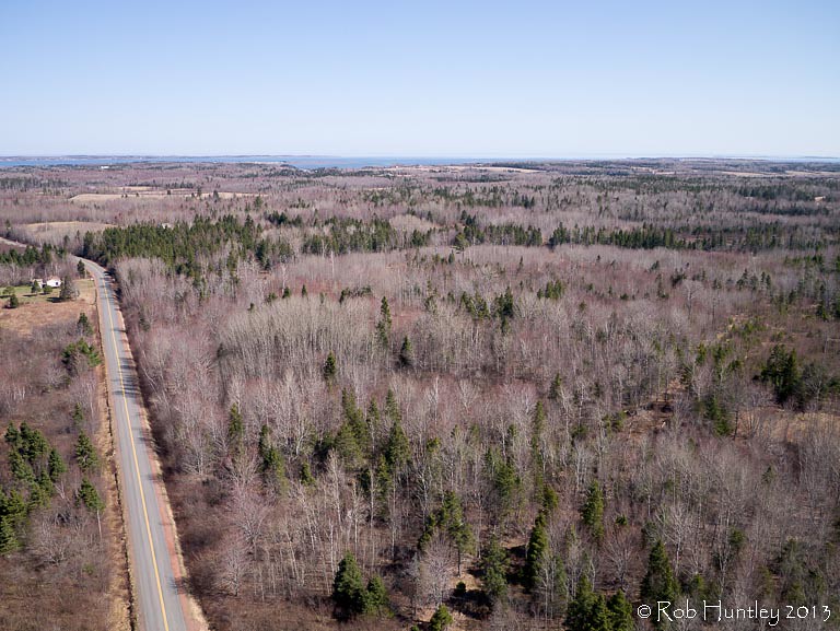
Aerial view of a road through the countryside near Tatamagouche, Nova Scotia - Kite Aerial Photography (KAP)
Balmoral Rd, Tatamagouche, NS B0K 1V0, Kanada Karte
Suchen Sie einen anderen Ort
Nahe Plätze
The Falls, NS B0K, Kanada
Matheson Brook Rd, Tatamagouche, NS B0K 1V0, Kanada
Balfron, NS B0K 1V0, Kanada
Balmoral Mills, NS B0K, Kanada
Tatamagouche, Nova Scotia B0K 1V0, Kanada
Waldegrave, NS B0K, Kanada
11 Alex Cox Rd, Tatamagouche, NS B0K 1V0, Kanada
Nuttby Mountain, Nuttby, NS B6L 6N2, Kanada
Nuttby, NS, Kanada
Nova Scotia, NS-, Colchester, Subd. B, NS B0K, Kanada
Barrachois, NS B0K 1V0, Kanada
NS-, Tatamagouche, NS B0K 1V0, Kanada
68 College Grant Rd, Scotsburn, NS B0K 1R0, Kanada
College Grant, NS B0K 1N0, Kanada
Truro Rd, McCallum Settlement, NS B6L 6V5, Kanada
Hobby Barn, NS-, Upper North River, NS B6L 6J8, Kanada
Upper North River, NS B6L, Kanada
Kemptown, NS, Kanada
Welsford, NS B0K 1N0, Kanada
Cape John, NS, Kanada
Letzte Suche
- 6 Rue Jules Ferry, Beausoleil, Frankreich Sonnenaufgang Sonnenuntergang Zeiten
- Otxandio, Biscay, Spain Sonnenaufgang Sonnenuntergang Zeiten
- Sattva Horizon, 4JC6+G9P, Vinayak Nagar, Kattigenahalli, Bengaluru, Karnataka, Indien Sonnenaufgang Sonnenuntergang Zeiten
- 富士山, Kitayama, Fujinomiya, Präfektur Shizuoka -, Japan Sonnenaufgang Sonnenuntergang Zeiten
- Laurel Rd, Townsend, TN, USA Sonnenaufgang Sonnenuntergang Zeiten
- Haibin South Road, China, Guang Dong Sheng, Shen Zhen Shi, Long Gang Qu, 海滨南路GFPQ+R9Q Sonnenaufgang Sonnenuntergang Zeiten
- Redondo Ave, Long Beach, CA, USA Sonnenaufgang Sonnenuntergang Zeiten
- Ulitsa Kalinina, 79, Rezh, Sverdlovskaya oblast', Russia Sonnenaufgang Sonnenuntergang Zeiten
- Leguwa, Nepal Sonnenaufgang Sonnenuntergang Zeiten
- Shustino, Vladimir Oblast, Russland Sonnenaufgang Sonnenuntergang Zeiten