Sunrise Sunset Times of Chihuahua Valley Rd, Warner Springs, CA, USA
Location: United States > California > San Diego County > Warner Springs >
Timezone:
America/Los_Angeles
Current Time:
2024-05-02 15:21:26
Longitude:
-116.6957026
Latitude:
33.3845567
Sunrise Today:
05:55:33 AM
Sunset Today:
07:31:35 PM
Daylength Today:
13h 36m 2s
Sunrise Tomorrow:
05:54:37 AM
Sunset Tomorrow:
07:32:20 PM
Daylength Tomorrow:
13h 37m 43s
Year Show All Dates
| Date | Sunrise | Sunset | Daylength |
|---|---|---|---|
| 01/01/2024 | 06:50:45 AM | 04:50:33 PM | 9h 59m 48s |
| 01/02/2024 | 06:50:55 AM | 04:51:19 PM | 10h 0m 24s |
| 01/03/2024 | 06:51:03 AM | 04:52:06 PM | 10h 1m 3s |
| 01/04/2024 | 06:51:09 AM | 04:52:53 PM | 10h 1m 44s |
| 01/05/2024 | 06:51:14 AM | 04:53:42 PM | 10h 2m 28s |
| 01/06/2024 | 06:51:17 AM | 04:54:31 PM | 10h 3m 14s |
| 01/07/2024 | 06:51:18 AM | 04:55:22 PM | 10h 4m 4s |
| 01/08/2024 | 06:51:17 AM | 04:56:13 PM | 10h 4m 56s |
| 01/09/2024 | 06:51:14 AM | 04:57:05 PM | 10h 5m 51s |
| 01/10/2024 | 06:51:10 AM | 04:57:57 PM | 10h 6m 47s |
| 01/11/2024 | 06:51:03 AM | 04:58:51 PM | 10h 7m 48s |
| 01/12/2024 | 06:50:55 AM | 04:59:44 PM | 10h 8m 49s |
| 01/13/2024 | 06:50:45 AM | 05:00:39 PM | 10h 9m 54s |
| 01/14/2024 | 06:50:33 AM | 05:01:34 PM | 10h 11m 1s |
| 01/15/2024 | 06:50:20 AM | 05:02:29 PM | 10h 12m 9s |
| 01/16/2024 | 06:50:04 AM | 05:03:25 PM | 10h 13m 21s |
| 01/17/2024 | 06:49:47 AM | 05:04:21 PM | 10h 14m 34s |
| 01/18/2024 | 06:49:28 AM | 05:05:18 PM | 10h 15m 50s |
| 01/19/2024 | 06:49:07 AM | 05:06:15 PM | 10h 17m 8s |
| 01/20/2024 | 06:48:45 AM | 05:07:12 PM | 10h 18m 27s |
| 01/21/2024 | 06:48:20 AM | 05:08:10 PM | 10h 19m 50s |
| 01/22/2024 | 06:47:54 AM | 05:09:07 PM | 10h 21m 13s |
| 01/23/2024 | 06:47:27 AM | 05:10:05 PM | 10h 22m 38s |
| 01/24/2024 | 06:46:57 AM | 05:11:03 PM | 10h 24m 6s |
| 01/25/2024 | 06:46:26 AM | 05:12:01 PM | 10h 25m 35s |
| 01/26/2024 | 06:45:53 AM | 05:12:59 PM | 10h 27m 6s |
| 01/27/2024 | 06:45:19 AM | 05:13:57 PM | 10h 28m 38s |
| 01/28/2024 | 06:44:43 AM | 05:14:55 PM | 10h 30m 12s |
| 01/29/2024 | 06:44:05 AM | 05:15:53 PM | 10h 31m 48s |
| 01/30/2024 | 06:43:26 AM | 05:16:51 PM | 10h 33m 25s |
| 01/31/2024 | 06:42:45 AM | 05:17:49 PM | 10h 35m 4s |
| 02/01/2024 | 06:42:03 AM | 05:18:47 PM | 10h 36m 44s |
| 02/02/2024 | 06:41:19 AM | 05:19:44 PM | 10h 38m 25s |
| 02/03/2024 | 06:40:34 AM | 05:20:42 PM | 10h 40m 8s |
| 02/04/2024 | 06:39:47 AM | 05:21:39 PM | 10h 41m 52s |
| 02/05/2024 | 06:38:59 AM | 05:22:36 PM | 10h 43m 37s |
| 02/06/2024 | 06:38:10 AM | 05:23:33 PM | 10h 45m 23s |
| 02/07/2024 | 06:37:19 AM | 05:24:30 PM | 10h 47m 11s |
| 02/08/2024 | 06:36:27 AM | 05:25:26 PM | 10h 48m 59s |
| 02/09/2024 | 06:35:34 AM | 05:26:22 PM | 10h 50m 48s |
| 02/10/2024 | 06:34:39 AM | 05:27:18 PM | 10h 52m 39s |
| 02/11/2024 | 06:33:43 AM | 05:28:13 PM | 10h 54m 30s |
| 02/12/2024 | 06:32:46 AM | 05:29:08 PM | 10h 56m 22s |
| 02/13/2024 | 06:31:48 AM | 05:30:03 PM | 10h 58m 15s |
| 02/14/2024 | 06:30:48 AM | 05:30:58 PM | 11h 0m 10s |
| 02/15/2024 | 06:29:48 AM | 05:31:52 PM | 11h 2m 4s |
| 02/16/2024 | 06:28:46 AM | 05:32:46 PM | 11h 4m 0s |
| 02/17/2024 | 06:27:43 AM | 05:33:39 PM | 11h 5m 56s |
| 02/18/2024 | 06:26:40 AM | 05:34:33 PM | 11h 7m 53s |
| 02/19/2024 | 06:25:35 AM | 05:35:25 PM | 11h 9m 50s |
| 02/20/2024 | 06:24:29 AM | 05:36:18 PM | 11h 11m 49s |
| 02/21/2024 | 06:23:23 AM | 05:37:10 PM | 11h 13m 47s |
| 02/22/2024 | 06:22:15 AM | 05:38:02 PM | 11h 15m 47s |
| 02/23/2024 | 06:21:07 AM | 05:38:53 PM | 11h 17m 46s |
| 02/24/2024 | 06:19:58 AM | 05:39:44 PM | 11h 19m 46s |
| 02/25/2024 | 06:18:48 AM | 05:40:35 PM | 11h 21m 47s |
| 02/26/2024 | 06:17:37 AM | 05:41:25 PM | 11h 23m 48s |
| 02/27/2024 | 06:16:25 AM | 05:42:15 PM | 11h 25m 50s |
| 02/28/2024 | 06:15:13 AM | 05:43:05 PM | 11h 27m 52s |
| 02/29/2024 | 06:14:00 AM | 05:43:55 PM | 11h 29m 55s |
| 03/01/2024 | 06:12:47 AM | 05:44:44 PM | 11h 31m 57s |
| 03/02/2024 | 06:11:32 AM | 05:45:32 PM | 11h 34m 0s |
| 03/03/2024 | 06:10:18 AM | 05:46:21 PM | 11h 36m 3s |
| 03/04/2024 | 06:09:02 AM | 05:47:09 PM | 11h 38m 7s |
| 03/05/2024 | 06:07:46 AM | 05:47:57 PM | 11h 40m 11s |
| 03/06/2024 | 06:06:30 AM | 05:48:44 PM | 11h 42m 14s |
| 03/07/2024 | 06:05:13 AM | 05:49:31 PM | 11h 44m 18s |
| 03/08/2024 | 06:03:56 AM | 05:50:18 PM | 11h 46m 22s |
| 03/09/2024 | 06:02:38 AM | 05:51:05 PM | 11h 48m 27s |
| 03/10/2024 | 07:01:23 AM | 06:51:50 PM | 11h 50m 27s |
| 03/11/2024 | 07:00:05 AM | 06:52:36 PM | 11h 52m 31s |
| 03/12/2024 | 06:58:46 AM | 06:53:22 PM | 11h 54m 36s |
| 03/13/2024 | 06:57:27 AM | 06:54:08 PM | 11h 56m 41s |
| 03/14/2024 | 06:56:07 AM | 06:54:53 PM | 11h 58m 46s |
| 03/15/2024 | 06:54:48 AM | 06:55:39 PM | 12h 0m 51s |
| 03/16/2024 | 06:53:28 AM | 06:56:24 PM | 12h 2m 56s |
| 03/17/2024 | 06:52:08 AM | 06:57:09 PM | 12h 5m 1s |
| 03/18/2024 | 06:50:48 AM | 06:57:54 PM | 12h 7m 6s |
| 03/19/2024 | 06:49:28 AM | 06:58:39 PM | 12h 9m 11s |
| 03/20/2024 | 06:48:07 AM | 06:59:23 PM | 12h 11m 16s |
| 03/21/2024 | 06:46:47 AM | 07:00:08 PM | 12h 13m 21s |
| 03/22/2024 | 06:45:27 AM | 07:00:52 PM | 12h 15m 25s |
| 03/23/2024 | 06:44:06 AM | 07:01:36 PM | 12h 17m 30s |
| 03/24/2024 | 06:42:46 AM | 07:02:21 PM | 12h 19m 35s |
| 03/25/2024 | 06:41:25 AM | 07:03:05 PM | 12h 21m 40s |
| 03/26/2024 | 06:40:05 AM | 07:03:49 PM | 12h 23m 44s |
| 03/27/2024 | 06:38:45 AM | 07:04:33 PM | 12h 25m 48s |
| 03/28/2024 | 06:37:25 AM | 07:05:17 PM | 12h 27m 52s |
| 03/29/2024 | 06:36:05 AM | 07:06:01 PM | 12h 29m 56s |
| 03/30/2024 | 06:34:46 AM | 07:06:45 PM | 12h 31m 59s |
| 03/31/2024 | 06:33:26 AM | 07:07:28 PM | 12h 34m 2s |
| 04/01/2024 | 06:32:07 AM | 07:08:12 PM | 12h 36m 5s |
| 04/02/2024 | 06:30:48 AM | 07:08:56 PM | 12h 38m 8s |
| 04/03/2024 | 06:29:30 AM | 07:09:40 PM | 12h 40m 10s |
| 04/04/2024 | 06:28:11 AM | 07:10:24 PM | 12h 42m 13s |
| 04/05/2024 | 06:26:53 AM | 07:11:08 PM | 12h 44m 15s |
| 04/06/2024 | 06:25:36 AM | 07:11:52 PM | 12h 46m 16s |
| 04/07/2024 | 06:24:19 AM | 07:12:36 PM | 12h 48m 17s |
| 04/08/2024 | 06:23:02 AM | 07:13:20 PM | 12h 50m 18s |
| 04/09/2024 | 06:21:46 AM | 07:14:04 PM | 12h 52m 18s |
| 04/10/2024 | 06:20:31 AM | 07:14:48 PM | 12h 54m 17s |
| 04/11/2024 | 06:19:16 AM | 07:15:32 PM | 12h 56m 16s |
| 04/12/2024 | 06:18:01 AM | 07:16:17 PM | 12h 58m 16s |
| 04/13/2024 | 06:16:47 AM | 07:17:01 PM | 13h 0m 14s |
| 04/14/2024 | 06:15:34 AM | 07:17:46 PM | 13h 2m 12s |
| 04/15/2024 | 06:14:22 AM | 07:18:30 PM | 13h 4m 8s |
| 04/16/2024 | 06:13:10 AM | 07:19:15 PM | 13h 6m 5s |
| 04/17/2024 | 06:11:59 AM | 07:20:00 PM | 13h 8m 1s |
| 04/18/2024 | 06:10:48 AM | 07:20:44 PM | 13h 9m 56s |
| 04/19/2024 | 06:09:38 AM | 07:21:29 PM | 13h 11m 51s |
| 04/20/2024 | 06:08:29 AM | 07:22:14 PM | 13h 13m 45s |
| 04/21/2024 | 06:07:21 AM | 07:22:59 PM | 13h 15m 38s |
| 04/22/2024 | 06:06:14 AM | 07:23:44 PM | 13h 17m 30s |
| 04/23/2024 | 06:05:08 AM | 07:24:29 PM | 13h 19m 21s |
| 04/24/2024 | 06:04:02 AM | 07:25:15 PM | 13h 21m 13s |
| 04/25/2024 | 06:02:58 AM | 07:26:00 PM | 13h 23m 2s |
| 04/26/2024 | 06:01:54 AM | 07:26:45 PM | 13h 24m 51s |
| 04/27/2024 | 06:00:52 AM | 07:27:31 PM | 13h 26m 39s |
| 04/28/2024 | 05:59:50 AM | 07:28:16 PM | 13h 28m 26s |
| 04/29/2024 | 05:58:49 AM | 07:29:02 PM | 13h 30m 13s |
| 04/30/2024 | 05:57:50 AM | 07:29:47 PM | 13h 31m 57s |
| 05/01/2024 | 05:56:52 AM | 07:30:32 PM | 13h 33m 40s |
| 05/02/2024 | 05:55:54 AM | 07:31:18 PM | 13h 35m 24s |
| 05/03/2024 | 05:54:58 AM | 07:32:03 PM | 13h 37m 5s |
| 05/04/2024 | 05:54:03 AM | 07:32:49 PM | 13h 38m 46s |
| 05/05/2024 | 05:53:09 AM | 07:33:34 PM | 13h 40m 25s |
| 05/06/2024 | 05:52:17 AM | 07:34:19 PM | 13h 42m 2s |
| 05/07/2024 | 05:51:25 AM | 07:35:04 PM | 13h 43m 39s |
| 05/08/2024 | 05:50:35 AM | 07:35:49 PM | 13h 45m 14s |
| 05/09/2024 | 05:49:46 AM | 07:36:34 PM | 13h 46m 48s |
| 05/10/2024 | 05:48:59 AM | 07:37:19 PM | 13h 48m 20s |
| 05/11/2024 | 05:48:13 AM | 07:38:03 PM | 13h 49m 50s |
| 05/12/2024 | 05:47:28 AM | 07:38:48 PM | 13h 51m 20s |
| 05/13/2024 | 05:46:44 AM | 07:39:32 PM | 13h 52m 48s |
| 05/14/2024 | 05:46:02 AM | 07:40:16 PM | 13h 54m 14s |
| 05/15/2024 | 05:45:21 AM | 07:40:59 PM | 13h 55m 38s |
| 05/16/2024 | 05:44:42 AM | 07:41:43 PM | 13h 57m 1s |
| 05/17/2024 | 05:44:04 AM | 07:42:26 PM | 13h 58m 22s |
| 05/18/2024 | 05:43:28 AM | 07:43:08 PM | 13h 59m 40s |
| 05/19/2024 | 05:42:53 AM | 07:43:51 PM | 14h 0m 58s |
| 05/20/2024 | 05:42:19 AM | 07:44:32 PM | 14h 2m 13s |
| 05/21/2024 | 05:41:47 AM | 07:45:14 PM | 14h 3m 27s |
| 05/22/2024 | 05:41:17 AM | 07:45:55 PM | 14h 4m 38s |
| 05/23/2024 | 05:40:48 AM | 07:46:35 PM | 14h 5m 47s |
| 05/24/2024 | 05:40:20 AM | 07:47:15 PM | 14h 6m 55s |
| 05/25/2024 | 05:39:54 AM | 07:47:54 PM | 14h 8m 0s |
| 05/26/2024 | 05:39:30 AM | 07:48:33 PM | 14h 9m 3s |
| 05/27/2024 | 05:39:07 AM | 07:49:11 PM | 14h 10m 4s |
| 05/28/2024 | 05:38:46 AM | 07:49:48 PM | 14h 11m 2s |
| 05/29/2024 | 05:38:26 AM | 07:50:25 PM | 14h 11m 59s |
| 05/30/2024 | 05:38:08 AM | 07:51:01 PM | 14h 12m 53s |
| 05/31/2024 | 05:37:52 AM | 07:51:36 PM | 14h 13m 44s |
| 06/01/2024 | 05:37:37 AM | 07:52:10 PM | 14h 14m 33s |
| 06/02/2024 | 05:37:23 AM | 07:52:44 PM | 14h 15m 21s |
| 06/03/2024 | 05:37:11 AM | 07:53:17 PM | 14h 16m 6s |
| 06/04/2024 | 05:37:01 AM | 07:53:48 PM | 14h 16m 47s |
| 06/05/2024 | 05:36:52 AM | 07:54:19 PM | 14h 17m 27s |
| 06/06/2024 | 05:36:45 AM | 07:54:49 PM | 14h 18m 4s |
| 06/07/2024 | 05:36:40 AM | 07:55:18 PM | 14h 18m 38s |
| 06/08/2024 | 05:36:36 AM | 07:55:45 PM | 14h 19m 9s |
| 06/09/2024 | 05:36:33 AM | 07:56:12 PM | 14h 19m 39s |
| 06/10/2024 | 05:36:32 AM | 07:56:37 PM | 14h 20m 5s |
| 06/11/2024 | 05:36:33 AM | 07:57:02 PM | 14h 20m 29s |
| 06/12/2024 | 05:36:35 AM | 07:57:25 PM | 14h 20m 50s |
| 06/13/2024 | 05:36:38 AM | 07:57:47 PM | 14h 21m 9s |
| 06/14/2024 | 05:36:43 AM | 07:58:08 PM | 14h 21m 25s |
| 06/15/2024 | 05:36:50 AM | 07:58:27 PM | 14h 21m 37s |
| 06/16/2024 | 05:36:58 AM | 07:58:45 PM | 14h 21m 47s |
| 06/17/2024 | 05:37:07 AM | 07:59:02 PM | 14h 21m 55s |
| 06/18/2024 | 05:37:18 AM | 07:59:17 PM | 14h 21m 59s |
| 06/19/2024 | 05:37:30 AM | 07:59:32 PM | 14h 22m 2s |
| 06/20/2024 | 05:37:43 AM | 07:59:44 PM | 14h 22m 1s |
| 06/21/2024 | 05:37:58 AM | 07:59:56 PM | 14h 21m 58s |
| 06/22/2024 | 05:38:14 AM | 08:00:05 PM | 14h 21m 51s |
| 06/23/2024 | 05:38:31 AM | 08:00:14 PM | 14h 21m 43s |
| 06/24/2024 | 05:38:50 AM | 08:00:21 PM | 14h 21m 31s |
| 06/25/2024 | 05:39:10 AM | 08:00:26 PM | 14h 21m 16s |
| 06/26/2024 | 05:39:30 AM | 08:00:30 PM | 14h 21m 0s |
| 06/27/2024 | 05:39:53 AM | 08:00:32 PM | 14h 20m 39s |
| 06/28/2024 | 05:40:16 AM | 08:00:33 PM | 14h 20m 17s |
| 06/29/2024 | 05:40:40 AM | 08:00:32 PM | 14h 19m 52s |
| 06/30/2024 | 05:41:05 AM | 08:00:30 PM | 14h 19m 25s |
| 07/01/2024 | 05:41:32 AM | 08:00:26 PM | 14h 18m 54s |
| 07/02/2024 | 05:41:59 AM | 08:00:20 PM | 14h 18m 21s |
| 07/03/2024 | 05:42:28 AM | 08:00:13 PM | 14h 17m 45s |
| 07/04/2024 | 05:42:57 AM | 08:00:05 PM | 14h 17m 8s |
| 07/05/2024 | 05:43:27 AM | 07:59:54 PM | 14h 16m 27s |
| 07/06/2024 | 05:43:58 AM | 07:59:42 PM | 14h 15m 44s |
| 07/07/2024 | 05:44:30 AM | 07:59:29 PM | 14h 14m 59s |
| 07/08/2024 | 05:45:03 AM | 07:59:14 PM | 14h 14m 11s |
| 07/09/2024 | 05:45:36 AM | 07:58:57 PM | 14h 13m 21s |
| 07/10/2024 | 05:46:10 AM | 07:58:38 PM | 14h 12m 28s |
| 07/11/2024 | 05:46:45 AM | 07:58:18 PM | 14h 11m 33s |
| 07/12/2024 | 05:47:20 AM | 07:57:57 PM | 14h 10m 37s |
| 07/13/2024 | 05:47:56 AM | 07:57:33 PM | 14h 9m 37s |
| 07/14/2024 | 05:48:33 AM | 07:57:09 PM | 14h 8m 36s |
| 07/15/2024 | 05:49:10 AM | 07:56:42 PM | 14h 7m 32s |
| 07/16/2024 | 05:49:48 AM | 07:56:14 PM | 14h 6m 26s |
| 07/17/2024 | 05:50:26 AM | 07:55:45 PM | 14h 5m 19s |
| 07/18/2024 | 05:51:05 AM | 07:55:14 PM | 14h 4m 9s |
| 07/19/2024 | 05:51:44 AM | 07:54:41 PM | 14h 2m 57s |
| 07/20/2024 | 05:52:23 AM | 07:54:07 PM | 14h 1m 44s |
| 07/21/2024 | 05:53:03 AM | 07:53:31 PM | 14h 0m 28s |
| 07/22/2024 | 05:53:43 AM | 07:52:54 PM | 13h 59m 11s |
| 07/23/2024 | 05:54:24 AM | 07:52:16 PM | 13h 57m 52s |
| 07/24/2024 | 05:55:05 AM | 07:51:35 PM | 13h 56m 30s |
| 07/25/2024 | 05:55:46 AM | 07:50:54 PM | 13h 55m 8s |
| 07/26/2024 | 05:56:27 AM | 07:50:11 PM | 13h 53m 44s |
| 07/27/2024 | 05:57:08 AM | 07:49:27 PM | 13h 52m 19s |
| 07/28/2024 | 05:57:50 AM | 07:48:41 PM | 13h 50m 51s |
| 07/29/2024 | 05:58:32 AM | 07:47:54 PM | 13h 49m 22s |
| 07/30/2024 | 05:59:14 AM | 07:47:05 PM | 13h 47m 51s |
| 07/31/2024 | 05:59:56 AM | 07:46:15 PM | 13h 46m 19s |
| 08/01/2024 | 06:00:38 AM | 07:45:24 PM | 13h 44m 46s |
| 08/02/2024 | 06:01:20 AM | 07:44:32 PM | 13h 43m 12s |
| 08/03/2024 | 06:02:02 AM | 07:43:38 PM | 13h 41m 36s |
| 08/04/2024 | 06:02:44 AM | 07:42:43 PM | 13h 39m 59s |
| 08/05/2024 | 06:03:27 AM | 07:41:47 PM | 13h 38m 20s |
| 08/06/2024 | 06:04:09 AM | 07:40:50 PM | 13h 36m 41s |
| 08/07/2024 | 06:04:51 AM | 07:39:52 PM | 13h 35m 1s |
| 08/08/2024 | 06:05:34 AM | 07:38:52 PM | 13h 33m 18s |
| 08/09/2024 | 06:06:16 AM | 07:37:51 PM | 13h 31m 35s |
| 08/10/2024 | 06:06:58 AM | 07:36:50 PM | 13h 29m 52s |
| 08/11/2024 | 06:07:40 AM | 07:35:47 PM | 13h 28m 7s |
| 08/12/2024 | 06:08:22 AM | 07:34:43 PM | 13h 26m 21s |
| 08/13/2024 | 06:09:04 AM | 07:33:38 PM | 13h 24m 34s |
| 08/14/2024 | 06:09:46 AM | 07:32:32 PM | 13h 22m 46s |
| 08/15/2024 | 06:10:28 AM | 07:31:25 PM | 13h 20m 57s |
| 08/16/2024 | 06:11:09 AM | 07:30:18 PM | 13h 19m 9s |
| 08/17/2024 | 06:11:51 AM | 07:29:09 PM | 13h 17m 18s |
| 08/18/2024 | 06:12:32 AM | 07:28:00 PM | 13h 15m 28s |
| 08/19/2024 | 06:13:14 AM | 07:26:49 PM | 13h 13m 35s |
| 08/20/2024 | 06:13:55 AM | 07:25:38 PM | 13h 11m 43s |
| 08/21/2024 | 06:14:36 AM | 07:24:26 PM | 13h 9m 50s |
| 08/22/2024 | 06:15:17 AM | 07:23:13 PM | 13h 7m 56s |
| 08/23/2024 | 06:15:58 AM | 07:22:00 PM | 13h 6m 2s |
| 08/24/2024 | 06:16:39 AM | 07:20:46 PM | 13h 4m 7s |
| 08/25/2024 | 06:17:19 AM | 07:19:31 PM | 13h 2m 12s |
| 08/26/2024 | 06:18:00 AM | 07:18:15 PM | 13h 0m 15s |
| 08/27/2024 | 06:18:40 AM | 07:16:59 PM | 12h 58m 19s |
| 08/28/2024 | 06:19:21 AM | 07:15:43 PM | 12h 56m 22s |
| 08/29/2024 | 06:20:01 AM | 07:14:25 PM | 12h 54m 24s |
| 08/30/2024 | 06:20:41 AM | 07:13:07 PM | 12h 52m 26s |
| 08/31/2024 | 06:21:21 AM | 07:11:49 PM | 12h 50m 28s |
| 09/01/2024 | 06:22:01 AM | 07:10:30 PM | 12h 48m 29s |
| 09/02/2024 | 06:22:41 AM | 07:09:11 PM | 12h 46m 30s |
| 09/03/2024 | 06:23:21 AM | 07:07:51 PM | 12h 44m 30s |
| 09/04/2024 | 06:24:01 AM | 07:06:31 PM | 12h 42m 30s |
| 09/05/2024 | 06:24:41 AM | 07:05:11 PM | 12h 40m 30s |
| 09/06/2024 | 06:25:20 AM | 07:03:50 PM | 12h 38m 30s |
| 09/07/2024 | 06:26:00 AM | 07:02:29 PM | 12h 36m 29s |
| 09/08/2024 | 06:26:40 AM | 07:01:07 PM | 12h 34m 27s |
| 09/09/2024 | 06:27:19 AM | 06:59:45 PM | 12h 32m 26s |
| 09/10/2024 | 06:27:59 AM | 06:58:23 PM | 12h 30m 24s |
| 09/11/2024 | 06:28:39 AM | 06:57:01 PM | 12h 28m 22s |
| 09/12/2024 | 06:29:18 AM | 06:55:39 PM | 12h 26m 21s |
| 09/13/2024 | 06:29:58 AM | 06:54:16 PM | 12h 24m 18s |
| 09/14/2024 | 06:30:38 AM | 06:52:54 PM | 12h 22m 16s |
| 09/15/2024 | 06:31:18 AM | 06:51:31 PM | 12h 20m 13s |
| 09/16/2024 | 06:31:57 AM | 06:50:08 PM | 12h 18m 11s |
| 09/17/2024 | 06:32:37 AM | 06:48:46 PM | 12h 16m 9s |
| 09/18/2024 | 06:33:17 AM | 06:47:23 PM | 12h 14m 6s |
| 09/19/2024 | 06:33:58 AM | 06:46:00 PM | 12h 12m 2s |
| 09/20/2024 | 06:34:38 AM | 06:44:37 PM | 12h 9m 59s |
| 09/21/2024 | 06:35:18 AM | 06:43:14 PM | 12h 7m 56s |
| 09/22/2024 | 06:35:59 AM | 06:41:52 PM | 12h 5m 53s |
| 09/23/2024 | 06:36:39 AM | 06:40:29 PM | 12h 3m 50s |
| 09/24/2024 | 06:37:20 AM | 06:39:07 PM | 12h 1m 47s |
| 09/25/2024 | 06:38:01 AM | 06:37:45 PM | 11h 59m 44s |
| 09/26/2024 | 06:38:42 AM | 06:36:23 PM | 11h 57m 41s |
| 09/27/2024 | 06:39:24 AM | 06:35:02 PM | 11h 55m 38s |
| 09/28/2024 | 06:40:05 AM | 06:33:40 PM | 11h 53m 35s |
| 09/29/2024 | 06:40:47 AM | 06:32:19 PM | 11h 51m 32s |
| 09/30/2024 | 06:41:29 AM | 06:30:59 PM | 11h 49m 30s |
| 10/01/2024 | 06:42:12 AM | 06:29:38 PM | 11h 47m 26s |
| 10/02/2024 | 06:42:54 AM | 06:28:18 PM | 11h 45m 24s |
| 10/03/2024 | 06:43:37 AM | 06:26:59 PM | 11h 43m 22s |
| 10/04/2024 | 06:44:20 AM | 06:25:40 PM | 11h 41m 20s |
| 10/05/2024 | 06:45:04 AM | 06:24:21 PM | 11h 39m 17s |
| 10/06/2024 | 06:45:47 AM | 06:23:03 PM | 11h 37m 16s |
| 10/07/2024 | 06:46:32 AM | 06:21:46 PM | 11h 35m 14s |
| 10/08/2024 | 06:47:16 AM | 06:20:29 PM | 11h 33m 13s |
| 10/09/2024 | 06:48:01 AM | 06:19:12 PM | 11h 31m 11s |
| 10/10/2024 | 06:48:46 AM | 06:17:57 PM | 11h 29m 11s |
| 10/11/2024 | 06:49:31 AM | 06:16:41 PM | 11h 27m 10s |
| 10/12/2024 | 06:50:17 AM | 06:15:27 PM | 11h 25m 10s |
| 10/13/2024 | 06:51:03 AM | 06:14:13 PM | 11h 23m 10s |
| 10/14/2024 | 06:51:49 AM | 06:13:01 PM | 11h 21m 12s |
| 10/15/2024 | 06:52:36 AM | 06:11:48 PM | 11h 19m 12s |
| 10/16/2024 | 06:53:23 AM | 06:10:37 PM | 11h 17m 14s |
| 10/17/2024 | 06:54:11 AM | 06:09:27 PM | 11h 15m 16s |
| 10/18/2024 | 06:54:59 AM | 06:08:17 PM | 11h 13m 18s |
| 10/19/2024 | 06:55:47 AM | 06:07:08 PM | 11h 11m 21s |
| 10/20/2024 | 06:56:35 AM | 06:06:01 PM | 11h 9m 26s |
| 10/21/2024 | 06:57:25 AM | 06:04:54 PM | 11h 7m 29s |
| 10/22/2024 | 06:58:14 AM | 06:03:48 PM | 11h 5m 34s |
| 10/23/2024 | 06:59:04 AM | 06:02:43 PM | 11h 3m 39s |
| 10/24/2024 | 06:59:54 AM | 06:01:40 PM | 11h 1m 46s |
| 10/25/2024 | 07:00:45 AM | 06:00:37 PM | 10h 59m 52s |
| 10/26/2024 | 07:01:35 AM | 05:59:36 PM | 10h 58m 1s |
| 10/27/2024 | 07:02:27 AM | 05:58:35 PM | 10h 56m 8s |
| 10/28/2024 | 07:03:18 AM | 05:57:36 PM | 10h 54m 18s |
| 10/29/2024 | 07:04:10 AM | 05:56:38 PM | 10h 52m 28s |
| 10/30/2024 | 07:05:03 AM | 05:55:41 PM | 10h 50m 38s |
| 10/31/2024 | 07:05:55 AM | 05:54:46 PM | 10h 48m 51s |
| 11/01/2024 | 07:06:48 AM | 05:53:52 PM | 10h 47m 4s |
| 11/02/2024 | 07:07:41 AM | 05:52:59 PM | 10h 45m 18s |
| 11/03/2024 | 06:08:37 AM | 04:52:05 PM | 10h 43m 28s |
| 11/04/2024 | 06:09:31 AM | 04:51:15 PM | 10h 41m 44s |
| 11/05/2024 | 06:10:25 AM | 04:50:27 PM | 10h 40m 2s |
| 11/06/2024 | 06:11:19 AM | 04:49:40 PM | 10h 38m 21s |
| 11/07/2024 | 06:12:14 AM | 04:48:54 PM | 10h 36m 40s |
| 11/08/2024 | 06:13:09 AM | 04:48:10 PM | 10h 35m 1s |
| 11/09/2024 | 06:14:04 AM | 04:47:27 PM | 10h 33m 23s |
| 11/10/2024 | 06:14:59 AM | 04:46:46 PM | 10h 31m 47s |
| 11/11/2024 | 06:15:54 AM | 04:46:06 PM | 10h 30m 12s |
| 11/12/2024 | 06:16:49 AM | 04:45:28 PM | 10h 28m 39s |
| 11/13/2024 | 06:17:44 AM | 04:44:52 PM | 10h 27m 8s |
| 11/14/2024 | 06:18:40 AM | 04:44:17 PM | 10h 25m 37s |
| 11/15/2024 | 06:19:35 AM | 04:43:44 PM | 10h 24m 9s |
| 11/16/2024 | 06:20:30 AM | 04:43:13 PM | 10h 22m 43s |
| 11/17/2024 | 06:21:26 AM | 04:42:43 PM | 10h 21m 17s |
| 11/18/2024 | 06:22:21 AM | 04:42:16 PM | 10h 19m 55s |
| 11/19/2024 | 06:23:16 AM | 04:41:49 PM | 10h 18m 33s |
| 11/20/2024 | 06:24:11 AM | 04:41:25 PM | 10h 17m 14s |
| 11/21/2024 | 06:25:06 AM | 04:41:02 PM | 10h 15m 56s |
| 11/22/2024 | 06:26:00 AM | 04:40:42 PM | 10h 14m 42s |
| 11/23/2024 | 06:26:55 AM | 04:40:23 PM | 10h 13m 28s |
| 11/24/2024 | 06:27:49 AM | 04:40:06 PM | 10h 12m 17s |
| 11/25/2024 | 06:28:42 AM | 04:39:50 PM | 10h 11m 8s |
| 11/26/2024 | 06:29:35 AM | 04:39:37 PM | 10h 10m 2s |
| 11/27/2024 | 06:30:28 AM | 04:39:25 PM | 10h 8m 57s |
| 11/28/2024 | 06:31:20 AM | 04:39:15 PM | 10h 7m 55s |
| 11/29/2024 | 06:32:12 AM | 04:39:08 PM | 10h 6m 56s |
| 11/30/2024 | 06:33:03 AM | 04:39:02 PM | 10h 5m 59s |
| 12/01/2024 | 06:33:54 AM | 04:38:57 PM | 10h 5m 3s |
| 12/02/2024 | 06:34:44 AM | 04:38:55 PM | 10h 4m 11s |
| 12/03/2024 | 06:35:33 AM | 04:38:55 PM | 10h 3m 22s |
| 12/04/2024 | 06:36:21 AM | 04:38:56 PM | 10h 2m 35s |
| 12/05/2024 | 06:37:09 AM | 04:39:00 PM | 10h 1m 51s |
| 12/06/2024 | 06:37:55 AM | 04:39:05 PM | 10h 1m 10s |
| 12/07/2024 | 06:38:41 AM | 04:39:12 PM | 10h 0m 31s |
| 12/08/2024 | 06:39:26 AM | 04:39:21 PM | 9h 59m 55s |
| 12/09/2024 | 06:40:10 AM | 04:39:32 PM | 9h 59m 22s |
| 12/10/2024 | 06:40:53 AM | 04:39:44 PM | 9h 58m 51s |
| 12/11/2024 | 06:41:35 AM | 04:39:58 PM | 9h 58m 23s |
| 12/12/2024 | 06:42:15 AM | 04:40:15 PM | 9h 58m 0s |
| 12/13/2024 | 06:42:55 AM | 04:40:32 PM | 9h 57m 37s |
| 12/14/2024 | 06:43:33 AM | 04:40:52 PM | 9h 57m 19s |
| 12/15/2024 | 06:44:10 AM | 04:41:13 PM | 9h 57m 3s |
| 12/16/2024 | 06:44:46 AM | 04:41:36 PM | 9h 56m 50s |
| 12/17/2024 | 06:45:20 AM | 04:42:01 PM | 9h 56m 41s |
| 12/18/2024 | 06:45:53 AM | 04:42:27 PM | 9h 56m 34s |
| 12/19/2024 | 06:46:25 AM | 04:42:55 PM | 9h 56m 30s |
| 12/20/2024 | 06:46:55 AM | 04:43:25 PM | 9h 56m 30s |
| 12/21/2024 | 06:47:24 AM | 04:43:56 PM | 9h 56m 32s |
| 12/22/2024 | 06:47:51 AM | 04:44:28 PM | 9h 56m 37s |
| 12/23/2024 | 06:48:16 AM | 04:45:02 PM | 9h 56m 46s |
| 12/24/2024 | 06:48:40 AM | 04:45:38 PM | 9h 56m 58s |
| 12/25/2024 | 06:49:03 AM | 04:46:14 PM | 9h 57m 11s |
| 12/26/2024 | 06:49:24 AM | 04:46:53 PM | 9h 57m 29s |
| 12/27/2024 | 06:49:43 AM | 04:47:32 PM | 9h 57m 49s |
| 12/28/2024 | 06:50:00 AM | 04:48:13 PM | 9h 58m 13s |
| 12/29/2024 | 06:50:16 AM | 04:48:55 PM | 9h 58m 39s |
| 12/30/2024 | 06:50:30 AM | 04:49:38 PM | 9h 59m 8s |
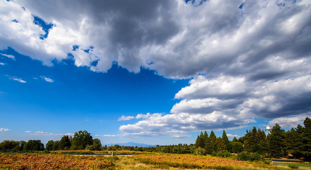
Sunrise & Sunset Photos

The Golden Day is Dying Beyond the Purple Hill

Los Coyotes Indian Reservation Hot Springs Mountain at Sunset

Los Coyotes Indian Reservation Hot Springs Mountain Sunset Timelapse

Sunset at Lake Henshaw

Sunset with @linhbergh | @tagmotorsports
Palomar Observatory-0028

Pacific Crest Trail, 2018

The gaze

Just Before the Break

Do You See A Face?

1345 Sunset colors on Santa Rosa Mountain and Toro Peak over Nance Canyon from Coyote Canyon Road

0904 Sunset clouds at our campsite on the PCT near mile 140

Pacific Crest Trail, 2018

Pacific Crest Trail, 2018

0603 View of Santa Rosa Mountain and Toro Peak at sunset from Campsite CS0129 on the PCT

Pacific Crest Trail, 2018

Pacific Crest Trail, 2018

Pacific Crest Trail, 2018

Pacific Crest Trail, 2018

Sunset over camp outside Warner Springs

Pacific Crest Trail, 2018

Misumena (F Thomisidae) with moth prey

Good Morning Sunshine

Sunrise in Agua Caliente

0607 Panorama sunrise from Campsite CS0129 on the PCT

0906 Sunrise on our fourth day of hiking at our campsite on the PCT near mile 140
Chihuahua Valley Rd, Warner Springs, CA, USA Map
Search another place
Near Places
Chihuahua Valley, California, USA
Chihuahua Valley Rd, Warner Springs, CA, USA
Stamnes Rd, Warner Springs, CA, USA
Chihuahua Valley Rd, Warner Springs, CA, USA
Warner Springs, CA, USA
Warner Springs Ranch Resort, CA-79, Warner Springs, CA, USA
Camino San Ignacio, Warner Springs, CA, USA
Schoepe Scout Reservation at Lost Valley, Chihuahua Valley Rd, Warner Springs, CA, USA
Anza, CA, USA
Anza, CA, USA
Bohlen Rd, Anza, CA, USA
San Felipe, CA, USA
Santa Ysabel Tribal Office, Santa Ysabel, CA, USA
Courtesy Dr, Mountain Center, CA, USA
CA-74, Mountain Center, CA, USA
Montezuma Valley Rd, Ranchita, CA, USA
Montezuma Valley Rd, Warner Springs, CA, USA
Ranchita, CA, USA
Montezuma Valley Rd, Warner Springs, CA, USA
Stevens Way, Warner Springs, CA, USA
Recent Searches
- Sunrise Sunset Times of Pantai Cermin, batu 10, Jalan Pantai, Port Dickson, Melaka, Malaysia
- Sunrise Sunset Times of Groblershoop, South Africa
- Sunrise Sunset Times of Petriti, Greece
- Sunrise Sunset Times of Chesaw Rd, Oroville, WA, USA
- Sunrise Sunset Times of N, Mt Pleasant, UT, USA
- Sunrise Sunset Times of Kawanecho Sasamado, Shimada, Shizuoka -, Japan
- Sunrise Sunset Times of 6 Rue Jules Ferry, Beausoleil, France
- Sunrise Sunset Times of Otxandio, Biscay, Spain
- Sunrise Sunset Times of Sattva Horizon, 4JC6+G9P, Vinayak Nagar, Kattigenahalli, Bengaluru, Karnataka, India
- Sunrise Sunset Times of Mount Fuji, Kitayama, Fujinomiya, Shizuoka -, Japan