Germer Basin, Idaho 美國的日出日落時間表
Location: 美國 > 愛達荷州 > 卡斯特縣 > ID 美國 >
時區:
America/Denver
當地時間:
2024-04-23 08:13:16
經度:
-114.2370042
緯度:
44.374366
今天日出時間:
06:38:03 AM
今天日落時間:
08:32:07 PM
今天日照時長:
13h 54m 4s
明天日出時間:
06:36:29 AM
明天日落時間:
08:33:20 PM
明天日照時長:
13h 56m 51s
顯示所有日期
| 日期 | 日出 | 日落 | 日照時長 |
|---|---|---|---|
| 2024年01月01日 | 08:12:53 AM | 05:08:42 PM | 8h 55m 49s |
| 2024年01月02日 | 08:12:53 AM | 05:09:38 PM | 8h 56m 45s |
| 2024年01月03日 | 08:12:51 AM | 05:10:35 PM | 8h 57m 44s |
| 2024年01月04日 | 08:12:46 AM | 05:11:34 PM | 8h 58m 48s |
| 2024年01月05日 | 08:12:38 AM | 05:12:35 PM | 8h 59m 57s |
| 2024年01月06日 | 08:12:28 AM | 05:13:38 PM | 9h 1m 10s |
| 2024年01月07日 | 08:12:15 AM | 05:14:42 PM | 9h 2m 27s |
| 2024年01月08日 | 08:12:00 AM | 05:15:47 PM | 9h 3m 47s |
| 2024年01月09日 | 08:11:43 AM | 05:16:54 PM | 9h 5m 11s |
| 2024年01月10日 | 08:11:22 AM | 05:18:02 PM | 9h 6m 40s |
| 2024年01月11日 | 08:11:00 AM | 05:19:12 PM | 9h 8m 12s |
| 2024年01月12日 | 08:10:35 AM | 05:20:23 PM | 9h 9m 48s |
| 2024年01月13日 | 08:10:07 AM | 05:21:35 PM | 9h 11m 28s |
| 2024年01月14日 | 08:09:37 AM | 05:22:48 PM | 9h 13m 11s |
| 2024年01月15日 | 08:09:05 AM | 05:24:02 PM | 9h 14m 57s |
| 2024年01月16日 | 08:08:30 AM | 05:25:18 PM | 9h 16m 48s |
| 2024年01月17日 | 08:07:53 AM | 05:26:34 PM | 9h 18m 41s |
| 2024年01月18日 | 08:07:13 AM | 05:27:51 PM | 9h 20m 38s |
| 2024年01月19日 | 08:06:31 AM | 05:29:09 PM | 9h 22m 38s |
| 2024年01月20日 | 08:05:47 AM | 05:30:28 PM | 9h 24m 41s |
| 2024年01月21日 | 08:05:01 AM | 05:31:47 PM | 9h 26m 46s |
| 2024年01月22日 | 08:04:13 AM | 05:33:07 PM | 9h 28m 54s |
| 2024年01月23日 | 08:03:22 AM | 05:34:28 PM | 9h 31m 6s |
| 2024年01月24日 | 08:02:30 AM | 05:35:49 PM | 9h 33m 19s |
| 2024年01月25日 | 08:01:35 AM | 05:37:11 PM | 9h 35m 36s |
| 2024年01月26日 | 08:00:38 AM | 05:38:33 PM | 9h 37m 55s |
| 2024年01月27日 | 07:59:39 AM | 05:39:55 PM | 9h 40m 16s |
| 2024年01月28日 | 07:58:39 AM | 05:41:18 PM | 9h 42m 39s |
| 2024年01月29日 | 07:57:36 AM | 05:42:41 PM | 9h 45m 5s |
| 2024年01月30日 | 07:56:31 AM | 05:44:05 PM | 9h 47m 34s |
| 2024年01月31日 | 07:55:25 AM | 05:45:28 PM | 9h 50m 3s |
| 2024年02月01日 | 07:54:17 AM | 05:46:52 PM | 9h 52m 35s |
| 2024年02月02日 | 07:53:07 AM | 05:48:16 PM | 9h 55m 9s |
| 2024年02月03日 | 07:51:55 AM | 05:49:40 PM | 9h 57m 45s |
| 2024年02月04日 | 07:50:41 AM | 05:51:04 PM | 10h 0m 23s |
| 2024年02月05日 | 07:49:26 AM | 05:52:29 PM | 10h 3m 3s |
| 2024年02月06日 | 07:48:10 AM | 05:53:53 PM | 10h 5m 43s |
| 2024年02月07日 | 07:46:51 AM | 05:55:17 PM | 10h 8m 26s |
| 2024年02月08日 | 07:45:32 AM | 05:56:41 PM | 10h 11m 9s |
| 2024年02月09日 | 07:44:10 AM | 05:58:05 PM | 10h 13m 55s |
| 2024年02月10日 | 07:42:48 AM | 05:59:29 PM | 10h 16m 41s |
| 2024年02月11日 | 07:41:23 AM | 06:00:53 PM | 10h 19m 30s |
| 2024年02月12日 | 07:39:58 AM | 06:02:16 PM | 10h 22m 18s |
| 2024年02月13日 | 07:38:31 AM | 06:03:40 PM | 10h 25m 9s |
| 2024年02月14日 | 07:37:03 AM | 06:05:03 PM | 10h 28m 0s |
| 2024年02月15日 | 07:35:34 AM | 06:06:26 PM | 10h 30m 52s |
| 2024年02月16日 | 07:34:03 AM | 06:07:49 PM | 10h 33m 46s |
| 2024年02月17日 | 07:32:31 AM | 06:09:12 PM | 10h 36m 41s |
| 2024年02月18日 | 07:30:58 AM | 06:10:34 PM | 10h 39m 36s |
| 2024年02月19日 | 07:29:24 AM | 06:11:57 PM | 10h 42m 33s |
| 2024年02月20日 | 07:27:49 AM | 06:13:18 PM | 10h 45m 29s |
| 2024年02月21日 | 07:26:13 AM | 06:14:40 PM | 10h 48m 27s |
| 2024年02月22日 | 07:24:36 AM | 06:16:01 PM | 10h 51m 25s |
| 2024年02月23日 | 07:22:58 AM | 06:17:23 PM | 10h 54m 25s |
| 2024年02月24日 | 07:21:19 AM | 06:18:43 PM | 10h 57m 24s |
| 2024年02月25日 | 07:19:40 AM | 06:20:04 PM | 11h 0m 24s |
| 2024年02月26日 | 07:17:59 AM | 06:21:24 PM | 11h 3m 25s |
| 2024年02月27日 | 07:16:18 AM | 06:22:44 PM | 11h 6m 26s |
| 2024年02月28日 | 07:14:35 AM | 06:24:04 PM | 11h 9m 29s |
| 2024年02月29日 | 07:12:52 AM | 06:25:23 PM | 11h 12m 31s |
| 2024年03月01日 | 07:11:09 AM | 06:26:42 PM | 11h 15m 33s |
| 2024年03月02日 | 07:09:25 AM | 06:28:01 PM | 11h 18m 36s |
| 2024年03月03日 | 07:07:40 AM | 06:29:20 PM | 11h 21m 40s |
| 2024年03月04日 | 07:05:54 AM | 06:30:38 PM | 11h 24m 44s |
| 2024年03月05日 | 07:04:08 AM | 06:31:56 PM | 11h 27m 48s |
| 2024年03月06日 | 07:02:21 AM | 06:33:14 PM | 11h 30m 53s |
| 2024年03月07日 | 07:00:34 AM | 06:34:31 PM | 11h 33m 57s |
| 2024年03月08日 | 06:58:47 AM | 06:35:49 PM | 11h 37m 2s |
| 2024年03月09日 | 06:56:59 AM | 06:37:06 PM | 11h 40m 7s |
| 2024年03月10日 | 07:55:15 AM | 07:38:19 PM | 11h 43m 4s |
| 2024年03月11日 | 07:53:26 AM | 07:39:36 PM | 11h 46m 10s |
| 2024年03月12日 | 07:51:37 AM | 07:40:52 PM | 11h 49m 15s |
| 2024年03月13日 | 07:49:48 AM | 07:42:08 PM | 11h 52m 20s |
| 2024年03月14日 | 07:47:58 AM | 07:43:24 PM | 11h 55m 26s |
| 2024年03月15日 | 07:46:08 AM | 07:44:40 PM | 11h 58m 32s |
| 2024年03月16日 | 07:44:18 AM | 07:45:55 PM | 12h 1m 37s |
| 2024年03月17日 | 07:42:28 AM | 07:47:11 PM | 12h 4m 43s |
| 2024年03月18日 | 07:40:37 AM | 07:48:26 PM | 12h 7m 49s |
| 2024年03月19日 | 07:38:47 AM | 07:49:41 PM | 12h 10m 54s |
| 2024年03月20日 | 07:36:56 AM | 07:50:56 PM | 12h 14m 0s |
| 2024年03月21日 | 07:35:06 AM | 07:52:11 PM | 12h 17m 5s |
| 2024年03月22日 | 07:33:15 AM | 07:53:25 PM | 12h 20m 10s |
| 2024年03月23日 | 07:31:24 AM | 07:54:40 PM | 12h 23m 16s |
| 2024年03月24日 | 07:29:34 AM | 07:55:54 PM | 12h 26m 20s |
| 2024年03月25日 | 07:27:43 AM | 07:57:09 PM | 12h 29m 26s |
| 2024年03月26日 | 07:25:53 AM | 07:58:23 PM | 12h 32m 30s |
| 2024年03月27日 | 07:24:02 AM | 07:59:37 PM | 12h 35m 35s |
| 2024年03月28日 | 07:22:12 AM | 08:00:51 PM | 12h 38m 39s |
| 2024年03月29日 | 07:20:22 AM | 08:02:05 PM | 12h 41m 43s |
| 2024年03月30日 | 07:18:32 AM | 08:03:19 PM | 12h 44m 47s |
| 2024年03月31日 | 07:16:43 AM | 08:04:33 PM | 12h 47m 50s |
| 2024年04月01日 | 07:14:54 AM | 08:05:47 PM | 12h 50m 53s |
| 2024年04月02日 | 07:13:05 AM | 08:07:01 PM | 12h 53m 56s |
| 2024年04月03日 | 07:11:16 AM | 08:08:15 PM | 12h 56m 59s |
| 2024年04月04日 | 07:09:28 AM | 08:09:29 PM | 13h 0m 1s |
| 2024年04月05日 | 07:07:40 AM | 08:10:43 PM | 13h 3m 3s |
| 2024年04月06日 | 07:05:53 AM | 08:11:56 PM | 13h 6m 3s |
| 2024年04月07日 | 07:04:06 AM | 08:13:10 PM | 13h 9m 4s |
| 2024年04月08日 | 07:02:20 AM | 08:14:24 PM | 13h 12m 4s |
| 2024年04月09日 | 07:00:34 AM | 08:15:38 PM | 13h 15m 4s |
| 2024年04月10日 | 06:58:49 AM | 08:16:52 PM | 13h 18m 3s |
| 2024年04月11日 | 06:57:04 AM | 08:18:05 PM | 13h 21m 1s |
| 2024年04月12日 | 06:55:20 AM | 08:19:19 PM | 13h 23m 59s |
| 2024年04月13日 | 06:53:37 AM | 08:20:33 PM | 13h 26m 56s |
| 2024年04月14日 | 06:51:54 AM | 08:21:47 PM | 13h 29m 53s |
| 2024年04月15日 | 06:50:13 AM | 08:23:00 PM | 13h 32m 47s |
| 2024年04月16日 | 06:48:31 AM | 08:24:14 PM | 13h 35m 43s |
| 2024年04月17日 | 06:46:51 AM | 08:25:28 PM | 13h 38m 37s |
| 2024年04月18日 | 06:45:12 AM | 08:26:42 PM | 13h 41m 30s |
| 2024年04月19日 | 06:43:33 AM | 08:27:55 PM | 13h 44m 22s |
| 2024年04月20日 | 06:41:56 AM | 08:29:09 PM | 13h 47m 13s |
| 2024年04月21日 | 06:40:19 AM | 08:30:23 PM | 13h 50m 4s |
| 2024年04月22日 | 06:38:43 AM | 08:31:36 PM | 13h 52m 53s |
| 2024年04月23日 | 06:37:08 AM | 08:32:50 PM | 13h 55m 42s |
| 2024年04月24日 | 06:35:35 AM | 08:34:03 PM | 13h 58m 28s |
| 2024年04月25日 | 06:34:02 AM | 08:35:17 PM | 14h 1m 15s |
| 2024年04月26日 | 06:32:31 AM | 08:36:30 PM | 14h 3m 59s |
| 2024年04月27日 | 06:31:00 AM | 08:37:43 PM | 14h 6m 43s |
| 2024年04月28日 | 06:29:31 AM | 08:38:56 PM | 14h 9m 25s |
| 2024年04月29日 | 06:28:03 AM | 08:40:09 PM | 14h 12m 6s |
| 2024年04月30日 | 06:26:36 AM | 08:41:21 PM | 14h 14m 45s |
| 2024年05月01日 | 06:25:11 AM | 08:42:34 PM | 14h 17m 23s |
| 2024年05月02日 | 06:23:47 AM | 08:43:46 PM | 14h 19m 59s |
| 2024年05月03日 | 06:22:24 AM | 08:44:58 PM | 14h 22m 34s |
| 2024年05月04日 | 06:21:03 AM | 08:46:09 PM | 14h 25m 6s |
| 2024年05月05日 | 06:19:43 AM | 08:47:21 PM | 14h 27m 38s |
| 2024年05月06日 | 06:18:25 AM | 08:48:31 PM | 14h 30m 6s |
| 2024年05月07日 | 06:17:08 AM | 08:49:42 PM | 14h 32m 34s |
| 2024年05月08日 | 06:15:52 AM | 08:50:52 PM | 14h 35m 0s |
| 2024年05月09日 | 06:14:38 AM | 08:52:02 PM | 14h 37m 24s |
| 2024年05月10日 | 06:13:26 AM | 08:53:11 PM | 14h 39m 45s |
| 2024年05月11日 | 06:12:16 AM | 08:54:20 PM | 14h 42m 4s |
| 2024年05月12日 | 06:11:07 AM | 08:55:29 PM | 14h 44m 22s |
| 2024年05月13日 | 06:10:00 AM | 08:56:36 PM | 14h 46m 36s |
| 2024年05月14日 | 06:08:54 AM | 08:57:43 PM | 14h 48m 49s |
| 2024年05月15日 | 06:07:51 AM | 08:58:50 PM | 14h 50m 59s |
| 2024年05月16日 | 06:06:49 AM | 08:59:56 PM | 14h 53m 7s |
| 2024年05月17日 | 06:05:49 AM | 09:01:01 PM | 14h 55m 12s |
| 2024年05月18日 | 06:04:51 AM | 09:02:05 PM | 14h 57m 14s |
| 2024年05月19日 | 06:03:55 AM | 09:03:08 PM | 14h 59m 13s |
| 2024年05月20日 | 06:03:00 AM | 09:04:11 PM | 15h 1m 11s |
| 2024年05月21日 | 06:02:08 AM | 09:05:12 PM | 15h 3m 4s |
| 2024年05月22日 | 06:01:18 AM | 09:06:13 PM | 15h 4m 55s |
| 2024年05月23日 | 06:00:29 AM | 09:07:13 PM | 15h 6m 44s |
| 2024年05月24日 | 05:59:43 AM | 09:08:11 PM | 15h 8m 28s |
| 2024年05月25日 | 05:58:59 AM | 09:09:09 PM | 15h 10m 10s |
| 2024年05月26日 | 05:58:17 AM | 09:10:05 PM | 15h 11m 48s |
| 2024年05月27日 | 05:57:37 AM | 09:11:00 PM | 15h 13m 23s |
| 2024年05月28日 | 05:56:59 AM | 09:11:54 PM | 15h 14m 55s |
| 2024年05月29日 | 05:56:24 AM | 09:12:46 PM | 15h 16m 22s |
| 2024年05月30日 | 05:55:50 AM | 09:13:38 PM | 15h 17m 48s |
| 2024年05月31日 | 05:55:19 AM | 09:14:27 PM | 15h 19m 8s |
| 2024年06月01日 | 05:54:50 AM | 09:15:16 PM | 15h 20m 26s |
| 2024年06月02日 | 05:54:23 AM | 09:16:03 PM | 15h 21m 40s |
| 2024年06月03日 | 05:53:59 AM | 09:16:48 PM | 15h 22m 49s |
| 2024年06月04日 | 05:53:37 AM | 09:17:32 PM | 15h 23m 55s |
| 2024年06月05日 | 05:53:17 AM | 09:18:14 PM | 15h 24m 57s |
| 2024年06月06日 | 05:52:59 AM | 09:18:54 PM | 15h 25m 55s |
| 2024年06月07日 | 05:52:43 AM | 09:19:33 PM | 15h 26m 50s |
| 2024年06月08日 | 05:52:30 AM | 09:20:10 PM | 15h 27m 40s |
| 2024年06月09日 | 05:52:19 AM | 09:20:45 PM | 15h 28m 26s |
| 2024年06月10日 | 05:52:10 AM | 09:21:18 PM | 15h 29m 8s |
| 2024年06月11日 | 05:52:04 AM | 09:21:49 PM | 15h 29m 45s |
| 2024年06月12日 | 05:52:00 AM | 09:22:18 PM | 15h 30m 18s |
| 2024年06月13日 | 05:51:58 AM | 09:22:46 PM | 15h 30m 48s |
| 2024年06月14日 | 05:51:58 AM | 09:23:11 PM | 15h 31m 13s |
| 2024年06月15日 | 05:52:01 AM | 09:23:34 PM | 15h 31m 33s |
| 2024年06月16日 | 05:52:06 AM | 09:23:56 PM | 15h 31m 50s |
| 2024年06月17日 | 05:52:13 AM | 09:24:15 PM | 15h 32m 2s |
| 2024年06月18日 | 05:52:22 AM | 09:24:32 PM | 15h 32m 10s |
| 2024年06月19日 | 05:52:33 AM | 09:24:46 PM | 15h 32m 13s |
| 2024年06月20日 | 05:52:47 AM | 09:24:59 PM | 15h 32m 12s |
| 2024年06月21日 | 05:53:03 AM | 09:25:09 PM | 15h 32m 6s |
| 2024年06月22日 | 05:53:20 AM | 09:25:18 PM | 15h 31m 58s |
| 2024年06月23日 | 05:53:40 AM | 09:25:24 PM | 15h 31m 44s |
| 2024年06月24日 | 05:54:02 AM | 09:25:27 PM | 15h 31m 25s |
| 2024年06月25日 | 05:54:26 AM | 09:25:29 PM | 15h 31m 3s |
| 2024年06月26日 | 05:54:51 AM | 09:25:28 PM | 15h 30m 37s |
| 2024年06月27日 | 05:55:19 AM | 09:25:24 PM | 15h 30m 5s |
| 2024年06月28日 | 05:55:49 AM | 09:25:19 PM | 15h 29m 30s |
| 2024年06月29日 | 05:56:20 AM | 09:25:11 PM | 15h 28m 51s |
| 2024年06月30日 | 05:56:53 AM | 09:25:01 PM | 15h 28m 8s |
| 2024年07月01日 | 05:57:28 AM | 09:24:48 PM | 15h 27m 20s |
| 2024年07月02日 | 05:58:05 AM | 09:24:33 PM | 15h 26m 28s |
| 2024年07月03日 | 05:58:43 AM | 09:24:16 PM | 15h 25m 33s |
| 2024年07月04日 | 05:59:23 AM | 09:23:57 PM | 15h 24m 34s |
| 2024年07月05日 | 06:00:05 AM | 09:23:35 PM | 15h 23m 30s |
| 2024年07月06日 | 06:00:48 AM | 09:23:11 PM | 15h 22m 23s |
| 2024年07月07日 | 06:01:33 AM | 09:22:45 PM | 15h 21m 12s |
| 2024年07月08日 | 06:02:19 AM | 09:22:16 PM | 15h 19m 57s |
| 2024年07月09日 | 06:03:06 AM | 09:21:45 PM | 15h 18m 39s |
| 2024年07月10日 | 06:03:55 AM | 09:21:12 PM | 15h 17m 17s |
| 2024年07月11日 | 06:04:45 AM | 09:20:37 PM | 15h 15m 52s |
| 2024年07月12日 | 06:05:37 AM | 09:19:59 PM | 15h 14m 22s |
| 2024年07月13日 | 06:06:29 AM | 09:19:20 PM | 15h 12m 51s |
| 2024年07月14日 | 06:07:23 AM | 09:18:38 PM | 15h 11m 15s |
| 2024年07月15日 | 06:08:18 AM | 09:17:54 PM | 15h 9m 36s |
| 2024年07月16日 | 06:09:14 AM | 09:17:08 PM | 15h 7m 54s |
| 2024年07月17日 | 06:10:11 AM | 09:16:20 PM | 15h 6m 9s |
| 2024年07月18日 | 06:11:09 AM | 09:15:29 PM | 15h 4m 20s |
| 2024年07月19日 | 06:12:07 AM | 09:14:37 PM | 15h 2m 30s |
| 2024年07月20日 | 06:13:07 AM | 09:13:43 PM | 15h 0m 36s |
| 2024年07月21日 | 06:14:08 AM | 09:12:47 PM | 14h 58m 39s |
| 2024年07月22日 | 06:15:09 AM | 09:11:49 PM | 14h 56m 40s |
| 2024年07月23日 | 06:16:11 AM | 09:10:48 PM | 14h 54m 37s |
| 2024年07月24日 | 06:17:14 AM | 09:09:46 PM | 14h 52m 32s |
| 2024年07月25日 | 06:18:17 AM | 09:08:43 PM | 14h 50m 26s |
| 2024年07月26日 | 06:19:21 AM | 09:07:37 PM | 14h 48m 16s |
| 2024年07月27日 | 06:20:25 AM | 09:06:30 PM | 14h 46m 5s |
| 2024年07月28日 | 06:21:30 AM | 09:05:21 PM | 14h 43m 51s |
| 2024年07月29日 | 06:22:36 AM | 09:04:10 PM | 14h 41m 34s |
| 2024年07月30日 | 06:23:42 AM | 09:02:57 PM | 14h 39m 15s |
| 2024年07月31日 | 06:24:48 AM | 09:01:43 PM | 14h 36m 55s |
| 2024年08月01日 | 06:25:55 AM | 09:00:27 PM | 14h 34m 32s |
| 2024年08月02日 | 06:27:02 AM | 08:59:10 PM | 14h 32m 8s |
| 2024年08月03日 | 06:28:10 AM | 08:57:51 PM | 14h 29m 41s |
| 2024年08月04日 | 06:29:18 AM | 08:56:31 PM | 14h 27m 13s |
| 2024年08月05日 | 06:30:26 AM | 08:55:09 PM | 14h 24m 43s |
| 2024年08月06日 | 06:31:34 AM | 08:53:46 PM | 14h 22m 12s |
| 2024年08月07日 | 06:32:42 AM | 08:52:21 PM | 14h 19m 39s |
| 2024年08月08日 | 06:33:51 AM | 08:50:55 PM | 14h 17m 4s |
| 2024年08月09日 | 06:35:00 AM | 08:49:28 PM | 14h 14m 28s |
| 2024年08月10日 | 06:36:09 AM | 08:47:59 PM | 14h 11m 50s |
| 2024年08月11日 | 06:37:18 AM | 08:46:30 PM | 14h 9m 12s |
| 2024年08月12日 | 06:38:27 AM | 08:44:59 PM | 14h 6m 32s |
| 2024年08月13日 | 06:39:37 AM | 08:43:26 PM | 14h 3m 49s |
| 2024年08月14日 | 06:40:46 AM | 08:41:53 PM | 14h 1m 7s |
| 2024年08月15日 | 06:41:55 AM | 08:40:19 PM | 13h 58m 24s |
| 2024年08月16日 | 06:43:05 AM | 08:38:43 PM | 13h 55m 38s |
| 2024年08月17日 | 06:44:15 AM | 08:37:06 PM | 13h 52m 51s |
| 2024年08月18日 | 06:45:24 AM | 08:35:29 PM | 13h 50m 5s |
| 2024年08月19日 | 06:46:34 AM | 08:33:50 PM | 13h 47m 16s |
| 2024年08月20日 | 06:47:43 AM | 08:32:11 PM | 13h 44m 28s |
| 2024年08月21日 | 06:48:53 AM | 08:30:31 PM | 13h 41m 38s |
| 2024年08月22日 | 06:50:02 AM | 08:28:49 PM | 13h 38m 47s |
| 2024年08月23日 | 06:51:12 AM | 08:27:07 PM | 13h 35m 55s |
| 2024年08月24日 | 06:52:21 AM | 08:25:24 PM | 13h 33m 3s |
| 2024年08月25日 | 06:53:31 AM | 08:23:41 PM | 13h 30m 10s |
| 2024年08月26日 | 06:54:40 AM | 08:21:56 PM | 13h 27m 16s |
| 2024年08月27日 | 06:55:50 AM | 08:20:11 PM | 13h 24m 21s |
| 2024年08月28日 | 06:56:59 AM | 08:18:26 PM | 13h 21m 27s |
| 2024年08月29日 | 06:58:09 AM | 08:16:39 PM | 13h 18m 30s |
| 2024年08月30日 | 06:59:18 AM | 08:14:52 PM | 13h 15m 34s |
| 2024年08月31日 | 07:00:27 AM | 08:13:05 PM | 13h 12m 38s |
| 2024年09月01日 | 07:01:37 AM | 08:11:17 PM | 13h 9m 40s |
| 2024年09月02日 | 07:02:46 AM | 08:09:28 PM | 13h 6m 42s |
| 2024年09月03日 | 07:03:55 AM | 08:07:39 PM | 13h 3m 44s |
| 2024年09月04日 | 07:05:04 AM | 08:05:49 PM | 13h 0m 45s |
| 2024年09月05日 | 07:06:14 AM | 08:03:59 PM | 12h 57m 45s |
| 2024年09月06日 | 07:07:23 AM | 08:02:09 PM | 12h 54m 46s |
| 2024年09月07日 | 07:08:32 AM | 08:00:18 PM | 12h 51m 46s |
| 2024年09月08日 | 07:09:41 AM | 07:58:27 PM | 12h 48m 46s |
| 2024年09月09日 | 07:10:51 AM | 07:56:36 PM | 12h 45m 45s |
| 2024年09月10日 | 07:12:00 AM | 07:54:44 PM | 12h 42m 44s |
| 2024年09月11日 | 07:13:09 AM | 07:52:53 PM | 12h 39m 44s |
| 2024年09月12日 | 07:14:19 AM | 07:51:01 PM | 12h 36m 42s |
| 2024年09月13日 | 07:15:28 AM | 07:49:08 PM | 12h 33m 40s |
| 2024年09月14日 | 07:16:37 AM | 07:47:16 PM | 12h 30m 39s |
| 2024年09月15日 | 07:17:47 AM | 07:45:24 PM | 12h 27m 37s |
| 2024年09月16日 | 07:18:57 AM | 07:43:31 PM | 12h 24m 34s |
| 2024年09月17日 | 07:20:06 AM | 07:41:38 PM | 12h 21m 32s |
| 2024年09月18日 | 07:21:16 AM | 07:39:46 PM | 12h 18m 30s |
| 2024年09月19日 | 07:22:26 AM | 07:37:53 PM | 12h 15m 27s |
| 2024年09月20日 | 07:23:36 AM | 07:36:01 PM | 12h 12m 25s |
| 2024年09月21日 | 07:24:47 AM | 07:34:08 PM | 12h 9m 21s |
| 2024年09月22日 | 07:25:57 AM | 07:32:16 PM | 12h 6m 19s |
| 2024年09月23日 | 07:27:07 AM | 07:30:23 PM | 12h 3m 16s |
| 2024年09月24日 | 07:28:18 AM | 07:28:31 PM | 12h 0m 13s |
| 2024年09月25日 | 07:29:29 AM | 07:26:39 PM | 11h 57m 10s |
| 2024年09月26日 | 07:30:40 AM | 07:24:48 PM | 11h 54m 8s |
| 2024年09月27日 | 07:31:51 AM | 07:22:56 PM | 11h 51m 5s |
| 2024年09月28日 | 07:33:03 AM | 07:21:05 PM | 11h 48m 2s |
| 2024年09月29日 | 07:34:14 AM | 07:19:14 PM | 11h 45m 0s |
| 2024年09月30日 | 07:35:26 AM | 07:17:23 PM | 11h 41m 57s |
| 2024年10月01日 | 07:36:38 AM | 07:15:33 PM | 11h 38m 55s |
| 2024年10月02日 | 07:37:51 AM | 07:13:43 PM | 11h 35m 52s |
| 2024年10月03日 | 07:39:03 AM | 07:11:54 PM | 11h 32m 51s |
| 2024年10月04日 | 07:40:16 AM | 07:10:05 PM | 11h 29m 49s |
| 2024年10月05日 | 07:41:29 AM | 07:08:17 PM | 11h 26m 48s |
| 2024年10月06日 | 07:42:43 AM | 07:06:29 PM | 11h 23m 46s |
| 2024年10月07日 | 07:43:57 AM | 07:04:42 PM | 11h 20m 45s |
| 2024年10月08日 | 07:45:11 AM | 07:02:55 PM | 11h 17m 44s |
| 2024年10月09日 | 07:46:25 AM | 07:01:09 PM | 11h 14m 44s |
| 2024年10月10日 | 07:47:40 AM | 06:59:24 PM | 11h 11m 44s |
| 2024年10月11日 | 07:48:55 AM | 06:57:39 PM | 11h 8m 44s |
| 2024年10月12日 | 07:50:10 AM | 06:55:55 PM | 11h 5m 45s |
| 2024年10月13日 | 07:51:25 AM | 06:54:12 PM | 11h 2m 47s |
| 2024年10月14日 | 07:52:41 AM | 06:52:30 PM | 10h 59m 49s |
| 2024年10月15日 | 07:53:57 AM | 06:50:48 PM | 10h 56m 51s |
| 2024年10月16日 | 07:55:14 AM | 06:49:07 PM | 10h 53m 53s |
| 2024年10月17日 | 07:56:31 AM | 06:47:28 PM | 10h 50m 57s |
| 2024年10月18日 | 07:57:48 AM | 06:45:49 PM | 10h 48m 1s |
| 2024年10月19日 | 07:59:05 AM | 06:44:11 PM | 10h 45m 6s |
| 2024年10月20日 | 08:00:23 AM | 06:42:34 PM | 10h 42m 11s |
| 2024年10月21日 | 08:01:41 AM | 06:40:58 PM | 10h 39m 17s |
| 2024年10月22日 | 08:02:59 AM | 06:39:24 PM | 10h 36m 25s |
| 2024年10月23日 | 08:04:17 AM | 06:37:50 PM | 10h 33m 33s |
| 2024年10月24日 | 08:05:36 AM | 06:36:18 PM | 10h 30m 42s |
| 2024年10月25日 | 08:06:55 AM | 06:34:47 PM | 10h 27m 52s |
| 2024年10月26日 | 08:08:15 AM | 06:33:17 PM | 10h 25m 2s |
| 2024年10月27日 | 08:09:34 AM | 06:31:48 PM | 10h 22m 14s |
| 2024年10月28日 | 08:10:54 AM | 06:30:21 PM | 10h 19m 27s |
| 2024年10月29日 | 08:12:14 AM | 06:28:55 PM | 10h 16m 41s |
| 2024年10月30日 | 08:13:34 AM | 06:27:30 PM | 10h 13m 56s |
| 2024年10月31日 | 08:14:54 AM | 06:26:07 PM | 10h 11m 13s |
| 2024年11月01日 | 08:16:14 AM | 06:24:45 PM | 10h 8m 31s |
| 2024年11月02日 | 08:17:35 AM | 06:23:25 PM | 10h 5m 50s |
| 2024年11月03日 | 07:18:59 AM | 05:22:03 PM | 10h 3m 4s |
| 2024年11月04日 | 07:20:19 AM | 05:20:47 PM | 10h 0m 28s |
| 2024年11月05日 | 07:21:40 AM | 05:19:31 PM | 9h 57m 51s |
| 2024年11月06日 | 07:23:01 AM | 05:18:18 PM | 9h 55m 17s |
| 2024年11月07日 | 07:24:21 AM | 05:17:06 PM | 9h 52m 45s |
| 2024年11月08日 | 07:25:42 AM | 05:15:56 PM | 9h 50m 14s |
| 2024年11月09日 | 07:27:02 AM | 05:14:47 PM | 9h 47m 45s |
| 2024年11月10日 | 07:28:23 AM | 05:13:41 PM | 9h 45m 18s |
| 2024年11月11日 | 07:29:43 AM | 05:12:36 PM | 9h 42m 53s |
| 2024年11月12日 | 07:31:02 AM | 05:11:34 PM | 9h 40m 32s |
| 2024年11月13日 | 07:32:22 AM | 05:10:33 PM | 9h 38m 11s |
| 2024年11月14日 | 07:33:41 AM | 05:09:34 PM | 9h 35m 53s |
| 2024年11月15日 | 07:35:00 AM | 05:08:38 PM | 9h 33m 38s |
| 2024年11月16日 | 07:36:19 AM | 05:07:43 PM | 9h 31m 24s |
| 2024年11月17日 | 07:37:37 AM | 05:06:51 PM | 9h 29m 14s |
| 2024年11月18日 | 07:38:54 AM | 05:06:01 PM | 9h 27m 7s |
| 2024年11月19日 | 07:40:11 AM | 05:05:13 PM | 9h 25m 2s |
| 2024年11月20日 | 07:41:28 AM | 05:04:27 PM | 9h 22m 59s |
| 2024年11月21日 | 07:42:43 AM | 05:03:43 PM | 9h 21m 0s |
| 2024年11月22日 | 07:43:58 AM | 05:03:02 PM | 9h 19m 4s |
| 2024年11月23日 | 07:45:13 AM | 05:02:23 PM | 9h 17m 10s |
| 2024年11月24日 | 07:46:26 AM | 05:01:46 PM | 9h 15m 20s |
| 2024年11月25日 | 07:47:38 AM | 05:01:12 PM | 9h 13m 34s |
| 2024年11月26日 | 07:48:50 AM | 05:00:40 PM | 9h 11m 50s |
| 2024年11月27日 | 07:50:00 AM | 05:00:11 PM | 9h 10m 11s |
| 2024年11月28日 | 07:51:10 AM | 04:59:44 PM | 9h 8m 34s |
| 2024年11月29日 | 07:52:18 AM | 04:59:19 PM | 9h 7m 1s |
| 2024年11月30日 | 07:53:25 AM | 04:58:57 PM | 9h 5m 32s |
| 2024年12月01日 | 07:54:31 AM | 04:58:38 PM | 9h 4m 7s |
| 2024年12月02日 | 07:55:35 AM | 04:58:21 PM | 9h 2m 46s |
| 2024年12月03日 | 07:56:38 AM | 04:58:07 PM | 9h 1m 29s |
| 2024年12月04日 | 07:57:40 AM | 04:57:55 PM | 9h 0m 15s |
| 2024年12月05日 | 07:58:40 AM | 04:57:46 PM | 8h 59m 6s |
| 2024年12月06日 | 07:59:38 AM | 04:57:39 PM | 8h 58m 1s |
| 2024年12月07日 | 08:00:35 AM | 04:57:36 PM | 8h 57m 1s |
| 2024年12月08日 | 08:01:30 AM | 04:57:34 PM | 8h 56m 4s |
| 2024年12月09日 | 08:02:23 AM | 04:57:35 PM | 8h 55m 12s |
| 2024年12月10日 | 08:03:15 AM | 04:57:39 PM | 8h 54m 24s |
| 2024年12月11日 | 08:04:04 AM | 04:57:46 PM | 8h 53m 42s |
| 2024年12月12日 | 08:04:52 AM | 04:57:55 PM | 8h 53m 3s |
| 2024年12月13日 | 08:05:38 AM | 04:58:07 PM | 8h 52m 29s |
| 2024年12月14日 | 08:06:21 AM | 04:58:21 PM | 8h 52m 0s |
| 2024年12月15日 | 08:07:03 AM | 04:58:38 PM | 8h 51m 35s |
| 2024年12月16日 | 08:07:42 AM | 04:58:57 PM | 8h 51m 15s |
| 2024年12月17日 | 08:08:20 AM | 04:59:19 PM | 8h 50m 59s |
| 2024年12月18日 | 08:08:55 AM | 04:59:43 PM | 8h 50m 48s |
| 2024年12月19日 | 08:09:27 AM | 05:00:10 PM | 8h 50m 43s |
| 2024年12月20日 | 08:09:58 AM | 05:00:39 PM | 8h 50m 41s |
| 2024年12月21日 | 08:10:26 AM | 05:01:10 PM | 8h 50m 44s |
| 2024年12月22日 | 08:10:52 AM | 05:01:44 PM | 8h 50m 52s |
| 2024年12月23日 | 08:11:15 AM | 05:02:21 PM | 8h 51m 6s |
| 2024年12月24日 | 08:11:36 AM | 05:02:59 PM | 8h 51m 23s |
| 2024年12月25日 | 08:11:54 AM | 05:03:40 PM | 8h 51m 46s |
| 2024年12月26日 | 08:12:10 AM | 05:04:23 PM | 8h 52m 13s |
| 2024年12月27日 | 08:12:24 AM | 05:05:08 PM | 8h 52m 44s |
| 2024年12月28日 | 08:12:35 AM | 05:05:55 PM | 8h 53m 20s |
| 2024年12月29日 | 08:12:43 AM | 05:06:45 PM | 8h 54m 2s |
| 2024年12月30日 | 08:12:49 AM | 05:07:36 PM | 8h 54m 47s |
日出日落照片

Photo

Along the base of the Pahsimeroi mountains.

Hwy 75 heading West from Challis Id

Lone Pine Peak from Challis, Idaho. Telephoto

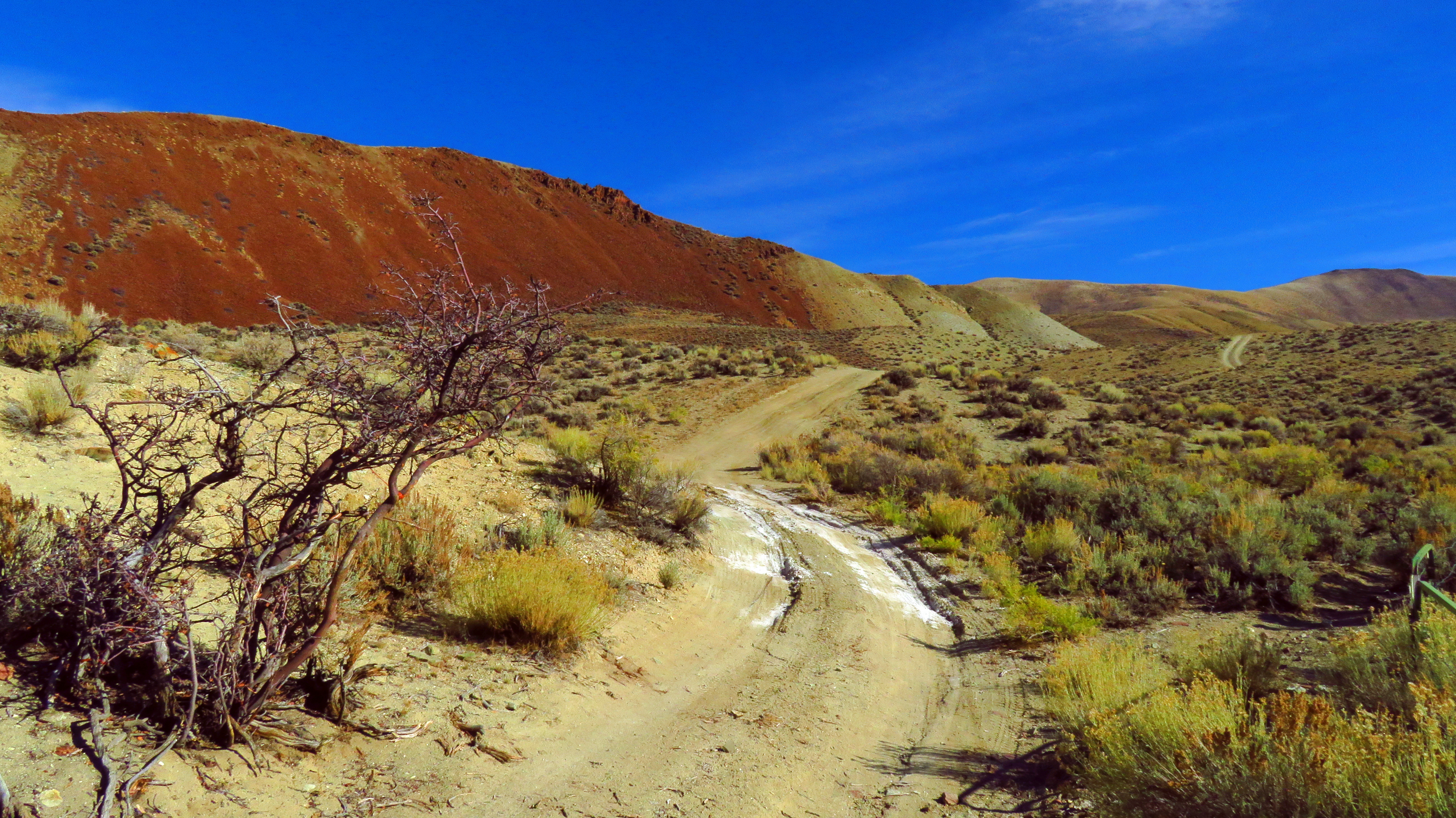
Arid hills in Malm Gulch near the Salmon River

Salmon River Scenic Byway (Idaho State Highway 75) from Stanley to Challis

Above Garden Creek in the Salmon River Mountains west of Challis, Idaho

West, across Round Valley toward the Twin Peaks in the Salmon River Mountains

Lone Pine Peak (distance). Photo taken near Challis, Idaho.

The Pahsimeroi Mountains from a flat near Challis, Idaho

In the East Fork Salmon river valley, Idaho

Boulders in the lower part of the East Fork Salmon River canyon

Down the lower part of the East Fork Salmon River canyon

East Fork of the Salmon River beneath the cliffs

Telephoto. Toward the confluence area of the East Fork and the Main Fork Salmon River
Sometimes, the Road is the Destination 4

Some Gulch Along Highway 75 in Idaho 1

DOS19-99
CW6D3271.jpg

CW6D3265.jpg

Departing Challis

Good morning Challis!
Germer Basin, Idaho 美國的地圖
搜索其他地方的日出日落時間
附近地點
美國愛達荷州卡斯特縣
Upper Hot Springs Rd, Challis, ID 美國Upper Hot Springs Road
Apex Ln, Challis, ID 美國
Challis, ID 美國
Main St, Challis, ID 美國
Rod and Gun Club Loop, Challis, ID 美國
美國爱达荷州克莱顿
美國爱达荷州克莱顿Holman Creek Campground
Custer Rd, Idaho 美國Custer Road
美國爱达荷州埃利斯
Torreys, ID 美國
美國爱达荷州梅
Twin Bridges Creek Rd, Mackay, ID 美國
Trail Creek Rd, Mackay, ID 美國Copper Basin Camp
Wild Horse Creek Rd, Mackay, ID 美國Wild Horse Creek Ranch
美國斯內克河
Quail Rd, Salmon, ID 美國
Iron Creek Rd, Salmon, ID 美國
美國愛達荷州
Forest Rd, Ketchum, ID 美國Wood River Campground
最近搜索
- Unnamed Road, Respublika Severnaya Osetiya — Alaniya, 俄羅斯的日出日落時間表
- Herbage Dr, Gulfport, MS 美國的日出日落時間表
- Pointe-au-Père, Rimouski, QC, 加拿大的日出日落時間表
- -, Japan的日出日落時間表
- End of Belair Road, Long Bay, Bridgetown 巴貝多Wyndham Grand Barbados Sam Lords Castle All Inclusive Re的日出日落時間表
- 日本〒- Hokkaido, Sapporo, Chuo Ward, Minami 2 Jōnishi, 5-chōme−6−1 狸小路5丁目内Satsugeki的日出日落時間表
- Feixiang District, Handan, Hebei, China的日出日落時間表
- 中國安徽省合肥市蜀山區合肥高新區的日出日落時間表
- 台灣苗栗縣竹南鎮龍江街巷15號龍鳳漁港的日出日落時間表
- Szeged, Jósika u. 10, 匈牙利塞格德會堂的日出日落時間表