CA-79, Descanso, CA 美国的日出日落时间表
Location: 美国 > 加利福尼亚州 > 圣迭戈县 > 美国加利福尼亚州德斯坎索 >
时区:
America/Los_Angeles
当地时间:
2024-04-20 01:39:05
经度:
-116.588469
纬度:
32.872814
今天日出时间:
06:09:26 AM
今天日落时间:
07:20:41 PM
今天日照时常:
13h 11m 15s
明天日出时间:
06:08:18 AM
明天日落时间:
07:21:25 PM
明天日照时常:
13h 13m 7s
显示所有日期
| 日期 | 日出 | 日落 | 日照时常 |
|---|---|---|---|
| 2024年01月01日 | 06:49:04 AM | 04:51:23 PM | 10h 2m 19s |
| 2024年01月02日 | 06:49:14 AM | 04:52:08 PM | 10h 2m 54s |
| 2024年01月03日 | 06:49:23 AM | 04:52:54 PM | 10h 3m 31s |
| 2024年01月04日 | 06:49:30 AM | 04:53:41 PM | 10h 4m 11s |
| 2024年01月05日 | 06:49:35 AM | 04:54:29 PM | 10h 4m 54s |
| 2024年01月06日 | 06:49:38 AM | 04:55:18 PM | 10h 5m 40s |
| 2024年01月07日 | 06:49:40 AM | 04:56:08 PM | 10h 6m 28s |
| 2024年01月08日 | 06:49:39 AM | 04:56:59 PM | 10h 7m 20s |
| 2024年01月09日 | 06:49:37 AM | 04:57:50 PM | 10h 8m 13s |
| 2024年01月10日 | 06:49:33 AM | 04:58:42 PM | 10h 9m 9s |
| 2024年01月11日 | 06:49:28 AM | 04:59:35 PM | 10h 10m 7s |
| 2024年01月12日 | 06:49:20 AM | 05:00:28 PM | 10h 11m 8s |
| 2024年01月13日 | 06:49:11 AM | 05:01:22 PM | 10h 12m 11s |
| 2024年01月14日 | 06:49:00 AM | 05:02:16 PM | 10h 13m 16s |
| 2024年01月15日 | 06:48:47 AM | 05:03:11 PM | 10h 14m 24s |
| 2024年01月16日 | 06:48:32 AM | 05:04:06 PM | 10h 15m 34s |
| 2024年01月17日 | 06:48:16 AM | 05:05:02 PM | 10h 16m 46s |
| 2024年01月18日 | 06:47:57 AM | 05:05:57 PM | 10h 18m 0s |
| 2024年01月19日 | 06:47:37 AM | 05:06:54 PM | 10h 19m 17s |
| 2024年01月20日 | 06:47:16 AM | 05:07:50 PM | 10h 20m 34s |
| 2024年01月21日 | 06:46:52 AM | 05:08:47 PM | 10h 21m 55s |
| 2024年01月22日 | 06:46:27 AM | 05:09:43 PM | 10h 23m 16s |
| 2024年01月23日 | 06:46:00 AM | 05:10:40 PM | 10h 24m 40s |
| 2024年01月24日 | 06:45:31 AM | 05:11:37 PM | 10h 26m 6s |
| 2024年01月25日 | 06:45:01 AM | 05:12:34 PM | 10h 27m 33s |
| 2024年01月26日 | 06:44:29 AM | 05:13:31 PM | 10h 29m 2s |
| 2024年01月27日 | 06:43:56 AM | 05:14:29 PM | 10h 30m 33s |
| 2024年01月28日 | 06:43:21 AM | 05:15:26 PM | 10h 32m 5s |
| 2024年01月29日 | 06:42:44 AM | 05:16:23 PM | 10h 33m 39s |
| 2024年01月30日 | 06:42:06 AM | 05:17:20 PM | 10h 35m 14s |
| 2024年01月31日 | 06:41:26 AM | 05:18:17 PM | 10h 36m 51s |
| 2024年02月01日 | 06:40:45 AM | 05:19:13 PM | 10h 38m 28s |
| 2024年02月02日 | 06:40:02 AM | 05:20:10 PM | 10h 40m 8s |
| 2024年02月03日 | 06:39:18 AM | 05:21:06 PM | 10h 41m 48s |
| 2024年02月04日 | 06:38:32 AM | 05:22:03 PM | 10h 43m 31s |
| 2024年02月05日 | 06:37:45 AM | 05:22:59 PM | 10h 45m 14s |
| 2024年02月06日 | 06:36:57 AM | 05:23:54 PM | 10h 46m 57s |
| 2024年02月07日 | 06:36:07 AM | 05:24:50 PM | 10h 48m 43s |
| 2024年02月08日 | 06:35:16 AM | 05:25:45 PM | 10h 50m 29s |
| 2024年02月09日 | 06:34:24 AM | 05:26:40 PM | 10h 52m 16s |
| 2024年02月10日 | 06:33:30 AM | 05:27:35 PM | 10h 54m 5s |
| 2024年02月11日 | 06:32:36 AM | 05:28:29 PM | 10h 55m 53s |
| 2024年02月12日 | 06:31:40 AM | 05:29:23 PM | 10h 57m 43s |
| 2024年02月13日 | 06:30:43 AM | 05:30:17 PM | 10h 59m 34s |
| 2024年02月14日 | 06:29:44 AM | 05:31:10 PM | 11h 1m 26s |
| 2024年02月15日 | 06:28:45 AM | 05:32:04 PM | 11h 3m 19s |
| 2024年02月16日 | 06:27:44 AM | 05:32:56 PM | 11h 5m 12s |
| 2024年02月17日 | 06:26:43 AM | 05:33:49 PM | 11h 7m 6s |
| 2024年02月18日 | 06:25:40 AM | 05:34:41 PM | 11h 9m 1s |
| 2024年02月19日 | 06:24:37 AM | 05:35:32 PM | 11h 10m 55s |
| 2024年02月20日 | 06:23:32 AM | 05:36:24 PM | 11h 12m 52s |
| 2024年02月21日 | 06:22:27 AM | 05:37:15 PM | 11h 14m 48s |
| 2024年02月22日 | 06:21:20 AM | 05:38:05 PM | 11h 16m 45s |
| 2024年02月23日 | 06:20:13 AM | 05:38:55 PM | 11h 18m 42s |
| 2024年02月24日 | 06:19:05 AM | 05:39:45 PM | 11h 20m 40s |
| 2024年02月25日 | 06:17:56 AM | 05:40:35 PM | 11h 22m 39s |
| 2024年02月26日 | 06:16:47 AM | 05:41:24 PM | 11h 24m 37s |
| 2024年02月27日 | 06:15:37 AM | 05:42:13 PM | 11h 26m 36s |
| 2024年02月28日 | 06:14:25 AM | 05:43:01 PM | 11h 28m 36s |
| 2024年02月29日 | 06:13:14 AM | 05:43:50 PM | 11h 30m 36s |
| 2024年03月01日 | 06:12:01 AM | 05:44:37 PM | 11h 32m 36s |
| 2024年03月02日 | 06:10:48 AM | 05:45:25 PM | 11h 34m 37s |
| 2024年03月03日 | 06:09:35 AM | 05:46:12 PM | 11h 36m 37s |
| 2024年03月04日 | 06:08:20 AM | 05:46:59 PM | 11h 38m 39s |
| 2024年03月05日 | 06:07:06 AM | 05:47:46 PM | 11h 40m 40s |
| 2024年03月06日 | 06:05:51 AM | 05:48:32 PM | 11h 42m 41s |
| 2024年03月07日 | 06:04:35 AM | 05:49:18 PM | 11h 44m 43s |
| 2024年03月08日 | 06:03:19 AM | 05:50:04 PM | 11h 46m 45s |
| 2024年03月09日 | 06:02:02 AM | 05:50:49 PM | 11h 48m 47s |
| 2024年03月10日 | 07:00:49 AM | 06:51:33 PM | 11h 50m 44s |
| 2024年03月11日 | 06:59:31 AM | 06:52:18 PM | 11h 52m 47s |
| 2024年03月12日 | 06:58:14 AM | 06:53:03 PM | 11h 54m 49s |
| 2024年03月13日 | 06:56:56 AM | 06:53:47 PM | 11h 56m 51s |
| 2024年03月14日 | 06:55:38 AM | 06:54:32 PM | 11h 58m 54s |
| 2024年03月15日 | 06:54:19 AM | 06:55:16 PM | 12h 0m 57s |
| 2024年03月16日 | 06:53:01 AM | 06:56:00 PM | 12h 2m 59s |
| 2024年03月17日 | 06:51:42 AM | 06:56:44 PM | 12h 5m 2s |
| 2024年03月18日 | 06:50:23 AM | 06:57:27 PM | 12h 7m 4s |
| 2024年03月19日 | 06:49:04 AM | 06:58:11 PM | 12h 9m 7s |
| 2024年03月20日 | 06:47:45 AM | 06:58:54 PM | 12h 11m 9s |
| 2024年03月21日 | 06:46:26 AM | 06:59:38 PM | 12h 13m 12s |
| 2024年03月22日 | 06:45:07 AM | 07:00:21 PM | 12h 15m 14s |
| 2024年03月23日 | 06:43:47 AM | 07:01:04 PM | 12h 17m 17s |
| 2024年03月24日 | 06:42:28 AM | 07:01:47 PM | 12h 19m 19s |
| 2024年03月25日 | 06:41:09 AM | 07:02:30 PM | 12h 21m 21s |
| 2024年03月26日 | 06:39:50 AM | 07:03:13 PM | 12h 23m 23s |
| 2024年03月27日 | 06:38:31 AM | 07:03:55 PM | 12h 25m 24s |
| 2024年03月28日 | 06:37:12 AM | 07:04:38 PM | 12h 27m 26s |
| 2024年03月29日 | 06:35:54 AM | 07:05:21 PM | 12h 29m 27s |
| 2024年03月30日 | 06:34:35 AM | 07:06:04 PM | 12h 31m 29s |
| 2024年03月31日 | 06:33:17 AM | 07:06:46 PM | 12h 33m 29s |
| 2024年04月01日 | 06:31:59 AM | 07:07:29 PM | 12h 35m 30s |
| 2024年04月02日 | 06:30:41 AM | 07:08:12 PM | 12h 37m 31s |
| 2024年04月03日 | 06:29:24 AM | 07:08:54 PM | 12h 39m 30s |
| 2024年04月04日 | 06:28:07 AM | 07:09:37 PM | 12h 41m 30s |
| 2024年04月05日 | 06:26:50 AM | 07:10:20 PM | 12h 43m 30s |
| 2024年04月06日 | 06:25:34 AM | 07:11:03 PM | 12h 45m 29s |
| 2024年04月07日 | 06:24:18 AM | 07:11:45 PM | 12h 47m 27s |
| 2024年04月08日 | 06:23:03 AM | 07:12:28 PM | 12h 49m 25s |
| 2024年04月09日 | 06:21:48 AM | 07:13:11 PM | 12h 51m 23s |
| 2024年04月10日 | 06:20:33 AM | 07:13:54 PM | 12h 53m 21s |
| 2024年04月11日 | 06:19:19 AM | 07:14:37 PM | 12h 55m 18s |
| 2024年04月12日 | 06:18:06 AM | 07:15:20 PM | 12h 57m 14s |
| 2024年04月13日 | 06:16:53 AM | 07:16:04 PM | 12h 59m 11s |
| 2024年04月14日 | 06:15:41 AM | 07:16:47 PM | 13h 1m 6s |
| 2024年04月15日 | 06:14:30 AM | 07:17:30 PM | 13h 3m 0s |
| 2024年04月16日 | 06:13:19 AM | 07:18:14 PM | 13h 4m 55s |
| 2024年04月17日 | 06:12:09 AM | 07:18:58 PM | 13h 6m 49s |
| 2024年04月18日 | 06:11:00 AM | 07:19:41 PM | 13h 8m 41s |
| 2024年04月19日 | 06:09:51 AM | 07:20:25 PM | 13h 10m 34s |
| 2024年04月20日 | 06:08:43 AM | 07:21:09 PM | 13h 12m 26s |
| 2024年04月21日 | 06:07:36 AM | 07:21:53 PM | 13h 14m 17s |
| 2024年04月22日 | 06:06:30 AM | 07:22:37 PM | 13h 16m 7s |
| 2024年04月23日 | 06:05:25 AM | 07:23:21 PM | 13h 17m 56s |
| 2024年04月24日 | 06:04:21 AM | 07:24:05 PM | 13h 19m 44s |
| 2024年04月25日 | 06:03:17 AM | 07:24:49 PM | 13h 21m 32s |
| 2024年04月26日 | 06:02:15 AM | 07:25:33 PM | 13h 23m 18s |
| 2024年04月27日 | 06:01:13 AM | 07:26:18 PM | 13h 25m 5s |
| 2024年04月28日 | 06:00:13 AM | 07:27:02 PM | 13h 26m 49s |
| 2024年04月29日 | 05:59:13 AM | 07:27:46 PM | 13h 28m 33s |
| 2024年04月30日 | 05:58:15 AM | 07:28:31 PM | 13h 30m 16s |
| 2024年05月01日 | 05:57:17 AM | 07:29:15 PM | 13h 31m 58s |
| 2024年05月02日 | 05:56:21 AM | 07:29:59 PM | 13h 33m 38s |
| 2024年05月03日 | 05:55:26 AM | 07:30:44 PM | 13h 35m 18s |
| 2024年05月04日 | 05:54:32 AM | 07:31:28 PM | 13h 36m 56s |
| 2024年05月05日 | 05:53:39 AM | 07:32:13 PM | 13h 38m 34s |
| 2024年05月06日 | 05:52:48 AM | 07:32:57 PM | 13h 40m 9s |
| 2024年05月07日 | 05:51:57 AM | 07:33:41 PM | 13h 41m 44s |
| 2024年05月08日 | 05:51:08 AM | 07:34:25 PM | 13h 43m 17s |
| 2024年05月09日 | 05:50:20 AM | 07:35:09 PM | 13h 44m 49s |
| 2024年05月10日 | 05:49:34 AM | 07:35:53 PM | 13h 46m 19s |
| 2024年05月11日 | 05:48:48 AM | 07:36:36 PM | 13h 47m 48s |
| 2024年05月12日 | 05:48:04 AM | 07:37:20 PM | 13h 49m 16s |
| 2024年05月13日 | 05:47:22 AM | 07:38:03 PM | 13h 50m 41s |
| 2024年05月14日 | 05:46:40 AM | 07:38:46 PM | 13h 52m 6s |
| 2024年05月15日 | 05:46:00 AM | 07:39:29 PM | 13h 53m 29s |
| 2024年05月16日 | 05:45:22 AM | 07:40:11 PM | 13h 54m 49s |
| 2024年05月17日 | 05:44:45 AM | 07:40:53 PM | 13h 56m 8s |
| 2024年05月18日 | 05:44:09 AM | 07:41:35 PM | 13h 57m 26s |
| 2024年05月19日 | 05:43:35 AM | 07:42:17 PM | 13h 58m 42s |
| 2024年05月20日 | 05:43:02 AM | 07:42:58 PM | 13h 59m 56s |
| 2024年05月21日 | 05:42:31 AM | 07:43:38 PM | 14h 1m 7s |
| 2024年05月22日 | 05:42:01 AM | 07:44:19 PM | 14h 2m 18s |
| 2024年05月23日 | 05:41:33 AM | 07:44:58 PM | 14h 3m 25s |
| 2024年05月24日 | 05:41:06 AM | 07:45:37 PM | 14h 4m 31s |
| 2024年05月25日 | 05:40:41 AM | 07:46:16 PM | 14h 5m 35s |
| 2024年05月26日 | 05:40:17 AM | 07:46:54 PM | 14h 6m 37s |
| 2024年05月27日 | 05:39:55 AM | 07:47:32 PM | 14h 7m 37s |
| 2024年05月28日 | 05:39:35 AM | 07:48:08 PM | 14h 8m 33s |
| 2024年05月29日 | 05:39:15 AM | 07:48:44 PM | 14h 9m 29s |
| 2024年05月30日 | 05:38:58 AM | 07:49:20 PM | 14h 10m 22s |
| 2024年05月31日 | 05:38:42 AM | 07:49:54 PM | 14h 11m 12s |
| 2024年06月01日 | 05:38:27 AM | 07:50:28 PM | 14h 12m 1s |
| 2024年06月02日 | 05:38:15 AM | 07:51:01 PM | 14h 12m 46s |
| 2024年06月03日 | 05:38:03 AM | 07:51:33 PM | 14h 13m 30s |
| 2024年06月04日 | 05:37:53 AM | 07:52:05 PM | 14h 14m 12s |
| 2024年06月05日 | 05:37:45 AM | 07:52:35 PM | 14h 14m 50s |
| 2024年06月06日 | 05:37:38 AM | 07:53:04 PM | 14h 15m 26s |
| 2024年06月07日 | 05:37:33 AM | 07:53:33 PM | 14h 16m 0s |
| 2024年06月08日 | 05:37:29 AM | 07:54:00 PM | 14h 16m 31s |
| 2024年06月09日 | 05:37:27 AM | 07:54:26 PM | 14h 16m 59s |
| 2024年06月10日 | 05:37:27 AM | 07:54:52 PM | 14h 17m 25s |
| 2024年06月11日 | 05:37:27 AM | 07:55:16 PM | 14h 17m 49s |
| 2024年06月12日 | 05:37:30 AM | 07:55:39 PM | 14h 18m 9s |
| 2024年06月13日 | 05:37:33 AM | 07:56:00 PM | 14h 18m 27s |
| 2024年06月14日 | 05:37:38 AM | 07:56:21 PM | 14h 18m 43s |
| 2024年06月15日 | 05:37:45 AM | 07:56:40 PM | 14h 18m 55s |
| 2024年06月16日 | 05:37:53 AM | 07:56:58 PM | 14h 19m 5s |
| 2024年06月17日 | 05:38:02 AM | 07:57:15 PM | 14h 19m 13s |
| 2024年06月18日 | 05:38:13 AM | 07:57:31 PM | 14h 19m 18s |
| 2024年06月19日 | 05:38:25 AM | 07:57:45 PM | 14h 19m 20s |
| 2024年06月20日 | 05:38:39 AM | 07:57:57 PM | 14h 19m 18s |
| 2024年06月21日 | 05:38:53 AM | 07:58:09 PM | 14h 19m 16s |
| 2024年06月22日 | 05:39:09 AM | 07:58:19 PM | 14h 19m 10s |
| 2024年06月23日 | 05:39:27 AM | 07:58:27 PM | 14h 19m 0s |
| 2024年06月24日 | 05:39:45 AM | 07:58:34 PM | 14h 18m 49s |
| 2024年06月25日 | 05:40:05 AM | 07:58:40 PM | 14h 18m 35s |
| 2024年06月26日 | 05:40:25 AM | 07:58:44 PM | 14h 18m 19s |
| 2024年06月27日 | 05:40:47 AM | 07:58:46 PM | 14h 17m 59s |
| 2024年06月28日 | 05:41:10 AM | 07:58:47 PM | 14h 17m 37s |
| 2024年06月29日 | 05:41:34 AM | 07:58:47 PM | 14h 17m 13s |
| 2024年06月30日 | 05:41:59 AM | 07:58:45 PM | 14h 16m 46s |
| 2024年07月01日 | 05:42:25 AM | 07:58:41 PM | 14h 16m 16s |
| 2024年07月02日 | 05:42:52 AM | 07:58:36 PM | 14h 15m 44s |
| 2024年07月03日 | 05:43:20 AM | 07:58:29 PM | 14h 15m 9s |
| 2024年07月04日 | 05:43:49 AM | 07:58:21 PM | 14h 14m 32s |
| 2024年07月05日 | 05:44:19 AM | 07:58:11 PM | 14h 13m 52s |
| 2024年07月06日 | 05:44:50 AM | 07:57:59 PM | 14h 13m 9s |
| 2024年07月07日 | 05:45:21 AM | 07:57:46 PM | 14h 12m 25s |
| 2024年07月08日 | 05:45:53 AM | 07:57:31 PM | 14h 11m 38s |
| 2024年07月09日 | 05:46:26 AM | 07:57:15 PM | 14h 10m 49s |
| 2024年07月10日 | 05:47:00 AM | 07:56:57 PM | 14h 9m 57s |
| 2024年07月11日 | 05:47:34 AM | 07:56:38 PM | 14h 9m 4s |
| 2024年07月12日 | 05:48:09 AM | 07:56:17 PM | 14h 8m 8s |
| 2024年07月13日 | 05:48:44 AM | 07:55:54 PM | 14h 7m 10s |
| 2024年07月14日 | 05:49:20 AM | 07:55:30 PM | 14h 6m 10s |
| 2024年07月15日 | 05:49:57 AM | 07:55:04 PM | 14h 5m 7s |
| 2024年07月16日 | 05:50:34 AM | 07:54:37 PM | 14h 4m 3s |
| 2024年07月17日 | 05:51:11 AM | 07:54:08 PM | 14h 2m 57s |
| 2024年07月18日 | 05:51:49 AM | 07:53:38 PM | 14h 1m 49s |
| 2024年07月19日 | 05:52:28 AM | 07:53:06 PM | 14h 0m 38s |
| 2024年07月20日 | 05:53:06 AM | 07:52:33 PM | 13h 59m 27s |
| 2024年07月21日 | 05:53:45 AM | 07:51:58 PM | 13h 58m 13s |
| 2024年07月22日 | 05:54:25 AM | 07:51:21 PM | 13h 56m 56s |
| 2024年07月23日 | 05:55:04 AM | 07:50:44 PM | 13h 55m 40s |
| 2024年07月24日 | 05:55:44 AM | 07:50:04 PM | 13h 54m 20s |
| 2024年07月25日 | 05:56:25 AM | 07:49:24 PM | 13h 52m 59s |
| 2024年07月26日 | 05:57:05 AM | 07:48:42 PM | 13h 51m 37s |
| 2024年07月27日 | 05:57:46 AM | 07:47:58 PM | 13h 50m 12s |
| 2024年07月28日 | 05:58:26 AM | 07:47:13 PM | 13h 48m 47s |
| 2024年07月29日 | 05:59:07 AM | 07:46:27 PM | 13h 47m 20s |
| 2024年07月30日 | 05:59:48 AM | 07:45:39 PM | 13h 45m 51s |
| 2024年07月31日 | 06:00:29 AM | 07:44:51 PM | 13h 44m 22s |
| 2024年08月01日 | 06:01:10 AM | 07:44:00 PM | 13h 42m 50s |
| 2024年08月02日 | 06:01:52 AM | 07:43:09 PM | 13h 41m 17s |
| 2024年08月03日 | 06:02:33 AM | 07:42:16 PM | 13h 39m 43s |
| 2024年08月04日 | 06:03:14 AM | 07:41:22 PM | 13h 38m 8s |
| 2024年08月05日 | 06:03:55 AM | 07:40:27 PM | 13h 36m 32s |
| 2024年08月06日 | 06:04:37 AM | 07:39:31 PM | 13h 34m 54s |
| 2024年08月07日 | 06:05:18 AM | 07:38:34 PM | 13h 33m 16s |
| 2024年08月08日 | 06:05:59 AM | 07:37:35 PM | 13h 31m 36s |
| 2024年08月09日 | 06:06:40 AM | 07:36:35 PM | 13h 29m 55s |
| 2024年08月10日 | 06:07:21 AM | 07:35:35 PM | 13h 28m 14s |
| 2024年08月11日 | 06:08:02 AM | 07:34:33 PM | 13h 26m 31s |
| 2024年08月12日 | 06:08:43 AM | 07:33:30 PM | 13h 24m 47s |
| 2024年08月13日 | 06:09:24 AM | 07:32:26 PM | 13h 23m 2s |
| 2024年08月14日 | 06:10:05 AM | 07:31:21 PM | 13h 21m 16s |
| 2024年08月15日 | 06:10:46 AM | 07:30:16 PM | 13h 19m 30s |
| 2024年08月16日 | 06:11:26 AM | 07:29:09 PM | 13h 17m 43s |
| 2024年08月17日 | 06:12:07 AM | 07:28:02 PM | 13h 15m 55s |
| 2024年08月18日 | 06:12:47 AM | 07:26:53 PM | 13h 14m 6s |
| 2024年08月19日 | 06:13:27 AM | 07:25:44 PM | 13h 12m 17s |
| 2024年08月20日 | 06:14:08 AM | 07:24:34 PM | 13h 10m 26s |
| 2024年08月21日 | 06:14:48 AM | 07:23:23 PM | 13h 8m 35s |
| 2024年08月22日 | 06:15:27 AM | 07:22:11 PM | 13h 6m 44s |
| 2024年08月23日 | 06:16:07 AM | 07:20:59 PM | 13h 4m 52s |
| 2024年08月24日 | 06:16:47 AM | 07:19:46 PM | 13h 2m 59s |
| 2024年08月25日 | 06:17:26 AM | 07:18:32 PM | 13h 1m 6s |
| 2024年08月26日 | 06:18:06 AM | 07:17:18 PM | 12h 59m 12s |
| 2024年08月27日 | 06:18:45 AM | 07:16:03 PM | 12h 57m 18s |
| 2024年08月28日 | 06:19:24 AM | 07:14:47 PM | 12h 55m 23s |
| 2024年08月29日 | 06:20:04 AM | 07:13:31 PM | 12h 53m 27s |
| 2024年08月30日 | 06:20:43 AM | 07:12:14 PM | 12h 51m 31s |
| 2024年08月31日 | 06:21:21 AM | 07:10:57 PM | 12h 49m 36s |
| 2024年09月01日 | 06:22:00 AM | 07:09:40 PM | 12h 47m 40s |
| 2024年09月02日 | 06:22:39 AM | 07:08:21 PM | 12h 45m 42s |
| 2024年09月03日 | 06:23:18 AM | 07:07:03 PM | 12h 43m 45s |
| 2024年09月04日 | 06:23:56 AM | 07:05:44 PM | 12h 41m 48s |
| 2024年09月05日 | 06:24:35 AM | 07:04:25 PM | 12h 39m 50s |
| 2024年09月06日 | 06:25:14 AM | 07:03:05 PM | 12h 37m 51s |
| 2024年09月07日 | 06:25:52 AM | 07:01:45 PM | 12h 35m 53s |
| 2024年09月08日 | 06:26:31 AM | 07:00:25 PM | 12h 33m 54s |
| 2024年09月09日 | 06:27:09 AM | 06:59:04 PM | 12h 31m 55s |
| 2024年09月10日 | 06:27:48 AM | 06:57:43 PM | 12h 29m 55s |
| 2024年09月11日 | 06:28:26 AM | 06:56:22 PM | 12h 27m 56s |
| 2024年09月12日 | 06:29:05 AM | 06:55:01 PM | 12h 25m 56s |
| 2024年09月13日 | 06:29:43 AM | 06:53:40 PM | 12h 23m 57s |
| 2024年09月14日 | 06:30:22 AM | 06:52:18 PM | 12h 21m 56s |
| 2024年09月15日 | 06:31:00 AM | 06:50:57 PM | 12h 19m 57s |
| 2024年09月16日 | 06:31:39 AM | 06:49:35 PM | 12h 17m 56s |
| 2024年09月17日 | 06:32:18 AM | 06:48:14 PM | 12h 15m 56s |
| 2024年09月18日 | 06:32:57 AM | 06:46:52 PM | 12h 13m 55s |
| 2024年09月19日 | 06:33:35 AM | 06:45:31 PM | 12h 11m 56s |
| 2024年09月20日 | 06:34:15 AM | 06:44:09 PM | 12h 9m 54s |
| 2024年09月21日 | 06:34:54 AM | 06:42:47 PM | 12h 7m 53s |
| 2024年09月22日 | 06:35:33 AM | 06:41:26 PM | 12h 5m 53s |
| 2024年09月23日 | 06:36:13 AM | 06:40:05 PM | 12h 3m 52s |
| 2024年09月24日 | 06:36:52 AM | 06:38:44 PM | 12h 1m 52s |
| 2024年09月25日 | 06:37:32 AM | 06:37:23 PM | 11h 59m 51s |
| 2024年09月26日 | 06:38:12 AM | 06:36:02 PM | 11h 57m 50s |
| 2024年09月27日 | 06:38:52 AM | 06:34:42 PM | 11h 55m 50s |
| 2024年09月28日 | 06:39:33 AM | 06:33:22 PM | 11h 53m 49s |
| 2024年09月29日 | 06:40:13 AM | 06:32:02 PM | 11h 51m 49s |
| 2024年09月30日 | 06:40:54 AM | 06:30:42 PM | 11h 49m 48s |
| 2024年10月01日 | 06:41:35 AM | 06:29:23 PM | 11h 47m 48s |
| 2024年10月02日 | 06:42:17 AM | 06:28:04 PM | 11h 45m 47s |
| 2024年10月03日 | 06:42:58 AM | 06:26:46 PM | 11h 43m 48s |
| 2024年10月04日 | 06:43:40 AM | 06:25:28 PM | 11h 41m 48s |
| 2024年10月05日 | 06:44:23 AM | 06:24:11 PM | 11h 39m 48s |
| 2024年10月06日 | 06:45:05 AM | 06:22:54 PM | 11h 37m 49s |
| 2024年10月07日 | 06:45:48 AM | 06:21:38 PM | 11h 35m 50s |
| 2024年10月08日 | 06:46:31 AM | 06:20:22 PM | 11h 33m 51s |
| 2024年10月09日 | 06:47:15 AM | 06:19:07 PM | 11h 31m 52s |
| 2024年10月10日 | 06:47:59 AM | 06:17:52 PM | 11h 29m 53s |
| 2024年10月11日 | 06:48:43 AM | 06:16:38 PM | 11h 27m 55s |
| 2024年10月12日 | 06:49:27 AM | 06:15:25 PM | 11h 25m 58s |
| 2024年10月13日 | 06:50:12 AM | 06:14:12 PM | 11h 24m 0s |
| 2024年10月14日 | 06:50:57 AM | 06:13:01 PM | 11h 22m 4s |
| 2024年10月15日 | 06:51:43 AM | 06:11:50 PM | 11h 20m 7s |
| 2024年10月16日 | 06:52:29 AM | 06:10:40 PM | 11h 18m 11s |
| 2024年10月17日 | 06:53:15 AM | 06:09:30 PM | 11h 16m 15s |
| 2024年10月18日 | 06:54:02 AM | 06:08:22 PM | 11h 14m 20s |
| 2024年10月19日 | 06:54:49 AM | 06:07:14 PM | 11h 12m 25s |
| 2024年10月20日 | 06:55:37 AM | 06:06:08 PM | 11h 10m 31s |
| 2024年10月21日 | 06:56:25 AM | 06:05:02 PM | 11h 8m 37s |
| 2024年10月22日 | 06:57:13 AM | 06:03:57 PM | 11h 6m 44s |
| 2024年10月23日 | 06:58:02 AM | 06:02:54 PM | 11h 4m 52s |
| 2024年10月24日 | 06:58:51 AM | 06:01:51 PM | 11h 3m 0s |
| 2024年10月25日 | 06:59:40 AM | 06:00:50 PM | 11h 1m 10s |
| 2024年10月26日 | 07:00:30 AM | 05:59:49 PM | 10h 59m 19s |
| 2024年10月27日 | 07:01:20 AM | 05:58:50 PM | 10h 57m 30s |
| 2024年10月28日 | 07:02:11 AM | 05:57:52 PM | 10h 55m 41s |
| 2024年10月29日 | 07:03:02 AM | 05:56:55 PM | 10h 53m 53s |
| 2024年10月30日 | 07:03:53 AM | 05:56:00 PM | 10h 52m 7s |
| 2024年10月31日 | 07:04:44 AM | 05:55:05 PM | 10h 50m 21s |
| 2024年11月01日 | 07:05:36 AM | 05:54:12 PM | 10h 48m 36s |
| 2024年11月02日 | 07:06:29 AM | 05:53:20 PM | 10h 46m 51s |
| 2024年11月03日 | 06:07:23 AM | 04:52:28 PM | 10h 45m 5s |
| 2024年11月04日 | 06:08:16 AM | 04:51:39 PM | 10h 43m 23s |
| 2024年11月05日 | 06:09:09 AM | 04:50:51 PM | 10h 41m 42s |
| 2024年11月06日 | 06:10:02 AM | 04:50:05 PM | 10h 40m 3s |
| 2024年11月07日 | 06:10:56 AM | 04:49:20 PM | 10h 38m 24s |
| 2024年11月08日 | 06:11:50 AM | 04:48:37 PM | 10h 36m 47s |
| 2024年11月09日 | 06:12:43 AM | 04:47:56 PM | 10h 35m 13s |
| 2024年11月10日 | 06:13:38 AM | 04:47:15 PM | 10h 33m 37s |
| 2024年11月11日 | 06:14:32 AM | 04:46:37 PM | 10h 32m 5s |
| 2024年11月12日 | 06:15:26 AM | 04:46:00 PM | 10h 30m 34s |
| 2024年11月13日 | 06:16:20 AM | 04:45:24 PM | 10h 29m 4s |
| 2024年11月14日 | 06:17:15 AM | 04:44:51 PM | 10h 27m 36s |
| 2024年11月15日 | 06:18:09 AM | 04:44:19 PM | 10h 26m 10s |
| 2024年11月16日 | 06:19:04 AM | 04:43:48 PM | 10h 24m 44s |
| 2024年11月17日 | 06:19:58 AM | 04:43:19 PM | 10h 23m 21s |
| 2024年11月18日 | 06:20:53 AM | 04:42:52 PM | 10h 21m 59s |
| 2024年11月19日 | 06:21:47 AM | 04:42:27 PM | 10h 20m 40s |
| 2024年11月20日 | 06:22:41 AM | 04:42:04 PM | 10h 19m 23s |
| 2024年11月21日 | 06:23:35 AM | 04:41:42 PM | 10h 18m 7s |
| 2024年11月22日 | 06:24:29 AM | 04:41:22 PM | 10h 16m 53s |
| 2024年11月23日 | 06:25:22 AM | 04:41:03 PM | 10h 15m 41s |
| 2024年11月24日 | 06:26:16 AM | 04:40:47 PM | 10h 14m 31s |
| 2024年11月25日 | 06:27:08 AM | 04:40:32 PM | 10h 13m 24s |
| 2024年11月26日 | 06:28:01 AM | 04:40:20 PM | 10h 12m 19s |
| 2024年11月27日 | 06:28:53 AM | 04:40:09 PM | 10h 11m 16s |
| 2024年11月28日 | 06:29:45 AM | 04:40:00 PM | 10h 10m 15s |
| 2024年11月29日 | 06:30:36 AM | 04:39:52 PM | 10h 9m 16s |
| 2024年11月30日 | 06:31:26 AM | 04:39:47 PM | 10h 8m 21s |
| 2024年12月01日 | 06:32:16 AM | 04:39:43 PM | 10h 7m 27s |
| 2024年12月02日 | 06:33:06 AM | 04:39:42 PM | 10h 6m 36s |
| 2024年12月03日 | 06:33:54 AM | 04:39:42 PM | 10h 5m 48s |
| 2024年12月04日 | 06:34:42 AM | 04:39:44 PM | 10h 5m 2s |
| 2024年12月05日 | 06:35:29 AM | 04:39:48 PM | 10h 4m 19s |
| 2024年12月06日 | 06:36:15 AM | 04:39:53 PM | 10h 3m 38s |
| 2024年12月07日 | 06:37:01 AM | 04:40:01 PM | 10h 3m 0s |
| 2024年12月08日 | 06:37:45 AM | 04:40:10 PM | 10h 2m 25s |
| 2024年12月09日 | 06:38:29 AM | 04:40:21 PM | 10h 1m 52s |
| 2024年12月10日 | 06:39:12 AM | 04:40:34 PM | 10h 1m 22s |
| 2024年12月11日 | 06:39:53 AM | 04:40:49 PM | 10h 0m 56s |
| 2024年12月12日 | 06:40:33 AM | 04:41:05 PM | 10h 0m 32s |
| 2024年12月13日 | 06:41:13 AM | 04:41:23 PM | 10h 0m 10s |
| 2024年12月14日 | 06:41:51 AM | 04:41:43 PM | 9h 59m 52s |
| 2024年12月15日 | 06:42:28 AM | 04:42:04 PM | 9h 59m 36s |
| 2024年12月16日 | 06:43:03 AM | 04:42:27 PM | 9h 59m 24s |
| 2024年12月17日 | 06:43:38 AM | 04:42:52 PM | 9h 59m 14s |
| 2024年12月18日 | 06:44:10 AM | 04:43:19 PM | 9h 59m 9s |
| 2024年12月19日 | 06:44:42 AM | 04:43:47 PM | 9h 59m 5s |
| 2024年12月20日 | 06:45:12 AM | 04:44:16 PM | 9h 59m 4s |
| 2024年12月21日 | 06:45:41 AM | 04:44:47 PM | 9h 59m 6s |
| 2024年12月22日 | 06:46:08 AM | 04:45:20 PM | 9h 59m 12s |
| 2024年12月23日 | 06:46:34 AM | 04:45:53 PM | 9h 59m 19s |
| 2024年12月24日 | 06:46:58 AM | 04:46:29 PM | 9h 59m 31s |
| 2024年12月25日 | 06:47:20 AM | 04:47:05 PM | 9h 59m 45s |
| 2024年12月26日 | 06:47:41 AM | 04:47:43 PM | 10h 0m 2s |
| 2024年12月27日 | 06:48:01 AM | 04:48:23 PM | 10h 0m 22s |
| 2024年12月28日 | 06:48:18 AM | 04:49:03 PM | 10h 0m 45s |
| 2024年12月29日 | 06:48:34 AM | 04:49:45 PM | 10h 1m 11s |
| 2024年12月30日 | 06:48:48 AM | 04:50:28 PM | 10h 1m 40s |
日出日落照片

Golden Hour at the Gate

The night sky at Cuyamaca Rancho State Park
The Milky Way and fire-damaged trees. Paso Picacho Campground at Cuyamaca Rancho State Park

Take Me Home, Star Trails Road

Sunrise at Bow Lake
U.S. Highway 80

East County Sunset

Mt Laguna east view at sunset

Lake Cuyamaca HDR

UFO flying above Stonewall Peak.
Dark and Deep

Mount Laguna Sunset With Snow and Ice In the Trees

Mount Laguna Snow

Stand Alone

Cloudy Milk

Interstate 8 Freeway and Pine Valley at Twilight

Ruins of the Buckman homestead along Old Highway 80 During Blue Hour

Sunset Colors

Vía Láctea

Milky Way and silhouettes of burnt trees in Cuyamaca Rancho State Park
Milky Way Panorama at Cuyamaca Rancho State Park. Different processing.

Yesterday morning my POV, inspired by #earg with the help of #stealthfins #xterrasurf #splwaterhousing #canon #662mob #sandiego #california #spring #mypov #wavecave #surflinelocalpro #surfline #mindsurf #surfing #bodyboarding #sunrise

A Stunning Sunset from Sunrise Highway @ Mt.Laguna, Julian, CA

Sunrise after thunderstorm

#mtlaguna #sunrisehwy #PacificCrestTrail #california #iphone

Mt Laguna view: Desert sunrise 12~12~2012

Mt Laguna east view at sunrise after overnight snow 1357571173.jpg 07-Jan-2013 0706 AM PST

Mt Laguna North view 07-Nov-2012 08:42 AM PST
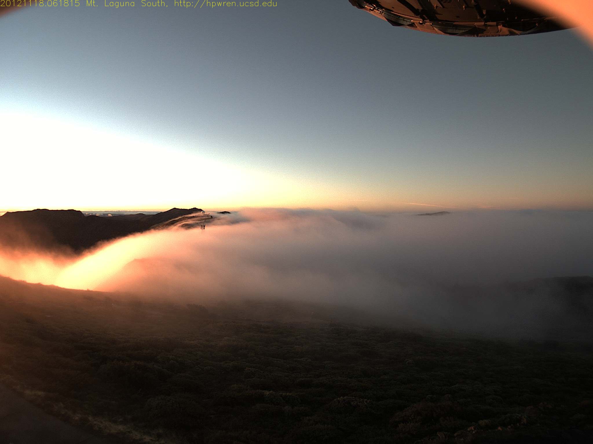
Early morning mist, sunrise at Mt Laguna

TV Gospel - Sunkissed!

Air Conditioned

Mt Laguna east view at sunrise

20170504_152325.jpg

Mt Laguna North view 07-Nov-2012 06:34 AM PST

Highway to the Milky Way

Mt Laguna North view

Mt Laguna east view during a snowfall

27-Oct-2012 at 7:38 am PST ~ Mt Laguna - North view -- VERY CLEAR and best time found for clarity

Light in the Window
CA-79, Descanso, CA 美国的地图
查询其他地方的日出日落时间
附近地点
Green Valley Falls, California, 美国
Boulder Creek Rd, Descanso, CA 美国
Boulder Creek Rd, Descanso, CA 美国
Cuyamaca Mountains, California 美国
Cuyamaca Peak, California 美国
CA-79, Julian, CA 美国Paso Picacho Campground
Stonewall Peak Trail, Julian, CA 美国
California 79, Julian, CA 美国Lake Cuyamaca Restaurant & Store
Lake Cuyamaca, California 美国
Sunrise Hwy, California, 美国Sunrise Highway
Kwaaymii Point, Julian, CA 美国
Navajo Rd, Julian, CA 美国
Pima Trail, Julian, CA 美国
Engineers Rd, Julian, CA 美国
Pine Valley, CA 美国Laguna Campground
Sandy Creek Rd, Julian, CA 美国
Grandview Way, Julian, CA 美国
Starlight Way, Julian, CA 美国
Iron Springs Rd, Julian, CA 美国
Lois Ln, Julian, CA 美国Lois Lane
最近搜索
- 1 Chome-8 Inohana, Chuo Ward, Chiba, -日本的日出日落时间表
- 1-chōme-8-1 Inohana, Chuo Ward, Chiba, -日本的日出日落时间表
- Hercules Dr, Colorado Springs, CO 美国的日出日落时间表
- Chiharadaihigashi, Ichihara, Chiba -日本的日出日落时间表
- West Sugar Creek, Charlotte, NC 美国的日出日落时间表
- Contulmo, Bío Bío, Chile的日出日落时间表
- 智利比奥比奥孔图尔莫的日出日落时间表
- Steadfast Ct, Daphne, AL 美国的日出日落时间表
- Horton in Ribblesdale, Settle BD24 0HB英国的日出日落时间表
- Rojo Ct, Atascadero, CA 美国的日出日落时间表