Paprika Rd, Campo, CA アメリカ合衆国パピカ・ロード日の出日の入り時間
Location: アメリカ合衆国 > カリフォルニア州 > サンディエゴ > アメリカ合衆国 〒 カリフォルニア州 カンポー >
時間帯:
America/Los_Angeles
現地時間:
2024-04-20 01:55:45
経度:
-116.4988774
緯度:
32.6875117
今日の日の出時刻:
06:09:18 AM
今日の日の入時刻:
07:20:06 PM
今日の日長:
13h 10m 48s
明日の日の出時刻:
06:08:11 AM
明日の日の入時刻:
07:20:49 PM
明日の日長:
13h 12m 38s
すべて表示する
| 日付 | 日出 | 日没 | 日長 |
|---|---|---|---|
| 2024年01月01日 | 06:48:16 AM | 04:51:28 PM | 10h 3m 12s |
| 2024年01月02日 | 06:48:26 AM | 04:52:13 PM | 10h 3m 47s |
| 2024年01月03日 | 06:48:35 AM | 04:52:59 PM | 10h 4m 24s |
| 2024年01月04日 | 06:48:42 AM | 04:53:46 PM | 10h 5m 4s |
| 2024年01月05日 | 06:48:47 AM | 04:54:34 PM | 10h 5m 47s |
| 2024年01月06日 | 06:48:51 AM | 04:55:23 PM | 10h 6m 32s |
| 2024年01月07日 | 06:48:52 AM | 04:56:13 PM | 10h 7m 21s |
| 2024年01月08日 | 06:48:52 AM | 04:57:03 PM | 10h 8m 11s |
| 2024年01月09日 | 06:48:50 AM | 04:57:54 PM | 10h 9m 4s |
| 2024年01月10日 | 06:48:47 AM | 04:58:46 PM | 10h 9m 59s |
| 2024年01月11日 | 06:48:41 AM | 04:59:38 PM | 10h 10m 57s |
| 2024年01月12日 | 06:48:34 AM | 05:00:31 PM | 10h 11m 57s |
| 2024年01月13日 | 06:48:25 AM | 05:01:25 PM | 10h 13m 0s |
| 2024年01月14日 | 06:48:14 AM | 05:02:19 PM | 10h 14m 5s |
| 2024年01月15日 | 06:48:01 AM | 05:03:14 PM | 10h 15m 13s |
| 2024年01月16日 | 06:47:47 AM | 05:04:08 PM | 10h 16m 21s |
| 2024年01月17日 | 06:47:30 AM | 05:05:04 PM | 10h 17m 34s |
| 2024年01月18日 | 06:47:12 AM | 05:05:59 PM | 10h 18m 47s |
| 2024年01月19日 | 06:46:53 AM | 05:06:55 PM | 10h 20m 2s |
| 2024年01月20日 | 06:46:31 AM | 05:07:51 PM | 10h 21m 20s |
| 2024年01月21日 | 06:46:08 AM | 05:08:47 PM | 10h 22m 39s |
| 2024年01月22日 | 06:45:43 AM | 05:09:44 PM | 10h 24m 1s |
| 2024年01月23日 | 06:45:17 AM | 05:10:41 PM | 10h 25m 24s |
| 2024年01月24日 | 06:44:48 AM | 05:11:37 PM | 10h 26m 49s |
| 2024年01月25日 | 06:44:18 AM | 05:12:34 PM | 10h 28m 16s |
| 2024年01月26日 | 06:43:47 AM | 05:13:31 PM | 10h 29m 44s |
| 2024年01月27日 | 06:43:14 AM | 05:14:28 PM | 10h 31m 14s |
| 2024年01月28日 | 06:42:39 AM | 05:15:24 PM | 10h 32m 45s |
| 2024年01月29日 | 06:42:03 AM | 05:16:21 PM | 10h 34m 18s |
| 2024年01月30日 | 06:41:25 AM | 05:17:18 PM | 10h 35m 53s |
| 2024年01月31日 | 06:40:45 AM | 05:18:14 PM | 10h 37m 29s |
| 2024年02月01日 | 06:40:05 AM | 05:19:11 PM | 10h 39m 6s |
| 2024年02月02日 | 06:39:22 AM | 05:20:07 PM | 10h 40m 45s |
| 2024年02月03日 | 06:38:38 AM | 05:21:03 PM | 10h 42m 25s |
| 2024年02月04日 | 06:37:53 AM | 05:21:59 PM | 10h 44m 6s |
| 2024年02月05日 | 06:37:07 AM | 05:22:54 PM | 10h 45m 47s |
| 2024年02月06日 | 06:36:19 AM | 05:23:50 PM | 10h 47m 31s |
| 2024年02月07日 | 06:35:29 AM | 05:24:45 PM | 10h 49m 16s |
| 2024年02月08日 | 06:34:39 AM | 05:25:40 PM | 10h 51m 1s |
| 2024年02月09日 | 06:33:47 AM | 05:26:34 PM | 10h 52m 47s |
| 2024年02月10日 | 06:32:54 AM | 05:27:29 PM | 10h 54m 35s |
| 2024年02月11日 | 06:31:59 AM | 05:28:23 PM | 10h 56m 24s |
| 2024年02月12日 | 06:31:04 AM | 05:29:16 PM | 10h 58m 12s |
| 2024年02月13日 | 06:30:07 AM | 05:30:10 PM | 11h 0m 3s |
| 2024年02月14日 | 06:29:09 AM | 05:31:03 PM | 11h 1m 54s |
| 2024年02月15日 | 06:28:10 AM | 05:31:55 PM | 11h 3m 45s |
| 2024年02月16日 | 06:27:10 AM | 05:32:48 PM | 11h 5m 38s |
| 2024年02月17日 | 06:26:09 AM | 05:33:40 PM | 11h 7m 31s |
| 2024年02月18日 | 06:25:07 AM | 05:34:31 PM | 11h 9m 24s |
| 2024年02月19日 | 06:24:04 AM | 05:35:23 PM | 11h 11m 19s |
| 2024年02月20日 | 06:22:59 AM | 05:36:13 PM | 11h 13m 14s |
| 2024年02月21日 | 06:21:54 AM | 05:37:04 PM | 11h 15m 10s |
| 2024年02月22日 | 06:20:49 AM | 05:37:54 PM | 11h 17m 5s |
| 2024年02月23日 | 06:19:42 AM | 05:38:44 PM | 11h 19m 2s |
| 2024年02月24日 | 06:18:34 AM | 05:39:33 PM | 11h 20m 59s |
| 2024年02月25日 | 06:17:26 AM | 05:40:23 PM | 11h 22m 57s |
| 2024年02月26日 | 06:16:17 AM | 05:41:11 PM | 11h 24m 54s |
| 2024年02月27日 | 06:15:07 AM | 05:42:00 PM | 11h 26m 53s |
| 2024年02月28日 | 06:13:56 AM | 05:42:48 PM | 11h 28m 52s |
| 2024年02月29日 | 06:12:45 AM | 05:43:36 PM | 11h 30m 51s |
| 2024年03月01日 | 06:11:33 AM | 05:44:23 PM | 11h 32m 50s |
| 2024年03月02日 | 06:10:20 AM | 05:45:10 PM | 11h 34m 50s |
| 2024年03月03日 | 06:09:07 AM | 05:45:57 PM | 11h 36m 50s |
| 2024年03月04日 | 06:07:53 AM | 05:46:43 PM | 11h 38m 50s |
| 2024年03月05日 | 06:06:39 AM | 05:47:30 PM | 11h 40m 51s |
| 2024年03月06日 | 06:05:24 AM | 05:48:15 PM | 11h 42m 51s |
| 2024年03月07日 | 06:04:09 AM | 05:49:01 PM | 11h 44m 52s |
| 2024年03月08日 | 06:02:53 AM | 05:49:46 PM | 11h 46m 53s |
| 2024年03月09日 | 06:01:37 AM | 05:50:32 PM | 11h 48m 55s |
| 2024年03月10日 | 07:00:24 AM | 06:51:14 PM | 11h 50m 50s |
| 2024年03月11日 | 06:59:07 AM | 06:51:59 PM | 11h 52m 52s |
| 2024年03月12日 | 06:57:50 AM | 06:52:43 PM | 11h 54m 53s |
| 2024年03月13日 | 06:56:32 AM | 06:53:28 PM | 11h 56m 56s |
| 2024年03月14日 | 06:55:15 AM | 06:54:12 PM | 11h 58m 57s |
| 2024年03月15日 | 06:53:57 AM | 06:54:55 PM | 12h 0m 58s |
| 2024年03月16日 | 06:52:39 AM | 06:55:39 PM | 12h 3m 0s |
| 2024年03月17日 | 06:51:20 AM | 06:56:22 PM | 12h 5m 2s |
| 2024年03月18日 | 06:50:02 AM | 06:57:06 PM | 12h 7m 4s |
| 2024年03月19日 | 06:48:43 AM | 06:57:49 PM | 12h 9m 6s |
| 2024年03月20日 | 06:47:25 AM | 06:58:32 PM | 12h 11m 7s |
| 2024年03月21日 | 06:46:06 AM | 06:59:15 PM | 12h 13m 9s |
| 2024年03月22日 | 06:44:47 AM | 06:59:57 PM | 12h 15m 10s |
| 2024年03月23日 | 06:43:28 AM | 07:00:40 PM | 12h 17m 12s |
| 2024年03月24日 | 06:42:10 AM | 07:01:22 PM | 12h 19m 12s |
| 2024年03月25日 | 06:40:51 AM | 07:02:05 PM | 12h 21m 14s |
| 2024年03月26日 | 06:39:32 AM | 07:02:47 PM | 12h 23m 15s |
| 2024年03月27日 | 06:38:14 AM | 07:03:30 PM | 12h 25m 16s |
| 2024年03月28日 | 06:36:55 AM | 07:04:12 PM | 12h 27m 17s |
| 2024年03月29日 | 06:35:37 AM | 07:04:54 PM | 12h 29m 17s |
| 2024年03月30日 | 06:34:19 AM | 07:05:37 PM | 12h 31m 18s |
| 2024年03月31日 | 06:33:01 AM | 07:06:19 PM | 12h 33m 18s |
| 2024年04月01日 | 06:31:44 AM | 07:07:01 PM | 12h 35m 17s |
| 2024年04月02日 | 06:30:26 AM | 07:07:43 PM | 12h 37m 17s |
| 2024年04月03日 | 06:29:10 AM | 07:08:26 PM | 12h 39m 16s |
| 2024年04月04日 | 06:27:53 AM | 07:09:08 PM | 12h 41m 15s |
| 2024年04月05日 | 06:26:37 AM | 07:09:50 PM | 12h 43m 13s |
| 2024年04月06日 | 06:25:21 AM | 07:10:33 PM | 12h 45m 12s |
| 2024年04月07日 | 06:24:05 AM | 07:11:15 PM | 12h 47m 10s |
| 2024年04月08日 | 06:22:50 AM | 07:11:57 PM | 12h 49m 7s |
| 2024年04月09日 | 06:21:36 AM | 07:12:40 PM | 12h 51m 4s |
| 2024年04月10日 | 06:20:22 AM | 07:13:23 PM | 12h 53m 1s |
| 2024年04月11日 | 06:19:09 AM | 07:14:05 PM | 12h 54m 56s |
| 2024年04月12日 | 06:17:56 AM | 07:14:48 PM | 12h 56m 52s |
| 2024年04月13日 | 06:16:43 AM | 07:15:31 PM | 12h 58m 48s |
| 2024年04月14日 | 06:15:32 AM | 07:16:14 PM | 13h 0m 42s |
| 2024年04月15日 | 06:14:21 AM | 07:16:57 PM | 13h 2m 36s |
| 2024年04月16日 | 06:13:10 AM | 07:17:40 PM | 13h 4m 30s |
| 2024年04月17日 | 06:12:01 AM | 07:18:23 PM | 13h 6m 22s |
| 2024年04月18日 | 06:10:52 AM | 07:19:06 PM | 13h 8m 14s |
| 2024年04月19日 | 06:09:44 AM | 07:19:50 PM | 13h 10m 6s |
| 2024年04月20日 | 06:08:36 AM | 07:20:33 PM | 13h 11m 57s |
| 2024年04月21日 | 06:07:30 AM | 07:21:16 PM | 13h 13m 46s |
| 2024年04月22日 | 06:06:24 AM | 07:22:00 PM | 13h 15m 36s |
| 2024年04月23日 | 06:05:19 AM | 07:22:44 PM | 13h 17m 25s |
| 2024年04月24日 | 06:04:15 AM | 07:23:27 PM | 13h 19m 12s |
| 2024年04月25日 | 06:03:12 AM | 07:24:11 PM | 13h 20m 59s |
| 2024年04月26日 | 06:02:10 AM | 07:24:55 PM | 13h 22m 45s |
| 2024年04月27日 | 06:01:09 AM | 07:25:39 PM | 13h 24m 30s |
| 2024年04月28日 | 06:00:09 AM | 07:26:23 PM | 13h 26m 14s |
| 2024年04月29日 | 05:59:10 AM | 07:27:07 PM | 13h 27m 57s |
| 2024年04月30日 | 05:58:11 AM | 07:27:51 PM | 13h 29m 40s |
| 2024年05月01日 | 05:57:14 AM | 07:28:35 PM | 13h 31m 21s |
| 2024年05月02日 | 05:56:19 AM | 07:29:19 PM | 13h 33m 0s |
| 2024年05月03日 | 05:55:24 AM | 07:30:03 PM | 13h 34m 39s |
| 2024年05月04日 | 05:54:30 AM | 07:30:47 PM | 13h 36m 17s |
| 2024年05月05日 | 05:53:38 AM | 07:31:31 PM | 13h 37m 53s |
| 2024年05月06日 | 05:52:46 AM | 07:32:15 PM | 13h 39m 29s |
| 2024年05月07日 | 05:51:56 AM | 07:32:59 PM | 13h 41m 3s |
| 2024年05月08日 | 05:51:08 AM | 07:33:42 PM | 13h 42m 34s |
| 2024年05月09日 | 05:50:20 AM | 07:34:26 PM | 13h 44m 6s |
| 2024年05月10日 | 05:49:34 AM | 07:35:10 PM | 13h 45m 36s |
| 2024年05月11日 | 05:48:49 AM | 07:35:53 PM | 13h 47m 4s |
| 2024年05月12日 | 05:48:05 AM | 07:36:36 PM | 13h 48m 31s |
| 2024年05月13日 | 05:47:23 AM | 07:37:19 PM | 13h 49m 56s |
| 2024年05月14日 | 05:46:42 AM | 07:38:02 PM | 13h 51m 20s |
| 2024年05月15日 | 05:46:02 AM | 07:38:44 PM | 13h 52m 42s |
| 2024年05月16日 | 05:45:24 AM | 07:39:26 PM | 13h 54m 2s |
| 2024年05月17日 | 05:44:47 AM | 07:40:08 PM | 13h 55m 21s |
| 2024年05月18日 | 05:44:12 AM | 07:40:50 PM | 13h 56m 38s |
| 2024年05月19日 | 05:43:38 AM | 07:41:31 PM | 13h 57m 53s |
| 2024年05月20日 | 05:43:06 AM | 07:42:12 PM | 13h 59m 6s |
| 2024年05月21日 | 05:42:35 AM | 07:42:52 PM | 14h 0m 17s |
| 2024年05月22日 | 05:42:05 AM | 07:43:32 PM | 14h 1m 27s |
| 2024年05月23日 | 05:41:37 AM | 07:44:11 PM | 14h 2m 34s |
| 2024年05月24日 | 05:41:11 AM | 07:44:50 PM | 14h 3m 39s |
| 2024年05月25日 | 05:40:46 AM | 07:45:29 PM | 14h 4m 43s |
| 2024年05月26日 | 05:40:22 AM | 07:46:06 PM | 14h 5m 44s |
| 2024年05月27日 | 05:40:00 AM | 07:46:44 PM | 14h 6m 44s |
| 2024年05月28日 | 05:39:40 AM | 07:47:20 PM | 14h 7m 40s |
| 2024年05月29日 | 05:39:21 AM | 07:47:56 PM | 14h 8m 35s |
| 2024年05月30日 | 05:39:03 AM | 07:48:31 PM | 14h 9m 28s |
| 2024年05月31日 | 05:38:48 AM | 07:49:06 PM | 14h 10m 18s |
| 2024年06月01日 | 05:38:33 AM | 07:49:39 PM | 14h 11m 6s |
| 2024年06月02日 | 05:38:21 AM | 07:50:12 PM | 14h 11m 51s |
| 2024年06月03日 | 05:38:09 AM | 07:50:44 PM | 14h 12m 35s |
| 2024年06月04日 | 05:38:00 AM | 07:51:15 PM | 14h 13m 15s |
| 2024年06月05日 | 05:37:52 AM | 07:51:45 PM | 14h 13m 53s |
| 2024年06月06日 | 05:37:45 AM | 07:52:15 PM | 14h 14m 30s |
| 2024年06月07日 | 05:37:40 AM | 07:52:43 PM | 14h 15m 3s |
| 2024年06月08日 | 05:37:36 AM | 07:53:10 PM | 14h 15m 34s |
| 2024年06月09日 | 05:37:34 AM | 07:53:36 PM | 14h 16m 2s |
| 2024年06月10日 | 05:37:34 AM | 07:54:01 PM | 14h 16m 27s |
| 2024年06月11日 | 05:37:35 AM | 07:54:25 PM | 14h 16m 50s |
| 2024年06月12日 | 05:37:37 AM | 07:54:48 PM | 14h 17m 11s |
| 2024年06月13日 | 05:37:41 AM | 07:55:10 PM | 14h 17m 29s |
| 2024年06月14日 | 05:37:46 AM | 07:55:30 PM | 14h 17m 44s |
| 2024年06月15日 | 05:37:53 AM | 07:55:50 PM | 14h 17m 57s |
| 2024年06月16日 | 05:38:01 AM | 07:56:08 PM | 14h 18m 7s |
| 2024年06月17日 | 05:38:10 AM | 07:56:24 PM | 14h 18m 14s |
| 2024年06月18日 | 05:38:21 AM | 07:56:40 PM | 14h 18m 19s |
| 2024年06月19日 | 05:38:33 AM | 07:56:54 PM | 14h 18m 21s |
| 2024年06月20日 | 05:38:46 AM | 07:57:07 PM | 14h 18m 21s |
| 2024年06月21日 | 05:39:01 AM | 07:57:18 PM | 14h 18m 17s |
| 2024年06月22日 | 05:39:17 AM | 07:57:28 PM | 14h 18m 11s |
| 2024年06月23日 | 05:39:34 AM | 07:57:36 PM | 14h 18m 2s |
| 2024年06月24日 | 05:39:52 AM | 07:57:43 PM | 14h 17m 51s |
| 2024年06月25日 | 05:40:12 AM | 07:57:49 PM | 14h 17m 37s |
| 2024年06月26日 | 05:40:33 AM | 07:57:53 PM | 14h 17m 20s |
| 2024年06月27日 | 05:40:55 AM | 07:57:56 PM | 14h 17m 1s |
| 2024年06月28日 | 05:41:17 AM | 07:57:57 PM | 14h 16m 40s |
| 2024年06月29日 | 05:41:41 AM | 07:57:56 PM | 14h 16m 15s |
| 2024年06月30日 | 05:42:06 AM | 07:57:54 PM | 14h 15m 48s |
| 2024年07月01日 | 05:42:32 AM | 07:57:51 PM | 14h 15m 19s |
| 2024年07月02日 | 05:42:59 AM | 07:57:46 PM | 14h 14m 47s |
| 2024年07月03日 | 05:43:27 AM | 07:57:39 PM | 14h 14m 12s |
| 2024年07月04日 | 05:43:56 AM | 07:57:31 PM | 14h 13m 35s |
| 2024年07月05日 | 05:44:25 AM | 07:57:21 PM | 14h 12m 56s |
| 2024年07月06日 | 05:44:56 AM | 07:57:10 PM | 14h 12m 14s |
| 2024年07月07日 | 05:45:27 AM | 07:56:57 PM | 14h 11m 30s |
| 2024年07月08日 | 05:45:59 AM | 07:56:43 PM | 14h 10m 44s |
| 2024年07月09日 | 05:46:32 AM | 07:56:26 PM | 14h 9m 54s |
| 2024年07月10日 | 05:47:05 AM | 07:56:09 PM | 14h 9m 4s |
| 2024年07月11日 | 05:47:39 AM | 07:55:50 PM | 14h 8m 11s |
| 2024年07月12日 | 05:48:14 AM | 07:55:29 PM | 14h 7m 15s |
| 2024年07月13日 | 05:48:49 AM | 07:55:06 PM | 14h 6m 17s |
| 2024年07月14日 | 05:49:25 AM | 07:54:42 PM | 14h 5m 17s |
| 2024年07月15日 | 05:50:01 AM | 07:54:17 PM | 14h 4m 16s |
| 2024年07月16日 | 05:50:38 AM | 07:53:50 PM | 14h 3m 12s |
| 2024年07月17日 | 05:51:15 AM | 07:53:21 PM | 14h 2m 6s |
| 2024年07月18日 | 05:51:53 AM | 07:52:51 PM | 14h 0m 58s |
| 2024年07月19日 | 05:52:31 AM | 07:52:20 PM | 13h 59m 49s |
| 2024年07月20日 | 05:53:09 AM | 07:51:47 PM | 13h 58m 38s |
| 2024年07月21日 | 05:53:48 AM | 07:51:12 PM | 13h 57m 24s |
| 2024年07月22日 | 05:54:27 AM | 07:50:36 PM | 13h 56m 9s |
| 2024年07月23日 | 05:55:07 AM | 07:49:58 PM | 13h 54m 51s |
| 2024年07月24日 | 05:55:46 AM | 07:49:19 PM | 13h 53m 33s |
| 2024年07月25日 | 05:56:26 AM | 07:48:39 PM | 13h 52m 13s |
| 2024年07月26日 | 05:57:06 AM | 07:47:57 PM | 13h 50m 51s |
| 2024年07月27日 | 05:57:47 AM | 07:47:14 PM | 13h 49m 27s |
| 2024年07月28日 | 05:58:27 AM | 07:46:29 PM | 13h 48m 2s |
| 2024年07月29日 | 05:59:08 AM | 07:45:44 PM | 13h 46m 36s |
| 2024年07月30日 | 05:59:48 AM | 07:44:56 PM | 13h 45m 8s |
| 2024年07月31日 | 06:00:29 AM | 07:44:08 PM | 13h 43m 39s |
| 2024年08月01日 | 06:01:10 AM | 07:43:18 PM | 13h 42m 8s |
| 2024年08月02日 | 06:01:51 AM | 07:42:27 PM | 13h 40m 36s |
| 2024年08月03日 | 06:02:32 AM | 07:41:35 PM | 13h 39m 3s |
| 2024年08月04日 | 06:03:12 AM | 07:40:41 PM | 13h 37m 29s |
| 2024年08月05日 | 06:03:53 AM | 07:39:46 PM | 13h 35m 53s |
| 2024年08月06日 | 06:04:34 AM | 07:38:50 PM | 13h 34m 16s |
| 2024年08月07日 | 06:05:15 AM | 07:37:53 PM | 13h 32m 38s |
| 2024年08月08日 | 06:05:56 AM | 07:36:55 PM | 13h 30m 59s |
| 2024年08月09日 | 06:06:37 AM | 07:35:56 PM | 13h 29m 19s |
| 2024年08月10日 | 06:07:18 AM | 07:34:55 PM | 13h 27m 37s |
| 2024年08月11日 | 06:07:58 AM | 07:33:54 PM | 13h 25m 56s |
| 2024年08月12日 | 06:08:39 AM | 07:32:52 PM | 13h 24m 13s |
| 2024年08月13日 | 06:09:19 AM | 07:31:48 PM | 13h 22m 29s |
| 2024年08月14日 | 06:10:00 AM | 07:30:44 PM | 13h 20m 44s |
| 2024年08月15日 | 06:10:40 AM | 07:29:38 PM | 13h 18m 58s |
| 2024年08月16日 | 06:11:20 AM | 07:28:32 PM | 13h 17m 12s |
| 2024年08月17日 | 06:12:00 AM | 07:27:25 PM | 13h 15m 25s |
| 2024年08月18日 | 06:12:40 AM | 07:26:17 PM | 13h 13m 37s |
| 2024年08月19日 | 06:13:20 AM | 07:25:08 PM | 13h 11m 48s |
| 2024年08月20日 | 06:14:00 AM | 07:23:59 PM | 13h 9m 59s |
| 2024年08月21日 | 06:14:39 AM | 07:22:48 PM | 13h 8m 9s |
| 2024年08月22日 | 06:15:19 AM | 07:21:37 PM | 13h 6m 18s |
| 2024年08月23日 | 06:15:58 AM | 07:20:25 PM | 13h 4m 27s |
| 2024年08月24日 | 06:16:38 AM | 07:19:12 PM | 13h 2m 34s |
| 2024年08月25日 | 06:17:17 AM | 07:17:59 PM | 13h 0m 42s |
| 2024年08月26日 | 06:17:56 AM | 07:16:45 PM | 12h 58m 49s |
| 2024年08月27日 | 06:18:35 AM | 07:15:30 PM | 12h 56m 55s |
| 2024年08月28日 | 06:19:13 AM | 07:14:15 PM | 12h 55m 2s |
| 2024年08月29日 | 06:19:52 AM | 07:13:00 PM | 12h 53m 8s |
| 2024年08月30日 | 06:20:31 AM | 07:11:43 PM | 12h 51m 12s |
| 2024年08月31日 | 06:21:09 AM | 07:10:26 PM | 12h 49m 17s |
| 2024年09月01日 | 06:21:48 AM | 07:09:09 PM | 12h 47m 21s |
| 2024年09月02日 | 06:22:26 AM | 07:07:51 PM | 12h 45m 25s |
| 2024年09月03日 | 06:23:04 AM | 07:06:33 PM | 12h 43m 29s |
| 2024年09月04日 | 06:23:43 AM | 07:05:15 PM | 12h 41m 32s |
| 2024年09月05日 | 06:24:21 AM | 07:03:56 PM | 12h 39m 35s |
| 2024年09月06日 | 06:24:59 AM | 07:02:37 PM | 12h 37m 38s |
| 2024年09月07日 | 06:25:37 AM | 07:01:17 PM | 12h 35m 40s |
| 2024年09月08日 | 06:26:15 AM | 06:59:57 PM | 12h 33m 42s |
| 2024年09月09日 | 06:26:53 AM | 06:58:37 PM | 12h 31m 44s |
| 2024年09月10日 | 06:27:31 AM | 06:57:17 PM | 12h 29m 46s |
| 2024年09月11日 | 06:28:09 AM | 06:55:56 PM | 12h 27m 47s |
| 2024年09月12日 | 06:28:47 AM | 06:54:35 PM | 12h 25m 48s |
| 2024年09月13日 | 06:29:25 AM | 06:53:15 PM | 12h 23m 50s |
| 2024年09月14日 | 06:30:04 AM | 06:51:54 PM | 12h 21m 50s |
| 2024年09月15日 | 06:30:42 AM | 06:50:32 PM | 12h 19m 50s |
| 2024年09月16日 | 06:31:20 AM | 06:49:11 PM | 12h 17m 51s |
| 2024年09月17日 | 06:31:58 AM | 06:47:50 PM | 12h 15m 52s |
| 2024年09月18日 | 06:32:37 AM | 06:46:29 PM | 12h 13m 52s |
| 2024年09月19日 | 06:33:15 AM | 06:45:08 PM | 12h 11m 53s |
| 2024年09月20日 | 06:33:54 AM | 06:43:47 PM | 12h 9m 53s |
| 2024年09月21日 | 06:34:33 AM | 06:42:26 PM | 12h 7m 53s |
| 2024年09月22日 | 06:35:12 AM | 06:41:05 PM | 12h 5m 53s |
| 2024年09月23日 | 06:35:51 AM | 06:39:44 PM | 12h 3m 53s |
| 2024年09月24日 | 06:36:30 AM | 06:38:23 PM | 12h 1m 53s |
| 2024年09月25日 | 06:37:09 AM | 06:37:03 PM | 11h 59m 54s |
| 2024年09月26日 | 06:37:49 AM | 06:35:42 PM | 11h 57m 53s |
| 2024年09月27日 | 06:38:29 AM | 06:34:22 PM | 11h 55m 53s |
| 2024年09月28日 | 06:39:09 AM | 06:33:03 PM | 11h 53m 54s |
| 2024年09月29日 | 06:39:49 AM | 06:31:43 PM | 11h 51m 54s |
| 2024年09月30日 | 06:40:29 AM | 06:30:24 PM | 11h 49m 55s |
| 2024年10月01日 | 06:41:10 AM | 06:29:05 PM | 11h 47m 55s |
| 2024年10月02日 | 06:41:51 AM | 06:27:47 PM | 11h 45m 56s |
| 2024年10月03日 | 06:42:32 AM | 06:26:29 PM | 11h 43m 57s |
| 2024年10月04日 | 06:43:14 AM | 06:25:12 PM | 11h 41m 58s |
| 2024年10月05日 | 06:43:56 AM | 06:23:55 PM | 11h 39m 59s |
| 2024年10月06日 | 06:44:38 AM | 06:22:38 PM | 11h 38m 0s |
| 2024年10月07日 | 06:45:20 AM | 06:21:22 PM | 11h 36m 2s |
| 2024年10月08日 | 06:46:03 AM | 06:20:07 PM | 11h 34m 4s |
| 2024年10月09日 | 06:46:46 AM | 06:18:52 PM | 11h 32m 6s |
| 2024年10月10日 | 06:47:29 AM | 06:17:38 PM | 11h 30m 9s |
| 2024年10月11日 | 06:48:13 AM | 06:16:25 PM | 11h 28m 12s |
| 2024年10月12日 | 06:48:57 AM | 06:15:12 PM | 11h 26m 15s |
| 2024年10月13日 | 06:49:42 AM | 06:14:00 PM | 11h 24m 18s |
| 2024年10月14日 | 06:50:27 AM | 06:12:49 PM | 11h 22m 22s |
| 2024年10月15日 | 06:51:12 AM | 06:11:38 PM | 11h 20m 26s |
| 2024年10月16日 | 06:51:57 AM | 06:10:28 PM | 11h 18m 31s |
| 2024年10月17日 | 06:52:43 AM | 06:09:19 PM | 11h 16m 36s |
| 2024年10月18日 | 06:53:30 AM | 06:08:11 PM | 11h 14m 41s |
| 2024年10月19日 | 06:54:16 AM | 06:07:04 PM | 11h 12m 48s |
| 2024年10月20日 | 06:55:04 AM | 06:05:58 PM | 11h 10m 54s |
| 2024年10月21日 | 06:55:51 AM | 06:04:53 PM | 11h 9m 2s |
| 2024年10月22日 | 06:56:39 AM | 06:03:49 PM | 11h 7m 10s |
| 2024年10月23日 | 06:57:27 AM | 06:02:45 PM | 11h 5m 18s |
| 2024年10月24日 | 06:58:16 AM | 06:01:43 PM | 11h 3m 27s |
| 2024年10月25日 | 06:59:05 AM | 06:00:42 PM | 11h 1m 37s |
| 2024年10月26日 | 06:59:54 AM | 05:59:42 PM | 10h 59m 48s |
| 2024年10月27日 | 07:00:44 AM | 05:58:43 PM | 10h 57m 59s |
| 2024年10月28日 | 07:01:34 AM | 05:57:46 PM | 10h 56m 12s |
| 2024年10月29日 | 07:02:25 AM | 05:56:49 PM | 10h 54m 24s |
| 2024年10月30日 | 07:03:16 AM | 05:55:54 PM | 10h 52m 38s |
| 2024年10月31日 | 07:04:07 AM | 05:55:00 PM | 10h 50m 53s |
| 2024年11月01日 | 07:04:58 AM | 05:54:07 PM | 10h 49m 9s |
| 2024年11月02日 | 07:05:50 AM | 05:53:16 PM | 10h 47m 26s |
| 2024年11月03日 | 06:06:44 AM | 04:52:24 PM | 10h 45m 40s |
| 2024年11月04日 | 06:07:37 AM | 04:51:35 PM | 10h 43m 58s |
| 2024年11月05日 | 06:08:29 AM | 04:50:48 PM | 10h 42m 19s |
| 2024年11月06日 | 06:09:22 AM | 04:50:02 PM | 10h 40m 40s |
| 2024年11月07日 | 06:10:16 AM | 04:49:18 PM | 10h 39m 2s |
| 2024年11月08日 | 06:11:09 AM | 04:48:35 PM | 10h 37m 26s |
| 2024年11月09日 | 06:12:02 AM | 04:47:54 PM | 10h 35m 52s |
| 2024年11月10日 | 06:12:56 AM | 04:47:14 PM | 10h 34m 18s |
| 2024年11月11日 | 06:13:50 AM | 04:46:36 PM | 10h 32m 46s |
| 2024年11月12日 | 06:14:44 AM | 04:45:59 PM | 10h 31m 15s |
| 2024年11月13日 | 06:15:38 AM | 04:45:24 PM | 10h 29m 46s |
| 2024年11月14日 | 06:16:32 AM | 04:44:50 PM | 10h 28m 18s |
| 2024年11月15日 | 06:17:26 AM | 04:44:19 PM | 10h 26m 53s |
| 2024年11月16日 | 06:18:21 AM | 04:43:48 PM | 10h 25m 27s |
| 2024年11月17日 | 06:19:15 AM | 04:43:20 PM | 10h 24m 5s |
| 2024年11月18日 | 06:20:09 AM | 04:42:53 PM | 10h 22m 44s |
| 2024年11月19日 | 06:21:03 AM | 04:42:28 PM | 10h 21m 25s |
| 2024年11月20日 | 06:21:57 AM | 04:42:05 PM | 10h 20m 8s |
| 2024年11月21日 | 06:22:50 AM | 04:41:44 PM | 10h 18m 54s |
| 2024年11月22日 | 06:23:44 AM | 04:41:24 PM | 10h 17m 40s |
| 2024年11月23日 | 06:24:37 AM | 04:41:06 PM | 10h 16m 29s |
| 2024年11月24日 | 06:25:30 AM | 04:40:50 PM | 10h 15m 20s |
| 2024年11月25日 | 06:26:22 AM | 04:40:35 PM | 10h 14m 13s |
| 2024年11月26日 | 06:27:15 AM | 04:40:23 PM | 10h 13m 8s |
| 2024年11月27日 | 06:28:07 AM | 04:40:12 PM | 10h 12m 5s |
| 2024年11月28日 | 06:28:58 AM | 04:40:03 PM | 10h 11m 5s |
| 2024年11月29日 | 06:29:49 AM | 04:39:56 PM | 10h 10m 7s |
| 2024年11月30日 | 06:30:39 AM | 04:39:51 PM | 10h 9m 12s |
| 2024年12月01日 | 06:31:29 AM | 04:39:48 PM | 10h 8m 19s |
| 2024年12月02日 | 06:32:18 AM | 04:39:46 PM | 10h 7m 28s |
| 2024年12月03日 | 06:33:07 AM | 04:39:46 PM | 10h 6m 39s |
| 2024年12月04日 | 06:33:54 AM | 04:39:49 PM | 10h 5m 55s |
| 2024年12月05日 | 06:34:41 AM | 04:39:53 PM | 10h 5m 12s |
| 2024年12月06日 | 06:35:27 AM | 04:39:58 PM | 10h 4m 31s |
| 2024年12月07日 | 06:36:13 AM | 04:40:06 PM | 10h 3m 53s |
| 2024年12月08日 | 06:36:57 AM | 04:40:15 PM | 10h 3m 18s |
| 2024年12月09日 | 06:37:40 AM | 04:40:27 PM | 10h 2m 47s |
| 2024年12月10日 | 06:38:23 AM | 04:40:40 PM | 10h 2m 17s |
| 2024年12月11日 | 06:39:04 AM | 04:40:54 PM | 10h 1m 50s |
| 2024年12月12日 | 06:39:45 AM | 04:41:11 PM | 10h 1m 26s |
| 2024年12月13日 | 06:40:24 AM | 04:41:29 PM | 10h 1m 5s |
| 2024年12月14日 | 06:41:02 AM | 04:41:49 PM | 10h 0m 47s |
| 2024年12月15日 | 06:41:39 AM | 04:42:10 PM | 10h 0m 31s |
| 2024年12月16日 | 06:42:14 AM | 04:42:34 PM | 10h 0m 20s |
| 2024年12月17日 | 06:42:48 AM | 04:42:58 PM | 10h 0m 10s |
| 2024年12月18日 | 06:43:21 AM | 04:43:25 PM | 10h 0m 4s |
| 2024年12月19日 | 06:43:53 AM | 04:43:53 PM | 10h 0m 0s |
| 2024年12月20日 | 06:44:23 AM | 04:44:22 PM | 9h 59m 59s |
| 2024年12月21日 | 06:44:52 AM | 04:44:53 PM | 10h 0m 1s |
| 2024年12月22日 | 06:45:19 AM | 04:45:26 PM | 10h 0m 7s |
| 2024年12月23日 | 06:45:45 AM | 04:46:00 PM | 10h 0m 15s |
| 2024年12月24日 | 06:46:09 AM | 04:46:35 PM | 10h 0m 26s |
| 2024年12月25日 | 06:46:31 AM | 04:47:11 PM | 10h 0m 40s |
| 2024年12月26日 | 06:46:52 AM | 04:47:49 PM | 10h 0m 57s |
| 2024年12月27日 | 06:47:12 AM | 04:48:28 PM | 10h 1m 16s |
| 2024年12月28日 | 06:47:29 AM | 04:49:09 PM | 10h 1m 40s |
| 2024年12月29日 | 06:47:46 AM | 04:49:50 PM | 10h 2m 4s |
| 2024年12月30日 | 06:48:00 AM | 04:50:33 PM | 10h 2m 33s |
写真

Lake Morena

Interstate 8 Freeway and Pine Valley at Twilight

Ruins of the Buckman homestead along Old Highway 80 During Blue Hour

Pacific Crest Trail, 2018

Lake Morena

First sunset.

Pacific Crest Trail, 2018

Roasting (vegetarian) marshmallows

Pacific Crest Trail, 2018

East County Sunset

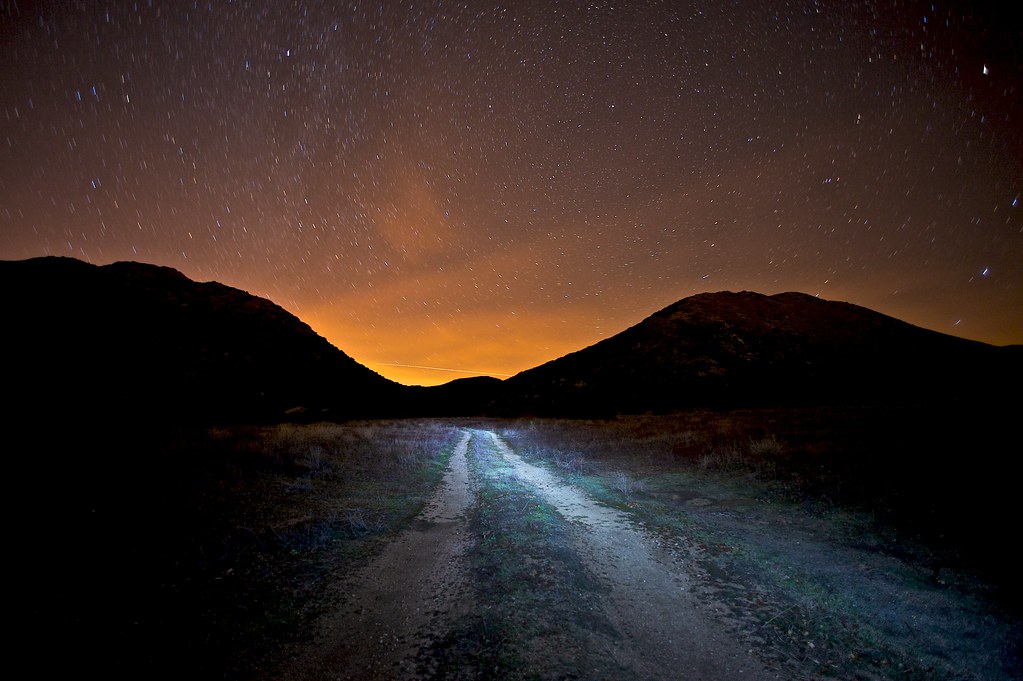
tecate divide #cpmsunsetprj

sunset in campo 2

Sunset Colors

sunset in campo 3

senset in campo 1

Sunset Highway Drive, Cleveland National Forest, San Diego - Jan 20, 2018.
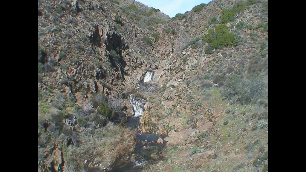
Waterfalls of CottonWood Creek
365-38

Christmas Sunset at Acorn Casino

Christmas sunset from Acorn Casino

Sunset Highway Drive, Cleveland National Forest, San Diego - Jan 20, 2018.

Light in the Window

day 3 sunrise

A Mile of Cars

TV Gospel - Sunkissed!

Air Conditioned

human presence

Pine Valley from Mt Laguna

Snow on the Laguna Mountains

Sunrise Highway Viewpoint
Paprika Rd, Campo, CA アメリカ合衆国パピカ・ロードの地図
別の場所を検索
近所の場所
Bass Rd, Campo, CA アメリカ合衆国
Swan Dr, Campo, CA アメリカ合衆国
Morena View Dr, Campo, CA アメリカ合衆国
Lake Morena Dr, Campo, CA アメリカ合衆国Lake Morena Drive
Lake Morena Dr, Campo, CA アメリカ合衆国
Buckman Springs Rd, Campo, CA アメリカ合衆国
Dewey Pl, Campo, CA アメリカ合衆国
Sheridan Rd, Campo, CA アメリカ合衆国シェリダン・ロード
アメリカ合衆国 〒 カリフォルニア州 カンポー
CA-94, Campo, CA アメリカ合衆国
アメリカ合衆国 〒 カリフォルニア州 ポトレロ
Shockey Truck Trail, Campo, CA アメリカ合衆国
Emery Ln, Potrero, CA アメリカ合衆国
Unnamed Road, Baja California, メキシコ
アメリカ合衆国 〒 カリフォルニア州 テカテ
1 Lewis Ln, Tecate, CA アメリカ合衆国
Carretera Libre Tecate-Mexicali km, canada verde, Tecate, B.C., メキシコCanada del Sol
メキシコ バハカリフォルニア タカテ
メキシコ バハカリフォルニア タカテ
Barrett Lake Rd, Dulzura, CA アメリカ合衆国
最近の検索
- 日本、〒- 千葉県千葉市中央区亥鼻1丁目8日の出日の入り時間
- 日本、〒- 千葉県千葉市中央区亥鼻1丁目8−1日の出日の入り時間
- Hercules Dr, Colorado Springs, CO, USA日の出日の入り時間
- 日本、〒- 千葉県市原市ちはら台東日の出日の入り時間
- アメリカ合衆国 〒 ノース・カロライナ州 シャーロット ウェスト・シュガー・クリーク日の出日の入り時間
- Contulmo, Bío Bío, Chile日の出日の入り時間
- チリ ビオビオ コントゥルモ日の出日の入り時間
- Steadfast Ct, Daphne, AL アメリカ合衆国日の出日の入り時間
- イギリス 〒BD24 0HB Settle, ホールトン・イン・リブルズデール日の出日の入り時間
- Rojo Ct, Atascadero, CA アメリカ合衆国日の出日の入り時間