Washington County, Florida, USA Sonnenaufgang Sonnenuntergang Zeiten
Location: USA > Florida >
Zeitzone:
America/Chicago
Ortszeit:
2024-04-20 06:17:24
Länge:
-85.684578
Breite:
30.548737
Sonnenaufgang Heute:
06:08:45 AM
Sonnenuntergang Heute:
07:14:10 PM
Tageslänge heute:
13h 5m 25s
Sonnenaufgang morgen:
06:07:43 AM
Sonnenuntergang Morgen:
07:14:49 PM
Tageslänge von morgen:
13h 7m 6s
Alle Termine anzeigen
| Datum | Sonnenaufgang | Sonnenuntergang | Tageslänge |
|---|---|---|---|
| 2024-01-01 | 06:39:56 AM | 04:53:08 PM | 10h 13m 12s |
| 2024-01-02 | 06:40:08 AM | 04:53:51 PM | 10h 13m 43s |
| 2024-01-03 | 06:40:19 AM | 04:54:35 PM | 10h 14m 16s |
| 2024-01-04 | 06:40:28 AM | 04:55:21 PM | 10h 14m 53s |
| 2024-01-05 | 06:40:35 AM | 04:56:07 PM | 10h 15m 32s |
| 2024-01-06 | 06:40:41 AM | 04:56:53 PM | 10h 16m 12s |
| 2024-01-07 | 06:40:45 AM | 04:57:41 PM | 10h 16m 56s |
| 2024-01-08 | 06:40:47 AM | 04:58:29 PM | 10h 17m 42s |
| 2024-01-09 | 06:40:48 AM | 04:59:18 PM | 10h 18m 30s |
| 2024-01-10 | 06:40:47 AM | 05:00:07 PM | 10h 19m 20s |
| 2024-01-11 | 06:40:44 AM | 05:00:57 PM | 10h 20m 13s |
| 2024-01-12 | 06:40:39 AM | 05:01:47 PM | 10h 21m 8s |
| 2024-01-13 | 06:40:33 AM | 05:02:38 PM | 10h 22m 5s |
| 2024-01-14 | 06:40:25 AM | 05:03:29 PM | 10h 23m 4s |
| 2024-01-15 | 06:40:16 AM | 05:04:21 PM | 10h 24m 5s |
| 2024-01-16 | 06:40:05 AM | 05:05:13 PM | 10h 25m 8s |
| 2024-01-17 | 06:39:52 AM | 05:06:05 PM | 10h 26m 13s |
| 2024-01-18 | 06:39:37 AM | 05:06:57 PM | 10h 27m 20s |
| 2024-01-19 | 06:39:21 AM | 05:07:50 PM | 10h 28m 29s |
| 2024-01-20 | 06:39:03 AM | 05:08:43 PM | 10h 29m 40s |
| 2024-01-21 | 06:38:43 AM | 05:09:36 PM | 10h 30m 53s |
| 2024-01-22 | 06:38:22 AM | 05:10:29 PM | 10h 32m 7s |
| 2024-01-23 | 06:37:59 AM | 05:11:22 PM | 10h 33m 23s |
| 2024-01-24 | 06:37:35 AM | 05:12:15 PM | 10h 34m 40s |
| 2024-01-25 | 06:37:09 AM | 05:13:08 PM | 10h 35m 59s |
| 2024-01-26 | 06:36:41 AM | 05:14:01 PM | 10h 37m 20s |
| 2024-01-27 | 06:36:12 AM | 05:14:54 PM | 10h 38m 42s |
| 2024-01-28 | 06:35:42 AM | 05:15:47 PM | 10h 40m 5s |
| 2024-01-29 | 06:35:10 AM | 05:16:40 PM | 10h 41m 30s |
| 2024-01-30 | 06:34:36 AM | 05:17:33 PM | 10h 42m 57s |
| 2024-01-31 | 06:34:01 AM | 05:18:25 PM | 10h 44m 24s |
| 2024-02-01 | 06:33:24 AM | 05:19:18 PM | 10h 45m 54s |
| 2024-02-02 | 06:32:46 AM | 05:20:10 PM | 10h 47m 24s |
| 2024-02-03 | 06:32:07 AM | 05:21:02 PM | 10h 48m 55s |
| 2024-02-04 | 06:31:26 AM | 05:21:54 PM | 10h 50m 28s |
| 2024-02-05 | 06:30:44 AM | 05:22:45 PM | 10h 52m 1s |
| 2024-02-06 | 06:30:00 AM | 05:23:36 PM | 10h 53m 36s |
| 2024-02-07 | 06:29:15 AM | 05:24:27 PM | 10h 55m 12s |
| 2024-02-08 | 06:28:29 AM | 05:25:18 PM | 10h 56m 49s |
| 2024-02-09 | 06:27:42 AM | 05:26:08 PM | 10h 58m 26s |
| 2024-02-10 | 06:26:54 AM | 05:26:58 PM | 11h 0m 4s |
| 2024-02-11 | 06:26:04 AM | 05:27:47 PM | 11h 1m 43s |
| 2024-02-12 | 06:25:13 AM | 05:28:37 PM | 11h 3m 24s |
| 2024-02-13 | 06:24:21 AM | 05:29:26 PM | 11h 5m 5s |
| 2024-02-14 | 06:23:28 AM | 05:30:14 PM | 11h 6m 46s |
| 2024-02-15 | 06:22:33 AM | 05:31:02 PM | 11h 8m 29s |
| 2024-02-16 | 06:21:38 AM | 05:31:50 PM | 11h 10m 12s |
| 2024-02-17 | 06:20:42 AM | 05:32:37 PM | 11h 11m 55s |
| 2024-02-18 | 06:19:44 AM | 05:33:24 PM | 11h 13m 40s |
| 2024-02-19 | 06:18:46 AM | 05:34:11 PM | 11h 15m 25s |
| 2024-02-20 | 06:17:47 AM | 05:34:57 PM | 11h 17m 10s |
| 2024-02-21 | 06:16:47 AM | 05:35:43 PM | 11h 18m 56s |
| 2024-02-22 | 06:15:46 AM | 05:36:29 PM | 11h 20m 43s |
| 2024-02-23 | 06:14:44 AM | 05:37:14 PM | 11h 22m 30s |
| 2024-02-24 | 06:13:41 AM | 05:37:59 PM | 11h 24m 18s |
| 2024-02-25 | 06:12:38 AM | 05:38:43 PM | 11h 26m 5s |
| 2024-02-26 | 06:11:33 AM | 05:39:27 PM | 11h 27m 54s |
| 2024-02-27 | 06:10:28 AM | 05:40:11 PM | 11h 29m 43s |
| 2024-02-28 | 06:09:23 AM | 05:40:54 PM | 11h 31m 31s |
| 2024-02-29 | 06:08:16 AM | 05:41:37 PM | 11h 33m 21s |
| 2024-03-01 | 06:07:09 AM | 05:42:20 PM | 11h 35m 11s |
| 2024-03-02 | 06:06:02 AM | 05:43:02 PM | 11h 37m 0s |
| 2024-03-03 | 06:04:53 AM | 05:43:44 PM | 11h 38m 51s |
| 2024-03-04 | 06:03:44 AM | 05:44:26 PM | 11h 40m 42s |
| 2024-03-05 | 06:02:35 AM | 05:45:07 PM | 11h 42m 32s |
| 2024-03-06 | 06:01:25 AM | 05:45:48 PM | 11h 44m 23s |
| 2024-03-07 | 06:00:15 AM | 05:46:29 PM | 11h 46m 14s |
| 2024-03-08 | 05:59:04 AM | 05:47:10 PM | 11h 48m 6s |
| 2024-03-09 | 05:57:53 AM | 05:47:50 PM | 11h 49m 57s |
| 2024-03-10 | 06:56:45 AM | 06:48:28 PM | 11h 51m 43s |
| 2024-03-11 | 06:55:33 AM | 06:49:08 PM | 11h 53m 35s |
| 2024-03-12 | 06:54:20 AM | 06:49:48 PM | 11h 55m 28s |
| 2024-03-13 | 06:53:08 AM | 06:50:27 PM | 11h 57m 19s |
| 2024-03-14 | 06:51:55 AM | 06:51:06 PM | 11h 59m 11s |
| 2024-03-15 | 06:50:42 AM | 06:51:45 PM | 12h 1m 3s |
| 2024-03-16 | 06:49:29 AM | 06:52:24 PM | 12h 2m 55s |
| 2024-03-17 | 06:48:15 AM | 06:53:02 PM | 12h 4m 47s |
| 2024-03-18 | 06:47:02 AM | 06:53:41 PM | 12h 6m 39s |
| 2024-03-19 | 06:45:48 AM | 06:54:19 PM | 12h 8m 31s |
| 2024-03-20 | 06:44:34 AM | 06:54:57 PM | 12h 10m 23s |
| 2024-03-21 | 06:43:21 AM | 06:55:35 PM | 12h 12m 14s |
| 2024-03-22 | 06:42:07 AM | 06:56:13 PM | 12h 14m 6s |
| 2024-03-23 | 06:40:53 AM | 06:56:51 PM | 12h 15m 58s |
| 2024-03-24 | 06:39:39 AM | 06:57:28 PM | 12h 17m 49s |
| 2024-03-25 | 06:38:25 AM | 06:58:06 PM | 12h 19m 41s |
| 2024-03-26 | 06:37:11 AM | 06:58:44 PM | 12h 21m 33s |
| 2024-03-27 | 06:35:58 AM | 06:59:21 PM | 12h 23m 23s |
| 2024-03-28 | 06:34:44 AM | 06:59:59 PM | 12h 25m 15s |
| 2024-03-29 | 06:33:31 AM | 07:00:36 PM | 12h 27m 5s |
| 2024-03-30 | 06:32:17 AM | 07:01:13 PM | 12h 28m 56s |
| 2024-03-31 | 06:31:04 AM | 07:01:51 PM | 12h 30m 47s |
| 2024-04-01 | 06:29:52 AM | 07:02:28 PM | 12h 32m 36s |
| 2024-04-02 | 06:28:39 AM | 07:03:06 PM | 12h 34m 27s |
| 2024-04-03 | 06:27:27 AM | 07:03:43 PM | 12h 36m 16s |
| 2024-04-04 | 06:26:15 AM | 07:04:21 PM | 12h 38m 6s |
| 2024-04-05 | 06:25:04 AM | 07:04:58 PM | 12h 39m 54s |
| 2024-04-06 | 06:23:52 AM | 07:05:36 PM | 12h 41m 44s |
| 2024-04-07 | 06:22:42 AM | 07:06:13 PM | 12h 43m 31s |
| 2024-04-08 | 06:21:31 AM | 07:06:51 PM | 12h 45m 20s |
| 2024-04-09 | 06:20:22 AM | 07:07:29 PM | 12h 47m 7s |
| 2024-04-10 | 06:19:12 AM | 07:08:07 PM | 12h 48m 55s |
| 2024-04-11 | 06:18:03 AM | 07:08:45 PM | 12h 50m 42s |
| 2024-04-12 | 06:16:55 AM | 07:09:23 PM | 12h 52m 28s |
| 2024-04-13 | 06:15:47 AM | 07:10:01 PM | 12h 54m 14s |
| 2024-04-14 | 06:14:40 AM | 07:10:39 PM | 12h 55m 59s |
| 2024-04-15 | 06:13:34 AM | 07:11:18 PM | 12h 57m 44s |
| 2024-04-16 | 06:12:28 AM | 07:11:56 PM | 12h 59m 28s |
| 2024-04-17 | 06:11:23 AM | 07:12:35 PM | 13h 1m 12s |
| 2024-04-18 | 06:10:18 AM | 07:13:13 PM | 13h 2m 55s |
| 2024-04-19 | 06:09:14 AM | 07:13:52 PM | 13h 4m 38s |
| 2024-04-20 | 06:08:11 AM | 07:14:31 PM | 13h 6m 20s |
| 2024-04-21 | 06:07:09 AM | 07:15:10 PM | 13h 8m 1s |
| 2024-04-22 | 06:06:08 AM | 07:15:49 PM | 13h 9m 41s |
| 2024-04-23 | 06:05:07 AM | 07:16:28 PM | 13h 11m 21s |
| 2024-04-24 | 06:04:08 AM | 07:17:08 PM | 13h 13m 0s |
| 2024-04-25 | 06:03:09 AM | 07:17:47 PM | 13h 14m 38s |
| 2024-04-26 | 06:02:11 AM | 07:18:26 PM | 13h 16m 15s |
| 2024-04-27 | 06:01:14 AM | 07:19:06 PM | 13h 17m 52s |
| 2024-04-28 | 06:00:18 AM | 07:19:46 PM | 13h 19m 28s |
| 2024-04-29 | 05:59:23 AM | 07:20:25 PM | 13h 21m 2s |
| 2024-04-30 | 05:58:29 AM | 07:21:05 PM | 13h 22m 36s |
| 2024-05-01 | 05:57:36 AM | 07:21:45 PM | 13h 24m 9s |
| 2024-05-02 | 05:56:44 AM | 07:22:25 PM | 13h 25m 41s |
| 2024-05-03 | 05:55:53 AM | 07:23:05 PM | 13h 27m 12s |
| 2024-05-04 | 05:55:03 AM | 07:23:45 PM | 13h 28m 42s |
| 2024-05-05 | 05:54:14 AM | 07:24:25 PM | 13h 30m 11s |
| 2024-05-06 | 05:53:27 AM | 07:25:05 PM | 13h 31m 38s |
| 2024-05-07 | 05:52:41 AM | 07:25:45 PM | 13h 33m 4s |
| 2024-05-08 | 05:51:55 AM | 07:26:25 PM | 13h 34m 30s |
| 2024-05-09 | 05:51:11 AM | 07:27:04 PM | 13h 35m 53s |
| 2024-05-10 | 05:50:29 AM | 07:27:44 PM | 13h 37m 15s |
| 2024-05-11 | 05:49:47 AM | 07:28:24 PM | 13h 38m 37s |
| 2024-05-12 | 05:49:07 AM | 07:29:03 PM | 13h 39m 56s |
| 2024-05-13 | 05:48:28 AM | 07:29:43 PM | 13h 41m 15s |
| 2024-05-14 | 05:47:50 AM | 07:30:22 PM | 13h 42m 32s |
| 2024-05-15 | 05:47:14 AM | 07:31:01 PM | 13h 43m 47s |
| 2024-05-16 | 05:46:39 AM | 07:31:40 PM | 13h 45m 1s |
| 2024-05-17 | 05:46:05 AM | 07:32:18 PM | 13h 46m 13s |
| 2024-05-18 | 05:45:33 AM | 07:32:57 PM | 13h 47m 24s |
| 2024-05-19 | 05:45:02 AM | 07:33:35 PM | 13h 48m 33s |
| 2024-05-20 | 05:44:32 AM | 07:34:12 PM | 13h 49m 40s |
| 2024-05-21 | 05:44:04 AM | 07:34:50 PM | 13h 50m 46s |
| 2024-05-22 | 05:43:37 AM | 07:35:27 PM | 13h 51m 50s |
| 2024-05-23 | 05:43:12 AM | 07:36:04 PM | 13h 52m 52s |
| 2024-05-24 | 05:42:48 AM | 07:36:40 PM | 13h 53m 52s |
| 2024-05-25 | 05:42:25 AM | 07:37:16 PM | 13h 54m 51s |
| 2024-05-26 | 05:42:04 AM | 07:37:51 PM | 13h 55m 47s |
| 2024-05-27 | 05:41:45 AM | 07:38:26 PM | 13h 56m 41s |
| 2024-05-28 | 05:41:26 AM | 07:39:00 PM | 13h 57m 34s |
| 2024-05-29 | 05:41:10 AM | 07:39:33 PM | 13h 58m 23s |
| 2024-05-30 | 05:40:54 AM | 07:40:07 PM | 13h 59m 13s |
| 2024-05-31 | 05:40:40 AM | 07:40:39 PM | 13h 59m 59s |
| 2024-06-01 | 05:40:28 AM | 07:41:11 PM | 14h 0m 43s |
| 2024-06-02 | 05:40:17 AM | 07:41:42 PM | 14h 1m 25s |
| 2024-06-03 | 05:40:07 AM | 07:42:12 PM | 14h 2m 5s |
| 2024-06-04 | 05:39:59 AM | 07:42:41 PM | 14h 2m 42s |
| 2024-06-05 | 05:39:52 AM | 07:43:10 PM | 14h 3m 18s |
| 2024-06-06 | 05:39:47 AM | 07:43:38 PM | 14h 3m 51s |
| 2024-06-07 | 05:39:43 AM | 07:44:05 PM | 14h 4m 22s |
| 2024-06-08 | 05:39:41 AM | 07:44:31 PM | 14h 4m 50s |
| 2024-06-09 | 05:39:39 AM | 07:44:56 PM | 14h 5m 17s |
| 2024-06-10 | 05:39:40 AM | 07:45:20 PM | 14h 5m 40s |
| 2024-06-11 | 05:39:41 AM | 07:45:44 PM | 14h 6m 3s |
| 2024-06-12 | 05:39:44 AM | 07:46:06 PM | 14h 6m 22s |
| 2024-06-13 | 05:39:49 AM | 07:46:27 PM | 14h 6m 38s |
| 2024-06-14 | 05:39:54 AM | 07:46:47 PM | 14h 6m 53s |
| 2024-06-15 | 05:40:01 AM | 07:47:06 PM | 14h 7m 5s |
| 2024-06-16 | 05:40:10 AM | 07:47:23 PM | 14h 7m 13s |
| 2024-06-17 | 05:40:19 AM | 07:47:40 PM | 14h 7m 21s |
| 2024-06-18 | 05:40:30 AM | 07:47:56 PM | 14h 7m 26s |
| 2024-06-19 | 05:40:42 AM | 07:48:10 PM | 14h 7m 28s |
| 2024-06-20 | 05:40:55 AM | 07:48:23 PM | 14h 7m 28s |
| 2024-06-21 | 05:41:09 AM | 07:48:34 PM | 14h 7m 25s |
| 2024-06-22 | 05:41:25 AM | 07:48:45 PM | 14h 7m 20s |
| 2024-06-23 | 05:41:42 AM | 07:48:54 PM | 14h 7m 12s |
| 2024-06-24 | 05:41:59 AM | 07:49:02 PM | 14h 7m 3s |
| 2024-06-25 | 05:42:18 AM | 07:49:08 PM | 14h 6m 50s |
| 2024-06-26 | 05:42:38 AM | 07:49:13 PM | 14h 6m 35s |
| 2024-06-27 | 05:42:59 AM | 07:49:17 PM | 14h 6m 18s |
| 2024-06-28 | 05:43:20 AM | 07:49:19 PM | 14h 5m 59s |
| 2024-06-29 | 05:43:43 AM | 07:49:20 PM | 14h 5m 37s |
| 2024-06-30 | 05:44:07 AM | 07:49:19 PM | 14h 5m 12s |
| 2024-07-01 | 05:44:31 AM | 07:49:17 PM | 14h 4m 46s |
| 2024-07-02 | 05:44:57 AM | 07:49:14 PM | 14h 4m 17s |
| 2024-07-03 | 05:45:23 AM | 07:49:09 PM | 14h 3m 46s |
| 2024-07-04 | 05:45:50 AM | 07:49:03 PM | 14h 3m 13s |
| 2024-07-05 | 05:46:18 AM | 07:48:55 PM | 14h 2m 37s |
| 2024-07-06 | 05:46:46 AM | 07:48:45 PM | 14h 1m 59s |
| 2024-07-07 | 05:47:16 AM | 07:48:35 PM | 14h 1m 19s |
| 2024-07-08 | 05:47:45 AM | 07:48:22 PM | 14h 0m 37s |
| 2024-07-09 | 05:48:16 AM | 07:48:09 PM | 13h 59m 53s |
| 2024-07-10 | 05:48:47 AM | 07:47:53 PM | 13h 59m 6s |
| 2024-07-11 | 05:49:19 AM | 07:47:37 PM | 13h 58m 18s |
| 2024-07-12 | 05:49:51 AM | 07:47:19 PM | 13h 57m 28s |
| 2024-07-13 | 05:50:24 AM | 07:46:59 PM | 13h 56m 35s |
| 2024-07-14 | 05:50:57 AM | 07:46:38 PM | 13h 55m 41s |
| 2024-07-15 | 05:51:30 AM | 07:46:15 PM | 13h 54m 45s |
| 2024-07-16 | 05:52:04 AM | 07:45:51 PM | 13h 53m 47s |
| 2024-07-17 | 05:52:39 AM | 07:45:25 PM | 13h 52m 46s |
| 2024-07-18 | 05:53:14 AM | 07:44:58 PM | 13h 51m 44s |
| 2024-07-19 | 05:53:49 AM | 07:44:30 PM | 13h 50m 41s |
| 2024-07-20 | 05:54:24 AM | 07:44:00 PM | 13h 49m 36s |
| 2024-07-21 | 05:55:00 AM | 07:43:29 PM | 13h 48m 29s |
| 2024-07-22 | 05:55:36 AM | 07:42:56 PM | 13h 47m 20s |
| 2024-07-23 | 05:56:12 AM | 07:42:22 PM | 13h 46m 10s |
| 2024-07-24 | 05:56:48 AM | 07:41:47 PM | 13h 44m 59s |
| 2024-07-25 | 05:57:25 AM | 07:41:10 PM | 13h 43m 45s |
| 2024-07-26 | 05:58:01 AM | 07:40:32 PM | 13h 42m 31s |
| 2024-07-27 | 05:58:38 AM | 07:39:52 PM | 13h 41m 14s |
| 2024-07-28 | 05:59:15 AM | 07:39:12 PM | 13h 39m 57s |
| 2024-07-29 | 05:59:52 AM | 07:38:30 PM | 13h 38m 38s |
| 2024-07-30 | 06:00:29 AM | 07:37:46 PM | 13h 37m 17s |
| 2024-07-31 | 06:01:06 AM | 07:37:02 PM | 13h 35m 56s |
| 2024-08-01 | 06:01:43 AM | 07:36:16 PM | 13h 34m 33s |
| 2024-08-02 | 06:02:20 AM | 07:35:29 PM | 13h 33m 9s |
| 2024-08-03 | 06:02:57 AM | 07:34:40 PM | 13h 31m 43s |
| 2024-08-04 | 06:03:34 AM | 07:33:51 PM | 13h 30m 17s |
| 2024-08-05 | 06:04:11 AM | 07:33:00 PM | 13h 28m 49s |
| 2024-08-06 | 06:04:48 AM | 07:32:09 PM | 13h 27m 21s |
| 2024-08-07 | 06:05:25 AM | 07:31:16 PM | 13h 25m 51s |
| 2024-08-08 | 06:06:01 AM | 07:30:22 PM | 13h 24m 21s |
| 2024-08-09 | 06:06:38 AM | 07:29:27 PM | 13h 22m 49s |
| 2024-08-10 | 06:07:15 AM | 07:28:31 PM | 13h 21m 16s |
| 2024-08-11 | 06:07:51 AM | 07:27:34 PM | 13h 19m 43s |
| 2024-08-12 | 06:08:27 AM | 07:26:36 PM | 13h 18m 9s |
| 2024-08-13 | 06:09:04 AM | 07:25:37 PM | 13h 16m 33s |
| 2024-08-14 | 06:09:40 AM | 07:24:37 PM | 13h 14m 57s |
| 2024-08-15 | 06:10:16 AM | 07:23:36 PM | 13h 13m 20s |
| 2024-08-16 | 06:10:52 AM | 07:22:34 PM | 13h 11m 42s |
| 2024-08-17 | 06:11:27 AM | 07:21:32 PM | 13h 10m 5s |
| 2024-08-18 | 06:12:03 AM | 07:20:28 PM | 13h 8m 25s |
| 2024-08-19 | 06:12:38 AM | 07:19:24 PM | 13h 6m 46s |
| 2024-08-20 | 06:13:14 AM | 07:18:19 PM | 13h 5m 5s |
| 2024-08-21 | 06:13:49 AM | 07:17:13 PM | 13h 3m 24s |
| 2024-08-22 | 06:14:24 AM | 07:16:06 PM | 13h 1m 42s |
| 2024-08-23 | 06:14:59 AM | 07:14:59 PM | 13h 0m 0s |
| 2024-08-24 | 06:15:34 AM | 07:13:51 PM | 12h 58m 17s |
| 2024-08-25 | 06:16:08 AM | 07:12:43 PM | 12h 56m 35s |
| 2024-08-26 | 06:16:43 AM | 07:11:33 PM | 12h 54m 50s |
| 2024-08-27 | 06:17:17 AM | 07:10:23 PM | 12h 53m 6s |
| 2024-08-28 | 06:17:51 AM | 07:09:13 PM | 12h 51m 22s |
| 2024-08-29 | 06:18:25 AM | 07:08:02 PM | 12h 49m 37s |
| 2024-08-30 | 06:18:59 AM | 07:06:50 PM | 12h 47m 51s |
| 2024-08-31 | 06:19:33 AM | 07:05:38 PM | 12h 46m 5s |
| 2024-09-01 | 06:20:07 AM | 07:04:26 PM | 12h 44m 19s |
| 2024-09-02 | 06:20:41 AM | 07:03:13 PM | 12h 42m 32s |
| 2024-09-03 | 06:21:14 AM | 07:01:59 PM | 12h 40m 45s |
| 2024-09-04 | 06:21:48 AM | 07:00:46 PM | 12h 38m 58s |
| 2024-09-05 | 06:22:21 AM | 06:59:32 PM | 12h 37m 11s |
| 2024-09-06 | 06:22:55 AM | 06:58:17 PM | 12h 35m 22s |
| 2024-09-07 | 06:23:28 AM | 06:57:02 PM | 12h 33m 34s |
| 2024-09-08 | 06:24:01 AM | 06:55:47 PM | 12h 31m 46s |
| 2024-09-09 | 06:24:35 AM | 06:54:32 PM | 12h 29m 57s |
| 2024-09-10 | 06:25:08 AM | 06:53:16 PM | 12h 28m 8s |
| 2024-09-11 | 06:25:41 AM | 06:52:01 PM | 12h 26m 20s |
| 2024-09-12 | 06:26:14 AM | 06:50:45 PM | 12h 24m 31s |
| 2024-09-13 | 06:26:48 AM | 06:49:29 PM | 12h 22m 41s |
| 2024-09-14 | 06:27:21 AM | 06:48:12 PM | 12h 20m 51s |
| 2024-09-15 | 06:27:55 AM | 06:46:56 PM | 12h 19m 1s |
| 2024-09-16 | 06:28:28 AM | 06:45:40 PM | 12h 17m 12s |
| 2024-09-17 | 06:29:02 AM | 06:44:23 PM | 12h 15m 21s |
| 2024-09-18 | 06:29:35 AM | 06:43:07 PM | 12h 13m 32s |
| 2024-09-19 | 06:30:09 AM | 06:41:51 PM | 12h 11m 42s |
| 2024-09-20 | 06:30:43 AM | 06:40:34 PM | 12h 9m 51s |
| 2024-09-21 | 06:31:17 AM | 06:39:18 PM | 12h 8m 1s |
| 2024-09-22 | 06:31:51 AM | 06:38:02 PM | 12h 6m 11s |
| 2024-09-23 | 06:32:25 AM | 06:36:46 PM | 12h 4m 21s |
| 2024-09-24 | 06:32:59 AM | 06:35:30 PM | 12h 2m 31s |
| 2024-09-25 | 06:33:34 AM | 06:34:14 PM | 12h 0m 40s |
| 2024-09-26 | 06:34:09 AM | 06:32:59 PM | 11h 58m 50s |
| 2024-09-27 | 06:34:43 AM | 06:31:43 PM | 11h 57m 0s |
| 2024-09-28 | 06:35:19 AM | 06:30:29 PM | 11h 55m 10s |
| 2024-09-29 | 06:35:54 AM | 06:29:14 PM | 11h 53m 20s |
| 2024-09-30 | 06:36:30 AM | 06:28:00 PM | 11h 51m 30s |
| 2024-10-01 | 06:37:06 AM | 06:26:46 PM | 11h 49m 40s |
| 2024-10-02 | 06:37:42 AM | 06:25:32 PM | 11h 47m 50s |
| 2024-10-03 | 06:38:18 AM | 06:24:19 PM | 11h 46m 1s |
| 2024-10-04 | 06:38:55 AM | 06:23:06 PM | 11h 44m 11s |
| 2024-10-05 | 06:39:32 AM | 06:21:54 PM | 11h 42m 22s |
| 2024-10-06 | 06:40:09 AM | 06:20:42 PM | 11h 40m 33s |
| 2024-10-07 | 06:40:47 AM | 06:19:31 PM | 11h 38m 44s |
| 2024-10-08 | 06:41:25 AM | 06:18:20 PM | 11h 36m 55s |
| 2024-10-09 | 06:42:03 AM | 06:17:10 PM | 11h 35m 7s |
| 2024-10-10 | 06:42:41 AM | 06:16:00 PM | 11h 33m 19s |
| 2024-10-11 | 06:43:20 AM | 06:14:52 PM | 11h 31m 32s |
| 2024-10-12 | 06:44:00 AM | 06:13:43 PM | 11h 29m 43s |
| 2024-10-13 | 06:44:39 AM | 06:12:36 PM | 11h 27m 57s |
| 2024-10-14 | 06:45:19 AM | 06:11:29 PM | 11h 26m 10s |
| 2024-10-15 | 06:46:00 AM | 06:10:23 PM | 11h 24m 23s |
| 2024-10-16 | 06:46:41 AM | 06:09:18 PM | 11h 22m 37s |
| 2024-10-17 | 06:47:22 AM | 06:08:14 PM | 11h 20m 52s |
| 2024-10-18 | 06:48:04 AM | 06:07:10 PM | 11h 19m 6s |
| 2024-10-19 | 06:48:46 AM | 06:06:08 PM | 11h 17m 22s |
| 2024-10-20 | 06:49:28 AM | 06:05:06 PM | 11h 15m 38s |
| 2024-10-21 | 06:50:11 AM | 06:04:05 PM | 11h 13m 54s |
| 2024-10-22 | 06:50:54 AM | 06:03:05 PM | 11h 12m 11s |
| 2024-10-23 | 06:51:38 AM | 06:02:06 PM | 11h 10m 28s |
| 2024-10-24 | 06:52:22 AM | 06:01:09 PM | 11h 8m 47s |
| 2024-10-25 | 06:53:06 AM | 06:00:12 PM | 11h 7m 6s |
| 2024-10-26 | 06:53:51 AM | 05:59:16 PM | 11h 5m 25s |
| 2024-10-27 | 06:54:36 AM | 05:58:22 PM | 11h 3m 46s |
| 2024-10-28 | 06:55:22 AM | 05:57:28 PM | 11h 2m 6s |
| 2024-10-29 | 06:56:08 AM | 05:56:36 PM | 11h 0m 28s |
| 2024-10-30 | 06:56:55 AM | 05:55:45 PM | 10h 58m 50s |
| 2024-10-31 | 06:57:41 AM | 05:54:55 PM | 10h 57m 14s |
| 2024-11-01 | 06:58:28 AM | 05:54:06 PM | 10h 55m 38s |
| 2024-11-02 | 06:59:16 AM | 05:53:19 PM | 10h 54m 3s |
| 2024-11-03 | 06:00:06 AM | 04:52:31 PM | 10h 52m 25s |
| 2024-11-04 | 06:00:54 AM | 04:51:46 PM | 10h 50m 52s |
| 2024-11-05 | 06:01:42 AM | 04:51:03 PM | 10h 49m 21s |
| 2024-11-06 | 06:02:31 AM | 04:50:21 PM | 10h 47m 50s |
| 2024-11-07 | 06:03:20 AM | 04:49:41 PM | 10h 46m 21s |
| 2024-11-08 | 06:04:10 AM | 04:49:01 PM | 10h 44m 51s |
| 2024-11-09 | 06:04:59 AM | 04:48:24 PM | 10h 43m 25s |
| 2024-11-10 | 06:05:49 AM | 04:47:48 PM | 10h 41m 59s |
| 2024-11-11 | 06:06:39 AM | 04:47:13 PM | 10h 40m 34s |
| 2024-11-12 | 06:07:29 AM | 04:46:40 PM | 10h 39m 11s |
| 2024-11-13 | 06:08:19 AM | 04:46:08 PM | 10h 37m 49s |
| 2024-11-14 | 06:09:10 AM | 04:45:38 PM | 10h 36m 28s |
| 2024-11-15 | 06:10:00 AM | 04:45:10 PM | 10h 35m 10s |
| 2024-11-16 | 06:10:51 AM | 04:44:43 PM | 10h 33m 52s |
| 2024-11-17 | 06:11:42 AM | 04:44:18 PM | 10h 32m 36s |
| 2024-11-18 | 06:12:32 AM | 04:43:54 PM | 10h 31m 22s |
| 2024-11-19 | 06:13:23 AM | 04:43:32 PM | 10h 30m 9s |
| 2024-11-20 | 06:14:14 AM | 04:43:12 PM | 10h 28m 58s |
| 2024-11-21 | 06:15:04 AM | 04:42:53 PM | 10h 27m 49s |
| 2024-11-22 | 06:15:55 AM | 04:42:36 PM | 10h 26m 41s |
| 2024-11-23 | 06:16:45 AM | 04:42:21 PM | 10h 25m 36s |
| 2024-11-24 | 06:17:35 AM | 04:42:08 PM | 10h 24m 33s |
| 2024-11-25 | 06:18:25 AM | 04:41:56 PM | 10h 23m 31s |
| 2024-11-26 | 06:19:14 AM | 04:41:46 PM | 10h 22m 32s |
| 2024-11-27 | 06:20:03 AM | 04:41:37 PM | 10h 21m 34s |
| 2024-11-28 | 06:20:52 AM | 04:41:31 PM | 10h 20m 39s |
| 2024-11-29 | 06:21:41 AM | 04:41:26 PM | 10h 19m 45s |
| 2024-11-30 | 06:22:29 AM | 04:41:23 PM | 10h 18m 54s |
| 2024-12-01 | 06:23:16 AM | 04:41:21 PM | 10h 18m 5s |
| 2024-12-02 | 06:24:03 AM | 04:41:22 PM | 10h 17m 19s |
| 2024-12-03 | 06:24:50 AM | 04:41:24 PM | 10h 16m 34s |
| 2024-12-04 | 06:25:36 AM | 04:41:28 PM | 10h 15m 52s |
| 2024-12-05 | 06:26:21 AM | 04:41:33 PM | 10h 15m 12s |
| 2024-12-06 | 06:27:06 AM | 04:41:40 PM | 10h 14m 34s |
| 2024-12-07 | 06:27:49 AM | 04:41:49 PM | 10h 14m 0s |
| 2024-12-08 | 06:28:32 AM | 04:42:00 PM | 10h 13m 28s |
| 2024-12-09 | 06:29:15 AM | 04:42:12 PM | 10h 12m 57s |
| 2024-12-10 | 06:29:56 AM | 04:42:26 PM | 10h 12m 30s |
| 2024-12-11 | 06:30:36 AM | 04:42:42 PM | 10h 12m 6s |
| 2024-12-12 | 06:31:16 AM | 04:42:59 PM | 10h 11m 43s |
| 2024-12-13 | 06:31:54 AM | 04:43:18 PM | 10h 11m 24s |
| 2024-12-14 | 06:32:32 AM | 04:43:38 PM | 10h 11m 6s |
| 2024-12-15 | 06:33:08 AM | 04:44:00 PM | 10h 10m 52s |
| 2024-12-16 | 06:33:43 AM | 04:44:24 PM | 10h 10m 41s |
| 2024-12-17 | 06:34:17 AM | 04:44:49 PM | 10h 10m 32s |
| 2024-12-18 | 06:34:50 AM | 04:45:15 PM | 10h 10m 25s |
| 2024-12-19 | 06:35:22 AM | 04:45:43 PM | 10h 10m 21s |
| 2024-12-20 | 06:35:52 AM | 04:46:12 PM | 10h 10m 20s |
| 2024-12-21 | 06:36:21 AM | 04:46:43 PM | 10h 10m 22s |
| 2024-12-22 | 06:36:49 AM | 04:47:15 PM | 10h 10m 26s |
| 2024-12-23 | 06:37:15 AM | 04:47:48 PM | 10h 10m 33s |
| 2024-12-24 | 06:37:40 AM | 04:48:23 PM | 10h 10m 43s |
| 2024-12-25 | 06:38:03 AM | 04:48:59 PM | 10h 10m 56s |
| 2024-12-26 | 06:38:25 AM | 04:49:36 PM | 10h 11m 11s |
| 2024-12-27 | 06:38:46 AM | 04:50:14 PM | 10h 11m 28s |
| 2024-12-28 | 06:39:05 AM | 04:50:53 PM | 10h 11m 48s |
| 2024-12-29 | 06:39:22 AM | 04:51:33 PM | 10h 12m 11s |
| 2024-12-30 | 06:39:38 AM | 04:52:15 PM | 10h 12m 37s |
Fotos
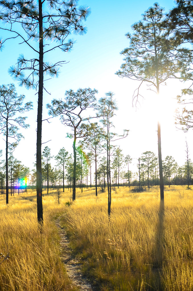
The Longleaf Forest

Hightower Springs. Holmes Creek. Washington County FL

Gulf Coast Lupine

Gulf Coast Lupine

Gulf Coast Lupine
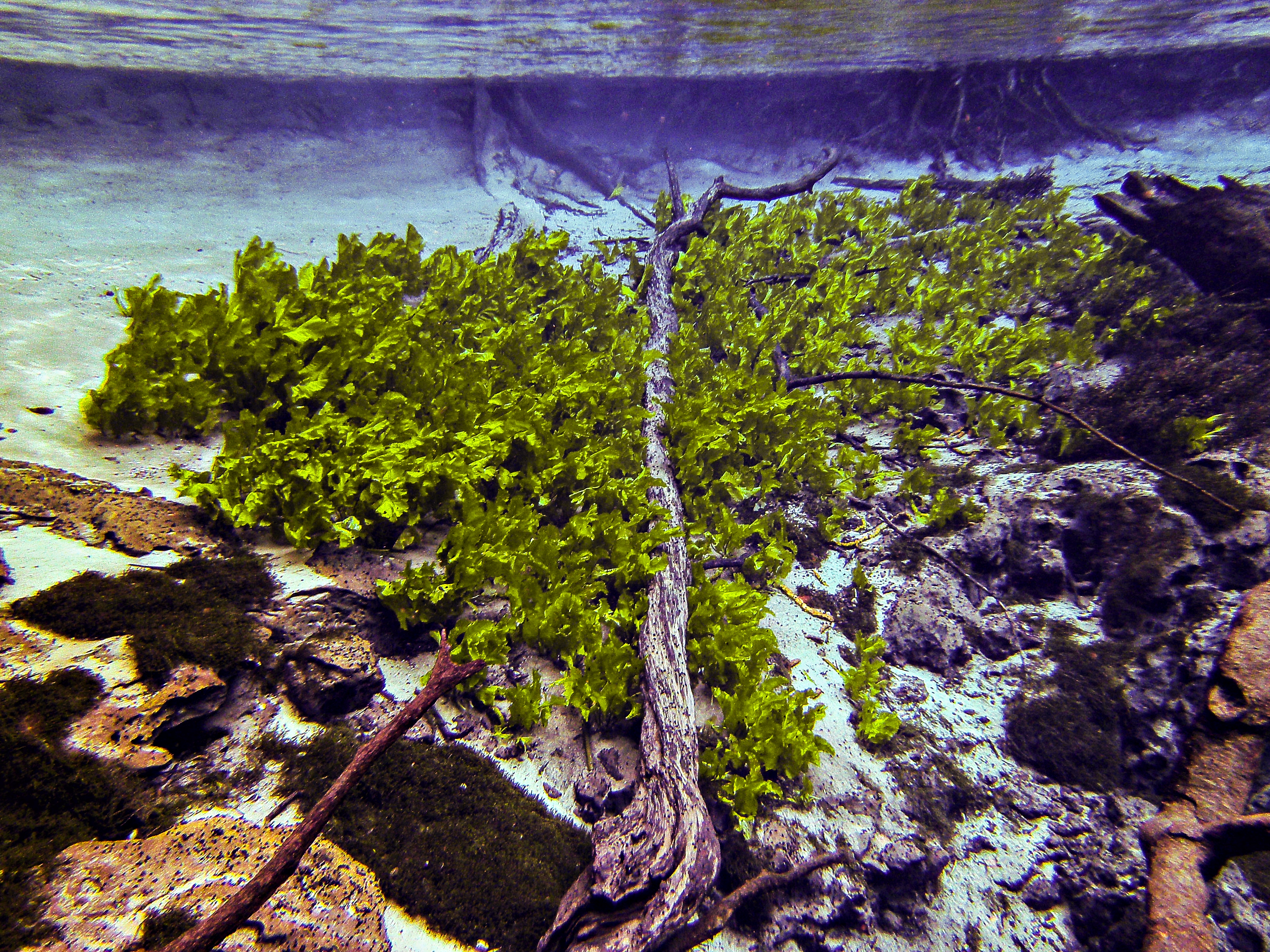
Twisted Trunk: Cypress Spring Head Basin

Leon, FAR0630

Gulf Coast Lupine

Gulf Coast Lupine

Gulf Coast Lupine

Gulf Coast Lupine

Gulf Coast Lupine

Gulf Coast Lupine

Gulf Coast Lupine

Gulf Coast Lupine

*Yawns*

Don't You Hear the Wolves Howling? I do.

A Starry Sky...

*Sticks Tongue Out at You*
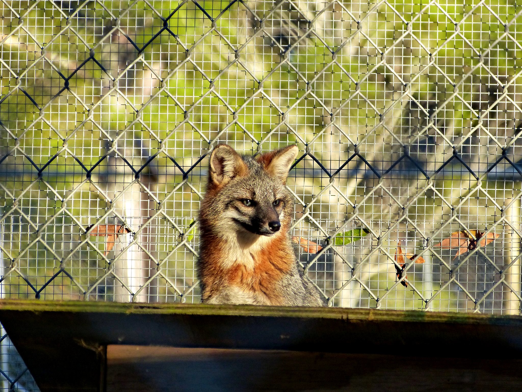
I See...

I'm cute!

*Yawns*
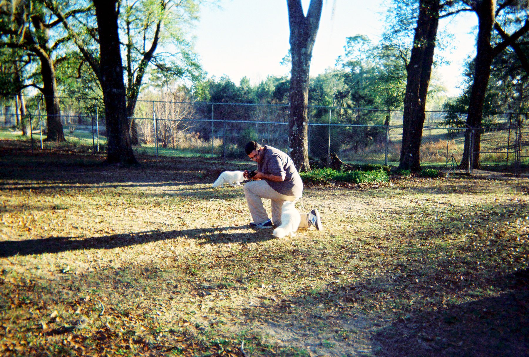
R1-04299-008A
Washington County, Florida, USA Karte
Suchen Sie einen anderen Ort
Orte in Washington County, Florida, USA
Nahe Plätze
Lucas Lake Road, Lucas Lake Rd, Florida, USA
Payne Lake Rd, Chipley, FL, USA
Hernandez Ln, Chipley, FL, USA
Windbrook St, Chipley, FL, USA
Pine Logging Rd, Chipley, FL, USA
Voltaire Dr, Chipley, FL, USA
Holmes Valley Rd, Vernon, FL, USA
Holmes Valley Rd, Vernon, FL, USA
Leisure Lakes Dr, Chipley, FL, USA
Morven St, Sunny Hills, FL, USA
Linwood Dr, Chipley, FL, USA
Sunny Hills Blvd, Chipley, FL, USA
FL-77, Chipley, FL, USA
Eva Pl, Chipley, FL, USA
Woodymarion Dr, Chipley, FL, USA
Columbia Boulevard, Columbia Blvd, Chipley, FL, USA
Deadening Rd, Chipley, FL, USA
Fairbanks Drive, Fairbanks Dr, Chipley, FL, USA
Fairbanks Dr, Chipley, FL, USA
Sunny Hills, FL, USA
Letzte Suche
- 87 Kilmartin Ave, Bristol, CT, USA Sonnenaufgang Sonnenuntergang Zeiten
- 1 Chome-8 Inohana, Chuo Ward, Chiba, -, Japan Sonnenaufgang Sonnenuntergang Zeiten
- 1-chōme-8-1 Inohana, Chuo Ward, Chiba, -, Japan Sonnenaufgang Sonnenuntergang Zeiten
- Hercules Dr, Colorado Springs, CO, USA Sonnenaufgang Sonnenuntergang Zeiten
- Chiharadaihigashi, Ichihara, Chiba -, Japan Sonnenaufgang Sonnenuntergang Zeiten
- West Sugar Creek, Charlotte, NC, USA Sonnenaufgang Sonnenuntergang Zeiten
- Contulmo, Bío Bío, Chile Sonnenaufgang Sonnenuntergang Zeiten
- Contulmo, Bío-Bío, Chile Sonnenaufgang Sonnenuntergang Zeiten
- Steadfast Ct, Daphne, AL, USA Sonnenaufgang Sonnenuntergang Zeiten
- Horton in Ribblesdale, Settle BD24 0HB, Vereinigtes Königreich Sonnenaufgang Sonnenuntergang Zeiten