Germer Basin, Idaho, USA Sonnenaufgang Sonnenuntergang Zeiten
Location: USA > Idaho > Custer County > Challis >
Zeitzone:
America/Denver
Ortszeit:
2024-04-19 02:05:07
Länge:
-114.2370042
Breite:
44.374366
Sonnenaufgang Heute:
06:44:31 AM
Sonnenuntergang Heute:
08:27:12 PM
Tageslänge heute:
13h 42m 41s
Sonnenaufgang morgen:
06:42:52 AM
Sonnenuntergang Morgen:
08:28:26 PM
Tageslänge von morgen:
13h 45m 34s
Alle Termine anzeigen
| Datum | Sonnenaufgang | Sonnenuntergang | Tageslänge |
|---|---|---|---|
| 2024-01-01 | 08:12:53 AM | 05:08:42 PM | 8h 55m 49s |
| 2024-01-02 | 08:12:53 AM | 05:09:38 PM | 8h 56m 45s |
| 2024-01-03 | 08:12:51 AM | 05:10:35 PM | 8h 57m 44s |
| 2024-01-04 | 08:12:46 AM | 05:11:34 PM | 8h 58m 48s |
| 2024-01-05 | 08:12:38 AM | 05:12:35 PM | 8h 59m 57s |
| 2024-01-06 | 08:12:28 AM | 05:13:38 PM | 9h 1m 10s |
| 2024-01-07 | 08:12:15 AM | 05:14:42 PM | 9h 2m 27s |
| 2024-01-08 | 08:12:00 AM | 05:15:47 PM | 9h 3m 47s |
| 2024-01-09 | 08:11:43 AM | 05:16:54 PM | 9h 5m 11s |
| 2024-01-10 | 08:11:22 AM | 05:18:02 PM | 9h 6m 40s |
| 2024-01-11 | 08:11:00 AM | 05:19:12 PM | 9h 8m 12s |
| 2024-01-12 | 08:10:35 AM | 05:20:23 PM | 9h 9m 48s |
| 2024-01-13 | 08:10:07 AM | 05:21:35 PM | 9h 11m 28s |
| 2024-01-14 | 08:09:37 AM | 05:22:48 PM | 9h 13m 11s |
| 2024-01-15 | 08:09:05 AM | 05:24:02 PM | 9h 14m 57s |
| 2024-01-16 | 08:08:30 AM | 05:25:18 PM | 9h 16m 48s |
| 2024-01-17 | 08:07:53 AM | 05:26:34 PM | 9h 18m 41s |
| 2024-01-18 | 08:07:13 AM | 05:27:51 PM | 9h 20m 38s |
| 2024-01-19 | 08:06:31 AM | 05:29:09 PM | 9h 22m 38s |
| 2024-01-20 | 08:05:47 AM | 05:30:28 PM | 9h 24m 41s |
| 2024-01-21 | 08:05:01 AM | 05:31:47 PM | 9h 26m 46s |
| 2024-01-22 | 08:04:13 AM | 05:33:07 PM | 9h 28m 54s |
| 2024-01-23 | 08:03:22 AM | 05:34:28 PM | 9h 31m 6s |
| 2024-01-24 | 08:02:30 AM | 05:35:49 PM | 9h 33m 19s |
| 2024-01-25 | 08:01:35 AM | 05:37:11 PM | 9h 35m 36s |
| 2024-01-26 | 08:00:38 AM | 05:38:33 PM | 9h 37m 55s |
| 2024-01-27 | 07:59:39 AM | 05:39:55 PM | 9h 40m 16s |
| 2024-01-28 | 07:58:39 AM | 05:41:18 PM | 9h 42m 39s |
| 2024-01-29 | 07:57:36 AM | 05:42:41 PM | 9h 45m 5s |
| 2024-01-30 | 07:56:31 AM | 05:44:05 PM | 9h 47m 34s |
| 2024-01-31 | 07:55:25 AM | 05:45:28 PM | 9h 50m 3s |
| 2024-02-01 | 07:54:17 AM | 05:46:52 PM | 9h 52m 35s |
| 2024-02-02 | 07:53:07 AM | 05:48:16 PM | 9h 55m 9s |
| 2024-02-03 | 07:51:55 AM | 05:49:40 PM | 9h 57m 45s |
| 2024-02-04 | 07:50:41 AM | 05:51:04 PM | 10h 0m 23s |
| 2024-02-05 | 07:49:26 AM | 05:52:29 PM | 10h 3m 3s |
| 2024-02-06 | 07:48:10 AM | 05:53:53 PM | 10h 5m 43s |
| 2024-02-07 | 07:46:51 AM | 05:55:17 PM | 10h 8m 26s |
| 2024-02-08 | 07:45:32 AM | 05:56:41 PM | 10h 11m 9s |
| 2024-02-09 | 07:44:10 AM | 05:58:05 PM | 10h 13m 55s |
| 2024-02-10 | 07:42:48 AM | 05:59:29 PM | 10h 16m 41s |
| 2024-02-11 | 07:41:23 AM | 06:00:53 PM | 10h 19m 30s |
| 2024-02-12 | 07:39:58 AM | 06:02:16 PM | 10h 22m 18s |
| 2024-02-13 | 07:38:31 AM | 06:03:40 PM | 10h 25m 9s |
| 2024-02-14 | 07:37:03 AM | 06:05:03 PM | 10h 28m 0s |
| 2024-02-15 | 07:35:34 AM | 06:06:26 PM | 10h 30m 52s |
| 2024-02-16 | 07:34:03 AM | 06:07:49 PM | 10h 33m 46s |
| 2024-02-17 | 07:32:31 AM | 06:09:12 PM | 10h 36m 41s |
| 2024-02-18 | 07:30:58 AM | 06:10:34 PM | 10h 39m 36s |
| 2024-02-19 | 07:29:24 AM | 06:11:57 PM | 10h 42m 33s |
| 2024-02-20 | 07:27:49 AM | 06:13:18 PM | 10h 45m 29s |
| 2024-02-21 | 07:26:13 AM | 06:14:40 PM | 10h 48m 27s |
| 2024-02-22 | 07:24:36 AM | 06:16:01 PM | 10h 51m 25s |
| 2024-02-23 | 07:22:58 AM | 06:17:23 PM | 10h 54m 25s |
| 2024-02-24 | 07:21:19 AM | 06:18:43 PM | 10h 57m 24s |
| 2024-02-25 | 07:19:40 AM | 06:20:04 PM | 11h 0m 24s |
| 2024-02-26 | 07:17:59 AM | 06:21:24 PM | 11h 3m 25s |
| 2024-02-27 | 07:16:18 AM | 06:22:44 PM | 11h 6m 26s |
| 2024-02-28 | 07:14:35 AM | 06:24:04 PM | 11h 9m 29s |
| 2024-02-29 | 07:12:52 AM | 06:25:23 PM | 11h 12m 31s |
| 2024-03-01 | 07:11:09 AM | 06:26:42 PM | 11h 15m 33s |
| 2024-03-02 | 07:09:25 AM | 06:28:01 PM | 11h 18m 36s |
| 2024-03-03 | 07:07:40 AM | 06:29:20 PM | 11h 21m 40s |
| 2024-03-04 | 07:05:54 AM | 06:30:38 PM | 11h 24m 44s |
| 2024-03-05 | 07:04:08 AM | 06:31:56 PM | 11h 27m 48s |
| 2024-03-06 | 07:02:21 AM | 06:33:14 PM | 11h 30m 53s |
| 2024-03-07 | 07:00:34 AM | 06:34:31 PM | 11h 33m 57s |
| 2024-03-08 | 06:58:47 AM | 06:35:49 PM | 11h 37m 2s |
| 2024-03-09 | 06:56:59 AM | 06:37:06 PM | 11h 40m 7s |
| 2024-03-10 | 07:55:15 AM | 07:38:19 PM | 11h 43m 4s |
| 2024-03-11 | 07:53:26 AM | 07:39:36 PM | 11h 46m 10s |
| 2024-03-12 | 07:51:37 AM | 07:40:52 PM | 11h 49m 15s |
| 2024-03-13 | 07:49:48 AM | 07:42:08 PM | 11h 52m 20s |
| 2024-03-14 | 07:47:58 AM | 07:43:24 PM | 11h 55m 26s |
| 2024-03-15 | 07:46:08 AM | 07:44:40 PM | 11h 58m 32s |
| 2024-03-16 | 07:44:18 AM | 07:45:55 PM | 12h 1m 37s |
| 2024-03-17 | 07:42:28 AM | 07:47:11 PM | 12h 4m 43s |
| 2024-03-18 | 07:40:37 AM | 07:48:26 PM | 12h 7m 49s |
| 2024-03-19 | 07:38:47 AM | 07:49:41 PM | 12h 10m 54s |
| 2024-03-20 | 07:36:56 AM | 07:50:56 PM | 12h 14m 0s |
| 2024-03-21 | 07:35:06 AM | 07:52:11 PM | 12h 17m 5s |
| 2024-03-22 | 07:33:15 AM | 07:53:25 PM | 12h 20m 10s |
| 2024-03-23 | 07:31:24 AM | 07:54:40 PM | 12h 23m 16s |
| 2024-03-24 | 07:29:34 AM | 07:55:54 PM | 12h 26m 20s |
| 2024-03-25 | 07:27:43 AM | 07:57:09 PM | 12h 29m 26s |
| 2024-03-26 | 07:25:53 AM | 07:58:23 PM | 12h 32m 30s |
| 2024-03-27 | 07:24:02 AM | 07:59:37 PM | 12h 35m 35s |
| 2024-03-28 | 07:22:12 AM | 08:00:51 PM | 12h 38m 39s |
| 2024-03-29 | 07:20:22 AM | 08:02:05 PM | 12h 41m 43s |
| 2024-03-30 | 07:18:32 AM | 08:03:19 PM | 12h 44m 47s |
| 2024-03-31 | 07:16:43 AM | 08:04:33 PM | 12h 47m 50s |
| 2024-04-01 | 07:14:54 AM | 08:05:47 PM | 12h 50m 53s |
| 2024-04-02 | 07:13:05 AM | 08:07:01 PM | 12h 53m 56s |
| 2024-04-03 | 07:11:16 AM | 08:08:15 PM | 12h 56m 59s |
| 2024-04-04 | 07:09:28 AM | 08:09:29 PM | 13h 0m 1s |
| 2024-04-05 | 07:07:40 AM | 08:10:43 PM | 13h 3m 3s |
| 2024-04-06 | 07:05:53 AM | 08:11:56 PM | 13h 6m 3s |
| 2024-04-07 | 07:04:06 AM | 08:13:10 PM | 13h 9m 4s |
| 2024-04-08 | 07:02:20 AM | 08:14:24 PM | 13h 12m 4s |
| 2024-04-09 | 07:00:34 AM | 08:15:38 PM | 13h 15m 4s |
| 2024-04-10 | 06:58:49 AM | 08:16:52 PM | 13h 18m 3s |
| 2024-04-11 | 06:57:04 AM | 08:18:05 PM | 13h 21m 1s |
| 2024-04-12 | 06:55:20 AM | 08:19:19 PM | 13h 23m 59s |
| 2024-04-13 | 06:53:37 AM | 08:20:33 PM | 13h 26m 56s |
| 2024-04-14 | 06:51:54 AM | 08:21:47 PM | 13h 29m 53s |
| 2024-04-15 | 06:50:13 AM | 08:23:00 PM | 13h 32m 47s |
| 2024-04-16 | 06:48:31 AM | 08:24:14 PM | 13h 35m 43s |
| 2024-04-17 | 06:46:51 AM | 08:25:28 PM | 13h 38m 37s |
| 2024-04-18 | 06:45:12 AM | 08:26:42 PM | 13h 41m 30s |
| 2024-04-19 | 06:43:33 AM | 08:27:55 PM | 13h 44m 22s |
| 2024-04-20 | 06:41:56 AM | 08:29:09 PM | 13h 47m 13s |
| 2024-04-21 | 06:40:19 AM | 08:30:23 PM | 13h 50m 4s |
| 2024-04-22 | 06:38:43 AM | 08:31:36 PM | 13h 52m 53s |
| 2024-04-23 | 06:37:08 AM | 08:32:50 PM | 13h 55m 42s |
| 2024-04-24 | 06:35:35 AM | 08:34:03 PM | 13h 58m 28s |
| 2024-04-25 | 06:34:02 AM | 08:35:17 PM | 14h 1m 15s |
| 2024-04-26 | 06:32:31 AM | 08:36:30 PM | 14h 3m 59s |
| 2024-04-27 | 06:31:00 AM | 08:37:43 PM | 14h 6m 43s |
| 2024-04-28 | 06:29:31 AM | 08:38:56 PM | 14h 9m 25s |
| 2024-04-29 | 06:28:03 AM | 08:40:09 PM | 14h 12m 6s |
| 2024-04-30 | 06:26:36 AM | 08:41:21 PM | 14h 14m 45s |
| 2024-05-01 | 06:25:11 AM | 08:42:34 PM | 14h 17m 23s |
| 2024-05-02 | 06:23:47 AM | 08:43:46 PM | 14h 19m 59s |
| 2024-05-03 | 06:22:24 AM | 08:44:58 PM | 14h 22m 34s |
| 2024-05-04 | 06:21:03 AM | 08:46:09 PM | 14h 25m 6s |
| 2024-05-05 | 06:19:43 AM | 08:47:21 PM | 14h 27m 38s |
| 2024-05-06 | 06:18:25 AM | 08:48:31 PM | 14h 30m 6s |
| 2024-05-07 | 06:17:08 AM | 08:49:42 PM | 14h 32m 34s |
| 2024-05-08 | 06:15:52 AM | 08:50:52 PM | 14h 35m 0s |
| 2024-05-09 | 06:14:38 AM | 08:52:02 PM | 14h 37m 24s |
| 2024-05-10 | 06:13:26 AM | 08:53:11 PM | 14h 39m 45s |
| 2024-05-11 | 06:12:16 AM | 08:54:20 PM | 14h 42m 4s |
| 2024-05-12 | 06:11:07 AM | 08:55:29 PM | 14h 44m 22s |
| 2024-05-13 | 06:10:00 AM | 08:56:36 PM | 14h 46m 36s |
| 2024-05-14 | 06:08:54 AM | 08:57:43 PM | 14h 48m 49s |
| 2024-05-15 | 06:07:51 AM | 08:58:50 PM | 14h 50m 59s |
| 2024-05-16 | 06:06:49 AM | 08:59:56 PM | 14h 53m 7s |
| 2024-05-17 | 06:05:49 AM | 09:01:01 PM | 14h 55m 12s |
| 2024-05-18 | 06:04:51 AM | 09:02:05 PM | 14h 57m 14s |
| 2024-05-19 | 06:03:55 AM | 09:03:08 PM | 14h 59m 13s |
| 2024-05-20 | 06:03:00 AM | 09:04:11 PM | 15h 1m 11s |
| 2024-05-21 | 06:02:08 AM | 09:05:12 PM | 15h 3m 4s |
| 2024-05-22 | 06:01:18 AM | 09:06:13 PM | 15h 4m 55s |
| 2024-05-23 | 06:00:29 AM | 09:07:13 PM | 15h 6m 44s |
| 2024-05-24 | 05:59:43 AM | 09:08:11 PM | 15h 8m 28s |
| 2024-05-25 | 05:58:59 AM | 09:09:09 PM | 15h 10m 10s |
| 2024-05-26 | 05:58:17 AM | 09:10:05 PM | 15h 11m 48s |
| 2024-05-27 | 05:57:37 AM | 09:11:00 PM | 15h 13m 23s |
| 2024-05-28 | 05:56:59 AM | 09:11:54 PM | 15h 14m 55s |
| 2024-05-29 | 05:56:24 AM | 09:12:46 PM | 15h 16m 22s |
| 2024-05-30 | 05:55:50 AM | 09:13:38 PM | 15h 17m 48s |
| 2024-05-31 | 05:55:19 AM | 09:14:27 PM | 15h 19m 8s |
| 2024-06-01 | 05:54:50 AM | 09:15:16 PM | 15h 20m 26s |
| 2024-06-02 | 05:54:23 AM | 09:16:03 PM | 15h 21m 40s |
| 2024-06-03 | 05:53:59 AM | 09:16:48 PM | 15h 22m 49s |
| 2024-06-04 | 05:53:37 AM | 09:17:32 PM | 15h 23m 55s |
| 2024-06-05 | 05:53:17 AM | 09:18:14 PM | 15h 24m 57s |
| 2024-06-06 | 05:52:59 AM | 09:18:54 PM | 15h 25m 55s |
| 2024-06-07 | 05:52:43 AM | 09:19:33 PM | 15h 26m 50s |
| 2024-06-08 | 05:52:30 AM | 09:20:10 PM | 15h 27m 40s |
| 2024-06-09 | 05:52:19 AM | 09:20:45 PM | 15h 28m 26s |
| 2024-06-10 | 05:52:10 AM | 09:21:18 PM | 15h 29m 8s |
| 2024-06-11 | 05:52:04 AM | 09:21:49 PM | 15h 29m 45s |
| 2024-06-12 | 05:52:00 AM | 09:22:18 PM | 15h 30m 18s |
| 2024-06-13 | 05:51:58 AM | 09:22:46 PM | 15h 30m 48s |
| 2024-06-14 | 05:51:58 AM | 09:23:11 PM | 15h 31m 13s |
| 2024-06-15 | 05:52:01 AM | 09:23:34 PM | 15h 31m 33s |
| 2024-06-16 | 05:52:06 AM | 09:23:56 PM | 15h 31m 50s |
| 2024-06-17 | 05:52:13 AM | 09:24:15 PM | 15h 32m 2s |
| 2024-06-18 | 05:52:22 AM | 09:24:32 PM | 15h 32m 10s |
| 2024-06-19 | 05:52:33 AM | 09:24:46 PM | 15h 32m 13s |
| 2024-06-20 | 05:52:47 AM | 09:24:59 PM | 15h 32m 12s |
| 2024-06-21 | 05:53:03 AM | 09:25:09 PM | 15h 32m 6s |
| 2024-06-22 | 05:53:20 AM | 09:25:18 PM | 15h 31m 58s |
| 2024-06-23 | 05:53:40 AM | 09:25:24 PM | 15h 31m 44s |
| 2024-06-24 | 05:54:02 AM | 09:25:27 PM | 15h 31m 25s |
| 2024-06-25 | 05:54:26 AM | 09:25:29 PM | 15h 31m 3s |
| 2024-06-26 | 05:54:51 AM | 09:25:28 PM | 15h 30m 37s |
| 2024-06-27 | 05:55:19 AM | 09:25:24 PM | 15h 30m 5s |
| 2024-06-28 | 05:55:49 AM | 09:25:19 PM | 15h 29m 30s |
| 2024-06-29 | 05:56:20 AM | 09:25:11 PM | 15h 28m 51s |
| 2024-06-30 | 05:56:53 AM | 09:25:01 PM | 15h 28m 8s |
| 2024-07-01 | 05:57:28 AM | 09:24:48 PM | 15h 27m 20s |
| 2024-07-02 | 05:58:05 AM | 09:24:33 PM | 15h 26m 28s |
| 2024-07-03 | 05:58:43 AM | 09:24:16 PM | 15h 25m 33s |
| 2024-07-04 | 05:59:23 AM | 09:23:57 PM | 15h 24m 34s |
| 2024-07-05 | 06:00:05 AM | 09:23:35 PM | 15h 23m 30s |
| 2024-07-06 | 06:00:48 AM | 09:23:11 PM | 15h 22m 23s |
| 2024-07-07 | 06:01:33 AM | 09:22:45 PM | 15h 21m 12s |
| 2024-07-08 | 06:02:19 AM | 09:22:16 PM | 15h 19m 57s |
| 2024-07-09 | 06:03:06 AM | 09:21:45 PM | 15h 18m 39s |
| 2024-07-10 | 06:03:55 AM | 09:21:12 PM | 15h 17m 17s |
| 2024-07-11 | 06:04:45 AM | 09:20:37 PM | 15h 15m 52s |
| 2024-07-12 | 06:05:37 AM | 09:19:59 PM | 15h 14m 22s |
| 2024-07-13 | 06:06:29 AM | 09:19:20 PM | 15h 12m 51s |
| 2024-07-14 | 06:07:23 AM | 09:18:38 PM | 15h 11m 15s |
| 2024-07-15 | 06:08:18 AM | 09:17:54 PM | 15h 9m 36s |
| 2024-07-16 | 06:09:14 AM | 09:17:08 PM | 15h 7m 54s |
| 2024-07-17 | 06:10:11 AM | 09:16:20 PM | 15h 6m 9s |
| 2024-07-18 | 06:11:09 AM | 09:15:29 PM | 15h 4m 20s |
| 2024-07-19 | 06:12:07 AM | 09:14:37 PM | 15h 2m 30s |
| 2024-07-20 | 06:13:07 AM | 09:13:43 PM | 15h 0m 36s |
| 2024-07-21 | 06:14:08 AM | 09:12:47 PM | 14h 58m 39s |
| 2024-07-22 | 06:15:09 AM | 09:11:49 PM | 14h 56m 40s |
| 2024-07-23 | 06:16:11 AM | 09:10:48 PM | 14h 54m 37s |
| 2024-07-24 | 06:17:14 AM | 09:09:46 PM | 14h 52m 32s |
| 2024-07-25 | 06:18:17 AM | 09:08:43 PM | 14h 50m 26s |
| 2024-07-26 | 06:19:21 AM | 09:07:37 PM | 14h 48m 16s |
| 2024-07-27 | 06:20:25 AM | 09:06:30 PM | 14h 46m 5s |
| 2024-07-28 | 06:21:30 AM | 09:05:21 PM | 14h 43m 51s |
| 2024-07-29 | 06:22:36 AM | 09:04:10 PM | 14h 41m 34s |
| 2024-07-30 | 06:23:42 AM | 09:02:57 PM | 14h 39m 15s |
| 2024-07-31 | 06:24:48 AM | 09:01:43 PM | 14h 36m 55s |
| 2024-08-01 | 06:25:55 AM | 09:00:27 PM | 14h 34m 32s |
| 2024-08-02 | 06:27:02 AM | 08:59:10 PM | 14h 32m 8s |
| 2024-08-03 | 06:28:10 AM | 08:57:51 PM | 14h 29m 41s |
| 2024-08-04 | 06:29:18 AM | 08:56:31 PM | 14h 27m 13s |
| 2024-08-05 | 06:30:26 AM | 08:55:09 PM | 14h 24m 43s |
| 2024-08-06 | 06:31:34 AM | 08:53:46 PM | 14h 22m 12s |
| 2024-08-07 | 06:32:42 AM | 08:52:21 PM | 14h 19m 39s |
| 2024-08-08 | 06:33:51 AM | 08:50:55 PM | 14h 17m 4s |
| 2024-08-09 | 06:35:00 AM | 08:49:28 PM | 14h 14m 28s |
| 2024-08-10 | 06:36:09 AM | 08:47:59 PM | 14h 11m 50s |
| 2024-08-11 | 06:37:18 AM | 08:46:30 PM | 14h 9m 12s |
| 2024-08-12 | 06:38:27 AM | 08:44:59 PM | 14h 6m 32s |
| 2024-08-13 | 06:39:37 AM | 08:43:26 PM | 14h 3m 49s |
| 2024-08-14 | 06:40:46 AM | 08:41:53 PM | 14h 1m 7s |
| 2024-08-15 | 06:41:55 AM | 08:40:19 PM | 13h 58m 24s |
| 2024-08-16 | 06:43:05 AM | 08:38:43 PM | 13h 55m 38s |
| 2024-08-17 | 06:44:15 AM | 08:37:06 PM | 13h 52m 51s |
| 2024-08-18 | 06:45:24 AM | 08:35:29 PM | 13h 50m 5s |
| 2024-08-19 | 06:46:34 AM | 08:33:50 PM | 13h 47m 16s |
| 2024-08-20 | 06:47:43 AM | 08:32:11 PM | 13h 44m 28s |
| 2024-08-21 | 06:48:53 AM | 08:30:31 PM | 13h 41m 38s |
| 2024-08-22 | 06:50:02 AM | 08:28:49 PM | 13h 38m 47s |
| 2024-08-23 | 06:51:12 AM | 08:27:07 PM | 13h 35m 55s |
| 2024-08-24 | 06:52:21 AM | 08:25:24 PM | 13h 33m 3s |
| 2024-08-25 | 06:53:31 AM | 08:23:41 PM | 13h 30m 10s |
| 2024-08-26 | 06:54:40 AM | 08:21:56 PM | 13h 27m 16s |
| 2024-08-27 | 06:55:50 AM | 08:20:11 PM | 13h 24m 21s |
| 2024-08-28 | 06:56:59 AM | 08:18:26 PM | 13h 21m 27s |
| 2024-08-29 | 06:58:09 AM | 08:16:39 PM | 13h 18m 30s |
| 2024-08-30 | 06:59:18 AM | 08:14:52 PM | 13h 15m 34s |
| 2024-08-31 | 07:00:27 AM | 08:13:05 PM | 13h 12m 38s |
| 2024-09-01 | 07:01:37 AM | 08:11:17 PM | 13h 9m 40s |
| 2024-09-02 | 07:02:46 AM | 08:09:28 PM | 13h 6m 42s |
| 2024-09-03 | 07:03:55 AM | 08:07:39 PM | 13h 3m 44s |
| 2024-09-04 | 07:05:04 AM | 08:05:49 PM | 13h 0m 45s |
| 2024-09-05 | 07:06:14 AM | 08:03:59 PM | 12h 57m 45s |
| 2024-09-06 | 07:07:23 AM | 08:02:09 PM | 12h 54m 46s |
| 2024-09-07 | 07:08:32 AM | 08:00:18 PM | 12h 51m 46s |
| 2024-09-08 | 07:09:41 AM | 07:58:27 PM | 12h 48m 46s |
| 2024-09-09 | 07:10:51 AM | 07:56:36 PM | 12h 45m 45s |
| 2024-09-10 | 07:12:00 AM | 07:54:44 PM | 12h 42m 44s |
| 2024-09-11 | 07:13:09 AM | 07:52:53 PM | 12h 39m 44s |
| 2024-09-12 | 07:14:19 AM | 07:51:01 PM | 12h 36m 42s |
| 2024-09-13 | 07:15:28 AM | 07:49:08 PM | 12h 33m 40s |
| 2024-09-14 | 07:16:37 AM | 07:47:16 PM | 12h 30m 39s |
| 2024-09-15 | 07:17:47 AM | 07:45:24 PM | 12h 27m 37s |
| 2024-09-16 | 07:18:57 AM | 07:43:31 PM | 12h 24m 34s |
| 2024-09-17 | 07:20:06 AM | 07:41:38 PM | 12h 21m 32s |
| 2024-09-18 | 07:21:16 AM | 07:39:46 PM | 12h 18m 30s |
| 2024-09-19 | 07:22:26 AM | 07:37:53 PM | 12h 15m 27s |
| 2024-09-20 | 07:23:36 AM | 07:36:01 PM | 12h 12m 25s |
| 2024-09-21 | 07:24:47 AM | 07:34:08 PM | 12h 9m 21s |
| 2024-09-22 | 07:25:57 AM | 07:32:16 PM | 12h 6m 19s |
| 2024-09-23 | 07:27:07 AM | 07:30:23 PM | 12h 3m 16s |
| 2024-09-24 | 07:28:18 AM | 07:28:31 PM | 12h 0m 13s |
| 2024-09-25 | 07:29:29 AM | 07:26:39 PM | 11h 57m 10s |
| 2024-09-26 | 07:30:40 AM | 07:24:48 PM | 11h 54m 8s |
| 2024-09-27 | 07:31:51 AM | 07:22:56 PM | 11h 51m 5s |
| 2024-09-28 | 07:33:03 AM | 07:21:05 PM | 11h 48m 2s |
| 2024-09-29 | 07:34:14 AM | 07:19:14 PM | 11h 45m 0s |
| 2024-09-30 | 07:35:26 AM | 07:17:23 PM | 11h 41m 57s |
| 2024-10-01 | 07:36:38 AM | 07:15:33 PM | 11h 38m 55s |
| 2024-10-02 | 07:37:51 AM | 07:13:43 PM | 11h 35m 52s |
| 2024-10-03 | 07:39:03 AM | 07:11:54 PM | 11h 32m 51s |
| 2024-10-04 | 07:40:16 AM | 07:10:05 PM | 11h 29m 49s |
| 2024-10-05 | 07:41:29 AM | 07:08:17 PM | 11h 26m 48s |
| 2024-10-06 | 07:42:43 AM | 07:06:29 PM | 11h 23m 46s |
| 2024-10-07 | 07:43:57 AM | 07:04:42 PM | 11h 20m 45s |
| 2024-10-08 | 07:45:11 AM | 07:02:55 PM | 11h 17m 44s |
| 2024-10-09 | 07:46:25 AM | 07:01:09 PM | 11h 14m 44s |
| 2024-10-10 | 07:47:40 AM | 06:59:24 PM | 11h 11m 44s |
| 2024-10-11 | 07:48:55 AM | 06:57:39 PM | 11h 8m 44s |
| 2024-10-12 | 07:50:10 AM | 06:55:55 PM | 11h 5m 45s |
| 2024-10-13 | 07:51:25 AM | 06:54:12 PM | 11h 2m 47s |
| 2024-10-14 | 07:52:41 AM | 06:52:30 PM | 10h 59m 49s |
| 2024-10-15 | 07:53:57 AM | 06:50:48 PM | 10h 56m 51s |
| 2024-10-16 | 07:55:14 AM | 06:49:07 PM | 10h 53m 53s |
| 2024-10-17 | 07:56:31 AM | 06:47:28 PM | 10h 50m 57s |
| 2024-10-18 | 07:57:48 AM | 06:45:49 PM | 10h 48m 1s |
| 2024-10-19 | 07:59:05 AM | 06:44:11 PM | 10h 45m 6s |
| 2024-10-20 | 08:00:23 AM | 06:42:34 PM | 10h 42m 11s |
| 2024-10-21 | 08:01:41 AM | 06:40:58 PM | 10h 39m 17s |
| 2024-10-22 | 08:02:59 AM | 06:39:24 PM | 10h 36m 25s |
| 2024-10-23 | 08:04:17 AM | 06:37:50 PM | 10h 33m 33s |
| 2024-10-24 | 08:05:36 AM | 06:36:18 PM | 10h 30m 42s |
| 2024-10-25 | 08:06:55 AM | 06:34:47 PM | 10h 27m 52s |
| 2024-10-26 | 08:08:15 AM | 06:33:17 PM | 10h 25m 2s |
| 2024-10-27 | 08:09:34 AM | 06:31:48 PM | 10h 22m 14s |
| 2024-10-28 | 08:10:54 AM | 06:30:21 PM | 10h 19m 27s |
| 2024-10-29 | 08:12:14 AM | 06:28:55 PM | 10h 16m 41s |
| 2024-10-30 | 08:13:34 AM | 06:27:30 PM | 10h 13m 56s |
| 2024-10-31 | 08:14:54 AM | 06:26:07 PM | 10h 11m 13s |
| 2024-11-01 | 08:16:14 AM | 06:24:45 PM | 10h 8m 31s |
| 2024-11-02 | 08:17:35 AM | 06:23:25 PM | 10h 5m 50s |
| 2024-11-03 | 07:18:59 AM | 05:22:03 PM | 10h 3m 4s |
| 2024-11-04 | 07:20:19 AM | 05:20:47 PM | 10h 0m 28s |
| 2024-11-05 | 07:21:40 AM | 05:19:31 PM | 9h 57m 51s |
| 2024-11-06 | 07:23:01 AM | 05:18:18 PM | 9h 55m 17s |
| 2024-11-07 | 07:24:21 AM | 05:17:06 PM | 9h 52m 45s |
| 2024-11-08 | 07:25:42 AM | 05:15:56 PM | 9h 50m 14s |
| 2024-11-09 | 07:27:02 AM | 05:14:47 PM | 9h 47m 45s |
| 2024-11-10 | 07:28:23 AM | 05:13:41 PM | 9h 45m 18s |
| 2024-11-11 | 07:29:43 AM | 05:12:36 PM | 9h 42m 53s |
| 2024-11-12 | 07:31:02 AM | 05:11:34 PM | 9h 40m 32s |
| 2024-11-13 | 07:32:22 AM | 05:10:33 PM | 9h 38m 11s |
| 2024-11-14 | 07:33:41 AM | 05:09:34 PM | 9h 35m 53s |
| 2024-11-15 | 07:35:00 AM | 05:08:38 PM | 9h 33m 38s |
| 2024-11-16 | 07:36:19 AM | 05:07:43 PM | 9h 31m 24s |
| 2024-11-17 | 07:37:37 AM | 05:06:51 PM | 9h 29m 14s |
| 2024-11-18 | 07:38:54 AM | 05:06:01 PM | 9h 27m 7s |
| 2024-11-19 | 07:40:11 AM | 05:05:13 PM | 9h 25m 2s |
| 2024-11-20 | 07:41:28 AM | 05:04:27 PM | 9h 22m 59s |
| 2024-11-21 | 07:42:43 AM | 05:03:43 PM | 9h 21m 0s |
| 2024-11-22 | 07:43:58 AM | 05:03:02 PM | 9h 19m 4s |
| 2024-11-23 | 07:45:13 AM | 05:02:23 PM | 9h 17m 10s |
| 2024-11-24 | 07:46:26 AM | 05:01:46 PM | 9h 15m 20s |
| 2024-11-25 | 07:47:38 AM | 05:01:12 PM | 9h 13m 34s |
| 2024-11-26 | 07:48:50 AM | 05:00:40 PM | 9h 11m 50s |
| 2024-11-27 | 07:50:00 AM | 05:00:11 PM | 9h 10m 11s |
| 2024-11-28 | 07:51:10 AM | 04:59:44 PM | 9h 8m 34s |
| 2024-11-29 | 07:52:18 AM | 04:59:19 PM | 9h 7m 1s |
| 2024-11-30 | 07:53:25 AM | 04:58:57 PM | 9h 5m 32s |
| 2024-12-01 | 07:54:31 AM | 04:58:38 PM | 9h 4m 7s |
| 2024-12-02 | 07:55:35 AM | 04:58:21 PM | 9h 2m 46s |
| 2024-12-03 | 07:56:38 AM | 04:58:07 PM | 9h 1m 29s |
| 2024-12-04 | 07:57:40 AM | 04:57:55 PM | 9h 0m 15s |
| 2024-12-05 | 07:58:40 AM | 04:57:46 PM | 8h 59m 6s |
| 2024-12-06 | 07:59:38 AM | 04:57:39 PM | 8h 58m 1s |
| 2024-12-07 | 08:00:35 AM | 04:57:36 PM | 8h 57m 1s |
| 2024-12-08 | 08:01:30 AM | 04:57:34 PM | 8h 56m 4s |
| 2024-12-09 | 08:02:23 AM | 04:57:35 PM | 8h 55m 12s |
| 2024-12-10 | 08:03:15 AM | 04:57:39 PM | 8h 54m 24s |
| 2024-12-11 | 08:04:04 AM | 04:57:46 PM | 8h 53m 42s |
| 2024-12-12 | 08:04:52 AM | 04:57:55 PM | 8h 53m 3s |
| 2024-12-13 | 08:05:38 AM | 04:58:07 PM | 8h 52m 29s |
| 2024-12-14 | 08:06:21 AM | 04:58:21 PM | 8h 52m 0s |
| 2024-12-15 | 08:07:03 AM | 04:58:38 PM | 8h 51m 35s |
| 2024-12-16 | 08:07:42 AM | 04:58:57 PM | 8h 51m 15s |
| 2024-12-17 | 08:08:20 AM | 04:59:19 PM | 8h 50m 59s |
| 2024-12-18 | 08:08:55 AM | 04:59:43 PM | 8h 50m 48s |
| 2024-12-19 | 08:09:27 AM | 05:00:10 PM | 8h 50m 43s |
| 2024-12-20 | 08:09:58 AM | 05:00:39 PM | 8h 50m 41s |
| 2024-12-21 | 08:10:26 AM | 05:01:10 PM | 8h 50m 44s |
| 2024-12-22 | 08:10:52 AM | 05:01:44 PM | 8h 50m 52s |
| 2024-12-23 | 08:11:15 AM | 05:02:21 PM | 8h 51m 6s |
| 2024-12-24 | 08:11:36 AM | 05:02:59 PM | 8h 51m 23s |
| 2024-12-25 | 08:11:54 AM | 05:03:40 PM | 8h 51m 46s |
| 2024-12-26 | 08:12:10 AM | 05:04:23 PM | 8h 52m 13s |
| 2024-12-27 | 08:12:24 AM | 05:05:08 PM | 8h 52m 44s |
| 2024-12-28 | 08:12:35 AM | 05:05:55 PM | 8h 53m 20s |
| 2024-12-29 | 08:12:43 AM | 05:06:45 PM | 8h 54m 2s |
| 2024-12-30 | 08:12:49 AM | 05:07:36 PM | 8h 54m 47s |
Fotos

Photo

Along the base of the Pahsimeroi mountains.

Hwy 75 heading West from Challis Id

Lone Pine Peak from Challis, Idaho. Telephoto

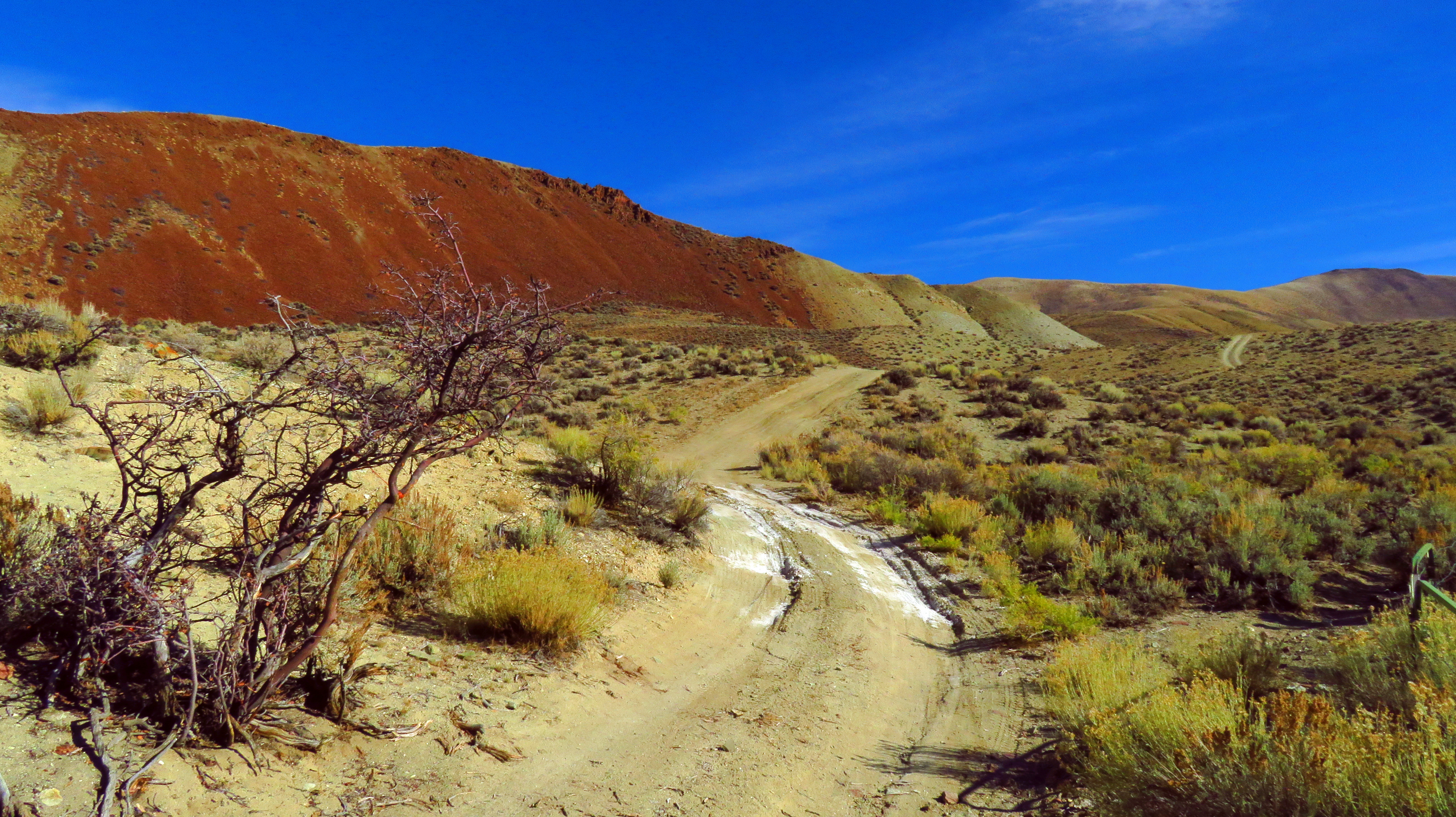
Arid hills in Malm Gulch near the Salmon River

Salmon River Scenic Byway (Idaho State Highway 75) from Stanley to Challis

Above Garden Creek in the Salmon River Mountains west of Challis, Idaho

West, across Round Valley toward the Twin Peaks in the Salmon River Mountains

Lone Pine Peak (distance). Photo taken near Challis, Idaho.

The Pahsimeroi Mountains from a flat near Challis, Idaho

In the East Fork Salmon river valley, Idaho

Boulders in the lower part of the East Fork Salmon River canyon

Down the lower part of the East Fork Salmon River canyon

East Fork of the Salmon River beneath the cliffs

Telephoto. Toward the confluence area of the East Fork and the Main Fork Salmon River
Sometimes, the Road is the Destination 4

Some Gulch Along Highway 75 in Idaho 1

DOS19-99
CW6D3271.jpg

CW6D3265.jpg

Departing Challis

Good morning Challis!
Germer Basin, Idaho, USA Karte
Suchen Sie einen anderen Ort
Nahe Plätze
Custer County, Idaho, USA
Upper Hot Springs Road, Upper Hot Springs Rd, Challis, ID, USA
Apex Ln, Challis, ID, USA
Challis, ID, USA
Main St, Challis, ID, USA
Rod and Gun Club Loop, Challis, ID, USA
Clayton, ID, USA
Holman Creek Campground, Clayton, ID, USA
Custer Road, Custer Rd, Idaho, USA
Ellis, ID, USA
Torreys, ID, USA
May, ID, USA
Twin Bridges Creek Rd, Mackay, ID, USA
Copper Basin Camp, Trail Creek Rd, Mackay, ID, USA
Wild Horse Creek Ranch, Wild Horse Creek Rd, Mackay, ID, USA
Snake River, USA
Quail Rd, Salmon, ID, USA
Iron Creek Rd, Salmon, ID, USA
Idaho, USA
Wood River Campground, Forest Rd, Ketchum, ID, USA
Letzte Suche
- Horton in Ribblesdale, Settle BD24 0HB, Vereinigtes Königreich Sonnenaufgang Sonnenuntergang Zeiten
- Rojo Ct, Atascadero, CA, USA Sonnenaufgang Sonnenuntergang Zeiten
- Lumagwas Diversified Farmers Multi-Purpose Cooperative, Lumagwas, Adtuyon, RV32+MH7, Pangantucan, Bu Sonnenaufgang Sonnenuntergang Zeiten
- 12 Hutchinson Woods Dr, Fletcher, NC, USA Sonnenaufgang Sonnenuntergang Zeiten
- Santa Maria del Mar, Peru Sonnenaufgang Sonnenuntergang Zeiten
- Holloway Ave, San Francisco, CA, USA Sonnenaufgang Sonnenuntergang Zeiten
- 1-chōme-1-5 Asahi, Utsunomiya, Tochigi -, Japan Sonnenaufgang Sonnenuntergang Zeiten
- Bist Hazari, Afghanistan Sonnenaufgang Sonnenuntergang Zeiten
- 82- D Rd, Captain Cook, HI, USA Sonnenaufgang Sonnenuntergang Zeiten
- Harlow CM20 2PR, Vereinigtes Königreich Sonnenaufgang Sonnenuntergang Zeiten