Sunrise Sunset Times of Cahill Ln, Weiser, ID, USA
Location: United States > Idaho > Washington County > Weiser >
Timezone:
America/Denver
Current Time:
2024-04-18 17:03:20
Longitude:
-116.8905474
Latitude:
44.1670116
Sunrise Today:
06:55:28 AM
Sunset Today:
08:37:28 PM
Daylength Today:
13h 42m 0s
Sunrise Tomorrow:
06:53:51 AM
Sunset Tomorrow:
08:38:41 PM
Daylength Tomorrow:
13h 44m 50s
Year Show All Dates
| Date | Sunrise | Sunset | Daylength |
|---|---|---|---|
| 01/01/2024 | 08:22:46 AM | 05:20:03 PM | 8h 57m 17s |
| 01/02/2024 | 08:22:47 AM | 05:20:58 PM | 8h 58m 11s |
| 01/03/2024 | 08:22:45 AM | 05:21:55 PM | 8h 59m 10s |
| 01/04/2024 | 08:22:40 AM | 05:22:54 PM | 9h 0m 14s |
| 01/05/2024 | 08:22:33 AM | 05:23:55 PM | 9h 1m 22s |
| 01/06/2024 | 08:22:23 AM | 05:24:57 PM | 9h 2m 34s |
| 01/07/2024 | 08:22:10 AM | 05:26:01 PM | 9h 3m 51s |
| 01/08/2024 | 08:21:56 AM | 05:27:06 PM | 9h 5m 10s |
| 01/09/2024 | 08:21:38 AM | 05:28:12 PM | 9h 6m 34s |
| 01/10/2024 | 08:21:18 AM | 05:29:20 PM | 9h 8m 2s |
| 01/11/2024 | 08:20:56 AM | 05:30:30 PM | 9h 9m 34s |
| 01/12/2024 | 08:20:31 AM | 05:31:40 PM | 9h 11m 9s |
| 01/13/2024 | 08:20:04 AM | 05:32:52 PM | 9h 12m 48s |
| 01/14/2024 | 08:19:35 AM | 05:34:04 PM | 9h 14m 29s |
| 01/15/2024 | 08:19:03 AM | 05:35:18 PM | 9h 16m 15s |
| 01/16/2024 | 08:18:28 AM | 05:36:33 PM | 9h 18m 5s |
| 01/17/2024 | 08:17:52 AM | 05:37:49 PM | 9h 19m 57s |
| 01/18/2024 | 08:17:13 AM | 05:39:06 PM | 9h 21m 53s |
| 01/19/2024 | 08:16:31 AM | 05:40:23 PM | 9h 23m 52s |
| 01/20/2024 | 08:15:48 AM | 05:41:41 PM | 9h 25m 53s |
| 01/21/2024 | 08:15:02 AM | 05:43:00 PM | 9h 27m 58s |
| 01/22/2024 | 08:14:14 AM | 05:44:20 PM | 9h 30m 6s |
| 01/23/2024 | 08:13:24 AM | 05:45:40 PM | 9h 32m 16s |
| 01/24/2024 | 08:12:32 AM | 05:47:00 PM | 9h 34m 28s |
| 01/25/2024 | 08:11:38 AM | 05:48:22 PM | 9h 36m 44s |
| 01/26/2024 | 08:10:42 AM | 05:49:43 PM | 9h 39m 1s |
| 01/27/2024 | 08:09:43 AM | 05:51:05 PM | 9h 41m 22s |
| 01/28/2024 | 08:08:43 AM | 05:52:27 PM | 9h 43m 44s |
| 01/29/2024 | 08:07:41 AM | 05:53:50 PM | 9h 46m 9s |
| 01/30/2024 | 08:06:37 AM | 05:55:13 PM | 9h 48m 36s |
| 01/31/2024 | 08:05:31 AM | 05:56:36 PM | 9h 51m 5s |
| 02/01/2024 | 08:04:24 AM | 05:57:59 PM | 9h 53m 35s |
| 02/02/2024 | 08:03:14 AM | 05:59:23 PM | 9h 56m 9s |
| 02/03/2024 | 08:02:03 AM | 06:00:46 PM | 9h 58m 43s |
| 02/04/2024 | 08:00:50 AM | 06:02:10 PM | 10h 1m 20s |
| 02/05/2024 | 07:59:36 AM | 06:03:33 PM | 10h 3m 57s |
| 02/06/2024 | 07:58:20 AM | 06:04:57 PM | 10h 6m 37s |
| 02/07/2024 | 07:57:02 AM | 06:06:20 PM | 10h 9m 18s |
| 02/08/2024 | 07:55:43 AM | 06:07:44 PM | 10h 12m 1s |
| 02/09/2024 | 07:54:22 AM | 06:09:07 PM | 10h 14m 45s |
| 02/10/2024 | 07:53:00 AM | 06:10:30 PM | 10h 17m 30s |
| 02/11/2024 | 07:51:36 AM | 06:11:53 PM | 10h 20m 17s |
| 02/12/2024 | 07:50:12 AM | 06:13:16 PM | 10h 23m 4s |
| 02/13/2024 | 07:48:45 AM | 06:14:39 PM | 10h 25m 54s |
| 02/14/2024 | 07:47:18 AM | 06:16:02 PM | 10h 28m 44s |
| 02/15/2024 | 07:45:49 AM | 06:17:24 PM | 10h 31m 35s |
| 02/16/2024 | 07:44:19 AM | 06:18:47 PM | 10h 34m 28s |
| 02/17/2024 | 07:42:48 AM | 06:20:09 PM | 10h 37m 21s |
| 02/18/2024 | 07:41:16 AM | 06:21:30 PM | 10h 40m 14s |
| 02/19/2024 | 07:39:43 AM | 06:22:52 PM | 10h 43m 9s |
| 02/20/2024 | 07:38:08 AM | 06:24:13 PM | 10h 46m 5s |
| 02/21/2024 | 07:36:33 AM | 06:25:34 PM | 10h 49m 1s |
| 02/22/2024 | 07:34:56 AM | 06:26:55 PM | 10h 51m 59s |
| 02/23/2024 | 07:33:19 AM | 06:28:15 PM | 10h 54m 56s |
| 02/24/2024 | 07:31:41 AM | 06:29:36 PM | 10h 57m 55s |
| 02/25/2024 | 07:30:02 AM | 06:30:55 PM | 11h 0m 53s |
| 02/26/2024 | 07:28:22 AM | 06:32:15 PM | 11h 3m 53s |
| 02/27/2024 | 07:26:41 AM | 06:33:34 PM | 11h 6m 53s |
| 02/28/2024 | 07:24:59 AM | 06:34:53 PM | 11h 9m 54s |
| 02/29/2024 | 07:23:17 AM | 06:36:12 PM | 11h 12m 55s |
| 03/01/2024 | 07:21:34 AM | 06:37:31 PM | 11h 15m 57s |
| 03/02/2024 | 07:19:51 AM | 06:38:49 PM | 11h 18m 58s |
| 03/03/2024 | 07:18:06 AM | 06:40:07 PM | 11h 22m 1s |
| 03/04/2024 | 07:16:21 AM | 06:41:24 PM | 11h 25m 3s |
| 03/05/2024 | 07:14:36 AM | 06:42:42 PM | 11h 28m 6s |
| 03/06/2024 | 07:12:50 AM | 06:43:59 PM | 11h 31m 9s |
| 03/07/2024 | 07:11:04 AM | 06:45:16 PM | 11h 34m 12s |
| 03/08/2024 | 07:09:17 AM | 06:46:32 PM | 11h 37m 15s |
| 03/09/2024 | 07:07:29 AM | 06:47:48 PM | 11h 40m 19s |
| 03/10/2024 | 08:05:46 AM | 07:49:01 PM | 11h 43m 15s |
| 03/11/2024 | 08:03:58 AM | 07:50:17 PM | 11h 46m 19s |
| 03/12/2024 | 08:02:10 AM | 07:51:33 PM | 11h 49m 23s |
| 03/13/2024 | 08:00:21 AM | 07:52:48 PM | 11h 52m 27s |
| 03/14/2024 | 07:58:32 AM | 07:54:04 PM | 11h 55m 32s |
| 03/15/2024 | 07:56:43 AM | 07:55:19 PM | 11h 58m 36s |
| 03/16/2024 | 07:54:53 AM | 07:56:34 PM | 12h 1m 41s |
| 03/17/2024 | 07:53:04 AM | 07:57:48 PM | 12h 4m 44s |
| 03/18/2024 | 07:51:14 AM | 07:59:03 PM | 12h 7m 49s |
| 03/19/2024 | 07:49:24 AM | 08:00:17 PM | 12h 10m 53s |
| 03/20/2024 | 07:47:34 AM | 08:01:31 PM | 12h 13m 57s |
| 03/21/2024 | 07:45:44 AM | 08:02:46 PM | 12h 17m 2s |
| 03/22/2024 | 07:43:54 AM | 08:04:00 PM | 12h 20m 6s |
| 03/23/2024 | 07:42:04 AM | 08:05:13 PM | 12h 23m 9s |
| 03/24/2024 | 07:40:14 AM | 08:06:27 PM | 12h 26m 13s |
| 03/25/2024 | 07:38:24 AM | 08:07:41 PM | 12h 29m 17s |
| 03/26/2024 | 07:36:35 AM | 08:08:54 PM | 12h 32m 19s |
| 03/27/2024 | 07:34:45 AM | 08:10:08 PM | 12h 35m 23s |
| 03/28/2024 | 07:32:55 AM | 08:11:21 PM | 12h 38m 26s |
| 03/29/2024 | 07:31:06 AM | 08:12:35 PM | 12h 41m 29s |
| 03/30/2024 | 07:29:17 AM | 08:13:48 PM | 12h 44m 31s |
| 03/31/2024 | 07:27:28 AM | 08:15:01 PM | 12h 47m 33s |
| 04/01/2024 | 07:25:40 AM | 08:16:15 PM | 12h 50m 35s |
| 04/02/2024 | 07:23:51 AM | 08:17:28 PM | 12h 53m 37s |
| 04/03/2024 | 07:22:04 AM | 08:18:41 PM | 12h 56m 37s |
| 04/04/2024 | 07:20:16 AM | 08:19:54 PM | 12h 59m 38s |
| 04/05/2024 | 07:18:29 AM | 08:21:07 PM | 13h 2m 38s |
| 04/06/2024 | 07:16:42 AM | 08:22:20 PM | 13h 5m 38s |
| 04/07/2024 | 07:14:56 AM | 08:23:34 PM | 13h 8m 38s |
| 04/08/2024 | 07:13:11 AM | 08:24:47 PM | 13h 11m 36s |
| 04/09/2024 | 07:11:25 AM | 08:26:00 PM | 13h 14m 35s |
| 04/10/2024 | 07:09:41 AM | 08:27:13 PM | 13h 17m 32s |
| 04/11/2024 | 07:07:57 AM | 08:28:26 PM | 13h 20m 29s |
| 04/12/2024 | 07:06:14 AM | 08:29:39 PM | 13h 23m 25s |
| 04/13/2024 | 07:04:31 AM | 08:30:52 PM | 13h 26m 21s |
| 04/14/2024 | 07:02:49 AM | 08:32:05 PM | 13h 29m 16s |
| 04/15/2024 | 07:01:08 AM | 08:33:19 PM | 13h 32m 11s |
| 04/16/2024 | 06:59:28 AM | 08:34:32 PM | 13h 35m 4s |
| 04/17/2024 | 06:57:48 AM | 08:35:45 PM | 13h 37m 57s |
| 04/18/2024 | 06:56:09 AM | 08:36:58 PM | 13h 40m 49s |
| 04/19/2024 | 06:54:31 AM | 08:38:11 PM | 13h 43m 40s |
| 04/20/2024 | 06:52:54 AM | 08:39:24 PM | 13h 46m 30s |
| 04/21/2024 | 06:51:18 AM | 08:40:37 PM | 13h 49m 19s |
| 04/22/2024 | 06:49:43 AM | 08:41:50 PM | 13h 52m 7s |
| 04/23/2024 | 06:48:09 AM | 08:43:03 PM | 13h 54m 54s |
| 04/24/2024 | 06:46:36 AM | 08:44:15 PM | 13h 57m 39s |
| 04/25/2024 | 06:45:04 AM | 08:45:28 PM | 14h 0m 24s |
| 04/26/2024 | 06:43:33 AM | 08:46:41 PM | 14h 3m 8s |
| 04/27/2024 | 06:42:03 AM | 08:47:53 PM | 14h 5m 50s |
| 04/28/2024 | 06:40:35 AM | 08:49:05 PM | 14h 8m 30s |
| 04/29/2024 | 06:39:08 AM | 08:50:18 PM | 14h 11m 10s |
| 04/30/2024 | 06:37:41 AM | 08:51:30 PM | 14h 13m 49s |
| 05/01/2024 | 06:36:17 AM | 08:52:41 PM | 14h 16m 24s |
| 05/02/2024 | 06:34:53 AM | 08:53:53 PM | 14h 19m 0s |
| 05/03/2024 | 06:33:31 AM | 08:55:04 PM | 14h 21m 33s |
| 05/04/2024 | 06:32:10 AM | 08:56:15 PM | 14h 24m 5s |
| 05/05/2024 | 06:30:51 AM | 08:57:26 PM | 14h 26m 35s |
| 05/06/2024 | 06:29:33 AM | 08:58:36 PM | 14h 29m 3s |
| 05/07/2024 | 06:28:17 AM | 08:59:46 PM | 14h 31m 29s |
| 05/08/2024 | 06:27:02 AM | 09:00:56 PM | 14h 33m 54s |
| 05/09/2024 | 06:25:49 AM | 09:02:05 PM | 14h 36m 16s |
| 05/10/2024 | 06:24:37 AM | 09:03:14 PM | 14h 38m 37s |
| 05/11/2024 | 06:23:27 AM | 09:04:22 PM | 14h 40m 55s |
| 05/12/2024 | 06:22:19 AM | 09:05:30 PM | 14h 43m 11s |
| 05/13/2024 | 06:21:13 AM | 09:06:37 PM | 14h 45m 24s |
| 05/14/2024 | 06:20:08 AM | 09:07:44 PM | 14h 47m 36s |
| 05/15/2024 | 06:19:05 AM | 09:08:49 PM | 14h 49m 44s |
| 05/16/2024 | 06:18:03 AM | 09:09:55 PM | 14h 51m 52s |
| 05/17/2024 | 06:17:04 AM | 09:10:59 PM | 14h 53m 55s |
| 05/18/2024 | 06:16:06 AM | 09:12:03 PM | 14h 55m 57s |
| 05/19/2024 | 06:15:11 AM | 09:13:06 PM | 14h 57m 55s |
| 05/20/2024 | 06:14:17 AM | 09:14:08 PM | 14h 59m 51s |
| 05/21/2024 | 06:13:25 AM | 09:15:09 PM | 15h 1m 44s |
| 05/22/2024 | 06:12:35 AM | 09:16:09 PM | 15h 3m 34s |
| 05/23/2024 | 06:11:48 AM | 09:17:08 PM | 15h 5m 20s |
| 05/24/2024 | 06:11:02 AM | 09:18:06 PM | 15h 7m 4s |
| 05/25/2024 | 06:10:18 AM | 09:19:03 PM | 15h 8m 45s |
| 05/26/2024 | 06:09:37 AM | 09:19:59 PM | 15h 10m 22s |
| 05/27/2024 | 06:08:57 AM | 09:20:54 PM | 15h 11m 57s |
| 05/28/2024 | 06:08:20 AM | 09:21:47 PM | 15h 13m 27s |
| 05/29/2024 | 06:07:44 AM | 09:22:40 PM | 15h 14m 56s |
| 05/30/2024 | 06:07:11 AM | 09:23:30 PM | 15h 16m 19s |
| 05/31/2024 | 06:06:41 AM | 09:24:20 PM | 15h 17m 39s |
| 06/01/2024 | 06:06:12 AM | 09:25:08 PM | 15h 18m 56s |
| 06/02/2024 | 06:05:45 AM | 09:25:54 PM | 15h 20m 9s |
| 06/03/2024 | 06:05:21 AM | 09:26:39 PM | 15h 21m 18s |
| 06/04/2024 | 06:04:59 AM | 09:27:23 PM | 15h 22m 24s |
| 06/05/2024 | 06:04:40 AM | 09:28:05 PM | 15h 23m 25s |
| 06/06/2024 | 06:04:22 AM | 09:28:45 PM | 15h 24m 23s |
| 06/07/2024 | 06:04:07 AM | 09:29:23 PM | 15h 25m 16s |
| 06/08/2024 | 06:03:54 AM | 09:30:00 PM | 15h 26m 6s |
| 06/09/2024 | 06:03:43 AM | 09:30:35 PM | 15h 26m 52s |
| 06/10/2024 | 06:03:35 AM | 09:31:07 PM | 15h 27m 32s |
| 06/11/2024 | 06:03:28 AM | 09:31:39 PM | 15h 28m 11s |
| 06/12/2024 | 06:03:24 AM | 09:32:08 PM | 15h 28m 44s |
| 06/13/2024 | 06:03:23 AM | 09:32:35 PM | 15h 29m 12s |
| 06/14/2024 | 06:03:23 AM | 09:33:00 PM | 15h 29m 37s |
| 06/15/2024 | 06:03:26 AM | 09:33:23 PM | 15h 29m 57s |
| 06/16/2024 | 06:03:31 AM | 09:33:45 PM | 15h 30m 14s |
| 06/17/2024 | 06:03:38 AM | 09:34:04 PM | 15h 30m 26s |
| 06/18/2024 | 06:03:47 AM | 09:34:20 PM | 15h 30m 33s |
| 06/19/2024 | 06:03:59 AM | 09:34:35 PM | 15h 30m 36s |
| 06/20/2024 | 06:04:12 AM | 09:34:48 PM | 15h 30m 36s |
| 06/21/2024 | 06:04:28 AM | 09:34:58 PM | 15h 30m 30s |
| 06/22/2024 | 06:04:45 AM | 09:35:06 PM | 15h 30m 21s |
| 06/23/2024 | 06:05:05 AM | 09:35:12 PM | 15h 30m 7s |
| 06/24/2024 | 06:05:27 AM | 09:35:16 PM | 15h 29m 49s |
| 06/25/2024 | 06:05:51 AM | 09:35:17 PM | 15h 29m 26s |
| 06/26/2024 | 06:06:16 AM | 09:35:17 PM | 15h 29m 1s |
| 06/27/2024 | 06:06:44 AM | 09:35:14 PM | 15h 28m 30s |
| 06/28/2024 | 06:07:13 AM | 09:35:08 PM | 15h 27m 55s |
| 06/29/2024 | 06:07:44 AM | 09:35:00 PM | 15h 27m 16s |
| 06/30/2024 | 06:08:18 AM | 09:34:50 PM | 15h 26m 32s |
| 07/01/2024 | 06:08:52 AM | 09:34:38 PM | 15h 25m 46s |
| 07/02/2024 | 06:09:29 AM | 09:34:23 PM | 15h 24m 54s |
| 07/03/2024 | 06:10:07 AM | 09:34:07 PM | 15h 24m 0s |
| 07/04/2024 | 06:10:47 AM | 09:33:47 PM | 15h 23m 0s |
| 07/05/2024 | 06:11:28 AM | 09:33:26 PM | 15h 21m 58s |
| 07/06/2024 | 06:12:11 AM | 09:33:02 PM | 15h 20m 51s |
| 07/07/2024 | 06:12:55 AM | 09:32:36 PM | 15h 19m 41s |
| 07/08/2024 | 06:13:41 AM | 09:32:08 PM | 15h 18m 27s |
| 07/09/2024 | 06:14:28 AM | 09:31:37 PM | 15h 17m 9s |
| 07/10/2024 | 06:15:17 AM | 09:31:05 PM | 15h 15m 48s |
| 07/11/2024 | 06:16:07 AM | 09:30:30 PM | 15h 14m 23s |
| 07/12/2024 | 06:16:58 AM | 09:29:52 PM | 15h 12m 54s |
| 07/13/2024 | 06:17:50 AM | 09:29:13 PM | 15h 11m 23s |
| 07/14/2024 | 06:18:43 AM | 09:28:32 PM | 15h 9m 49s |
| 07/15/2024 | 06:19:38 AM | 09:27:48 PM | 15h 8m 10s |
| 07/16/2024 | 06:20:33 AM | 09:27:02 PM | 15h 6m 29s |
| 07/17/2024 | 06:21:30 AM | 09:26:15 PM | 15h 4m 45s |
| 07/18/2024 | 06:22:27 AM | 09:25:25 PM | 15h 2m 58s |
| 07/19/2024 | 06:23:25 AM | 09:24:33 PM | 15h 1m 8s |
| 07/20/2024 | 06:24:24 AM | 09:23:39 PM | 14h 59m 15s |
| 07/21/2024 | 06:25:24 AM | 09:22:44 PM | 14h 57m 20s |
| 07/22/2024 | 06:26:25 AM | 09:21:46 PM | 14h 55m 21s |
| 07/23/2024 | 06:27:27 AM | 09:20:46 PM | 14h 53m 19s |
| 07/24/2024 | 06:28:29 AM | 09:19:45 PM | 14h 51m 16s |
| 07/25/2024 | 06:29:32 AM | 09:18:42 PM | 14h 49m 10s |
| 07/26/2024 | 06:30:35 AM | 09:17:37 PM | 14h 47m 2s |
| 07/27/2024 | 06:31:39 AM | 09:16:30 PM | 14h 44m 51s |
| 07/28/2024 | 06:32:44 AM | 09:15:21 PM | 14h 42m 37s |
| 07/29/2024 | 06:33:49 AM | 09:14:11 PM | 14h 40m 22s |
| 07/30/2024 | 06:34:54 AM | 09:12:59 PM | 14h 38m 5s |
| 07/31/2024 | 06:36:00 AM | 09:11:45 PM | 14h 35m 45s |
| 08/01/2024 | 06:37:06 AM | 09:10:30 PM | 14h 33m 24s |
| 08/02/2024 | 06:38:13 AM | 09:09:13 PM | 14h 31m 0s |
| 08/03/2024 | 06:39:20 AM | 09:07:55 PM | 14h 28m 35s |
| 08/04/2024 | 06:40:27 AM | 09:06:35 PM | 14h 26m 8s |
| 08/05/2024 | 06:41:34 AM | 09:05:14 PM | 14h 23m 40s |
| 08/06/2024 | 06:42:42 AM | 09:03:51 PM | 14h 21m 9s |
| 08/07/2024 | 06:43:50 AM | 09:02:27 PM | 14h 18m 37s |
| 08/08/2024 | 06:44:58 AM | 09:01:02 PM | 14h 16m 4s |
| 08/09/2024 | 06:46:06 AM | 08:59:35 PM | 14h 13m 29s |
| 08/10/2024 | 06:47:14 AM | 08:58:07 PM | 14h 10m 53s |
| 08/11/2024 | 06:48:23 AM | 08:56:38 PM | 14h 8m 15s |
| 08/12/2024 | 06:49:32 AM | 08:55:08 PM | 14h 5m 36s |
| 08/13/2024 | 06:50:40 AM | 08:53:36 PM | 14h 2m 56s |
| 08/14/2024 | 06:51:49 AM | 08:52:03 PM | 14h 0m 14s |
| 08/15/2024 | 06:52:58 AM | 08:50:30 PM | 13h 57m 32s |
| 08/16/2024 | 06:54:07 AM | 08:48:55 PM | 13h 54m 48s |
| 08/17/2024 | 06:55:16 AM | 08:47:19 PM | 13h 52m 3s |
| 08/18/2024 | 06:56:25 AM | 08:45:42 PM | 13h 49m 17s |
| 08/19/2024 | 06:57:34 AM | 08:44:04 PM | 13h 46m 30s |
| 08/20/2024 | 06:58:42 AM | 08:42:25 PM | 13h 43m 43s |
| 08/21/2024 | 06:59:51 AM | 08:40:45 PM | 13h 40m 54s |
| 08/22/2024 | 07:01:00 AM | 08:39:05 PM | 13h 38m 5s |
| 08/23/2024 | 07:02:09 AM | 08:37:23 PM | 13h 35m 14s |
| 08/24/2024 | 07:03:18 AM | 08:35:41 PM | 13h 32m 23s |
| 08/25/2024 | 07:04:27 AM | 08:33:58 PM | 13h 29m 31s |
| 08/26/2024 | 07:05:36 AM | 08:32:14 PM | 13h 26m 38s |
| 08/27/2024 | 07:06:45 AM | 08:30:30 PM | 13h 23m 45s |
| 08/28/2024 | 07:07:53 AM | 08:28:45 PM | 13h 20m 52s |
| 08/29/2024 | 07:09:02 AM | 08:26:59 PM | 13h 17m 57s |
| 08/30/2024 | 07:10:11 AM | 08:25:13 PM | 13h 15m 2s |
| 08/31/2024 | 07:11:19 AM | 08:23:26 PM | 13h 12m 7s |
| 09/01/2024 | 07:12:28 AM | 08:21:38 PM | 13h 9m 10s |
| 09/02/2024 | 07:13:37 AM | 08:19:51 PM | 13h 6m 14s |
| 09/03/2024 | 07:14:45 AM | 08:18:02 PM | 13h 3m 17s |
| 09/04/2024 | 07:15:54 AM | 08:16:13 PM | 13h 0m 19s |
| 09/05/2024 | 07:17:02 AM | 08:14:24 PM | 12h 57m 22s |
| 09/06/2024 | 07:18:11 AM | 08:12:34 PM | 12h 54m 23s |
| 09/07/2024 | 07:19:20 AM | 08:10:44 PM | 12h 51m 24s |
| 09/08/2024 | 07:20:28 AM | 08:08:54 PM | 12h 48m 26s |
| 09/09/2024 | 07:21:37 AM | 08:07:03 PM | 12h 45m 26s |
| 09/10/2024 | 07:22:45 AM | 08:05:12 PM | 12h 42m 27s |
| 09/11/2024 | 07:23:54 AM | 08:03:21 PM | 12h 39m 27s |
| 09/12/2024 | 07:25:03 AM | 08:01:30 PM | 12h 36m 27s |
| 09/13/2024 | 07:26:12 AM | 07:59:38 PM | 12h 33m 26s |
| 09/14/2024 | 07:27:20 AM | 07:57:46 PM | 12h 30m 26s |
| 09/15/2024 | 07:28:29 AM | 07:55:55 PM | 12h 27m 26s |
| 09/16/2024 | 07:29:38 AM | 07:54:03 PM | 12h 24m 25s |
| 09/17/2024 | 07:30:47 AM | 07:52:11 PM | 12h 21m 24s |
| 09/18/2024 | 07:31:57 AM | 07:50:19 PM | 12h 18m 22s |
| 09/19/2024 | 07:33:06 AM | 07:48:27 PM | 12h 15m 21s |
| 09/20/2024 | 07:34:15 AM | 07:46:35 PM | 12h 12m 20s |
| 09/21/2024 | 07:35:25 AM | 07:44:43 PM | 12h 9m 18s |
| 09/22/2024 | 07:36:35 AM | 07:42:51 PM | 12h 6m 16s |
| 09/23/2024 | 07:37:44 AM | 07:41:00 PM | 12h 3m 16s |
| 09/24/2024 | 07:38:54 AM | 07:39:08 PM | 12h 0m 14s |
| 09/25/2024 | 07:40:05 AM | 07:37:17 PM | 11h 57m 12s |
| 09/26/2024 | 07:41:15 AM | 07:35:26 PM | 11h 54m 11s |
| 09/27/2024 | 07:42:26 AM | 07:33:35 PM | 11h 51m 9s |
| 09/28/2024 | 07:43:36 AM | 07:31:45 PM | 11h 48m 9s |
| 09/29/2024 | 07:44:47 AM | 07:29:54 PM | 11h 45m 7s |
| 09/30/2024 | 07:45:59 AM | 07:28:04 PM | 11h 42m 5s |
| 10/01/2024 | 07:47:10 AM | 07:26:15 PM | 11h 39m 5s |
| 10/02/2024 | 07:48:22 AM | 07:24:26 PM | 11h 36m 4s |
| 10/03/2024 | 07:49:34 AM | 07:22:37 PM | 11h 33m 3s |
| 10/04/2024 | 07:50:46 AM | 07:20:49 PM | 11h 30m 3s |
| 10/05/2024 | 07:51:59 AM | 07:19:01 PM | 11h 27m 2s |
| 10/06/2024 | 07:53:11 AM | 07:17:14 PM | 11h 24m 3s |
| 10/07/2024 | 07:54:24 AM | 07:15:27 PM | 11h 21m 3s |
| 10/08/2024 | 07:55:38 AM | 07:13:41 PM | 11h 18m 3s |
| 10/09/2024 | 07:56:51 AM | 07:11:56 PM | 11h 15m 5s |
| 10/10/2024 | 07:58:05 AM | 07:10:11 PM | 11h 12m 6s |
| 10/11/2024 | 07:59:20 AM | 07:08:27 PM | 11h 9m 7s |
| 10/12/2024 | 08:00:34 AM | 07:06:44 PM | 11h 6m 10s |
| 10/13/2024 | 08:01:49 AM | 07:05:02 PM | 11h 3m 13s |
| 10/14/2024 | 08:03:04 AM | 07:03:20 PM | 11h 0m 16s |
| 10/15/2024 | 08:04:20 AM | 07:01:39 PM | 10h 57m 19s |
| 10/16/2024 | 08:05:36 AM | 06:59:59 PM | 10h 54m 23s |
| 10/17/2024 | 08:06:52 AM | 06:58:20 PM | 10h 51m 28s |
| 10/18/2024 | 08:08:08 AM | 06:56:42 PM | 10h 48m 34s |
| 10/19/2024 | 08:09:25 AM | 06:55:05 PM | 10h 45m 40s |
| 10/20/2024 | 08:10:42 AM | 06:53:28 PM | 10h 42m 46s |
| 10/21/2024 | 08:11:59 AM | 06:51:53 PM | 10h 39m 54s |
| 10/22/2024 | 08:13:17 AM | 06:50:19 PM | 10h 37m 2s |
| 10/23/2024 | 08:14:35 AM | 06:48:46 PM | 10h 34m 11s |
| 10/24/2024 | 08:15:53 AM | 06:47:15 PM | 10h 31m 22s |
| 10/25/2024 | 08:17:11 AM | 06:45:44 PM | 10h 28m 33s |
| 10/26/2024 | 08:18:30 AM | 06:44:15 PM | 10h 25m 45s |
| 10/27/2024 | 08:19:49 AM | 06:42:47 PM | 10h 22m 58s |
| 10/28/2024 | 08:21:08 AM | 06:41:20 PM | 10h 20m 12s |
| 10/29/2024 | 08:22:27 AM | 06:39:55 PM | 10h 17m 28s |
| 10/30/2024 | 08:23:47 AM | 06:38:31 PM | 10h 14m 44s |
| 10/31/2024 | 08:25:06 AM | 06:37:08 PM | 10h 12m 2s |
| 11/01/2024 | 08:26:26 AM | 06:35:47 PM | 10h 9m 21s |
| 11/02/2024 | 08:27:46 AM | 06:34:28 PM | 10h 6m 42s |
| 11/03/2024 | 07:29:09 AM | 05:33:07 PM | 10h 3m 58s |
| 11/04/2024 | 07:30:29 AM | 05:31:50 PM | 10h 1m 21s |
| 11/05/2024 | 07:31:49 AM | 05:30:36 PM | 9h 58m 47s |
| 11/06/2024 | 07:33:09 AM | 05:29:23 PM | 9h 56m 14s |
| 11/07/2024 | 07:34:29 AM | 05:28:12 PM | 9h 53m 43s |
| 11/08/2024 | 07:35:49 AM | 05:27:02 PM | 9h 51m 13s |
| 11/09/2024 | 07:37:09 AM | 05:25:54 PM | 9h 48m 45s |
| 11/10/2024 | 07:38:29 AM | 05:24:49 PM | 9h 46m 20s |
| 11/11/2024 | 07:39:48 AM | 05:23:45 PM | 9h 43m 57s |
| 11/12/2024 | 07:41:08 AM | 05:22:43 PM | 9h 41m 35s |
| 11/13/2024 | 07:42:27 AM | 05:21:42 PM | 9h 39m 15s |
| 11/14/2024 | 07:43:45 AM | 05:20:44 PM | 9h 36m 59s |
| 11/15/2024 | 07:45:04 AM | 05:19:48 PM | 9h 34m 44s |
| 11/16/2024 | 07:46:22 AM | 05:18:54 PM | 9h 32m 32s |
| 11/17/2024 | 07:47:39 AM | 05:18:02 PM | 9h 30m 23s |
| 11/18/2024 | 07:48:56 AM | 05:17:13 PM | 9h 28m 17s |
| 11/19/2024 | 07:50:13 AM | 05:16:25 PM | 9h 26m 12s |
| 11/20/2024 | 07:51:29 AM | 05:15:40 PM | 9h 24m 11s |
| 11/21/2024 | 07:52:44 AM | 05:14:57 PM | 9h 22m 13s |
| 11/22/2024 | 07:53:58 AM | 05:14:16 PM | 9h 20m 18s |
| 11/23/2024 | 07:55:12 AM | 05:13:37 PM | 9h 18m 25s |
| 11/24/2024 | 07:56:25 AM | 05:13:01 PM | 9h 16m 36s |
| 11/25/2024 | 07:57:37 AM | 05:12:27 PM | 9h 14m 50s |
| 11/26/2024 | 07:58:48 AM | 05:11:56 PM | 9h 13m 8s |
| 11/27/2024 | 07:59:58 AM | 05:11:27 PM | 9h 11m 29s |
| 11/28/2024 | 08:01:07 AM | 05:11:01 PM | 9h 9m 54s |
| 11/29/2024 | 08:02:15 AM | 05:10:37 PM | 9h 8m 22s |
| 11/30/2024 | 08:03:21 AM | 05:10:15 PM | 9h 6m 54s |
| 12/01/2024 | 08:04:27 AM | 05:09:56 PM | 9h 5m 29s |
| 12/02/2024 | 08:05:31 AM | 05:09:39 PM | 9h 4m 8s |
| 12/03/2024 | 08:06:33 AM | 05:09:26 PM | 9h 2m 53s |
| 12/04/2024 | 08:07:35 AM | 05:09:14 PM | 9h 1m 39s |
| 12/05/2024 | 08:08:34 AM | 05:09:05 PM | 9h 0m 31s |
| 12/06/2024 | 08:09:33 AM | 05:08:59 PM | 8h 59m 26s |
| 12/07/2024 | 08:10:29 AM | 05:08:55 PM | 8h 58m 26s |
| 12/08/2024 | 08:11:24 AM | 05:08:54 PM | 8h 57m 30s |
| 12/09/2024 | 08:12:17 AM | 05:08:56 PM | 8h 56m 39s |
| 12/10/2024 | 08:13:08 AM | 05:09:00 PM | 8h 55m 52s |
| 12/11/2024 | 08:13:58 AM | 05:09:07 PM | 8h 55m 9s |
| 12/12/2024 | 08:14:45 AM | 05:09:16 PM | 8h 54m 31s |
| 12/13/2024 | 08:15:31 AM | 05:09:28 PM | 8h 53m 57s |
| 12/14/2024 | 08:16:14 AM | 05:09:42 PM | 8h 53m 28s |
| 12/15/2024 | 08:16:56 AM | 05:09:59 PM | 8h 53m 3s |
| 12/16/2024 | 08:17:35 AM | 05:10:18 PM | 8h 52m 43s |
| 12/17/2024 | 08:18:12 AM | 05:10:40 PM | 8h 52m 28s |
| 12/18/2024 | 08:18:47 AM | 05:11:05 PM | 8h 52m 18s |
| 12/19/2024 | 08:19:20 AM | 05:11:31 PM | 8h 52m 11s |
| 12/20/2024 | 08:19:50 AM | 05:12:01 PM | 8h 52m 11s |
| 12/21/2024 | 08:20:18 AM | 05:12:32 PM | 8h 52m 14s |
| 12/22/2024 | 08:20:44 AM | 05:13:06 PM | 8h 52m 22s |
| 12/23/2024 | 08:21:07 AM | 05:13:42 PM | 8h 52m 35s |
| 12/24/2024 | 08:21:28 AM | 05:14:21 PM | 8h 52m 53s |
| 12/25/2024 | 08:21:47 AM | 05:15:01 PM | 8h 53m 14s |
| 12/26/2024 | 08:22:03 AM | 05:15:44 PM | 8h 53m 41s |
| 12/27/2024 | 08:22:16 AM | 05:16:29 PM | 8h 54m 13s |
| 12/28/2024 | 08:22:28 AM | 05:17:16 PM | 8h 54m 48s |
| 12/29/2024 | 08:22:36 AM | 05:18:06 PM | 8h 55m 30s |
| 12/30/2024 | 08:22:42 AM | 05:18:57 PM | 8h 56m 15s |
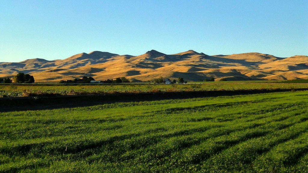
Sunrise & Sunset Photos
Indianhead Rd, Weiser, ID #3

DSC_2341 (1)

#roadtripping home to Utah and after a couple of stops for the kids, ended up catching the #sunset from the perfect #viewpoint #pnw #oregon #exploreoregon

DSC_2604 (1)

Indianhead Rd, Weiser, ID #1

Indianhead Rd, Weiser, ID #2

DSC_2381 (2)

DSC_2381 (7)

DSC_2381 (8)

DSC_2381 (5)

DSC_2381 (4)

DSC_2381 (1)

DSC_2604 (2)
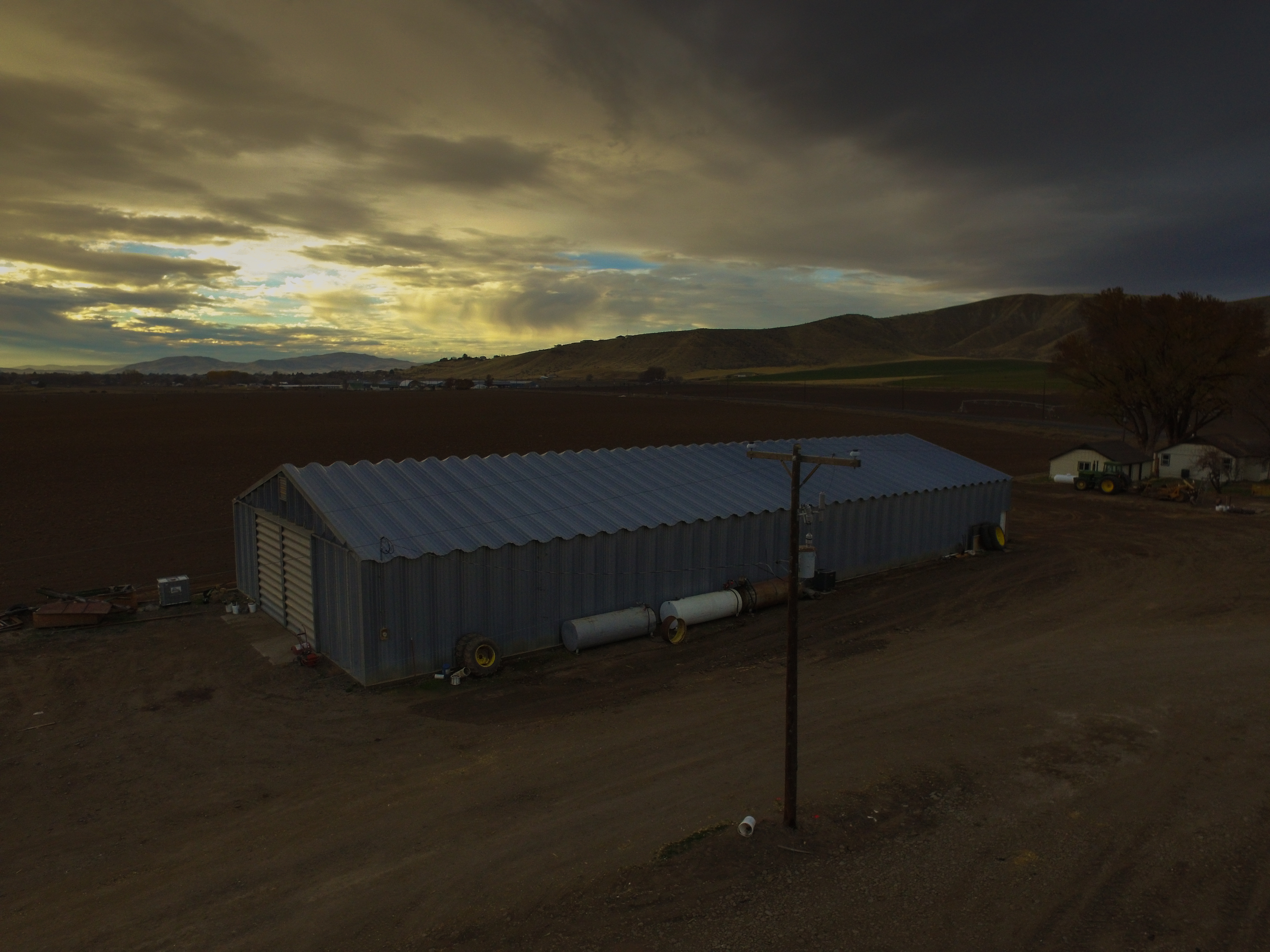
Barn at Sunset
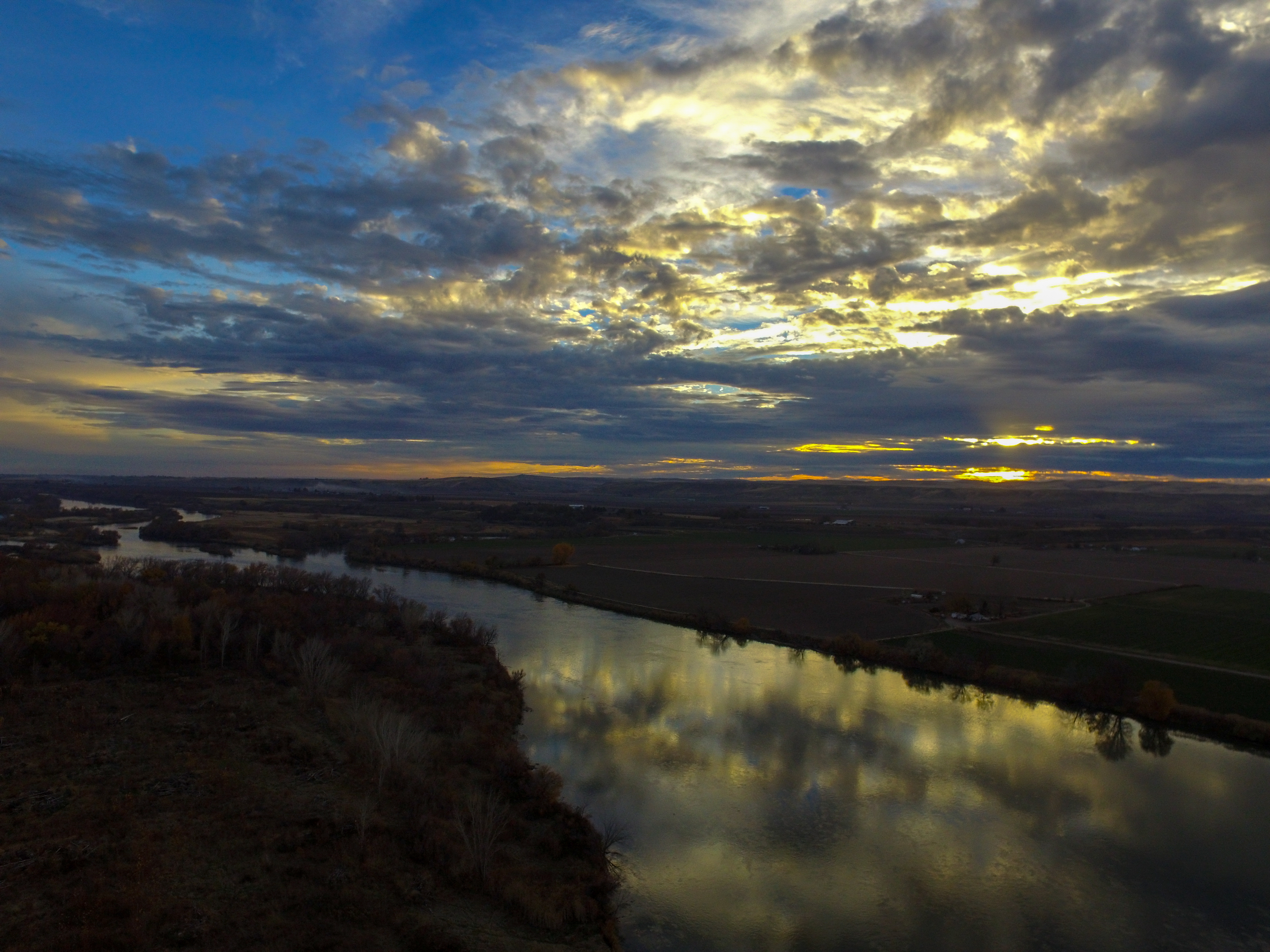
Snake River Sunset

DSC_2381 (6)

DSC_2381 (3)

DSC_2342 (1)
Cahill Ln, Weiser, ID, USA Map
Search another place
Near Places
River Rd, Payette, ID, USA
N 6th St, Payette, ID, USA
Manser Dr, Payette, ID, USA
Payette, ID, USA
Hyline Rd, Ontario, OR, USA
Weiser, ID, USA
W 7th St, Weiser, ID, USA
NW 16th St, Fruitland, ID, USA
NW 11th St, Ontario, OR, USA
Southeast 1st Avenue, SE 1st Ave, Ontario, OR, USA
Ontario, OR, USA
Spring Creek Ln, Fruitland, ID, USA
W 1st St, Fruitland, ID, USA
Fruitland, ID, USA
SW 4th St, Fruitland, ID, USA
Ontario Heights Rd, Ontario, OR, USA
SW 2nd St, Ontario, OR, USA
Idaho Elks Hearing and Balance Center: Ontario, SW 4th Ave, Ontario, OR, USA
57 NW 16th St, Ontario, OR, USA
River Bend Ln, Weiser, ID, USA
Recent Searches
- Sunrise Sunset Times of Rojo Ct, Atascadero, CA, USA
- Sunrise Sunset Times of Lumagwas Diversified Farmers Multi-Purpose Cooperative, Lumagwas, Adtuyon, RV32+MH7, Pangantucan, Bu
- Sunrise Sunset Times of 12 Hutchinson Woods Dr, Fletcher, NC, USA
- Sunrise Sunset Times of Santa Maria del Mar, Peru
- Sunrise Sunset Times of Holloway Ave, San Francisco, CA, USA
- Sunrise Sunset Times of 1-chōme-1-5 Asahi, Utsunomiya, Tochigi -, Japan
- Sunrise Sunset Times of Bist Hazari, Afghanistan
- Sunrise Sunset Times of 82- D Rd, Captain Cook, HI, USA
- Sunrise Sunset Times of Harlow CM20 2PR, UK
- Sunrise Sunset Times of Yadozaki Tairausuiso, Iwaki, Fukushima -, Japan